buckeyefan1
-
Posts
13,278 -
Joined
Content Type
Profiles
Blogs
Forums
American Weather
Media Demo
Store
Gallery
Everything posted by buckeyefan1
-

-
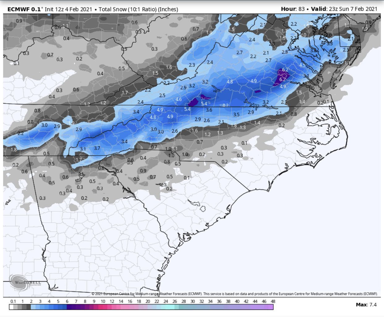
I’m sure most of the se crew would gladly take any type of frozen flakes that fall
-
-
Nice to see the 06 euro come on board

-
I have no words for the 18z gfs. I’m speechless and that doesn’t happen often
-
Ya’ll are having a lot of cliff diving mood swings with each model run in here There’s a lot of flying energy and the models always struggle when there’s a pattern change. So just breathe deeply, relax and remember we’re all wanting the same thing as we watch it unfold.
-
I really appreciate all the pictures everyone has posted so far this winter. Absolutely beautiful
-
I had 9” imby (Columbia) back in Feb. of ‘10. That was, and still is, the only snow I knew was coming ten days away. The only uncertainty was how much moisture was going to fall. That’s the most snow I’ve ever seen in sc and it was all melted before noon the next day
-
Currently it’s 44 degrees with cloudy skies. I’ve got my black construction paper and flashlight ready to document the overnight flizzard
-
Indeed! The para needs to keep it south for a few days.
-
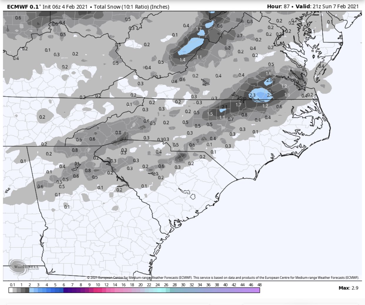
Right!? It still drops 5-6” imby. The next couple weeks are going to be interesting for sure. I couldn’t help but notice that the Euro gives me a dusting in the early morning hours tomorrow
-
I’m gonna need this a bit further south
-
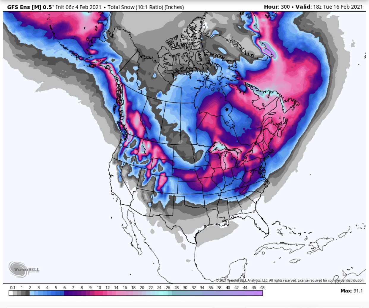
After 177 hours of model watching and 2’ 7” of digital snow, my only reward has been 86 sleet pellets for 45 seconds. I agree. MBY hasn’t cashed in, but so far I’ve spent this winter tracking threats and watching with jealous envy as other se crew members did. Which is 100x better than the last couple
-
It’s sleeting in Fountain Inn
-
Anytime!
-
Done
-
We live in the south and the only thing we can hope for are frozen precipitation opportunities The more opportunities, the better our odds of cashing in I haven’t seen anything frozen yet, but this winter has been 1000x’s better than the past few imby
-
Pinned for easier access good luck
-
GSP..... .LONG TERM /SUNDAY THROUGH TUESDAY/... As of 230 PM Wednesday...onset of precip will be Saturday evening, depending on placement of best moisture and timing of shortwave trough the region, which GFS and European models still disagree on. ECMWF still shows a coastal low developing and passing south of our CWA, which introduces a threat of winter wx, though it`s still too far out to pin down any details. GFS leans more into the coastal low setup as of the 12z run. Either case is likely to produce some snow showers in the mountains but if ECMWF guidance pans out then this could extend into the NC Piedmont. In any case, chilly temps will stay in place through Tuesday, before a new upper system approaches from the west. Models diverge greatly as far as timing and dynamics of this system.
-
It will happen
-
I miss going up there whenever I had to go to Durham! I probably know the Durham area better than the Greenville area Whenever things get back to normal, you can bet we’ll have to all get together for a few laughs
-
Right!? An hour west is all I need
-
MBY still needs the euro to slow down and slide a bit south. I’m not fond of ice......
-
MBY still gets rain for as far out in time as the models can go. Yay
-