

buckeyefan1
-
Posts
13,278 -
Joined
Content Type
Profiles
Blogs
Forums
American Weather
Media Demo
Store
Gallery
Everything posted by buckeyefan1
-
I’m not ready for the 80’s
-
Lows in the 40’s and highs in the low 70’s is absolute perfection
-
I’m over all this pollen
-
The end is where the beginning starts and every goodbye brings you closer to the next hello
-
Please stop and think before you post again
-
Severe Weather Statement National Weather Service Greenville-Spartanburg SC 402 PM EDT Thu Mar 25 2021 SCC001-007-045-252015- /O.CON.KGSP.TO.W.0007.000000T0000Z-210325T2015Z/ Greenville SC-Anderson SC-Abbeville SC- 402 PM EDT Thu Mar 25 2021 ...A TORNADO WARNING REMAINS IN EFFECT UNTIL 415 PM EDT FOR SOUTHEASTERN GREENVILLE...SOUTHEASTERN ANDERSON AND NORTHEASTERN ABBEVILLE COUNTIES... At 402 PM EDT, a severe thunderstorm capable of producing a tornado was located 13 miles southeast of Anderson, or near Honea Path, moving east at 40 mph. HAZARD...Tornado. SOURCE...Radar indicated rotation. IMPACT...Flying debris will be dangerous to those caught without shelter. Mobile homes will be damaged or destroyed. Damage to roofs, windows, and vehicles will occur. Tree damage is likely. This dangerous storm will be near... Ware Shoals around 420 PM EDT. Other locations impacted by this dangerous storm include Princeton and Fork Shoals. PRECAUTIONARY/PREPAREDNESS ACTIONS... TAKE COVER NOW! Move to a basement or an interior room on the lowest floor of a sturdy building. Avoid windows. If you are outdoors, in a mobile home, or in a vehicle, move to the closest substantial shelter and protect yourself from flying debris. Please report damaging winds, hail, or flooding to the National Weather Service Greenville-Spartanburg by calling toll free, 1, 800, 2 6 7, 8 1 0 1, or by posting on our Facebook page, or Tweet it using hashtag nwsgsp. Your message should describe the event and the specific location where it occurred. && LAT...LON 3471 8219 3459 8224 3454 8224 3448 8231 3447 8231 3441 8225 3439 8227 3432 8258 3462 8245 TIME...MOT...LOC 2002Z 253DEG 36KT 3442 8244 TORNADO...RADAR INDICATED HAIL...<.75IN $$ RWH
-
Thank you
-
Wizard021....now banned twice today Now back to your regular scheduled program
-
I’m not looking forward to the heat at all
-
Let the banter and b*tching commence
-
This skinny little line moving through the upstate means business
-
Bye
- 825 replies
-
- 22
-

-

-

-
Stop. This will be your only warning. I will not hesitate to send you to timeout for the next 5 days. Proceed carefully
- 825 replies
-
- 12
-
-
I’ve got thunder
-
The pear and apple trees are blooming, red buds are sprouting, daffodils are beautiful, tulips and azaleas will be blooming soon too. I’m putting some grass seed down tomorrow and I think I’m gonna use 5 gal buckets for the garden this year. Only because I will be able to control water intake and I can move them if they’re not doing well
-
And here we are
-
Highs near 70 with lows near 50 = absolutely beautiful weather As for the pollen
-
Catalina, AZ (in between Tucson and Phoenix-my old stomping grounds) had 3” of snow this morning
-
Why does my point and click on weatherbug show a sloppy mix Monday the 15th and Tuesday the 16th? Didn’t they get the message that I’m done with these games?
-
I’ve never had that issue in the 33 years I’ve lived here There are only the following seasons...Almost summer, summer, hell and molten lava
-

Post your 2020-2021 Snowfall totals here
buckeyefan1 replied to Avdave's topic in Southeastern States
0.0 imby -
Miracles can happen
-
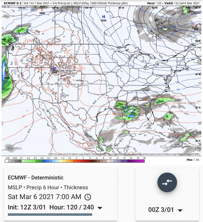
12z Euro
-
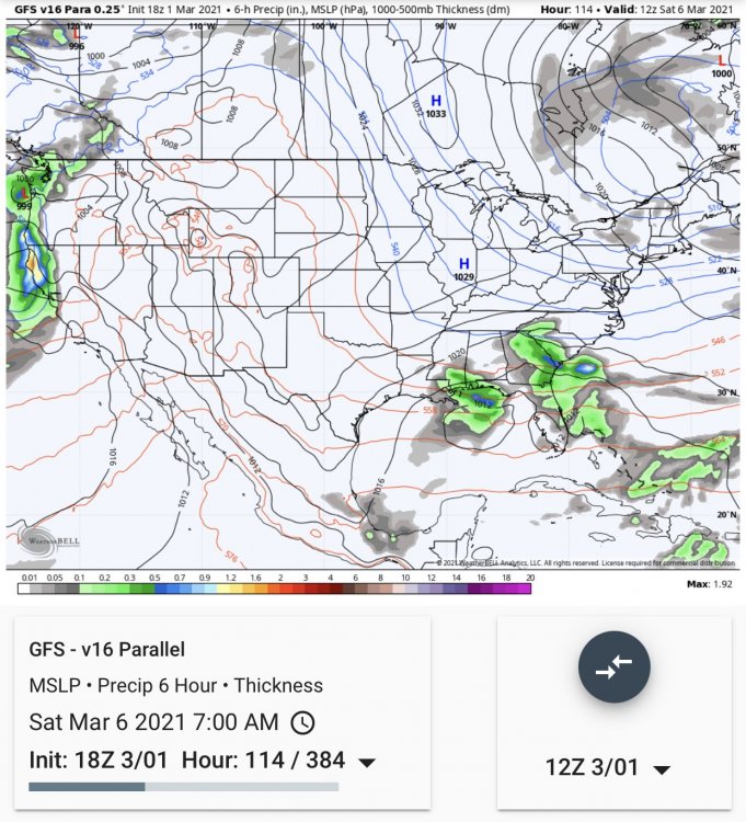
18z Para......Sooooooooo close
-
I’m all in for this March madness #gobigorgohome #cinderellastory


