

buckeyefan1
-
Posts
13,278 -
Joined
Content Type
Profiles
Blogs
Forums
American Weather
Media Demo
Store
Gallery
Everything posted by buckeyefan1
-
Shrederola gets its name honestly
-
When your opinion becomes relevant, I'll ask for your advice. Until then, please feel free to contact someone who cares.
-
Dear newbies, STOP posting nonsense. Read more and post less before you find yourself on the outside looking in. This will be the last warning you will get. For the rest of you.....please carry on
- 536 replies
-
- 13
-

-

-
A severe t-storm warning and the rain is so close I can hear it, yet nothing is falling above me I'll take 77 degrees instead of 95 degrees as a consolation
-
Please stop with the hype. There is no way to know which model will be correct.
- 536 replies
-
- 10
-
-
-
Smoke is horrible, but I have to admit the ring around the sun with the orange tint, makes for a beautiful sunset
-
Trolls......sigh
-
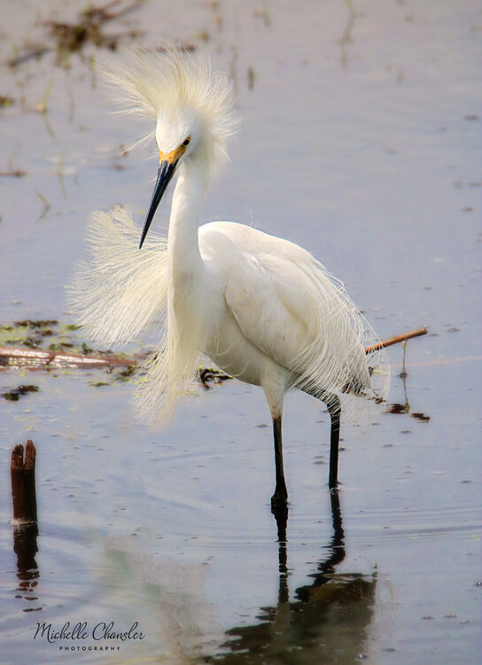
This snowy egret was having a bad hair day
-

2021 Atlantic Hurricane season
buckeyefan1 replied to StormchaserChuck!'s topic in Tropical Headquarters
Keep this thread on topic. It's a hurricane season pinned thread, not post about winter and whatever else pops into your head thread. Please report stoopidity so that it can be removed as soon as possible. Now.....back to your regular scheduled program -
2021 Atlantic Hurricane season
buckeyefan1 replied to StormchaserChuck!'s topic in Tropical Headquarters
Good bye Vort -
Morning glories and moonflowers
-
75 amazing degrees yesterday, woke up to another beautiful 66 degrees this morning and today's high topped off at 78 imby Only added about .30 to the bucket, but it's much better than the zilch I've received recently
-
Woke up to a beautiful 66 degrees this morning and tomorrow's high is forecasted at 74
-
Not a drop here and currently 88/72
-
GSP .LONG TERM /TUESDAY NIGHT THROUGH SATURDAY/... As of 200 PM EDT Saturday: Models are in good agreement on another shortwave trough riding into and sharpening the large upper trough over the Southeast Wednesday, inducing another sfc wave along a persistent stationary front along the Gulf Coast or the Coastal Plain. A sfc ridge will push in from the north and could shunt the deeper moisture to the south and east of the area. As such, PoPs trend down Wednesday thru Friday. The upper longwave trough does gradually weaken/flatten out, but not completely thru next Saturday. The flattening flow may allow the stationary coastal front to lift back north into the area an increase our rain chances. Despite the slightly drier trend in the models, PoPs remain above climo in the fcst for now thru the entire medium range. Max temps will be 5-10 deg below normal, trending toward normal by next Saturday. Min temps will be near to slightly below normal.
-
Right?!?!
-
I haven't had a date since I left the narcissistic sociopath 5 years ago. Having to keep restraining orders current will do that
-
He got all butthurt when I told him to read more and post less and resorted to vulgar, misogynistic name calling I'm pretty sure it was a sock for someone who has been banned several times, and he'll go running back to where he came from whining about how mean I am
-
He made too easy
-
Gotta keep the poofing skills sharp before the winter weenies arrive
-
The trash has now been removed
-
I'm over this disgusting, sultry, oppressive heat
-
I'm looking forward to a week of low 80's with a chance of rain You can't ask for better weather for the south in August, and it seems as if the tropics will be heating up too
-
I'm not sure what your problem is, but I suggest you read more and post less before you find yourself on the outside looking in. It's your choice. Choose wisely
-
+1


