buckeyefan1
-
Posts
13,278 -
Joined
Content Type
Profiles
Blogs
Forums
American Weather
Media Demo
Store
Gallery
Everything posted by buckeyefan1
-
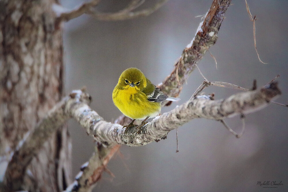
Here's a cute pine warbler to brighten your day
-

January 20-22 “bring the mojo” winter storm threat
buckeyefan1 replied to lilj4425's topic in Southeastern States
18z 12z -
2021-2022 Fall/Winter Mountains Thread
buckeyefan1 replied to BlueRidgeFolklore's topic in Southeastern States
There's a kink in the energy that is sitting on the western FL panhandle. It wasn't there at 12z or 0z -
2021-2022 Fall/Winter Mountains Thread
buckeyefan1 replied to BlueRidgeFolklore's topic in Southeastern States
I haven't looked too closely yet, but it doesn't appear as if there were any changes that stood out to me at first glance. There was less moisture, and maybe the northern stream wasn't as pronounced. Maybe? Overall though, it looked similar to me. ps....I had wine with dinner and not wearing my glasses, so I could be totally wrong -
MBY looks like that too and I can't wait to add to it
-
January 20-22 “bring the mojo” winter storm threat
buckeyefan1 replied to lilj4425's topic in Southeastern States
GSP .SHORT TERM /WEDNESDAY NIGHT THROUGH FRIDAY/... As of 215 pm EST Tuesday: The pattern will get active once again through the short-term period as a series of northern stream waves dive southeast through the Great Lakes region Wednesday night into Thursday and amplify a positively tilted trough from the Upper Midwest to the central Plains. The trough will help to drive a moist cold front into the southern Appalachians Wednesday night, which will slip southeast of the area through Thursday. Anticipate mainly liquid ptypes with the fropa, except at the higher peaks and increasingly along the Tennessee border in brief, post fropa northwest flow. Since the highest QPF over the western mountains should be one-half inch or less, this should not be sufficient for hydro issues to develop, even with some mountain snow melt. It has become questionable how much of a lull will develop between the cold fropa and redeveloping upglide over the stalling boundary. A consensus is building that a sharpening upper jetlet may develop along the southern Appalachians Thursday night through Friday. The amplifying upstream trough will be potent, but now appears less likely to cut off west of the Appalachians and more likely to get picked up by the northern stream. The main uncertainty during the Thursday night to Friday period is how vigorous any surface waves become along the stalled boundary draped to our southeast. The ECM has stronger development and pulls more moisture, and thereby QPF, over the region Friday, while the GFS has a more muted response. The ECMWF has trended slightly toward the GFS, but the GEFS ensembles have plenty of snowy members still. Will use an ensemble approach to profiles and keep mainly snow across the region, but with a snow, sleet, and freezing rain mention for the southeast third. This will be introduced into the HWO. Temps will be shaded below guidance as cold air damming develops Friday from 1040 mb high pressure over New England. The wintry precipitation will continue into the early extended period. && .LONG TERM /FRIDAY NIGHT THROUGH TUESDAY/... As of 225 pm EST Tuesday: Wintry precipitation may well be ongoing in the forecast area Friday night as surface wave development continues along a frontal zone stalled near the coast. Profiles look cold overall, but with any warm nose energy aloft likely affecting locations southeast of I-85 where QPF may be better. It increasingly appears that the best overlap of cold, snow-supporting profiles and decent QPF will be over the northwest NC Piedmont Friday night into Saturday morning. And, any ice accumulations will be more likely over the southeast Piedmont. However, considerable uncertainty exists with this system and it remains too early to feature any Watch products. The wintry potential will be addressed in the HWO, and first cut accumulations will likely be advertised on Wednesday for the entire late week period. The system should pull away to the northeast later Saturday, but reinforcing energy digging into the eastern CONUS trough will amplify the pattern to keep cold air over the region through the rest of the weekend and into early next week. There is some potential for clipper-type waves to dig into the trough and bring scattered snow showers to the NC mountains periodically, but this will be very hard to time. Temperatures remain below climatology well into next week. -
Mid to Long Range Discussion ~ 2022
buckeyefan1 replied to buckeyefan1's topic in Southeastern States
Canada's boom -
Neither should someone who lives near richmond
-
January 20-22 “bring the mojo” winter storm threat
buckeyefan1 replied to lilj4425's topic in Southeastern States
^^^^^^^^^^^^^THIS! Keep the banter where it belongs. There wasn't half of the banter in the pinned discussion thread from the last system that there is in this thread and there is still 3-4 days to go. This will be the only verbal warning. -
By that logic, Cincinnati, Ohio, Indianapolis, Ind and Lexington, KY all have the same climate as Greenville, SC so they should post here too
-
January 20-22 “bring the mojo” winter storm threat
buckeyefan1 replied to lilj4425's topic in Southeastern States
I'm still sticking with the EE rule -
Mid to Long Range Discussion ~ 2022
buckeyefan1 replied to buckeyefan1's topic in Southeastern States
Yes indeed! It's been sending bomb signals for a bit now -
2021-2022 Fall/Winter Mountains Thread
buckeyefan1 replied to BlueRidgeFolklore's topic in Southeastern States
I wanna stay in here -
What is up with all the va folks here? I can kinda understand those near the border, but this is the south not the MA
-
2021-2022 Fall/Winter Mountains Thread
buckeyefan1 replied to BlueRidgeFolklore's topic in Southeastern States
I'm honestly not sure In other news gefs expanded the winter precip area -
January 20-22 “bring the mojo” winter storm threat
buckeyefan1 replied to lilj4425's topic in Southeastern States
gefs expanded precip from 06z to 12z -
January 20-22 “bring the mojo” winter storm threat
buckeyefan1 replied to lilj4425's topic in Southeastern States
To my untrained eye, it looks like the gfs took a baby step towards the euro -
2021-2022 Fall/Winter Mountains Thread
buckeyefan1 replied to BlueRidgeFolklore's topic in Southeastern States
zwyts said it -
January 20-22 “bring the mojo” winter storm threat
buckeyefan1 replied to lilj4425's topic in Southeastern States
The EE rule -
Dropped to 19 degrees early this morning
-
January 20-22 “bring the mojo” winter storm threat
buckeyefan1 replied to lilj4425's topic in Southeastern States
GSP .LONG TERM /SATURDAY THROUGH MONDAY/... As of 230 AM EST Tuesday: An active extended is in store as models come into better agreement about a potent system entering the eastern CONUS over the weekend. Deterministic guidance is struggling to handle the system consistently, with the last 2 runs of the ECMWF finally converging on a strong cyclone affecting the Carolinas, even as latest run of the GFS begins to diverge from this solution. The CMC has consistently depicted a solution in line with the latest ECMWF. Such a solution would result in cyclogenesis along a stalled frontal boundary south and east of the forecast area, in turn producing a cyclone that shifts east too quickly to appreciably warm 850mb temps. So, precipitation develops atop bitterly cold low-level air, resulting in an all-snow solution throughout Friday night and much of Saturday. About 75% of GEFS members now depict some amount of wintry precip occurring with this system, indicating the latest dry solution from the deterministic run is an outlier; nonetheless, there remains significant uncertainty with the timing and intensity of this system, as well as what, if any, accumulations could be expected should another winter system actual materialize. In any case, the upper pattern becomes much less perturbed behind this system, and cold, dry air builds in at the surface. A weak reinforcing cold front should arrive Monday evening, but looks too dry to warrant any PoPs. -
January 20-22 “bring the mojo” winter storm threat
buckeyefan1 replied to lilj4425's topic in Southeastern States
-
January 20-22 “bring the mojo” winter storm threat
buckeyefan1 replied to lilj4425's topic in Southeastern States
35/50 of those members show mby getting snow -
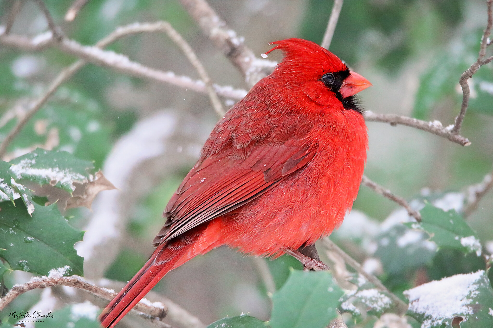
Backyard birding in the snow Here's a classic southern snow cardinal to brighten your day

-
January 20-22 “bring the mojo” winter storm threat
buckeyefan1 replied to lilj4425's topic in Southeastern States
Looks a little sharper heading into texas