michsnowfreak
-
Posts
18,421 -
Joined
-
Last visited
Content Type
Profiles
Blogs
Forums
American Weather
Media Demo
Store
Gallery
Everything posted by michsnowfreak
-

2026-2027 Super El Nino
michsnowfreak replied to Stormchaserchuck1's topic in Weather Forecasting and Discussion
Not sold on a super el nino and especially not on a torch. I do think it will be milder here than the last 2 cold winters, however. -
Snowpack is definitely not created equal depending on area. The exact same amount in different areas and the same conditions will do different things.
-
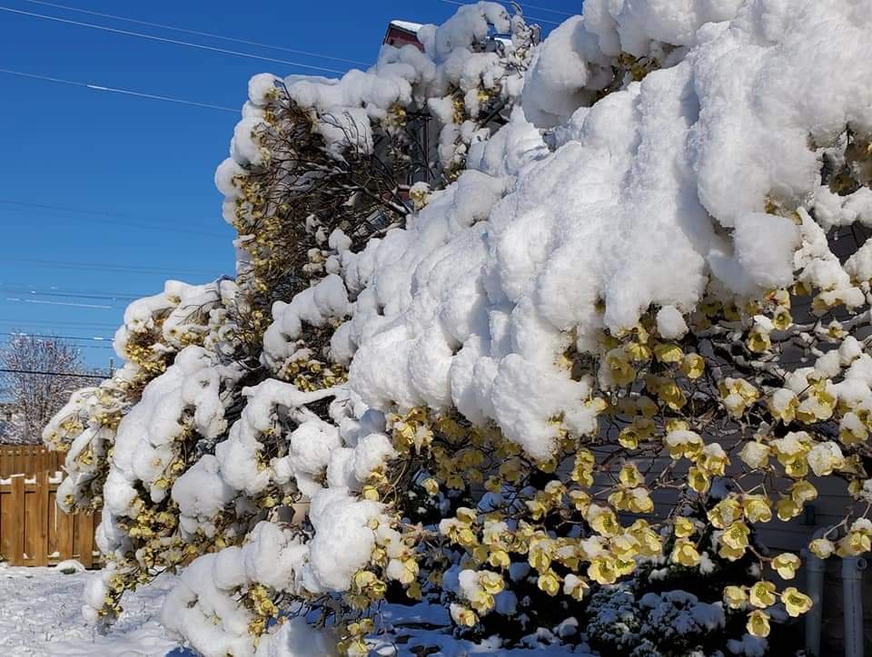
How much snow is left?
-
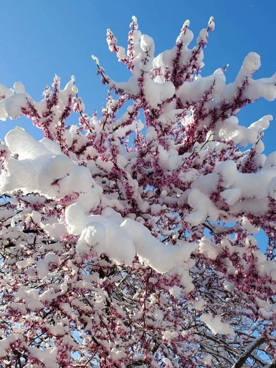
5 years ago today. Tuese were some amazing winter/spring clash scenes. 4.4" of snow fell here, 3.6" DTW but near 6" on the MI/OH border.
-
28° at Detroit this morning after a trace of snow yesterday.
-
2026-2027 Super El Nino
michsnowfreak replied to Stormchaserchuck1's topic in Weather Forecasting and Discussion
I dont really keep track of severe (other than my own daily weather obs), but what I do know is we've had a lot of pretty dull severe seasons, so we were overdue. -
2026-2027 Super El Nino
michsnowfreak replied to Stormchaserchuck1's topic in Weather Forecasting and Discussion
There have been 13 confirmed tornados in Michigan this year (Mar/Apr), which is wild. There was one 4 miles to my north Apr 15 which is the closest I can ever recall. Pic below is of that tornadic 2am storm.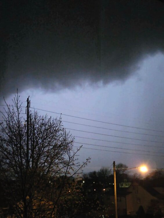
-
2026-2027 Super El Nino
michsnowfreak replied to Stormchaserchuck1's topic in Weather Forecasting and Discussion
Thanks for the explanation! Makes sense. -
2026-2027 Super El Nino
michsnowfreak replied to Stormchaserchuck1's topic in Weather Forecasting and Discussion
That is one funky looking standout of blue. Jokes aside, I know you know it, but remember its all relative. The coldest winter ever recorded in Anniston, AL is warmer than the warmest winter ever recorded here. I feel like when we are so far out from the next winter, its easy to focus too much on temps. -
2026-2027 Super El Nino
michsnowfreak replied to Stormchaserchuck1's topic in Weather Forecasting and Discussion
Cansips still onto another cold winter here in the Lakes. I have my doubts, but it by far was the best model locally last winter. This is why it will be interesting to follow along this summer. After 2 cold winters, personally I expect a mild winter next year, tho not nearly to the extreme that a few here are undoubtedly hoping for. Those of us at more northern latitudes have seen multiple snowstorms track south the last few years (more than usual) so as always seeing how ALL the indicies, the Pacific, etc behave is just as important as actual temp anamolies. -
2026-2027 Super El Nino
michsnowfreak replied to Stormchaserchuck1's topic in Weather Forecasting and Discussion
How can NG "predict" weather trends months in advance? -
Yes. Although I WILL say...and this is NOT taking ANYTHING away from them...but NWS MQT is really not representative of Marquette. Its an absolute microclimate snowmagnet. There are multiple similar lake superior microclimates up there (for instance, look at our own @weatherbo) but many of them are in extremely rural to non-populated areas where we may never know how much snow possibly falls at THE best spot. I used to watch the NMU snowcam in Marquette and you could tell there was nowhere near the amt of snow on the ground as MQT officially had. But when I went up there and scoped the area out its an absolute fact. The snow rapidly increases, and its very noticeably, right near the NWS office. The 7am snowdepth today at MQT is 19". The city of Marquette webcams show completely bare ground. For anyone of us, take the absolute snowiest location in your entire metro-area and its outskirts and pretend that would be the official climate station. It would be like Detroit snow records being taken in Lake Orion (which unofficially averages probably 60", not 40-45" like Detroit). Thats how it is in Marquette.
-
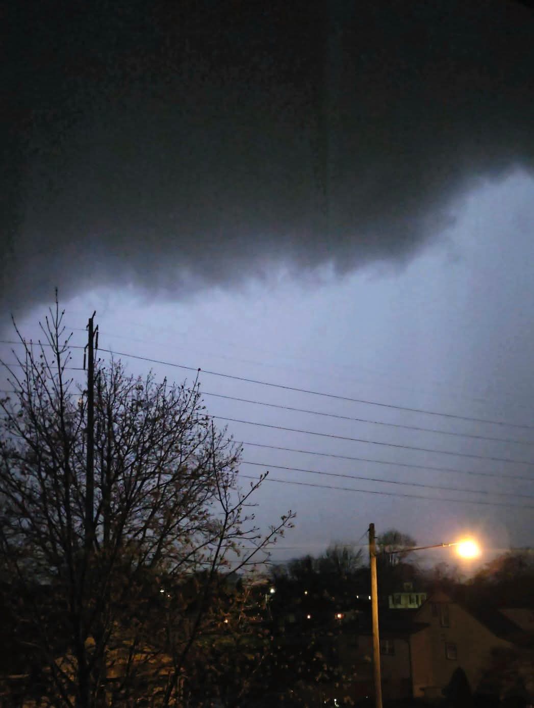
My phone woke me at 2am with the tornado warning alert. I ended up being up 2 hours. The storm was wicked but no tornado here. Possible one 3 miles north. Got 0.82" rain. Looks like quite a bit of damage noted in ann arbor, Dearborn, lincoln park. The constant lightning illuminated the black cloud overhead
-
2026-2027 Super El Nino
michsnowfreak replied to Stormchaserchuck1's topic in Weather Forecasting and Discussion
Other than that one article that is shared over and over by the same people, we have no idea what went into measuring at every location pre-1950. I think actually 1948 is when the 6 hr started at airports. That is also when they started rounding up daily snow depth to nearest inch. I have done plenty of local research on past weather events and while human error was there in 1880 and is there in 2026, I am pretty confident in the snow record at Detroit (and most other 1st order stations) being quite accurate. Now, coops and NON first order, who knows and there are undoubtedly tons of error. Back in the 1800s and very early 1900s they would always say "10 inches of snow fell on the level" or something like that. They applied a 10-1 ratio usually. But it would make more sense to apply a 10-1 ratio to what you measured than to melt snow down for a liquid and apply the ratio to snow. Its a hell of a lot easier measuring snow than it is melting it down for liquid equivalent. -
2026-2027 Super El Nino
michsnowfreak replied to Stormchaserchuck1's topic in Weather Forecasting and Discussion
Again, to be clear, im only doubting super at this point. It would be unheard of so close. Definitely a nino is coming. Super would not be fun, but we always get winter in the great lakes. Thats a great thing about living here. You're rescued in the worst case scenarios. Our climate is less feast/famine. One thing that im liking is the persistent of the eastern trough in recent years. -
2026-2027 Super El Nino
michsnowfreak replied to Stormchaserchuck1's topic in Weather Forecasting and Discussion
Shortly after I posted that I discovered the dataset and I must say its very impressive to have an actual consistent record of snow/temp/precip pre-1870. I would kill to have that for my area. As for measuring snow...ive seen that link many times. I've also measured snow for 30 years. Pre-1950 we dont know how individual observers measured. Each station mightve had their own method. What i CAN tell you is that clearing at 6 hours mostly affects fluffy lake snow, double digit storms, or a very long duration snowfall. More run of the mill snowfalls without taint the effect is minimal. -
Im anti hype. El nino coming nearly for sure. But to predict super so far out....totally skeptical.
-
Pre nino summers are often cooler than avg in the Great Lakes.
-
Id bet money its not a super nino. But yes, an El Nino is coming
-
2026-2027 Super El Nino
michsnowfreak replied to Stormchaserchuck1's topic in Weather Forecasting and Discussion
1916-17, 1917-18, & 1919-20 were very cold winters and 1918-19 & 1920-21 very mild here. Of particular extreme was 1917-18 & 1918-19. The cold 1917-18 was extremely impressive and it likely ranks as one of the conus coldest winters on record (I concentrate on local & regional weather, not the entire conus, so idk the ranking). Then 1918-19 was a mild, snowless winter with a huge influenza pandemic. Newspapers at the time attributed the unusually warm winter weather to helping fuel "The Grippe". -
2026-2027 Super El Nino
michsnowfreak replied to Stormchaserchuck1's topic in Weather Forecasting and Discussion
I know you have a lot of pent up troll posting to do from us having a cold winter, but honestly this is a perfect example of why one year is never a perfect match. 1996-97 here had an average winter and a cold spring. 2025-26 had a cold winter and a so far warm spring. -
2026-2027 Super El Nino
michsnowfreak replied to Stormchaserchuck1's topic in Weather Forecasting and Discussion
Its funny youre being your usual smart ass self when I made one comment on an alleged newark dataset i didnt know existed and had never seen. Its funnier though that you always ridicule snow amounts from notorious low snow decades like the 1930s or 1950s when the weather bureau was well established and records detailed "there must be something wrong with how they measured". But a random snowy dataset with minimal info pops up from the 1850s and its gospel, no questions asked. -
2026-2027 Super El Nino
michsnowfreak replied to Stormchaserchuck1's topic in Weather Forecasting and Discussion
This winter was much colder in the Great Lakes than 1996-97. -
I remember how they kept getting slammed in 2001-02. As warm as that winter was, we had a few food winter storms here. However, that winter was infamously nearly snowless in parts of the east coast.
-
2026-2027 Super El Nino
michsnowfreak replied to Stormchaserchuck1's topic in Weather Forecasting and Discussion
I didnt say they lied. I was questioning the snowfall since NYC records began in 1869 and never averaged close to 40" (other then 2010s). However, I did not see this Newark list. When I clicked "Newark Area" it started in 1930. Usually "area" is the most comprehensive data set for an area. But in this case its not. Not sure where this old data suddenly came from, but I consider any old data pre-1870 to be fascinating because of it's rarity. Indeed that does avg low 40s. Very interesting and would wonder how accurate it is. Newark 1850-1870 average is near idential to present-day Detroit average snowfall, but Newark 1850-1870 DJF still averaged 2.2F warmer and over 4" wetter in winter than present-day Detroit. I wish we had those records for here (there are some sparse observations/journals, but not enough accuracy for a complete record).