

michsnowfreak
-
Posts
16,672 -
Joined
-
Last visited
Content Type
Profiles
Blogs
Forums
American Weather
Media Demo
Store
Gallery
Everything posted by michsnowfreak
-

Winter 2024-25 Medium/Long Range Discussion
michsnowfreak replied to michsnowfreak's topic in Lakes/Ohio Valley
We are on the same page in that we both love winter. We are not on the same page in expecting a climatology that has never existed. 2013-14 wasn't just a good winter. It was an extraordinary, historic, epic winter here. Funny thing about 2014-15 is that snowfall overall wasn't impressive but the cold and snowdepth was. In fact. The snow depth was so impressive that it placed winter in #2 of your SDD category (2013-14 blew away #1 and it wasn't even close). Since then we have had some good winters (2017-18, 2020-21) and some great individual months and storms, though the historic streak of 2007-15 certainly has ended. But all winters since 2015 have certainly not been horrible here. Last but not least. It's been a very unlucky winter in Chicago. There's been plentiful cold but it's been so dry. I dont expect you to like it but theres nothing you can do about the weather. While it's been lackluster in Detroit too, we've had a more beavis-tolerant winter. Snow was on the ground most of January. -
Winter 2024-25 Medium/Long Range Discussion
michsnowfreak replied to michsnowfreak's topic in Lakes/Ohio Valley
First of all. Observations were very reliable. If anything they were more detailed than we get today. Everything was manual, now snow is the only thing manual (outside of necessary fixes to the wx observing equipment). The mid century time frame was one of the worst for snowstorms here. We did have a few good ice storms. And second of all. You love to use the coldest normals in Chicago's entire climate record as your norm, but yet it's not fair for us to acknowledge how good the last few decades have been for snowstorms? -
Winter 2024-25 Medium/Long Range Discussion
michsnowfreak replied to michsnowfreak's topic in Lakes/Ohio Valley
The last 6"+ storm at Detroit was March 3, 2023. (the largest storm last winter was 4.7", and the largest this year to date has been 3.7"). The historical average is just over 1 storm per winter of 6"+. However, there have been obviously many years where we dont see one, particularly in the middle third of the 20th century. The most 6"+ storms in a single winter was 6 in 2013-14. The most consecutive winters withOUT a 6"+ storm was 6, from 1944-45 thru 1949-50. The most consecutive winters with at least one 6"+ storm was 14, from 1890-91 thru 1903-04 The decade with the least 6"+ storms on record was the 1940s, when just one storm of 6"+ fell The decade with the most 6"+ storms on record was the 2010s, when 19 storms saw 6"+ Despite not having a 6"+ storm since March 3, 2023, we have already seen 6 in the 2020s. -
Winter 2024-25 Medium/Long Range Discussion
michsnowfreak replied to michsnowfreak's topic in Lakes/Ohio Valley
Wow aiming high haha. Both months were cold. Feb 1985 had 16.9" of snow with a peak depth of 12" and Feb 2021 had 21.4" with a peak depth of 14". Actually 2020-21 had some fun times. An underrated winter imo -
Winter 2024-25 Medium/Long Range Discussion
michsnowfreak replied to michsnowfreak's topic in Lakes/Ohio Valley
How much snow do you have on the ground? We had freezing rain. Our ground is frozen solid, but only piles of snow remain. The snowpack melted off the last day of January, and though we had some snow sunday it melted Monday. -
Winter 2024-25 Medium/Long Range Discussion
michsnowfreak replied to michsnowfreak's topic in Lakes/Ohio Valley
The ensembles are as active as they have been at any point all winter heading into the next few weeks. Something good better come out of it! -
Fall/Winter '24 Banter and Complaints Go Here
michsnowfreak replied to IWXwx's topic in Lakes/Ohio Valley
ive noticed this over the years too...people think that other areas have consistent modeling. They dont. They have had countless fantasy storms in the northeast. The upcoming pattern is very active on the ensembles for the northeast although our sub (especially eastern sub) should get some fun too. -
Fall/Winter '24 Banter and Complaints Go Here
michsnowfreak replied to IWXwx's topic in Lakes/Ohio Valley
Snowcover would have helped no doubt, but its always subjective to guess/assume HOW much snowcover would have helped. We had snowcover most of the month in Detroit. It was a solid cold month, but not top 20. Plus, especially at Chicago (but DTW too), the mild departures the last 4 days really ate into the departure. Say what you want about the overall flavor of the month, but it was absolutely for the most part a much colder month than was anticipated. Chicago January 2025 temp departure vs various normals. POR normal (1873-2025): -1.6 1991-2020: -1.6 1981-2010: -1.1 1971-2000: +0.4 1961-1990: +0.9 1951-1980: +0.1 1941-1970: -1.7 1931-1960: -3.7 1921-1950: -3.6 1911-1940: -3.1 1901-1930: -2.3 1891-1920: -1.8 Detroit Jan 2025 temp departure POR 1874-2025: -2.1 1991-2020: -2.6 1981-2010: -2.1 1971-2000: -1.0 1961-1990: -0.2 1951-1980: -0.9 1941-1970: -2.2 1931-1960: -3.8 1921-1950: -3.2 1911-1940: -2.4 1901-1930: -1.5 1891-1920: -1.4 1881-1910: -1.5 -
Freezing rain (about 0.07") with temps in the 20s. Slick as snot on a brass doorknob.

-
I still have no idea what precip type we get tonight. Models seemed to have backed away from freezing rain and are leaning more snow/sleet but at this point it's anybodys guess.
-
Oh for sure. That's one of the main issues I'd imagine.
-
Those type of maps always need to be taken with a grain of salt. Especially season snowfall maps.
-
Michigan definitely in the game for Sat too. But no idea if I'll see snow or snow/sleet/freezing rain.
-
I hate even trying to pick one. But I still think I'd pick cold. Hopefully you'll get hit soon!
-
TCCs M.O. is posting xmacis graphs, and we all know it involves tons of cherry picking (ie: picking the snowiest period of record for Charleston WV and comparing it to Detroit) but he doesnt seem to understand how weather actually works. Just a few days ago he was complaining how lake effect snow is "fake" by posting snowfall and snow depth of lake and non lake effect areas. Apparently now that goes out the window when discussing Cleveland lol. Cleveland is in a lake effect snowbelt, though the eastern burbs of Cleveland get more than the airport. An easy way to actually understand climate is when comparing Cleveland, Chicago, and Detroit. Cleveland typically gets plenty of LES but is the warmest of the 3 cities...Chicago hardly gets any LES except for the occasional band, but is the coldest of the 3 cities. Detroit gets lots of lake effect flakes but this typically only several inches of snow are direct LES. Cleveland's average winter temp is over 2F warmer than Detroit, and over 3F warmer than Chicago. Historically, while averaging notably more snowfall than Detroit (and Chicago), Cleveland and Detroit average around the same amount of days annually with snow on the ground, and this is only a handful of days more annually than Chicago (despite Chicago averaging well less snow than Cleveland). Lake effect snow is fun, it certainly isnt "fake" but it definitely is a different kind of snow, which is why IMO its always important to have accurate numbers for liquid precip, snowfall, and snow depth.
-
I work right by a window looking out into my backyard. The yard is now frozen brown/yellow/pale green grass with a few snow piles and I am always reminded how much I HATE looking at bare ground after a prolonged period of snowcover, even not deep. I mean, it sucks anytime, but its less of an "ugh" factor when you have only had snowcover for a few days.
-
Yes, the winter of 2022-23, mild as it was, was stellar for photography. You had: Dec 23-24 blizzard conditions Jan 22 wet snowstorm Jan 25 wet snowstorm Feb 22 ice storm Mar 3 wet snowstorm Mar 10 wet snowstorm
-
It's been a really good winter for snowcover (albeit not deep) for the thumb and Detroit's far NW/elevated suburbs. Even for DTW proper there has been "some" snow, even if just a trace, on the ground most of winter. We are now down to bare ground except for piles but HOPEFULLY the next week and afterward produce with some more cold coming.
-
This winter has sucked for people who only plow but if they plow AND salt it's a different story. There have been lots of saltings needed. But the only real widespread plow was the Jan 10/11 (3.7" DTW, 3.9" here). We still have old icy piles from that lol.
-
We did lose our snow (other than piles) but only hit 43. I had no idea it was so warm just to our south!
-
The March 3, 2023 winter storm locally had a tremendous amount of thunder/lightning reported throughout SE MI. I was able to actual personally experience thundersnow and thundersleet/freezing rain both during that event.
-
Winter 2024-25 Medium/Long Range Discussion
michsnowfreak replied to michsnowfreak's topic in Lakes/Ohio Valley
The ensembles look very active going forward in February. Any details or op run hugging, which is always strongly discouraged, is probably even more worthless than usual with the type of pattern (strong baroclinic zone, very cold north/warm south, etc). I actually thought I heard blocking is expected into March, but that is way too far out to even think about at this time. -
January 2025 at DTW. Lots of zzzs but lots of flakes too. STATION: DETROIT MI MONTH: JANUARY YEAR: 2025 LATITUDE: 42 13 N LONGITUDE: 83 20 W TEMPERATURE IN F: :PCPN: SNOW: WIND :SUNSHINE: SKY :PK WND ================================================================================ 1 2 3 4 5 6A 6B 7 8 9 10 11 12 13 14 15 16 17 18 12Z AVG MX 2MIN DY MAX MIN AVG DEP HDD CDD WTR SNW DPTH SPD SPD DIR MIN PSBL S-S WX SPD DR ================================================================================ 1 37 30 34 6 31 0 0.01 T 0 13.2 22 260 M M 10 1 28 250 2 30 27 29 2 36 0 T 0.1 0 13.3 21 280 M M 10 29 270 3 28 23 26 -1 39 0 0.02 0.4 T 13.7 24 290 M M 10 32 280 4 25 19 22 -5 43 0 T T T 14.9 22 270 M M 9 31 310 5 27 12 20 -7 45 0 T T T 8.2 16 300 M M 7 23 290 6 28 21 25 -2 40 0 0.01 0.1 T 12.2 23 10 M M 10 169 31 340 7 30 21 26 0 39 0 T T T 10.7 21 320 M M 9 31 330 8 26 16 21 -5 44 0 T T T 8.5 16 300 M M 10 25 330 9 28 7 18 -8 47 0 0.00 0.0 T 5.7 13 210 M M 2 17 220 10 26 15 21 -5 44 0 0.16 3.2 T 8.2 18 190 M M 9 128 24 190 11 34 17 26 0 39 0 0.04 0.5 4 7.2 15 290 M M 9 1 19 280 12 34 23 29 3 36 0 0.02 0.6 3 12.2 23 210 M M 9 1 30 200 13 34 16 25 -1 40 0 T T 3 16.2 29 230 M M 10 9 36 230 14 20 9 15 -11 50 0 0.03 0.8 3 11.0 21 310 M M 7 28 300 15 26 8 17 -9 48 0 T T 4 11.8 21 220 M M 7 27 210 16 32 17 25 0 40 0 0.05 1.4 4 11.5 22 220 M M 10 189 29 210 17 38 20 29 4 36 0 0.00 0.0 4 13.3 23 190 M M 7 30 190 18 38 20 29 4 36 0 0.24 T 2 12.6 23 220 M M 8 1 26 340 19 22 8 15 -10 50 0 T T 2 9.0 18 300 M M 9 24 290 20 13 5 9 -16 56 0 T T 2 14.2 24 240 M M 5 32 220 21 10 0 5 -20 60 0 T T 2 12.3 21 280 M M 6 27 220 22 16 -3 7 -18 58 0 0.01 0.1 2 13.1 20 170 M M 7 25 190 23 26 13 20 -5 45 0 0.07 1.4 2 10.5 18 300 M M 9 19 22 290 24 23 8 16 -9 49 0 T 0.1 3 7.8 15 240 M M 7 1 20 230 25 35 11 23 -2 42 0 T T 3 13.8 26 220 M M 7 37 220 26 32 21 27 2 38 0 T T 2 11.5 22 270 M M 6 34 270 27 38 18 28 3 37 0 0.00 0.0 2 19.4 32 230 M M 5 52 230 28 41 26 34 9 31 0 T T 1 15.3 31 220 M M 9 43 220 29 43 25 34 9 31 0 T T 1 12.2 25 280 M M 7 37 270 30 46 23 35 10 30 0 0.00 0.0 T 7.4 16 200 M M 8 21 200 31 40 27 34 9 31 0 0.60 0.2 0 9.3 30 10 M M 10 12 41 10 ================================================================================ SM 926 503 1291 0 1.26 8.9 360.2 M 248 ================================================================================ AV 29.9 16.2 11.6 FASTST M M 8 MAX(MPH) MISC ----> 32 230 52 230 ================================================================================ NOTES: # LAST OF SEVERAL OCCURRENCES COLUMN 17 PEAK WIND IN M.P.H. PRELIMINARY LOCAL CLIMATOLOGICAL DATA (WS FORM: F-6) , PAGE 2 STATION: DETROIT MI MONTH: JANUARY YEAR: 2025 LATITUDE: 42 13 N LONGITUDE: 83 20 W [TEMPERATURE DATA] [PRECIPITATION DATA] SYMBOLS USED IN COLUMN 16 AVERAGE MONTHLY: 23.0 TOTAL FOR MONTH: 1.26 1 = FOG OR MIST DPTR FM NORMAL: -2.8 DPTR FM NORMAL: -0.97 2 = FOG REDUCING VISIBILITY HIGHEST: 46 ON 30 GRTST 24HR 0.60 ON 31-31 TO 1/4 MILE OR LESS LOWEST: -3 ON 22 3 = THUNDER SNOW, ICE PELLETS, HAIL 4 = ICE PELLETS TOTAL MONTH: 8.9 INCHES 5 = HAIL GRTST 24HR 3.2 ON 10-10 6 = FREEZING RAIN OR DRIZZLE GRTST DEPTH: 4 ON 17,16 7 = DUSTSTORM OR SANDSTORM: VSBY 1/2 MILE OR LESS 8 = SMOKE OR HAZE [NO. OF DAYS WITH] [WEATHER - DAYS WITH] 9 = BLOWING SNOW X = TORNADO MAX 32 OR BELOW: 19 0.01 INCH OR MORE: 12 MAX 90 OR ABOVE: 0 0.10 INCH OR MORE: 3 MIN 32 OR BELOW: 31 0.50 INCH OR MORE: 1 MIN 0 OR BELOW: 2 1.00 INCH OR MORE: 0
-
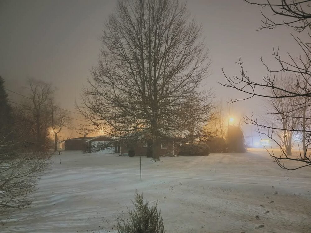
Foggy evening tonight.
-
We have had a lot of days since late November with a light amount of snow on the ground, but our peak depth (on multiple days in Jan) was only 4" so far. Last winter was obviously a well discussed mild train wreck, but during the brief spell of deep winter last January we got up to 7" snow depth.


