

michsnowfreak
-
Posts
16,673 -
Joined
-
Last visited
Content Type
Profiles
Blogs
Forums
American Weather
Media Demo
Store
Gallery
Everything posted by michsnowfreak
-

Winter 2024-25 Medium/Long Range Discussion
michsnowfreak replied to michsnowfreak's topic in Lakes/Ohio Valley
I know we have different versions of big storms, but last double digit storm at DTW was Feb 2021. -
Fall/Winter '24 Banter and Complaints Go Here
michsnowfreak replied to IWXwx's topic in Lakes/Ohio Valley
It's funny enough seeing the changes around SE MI from place to place. Imagine the snowbelt. Live in Buffalos immediate south suburbs? Enjoy 2 or 3 feet. Live in Buffalos immediate north suburbs? You won't see a flake. -
November 2024 General Discussion
michsnowfreak replied to SchaumburgStormer's topic in Lakes/Ohio Valley
After this nice band overnight Thursday night, the weather turned more squally. After starting the day in the sweet spot, my area spent the rest of the day mostly with mood flakes while some wicked squalls caused icy freeway gridlock in other parts of the area JUST to my north. Such is LES in SE MI. Finished with 1.6" imby and 1.5" DTW. The effects of the mild November were seen in a few ways. Despite staying below freezing all day roughly half the snow melted from underneath before freezing up. The other way was the icy roads. Snow melted on impact on the roads then quickly turned to ice. But November is ending today with a light snowcover, mood flakes, and temps that won't get out of the 20s. Welcome winter!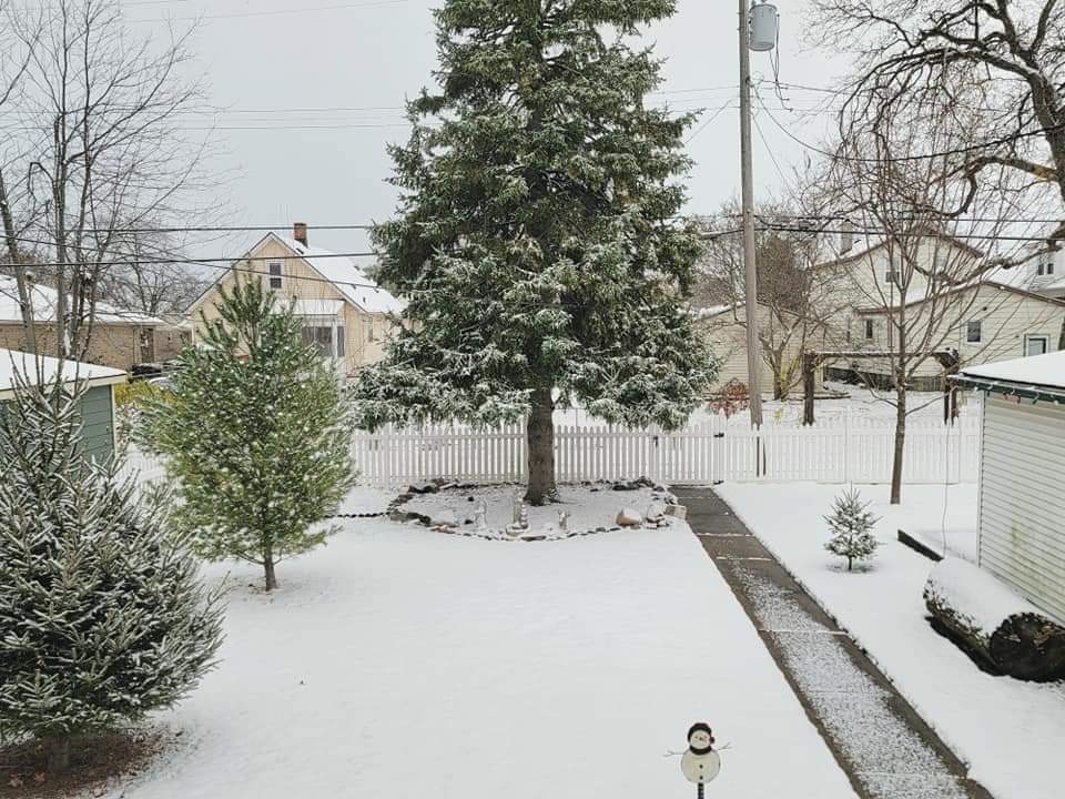
-
The Lakes are cranking. No more kicking the cold can...Winter has arrived. Looking for huge totals in parts of upstate NY and upper MI. Woke up to a fresh blanket of snow here as well with squalls looking to hit later today and tonight.
-
Fall/Winter '24 Banter and Complaints Go Here
michsnowfreak replied to IWXwx's topic in Lakes/Ohio Valley
Detroit avg for December is 8.9". Long term avg is closer to 10", but recent years have trended Dec snowfall down and Jan/Feb up. So the last time Detroit technically eclipsed avg was Dec 2020 with 9.6", but the last time of 10+ was Dec 2017 with 22.5". -
November 2024 General Discussion
michsnowfreak replied to SchaumburgStormer's topic in Lakes/Ohio Valley
Woke up to 1.5" of fresh snow from a steady I-94 band. Now the snow should be more squally today and tonight.
-
Fall/Winter '24 Banter and Complaints Go Here
michsnowfreak replied to IWXwx's topic in Lakes/Ohio Valley
And long range ensembles show the warmth eroding up there too. Nothing to worry about for winter. -
Winter 2024-25 Medium/Long Range Discussion
michsnowfreak replied to michsnowfreak's topic in Lakes/Ohio Valley
Agree 100%. I do expect some clippers in the coming weeks as well. -
Winter 2024-25 Medium/Long Range Discussion
michsnowfreak replied to michsnowfreak's topic in Lakes/Ohio Valley
No mild weather as far as the ensembles or weeklies can see...but obviously we know how the models are lol. -
Winter 2024-25 Medium/Long Range Discussion
michsnowfreak replied to michsnowfreak's topic in Lakes/Ohio Valley
Not sure if it's been mentioned, but both the Euro and it's ensembles come out a bit earlier now. -
Winter 2024-25 Medium/Long Range Discussion
michsnowfreak replied to michsnowfreak's topic in Lakes/Ohio Valley
Euro weeklies look good. Weeks 1-3 colder than avg, weeks 4-6 near avg. -
Euro weeklies continue to look good.
-
Winter 2024-25 Medium/Long Range Discussion
michsnowfreak replied to michsnowfreak's topic in Lakes/Ohio Valley
Looks like a LES/Clipper pattern will be setting up shop for a while. Always run the risk of cold and dry but a reminder- clipper patterns are probably THE most unpredictable patterns outside of a several day lead time. Modeled clippers can vanish and others pop out of nowhere. -
It's looking like a LES/Clipper pattern. As we know, clippers are probably THE most difficult pattern to forecast more than a handful of days out. Always run the risk of cold and dry but what an unexpected early start to good winter weather.
-
If I judge a winter on just total snowfall and not all other factors like cold and snowfall, then I guess I really need to give a lot more credit to the post-2015 era and less credit to the fact it was mild.
-
Funny story about that. As you know, Detroit had record snowfall, snowcover, and snow depth that winter. There was snow on the ground continuously from Dec 8 - Mar 29. It was deep most of the time and the ONLY exception was a thaw (no torch here) just before Christmas that made Christmas week see snowcover down to T-1" before ramping back up Jan 1st. While it was cold with spotty old snow and a fresh dusting for Christmas, it was literally the only time from early Dec until late Mar that grass was visible.
-
While that's true, another thing to note is that the colder departures going south could be in part due to socking Michigan, northern IN/OH, and upstate NY in overcast while other areas are more clear.
-
Winter 2024-25 Medium/Long Range Discussion
michsnowfreak replied to michsnowfreak's topic in Lakes/Ohio Valley
My family is going to cut down our Christmas trees Sun, Dec 1st. How fun would that be to have it snow! -
Winter 2024-25 Medium/Long Range Discussion
michsnowfreak replied to michsnowfreak's topic in Lakes/Ohio Valley
Yes that's exactly right. You know you're in a clipper pattern, but some modeled events fade away and others can surprise and pop up out of nowhere. -
Winter 2024-25 Medium/Long Range Discussion
michsnowfreak replied to michsnowfreak's topic in Lakes/Ohio Valley
Its kind of a given, but if the ingredients come together right, there could be some major LES in the coming weeks. Your talking well above avg lake water temps and well below avg air temps to end November and start December. Theres going to be some regardless, but already will have a few of the key ingredients in place for a major outbreak. -
Winter 2024-25 Medium/Long Range Discussion
michsnowfreak replied to michsnowfreak's topic in Lakes/Ohio Valley
Yikes, I did have that math off. However shall I recover from being burned by an agenda pushing troll who annoys almost every poster in every subforum with excessive cherry picked drivel. -
Winter 2024-25 Medium/Long Range Discussion
michsnowfreak replied to michsnowfreak's topic in Lakes/Ohio Valley
Since youre relatively new to the midwest, I will tell you that if we can get a clipper pattern going, that is fun as well! -
Winter 2024-25 Medium/Long Range Discussion
michsnowfreak replied to michsnowfreak's topic in Lakes/Ohio Valley
LMAO. I have him blocked so i only see stuff if someone quotes him. Someone needs reading comprehension Im guessing. Apparently since 2024 has been a warm year, the cold pattern coming up cant be called a cold pattern. . Im very worried about being at 11% of avg snowfall thru November 21st though. Back in 2019, we were at 1,188% of avg snowfall as of November 21st, and that imminently led to a season of 1,188% snowfall I assume (I just have to confirm DTW saw 53,460 inches of snow in 2019-20). -
Winter 2024-25 Medium/Long Range Discussion
michsnowfreak replied to michsnowfreak's topic in Lakes/Ohio Valley
I'm actually pleasantly surprised how December looks to start with well below average temps. Until very recently Dec was looking mild, so this is a treat. I'll worry about mid December and beyond later. Not going to start extrapolating the 384 hr gfs -
White christmas on the east coast/new england this year lol. There is no possible meteorological explanation why those grinch storms always hit you at Christmas other than bad luck. Its bound to change. Our general White Christmas (1"+ snowcover) climo here is 50/50 and there's been no trend away from that in recent years.


