michsnowfreak
-
Posts
18,307 -
Joined
-
Last visited
Content Type
Profiles
Blogs
Forums
American Weather
Media Demo
Store
Gallery
Everything posted by michsnowfreak
-
Fail. Late evening flurries developed yesterday and have continued all day today. So 18 days in a row with snow falling
-

Winter 2025-26 Medium/Long Range Discussion
michsnowfreak replied to michsnowfreak's topic in Lakes/Ohio Valley
Next Friday has my interest. Its a week away but all models amd ensembles have some sort of clipper type system ahead of more cold. -
Sun is out today. While Chicago sees LES, this will be our first day in 17 days with no snow falling.
-
Winter 2025-26 Medium/Long Range Discussion
michsnowfreak replied to michsnowfreak's topic in Lakes/Ohio Valley
IF you dress properly, walking in the single digits is invigorating. In the worst of heat/humidity you can be naked with a bottle of water and its still miserable. Different strokes. -
Winter 2025-26 Medium/Long Range Discussion
michsnowfreak replied to michsnowfreak's topic in Lakes/Ohio Valley
No doubt southern cities are growing and no doubt that tons of people hate winter. To say "no one" likes deep winter is wrong. You think we are sick, go to the UP and watch people snowmobile for 6 months and then STILL get mad when snow melts in April lol. -
Winter 2025-26 Medium/Long Range Discussion
michsnowfreak replied to michsnowfreak's topic in Lakes/Ohio Valley
My cousin is a mailman. He is not a weather enthusiast at all really, though he does more or less like the 4 seasons. He has no overall preference of winter or summer (though Id give the lean towards summer as hes a baseball fanatic) and he says absolutely without a doubt if he had to choose between the bitter cold and extreme heat/humidity, hed take the cold all day every day. -
2025-2026 ENSO
michsnowfreak replied to 40/70 Benchmark's topic in Weather Forecasting and Discussion
Weve all talked about cold and snow, but I should mention that unsurprisingly, the Great Lakes ice cover is well above normal. Lake Erie is like 95% ice covered already. -
Winter 2025-26 Medium/Long Range Discussion
michsnowfreak replied to michsnowfreak's topic in Lakes/Ohio Valley
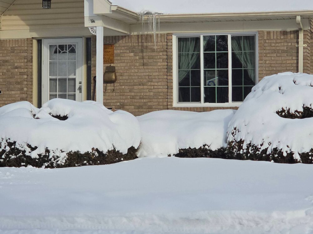
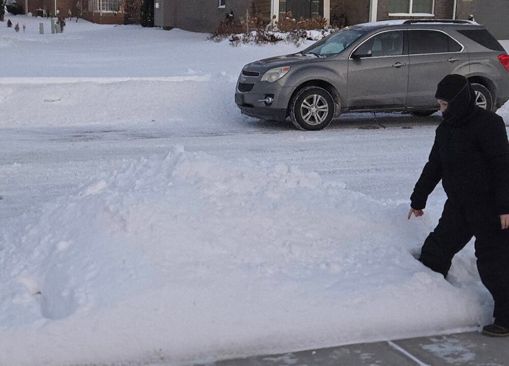
A lot of people do. When I say "deep winter" I dont just mean the cold. I mean the whole ball of frozen wax. And snow is falling most of the time anyway lol. Theres 7-10" of packed powder on the ground in SE MI plus bitter cold temps (and of course those big weenie snow banks). Its the dead of winter so there are winter festivals every weekend (this weekend is the long-standing Plymouth Ice Festival). This pleases kids, skiiers/cross country skiiers, snowboarders, snowmobilers, ice fishermen, and snow weenies of all ages. Sure plenty of people hate it, but a lot of people in MI like winter. -
Winter 2025-26 Medium/Long Range Discussion
michsnowfreak replied to michsnowfreak's topic in Lakes/Ohio Valley
Honestly. I know my areas climo/tendencies. I look at all the models and ensembles and look for trends....ESPECIALLY on ensembles. I look for what things are showing up consistently in some form or another vs things that are there one run and gone the next. Also I never ever take any model verbatim. Thats how I model watch because I dont understand a lot of the more technical stuff either. -
0.4" of snow today. Measurable snow has fallen on 14 of the past 15 days. Deep winter continues. January snowfall imby 17.6" and season to date 34.9". DTW Jan is 17.1" and season to date 33.9".

-
1/24-1/25 Major Winter Storm - S. IL, IN, and OH
michsnowfreak replied to A-L-E-K's topic in Lakes/Ohio Valley
I usually dont remember forecasted amounts from that long ago, just if something was a big bust either way. There were actually 2 positive busts right on the heels of GHDI. Feb 5 we got 4-6" when forecast 0, and Feb 20 we got 10-11" when forecast 1-3. Considering the fact that GHD/superbowl snowstorms have been shockingly frequent since 2011 and the Lions have risen from the dead, its a possibility. -
2025-2026 ENSO
michsnowfreak replied to 40/70 Benchmark's topic in Weather Forecasting and Discussion
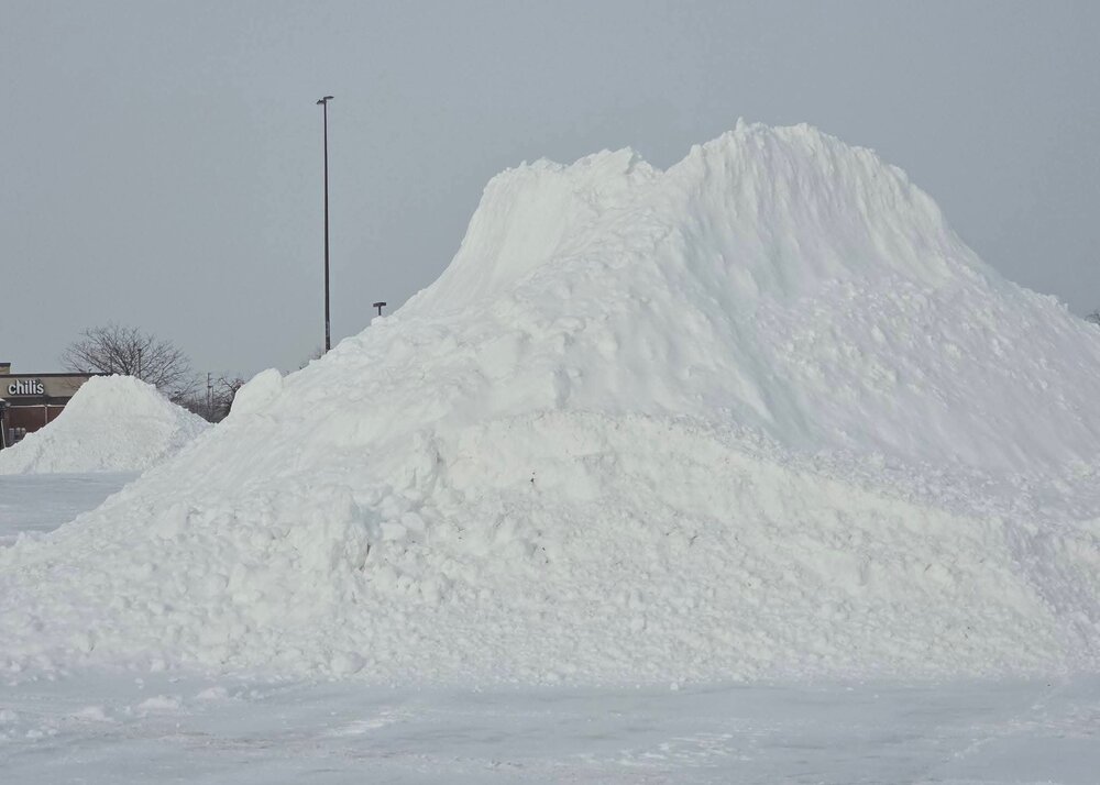
We didnt get a huge storm but its been arctic cold, so the past 2 weeks weve seen a 6" & a 5" storm and multiple smaller ones, theres huge snowbanks everywhere. That really adds to the look IMO. -
Winter 2025-26 Medium/Long Range Discussion
michsnowfreak replied to michsnowfreak's topic in Lakes/Ohio Valley
Its always interesting when several models/ensembles hint at roughly the same idea 2 weeks out, so its worth watching. But the key words...2 weeks out lol. In the mean time, just enjoying deep winter and hoping a clipper or two pops up. -
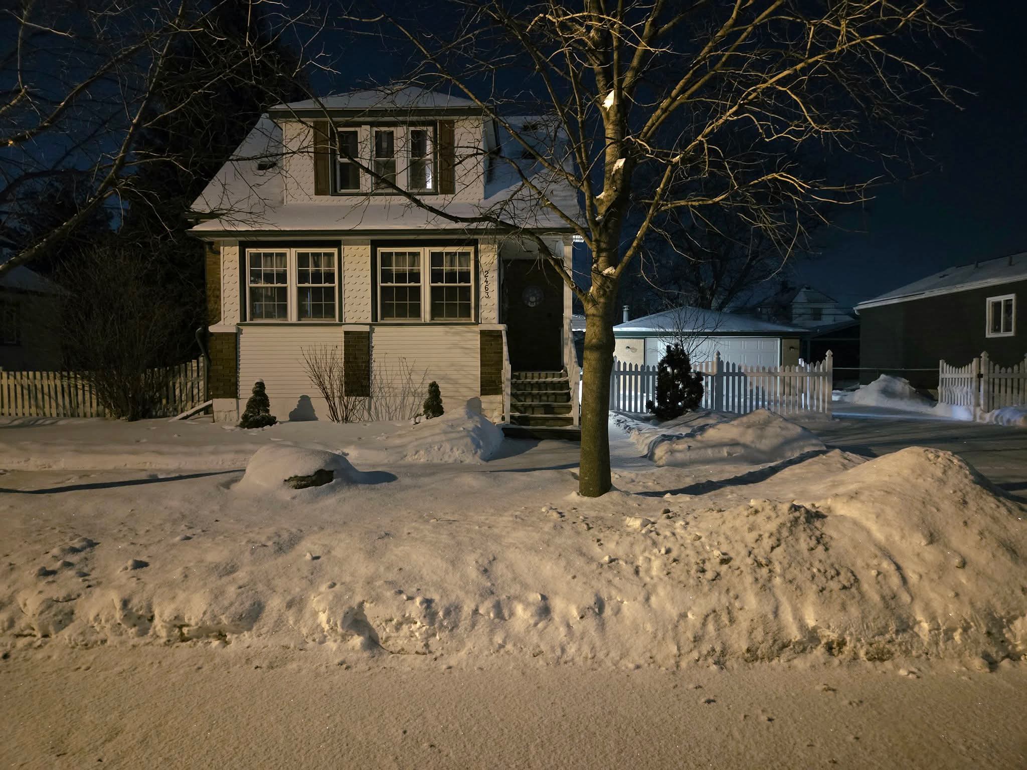
I was telling a story about the King winter of 2013-14 to someone, and it reminded me that it was the only time in my life i was ever scared of snow, albeit briefly. It was mid-late Feb and the snow depth approached 2 feet with huge drifts. I was in a hilly, drift-prone area not far from DTW, so of course, I wanted to play around and see how high some of the drifts are. When walking in deep snow, its best to KNOW your area, which I did not. So there I am, with my 40" snow stick getting a kick out of sticking it all the way in without hitting bottom (first time id ever done that), then I fell into chest deep snow. Those drifts are hardpacked. I couldnt move my arms to get out. After brief panic i started wiggling fingers to loosen the snow and as it loosened, i was eventually able to tunnel enough snow to get out of the drift. Absolutely wild. I walk in extremely deep snow every year up north, but never had an experience of falling into packed powder to my chest. There will be harsh winters (this has happily turned into one), but there will never be another 2013-14.
-
1/24-1/25 Major Winter Storm - S. IL, IN, and OH
michsnowfreak replied to A-L-E-K's topic in Lakes/Ohio Valley
The irony, youre right back to knocking double digit storms & exaggeration bs. 2013-14 was a months-long big dog. DTW had two 10"-11" snowstorms in 1 week (Dec 31/Jan 1 & Jan 5/6) and had double digit snow depth for months. The Jan 5/6 storm had 12-18" in a band NW of Detroit. A 2 foot snowpack with 4-5' drifts during Feb was the peak of that insane winter. And no, Feb 1/2, 2015 DID NOT take 30+ hours to get to 17". A huge majority of it fell between 11am-8pm Feb 1st. If that is not a big dog, I dont EVER want to hear reference to another area getting a snowstorm of 17" or less as being a big dog. And lastly, no, GHDII was our moment. GHD1, ahhh yes the early days of the laughable kuchera maps. Storm was a bust but not crazy. NWS Forecast was 10-15" and the area saw 8-12" (now THAT one took like 30 hours). Kuchi maps of course were higher. -
Winter 2025-26 Short Range Discussion
michsnowfreak replied to SchaumburgStormer's topic in Lakes/Ohio Valley
Some hit and miss squalls today dropped 0.4" and drifted some of the snowcover around. 13 of the past 14 days saw measurable snowfall. The lone holdout was Jan 20 with just a T. Deep winter continues. -
1/24-1/25 Major Winter Storm - S. IL, IN, and OH
michsnowfreak replied to A-L-E-K's topic in Lakes/Ohio Valley
Feb 1, 2015 essentially felt like a 20" storm at DTW. 3" on the ground to start, then nearly 17" more in 24 hrs. -
1/24-1/25 Major Winter Storm - S. IL, IN, and OH
michsnowfreak replied to A-L-E-K's topic in Lakes/Ohio Valley
PHN is Port Huron. Which is in SE MI, northeast of Detroit. He is not faulted for wanting a 20" storm. He is faulted for his repeated schtick of coming to the board during winter only, a time he does not reside in MI, mostly to stir his repetitious pot that everyone gets 20" storms but here, say weather/climate stats proving that wrong are bs, etc. Me, someone who loves snow and lives in a place where it snows all the time but said snow doesn't come 20" in 1 day, being his main target. And really, the era of '65-'85 did have one massive storm here (Dec 1, 1974, 19.3") but the era of 1999-2015 had far more double digit storms in SE MI than 1965-85. -
Yeah the drumbeat goes on. Frigid week ahead.
-
1/24-1/25 Major Winter Storm - S. IL, IN, and OH
michsnowfreak replied to A-L-E-K's topic in Lakes/Ohio Valley
Lmao you complained about double digit snowstorms all the time back in the 2000s/10s. You did in 2014, even with 2 feet on the ground because with all the storms we had no individual fall was over 12". The very next year, when Detroit got nearly 17" of snow on Feb 1/2, 2015 you found plenty of critique saying it was boring and took 24 hours to achieve (despite hours of visibility below 1/4 mile). Our last double digit storm (Feb 2021) you dont remember (even though you were in FL) so I guess it didnt happen. In fact you ghost this board all year except in winter when youre in FL so you can troll/repeat how no 20" storms are hitting SE MI. Me posting how many 20"+ storms in every first order station in the entire non-lake belt midwest is not "bs", its actual weather data. And how extremely lucky that you've experienced several! Your job just happened to place you in a town the exact day a 20" storm hit. That's lotto lucky. As for the tundra. Theres deep snow in place and mountains of snow everywhere, so i dont mind it in the least. Perfect for winter rec. -
Winter 2025-26 Medium/Long Range Discussion
michsnowfreak replied to michsnowfreak's topic in Lakes/Ohio Valley
Ive noticed the clipper pattern showing up on LR models. -
1/24-1/25 Major Winter Storm - S. IL, IN, and OH
michsnowfreak replied to A-L-E-K's topic in Lakes/Ohio Valley
Not to mention, we get plenty of big snowstorms. He is talking 20"+. Which any amount of data you can find will tell you that it is EXTREMELY rare in this region. Dubuque, Moline, Cedar Rapids, Rockford, Fort Wayne, Indianapolis, Cincinnati, Dayton, LaCrosse, Bismark, Peoria, Springfield, St Louis, Madison - not a single 20" storm in their climate record. Detroit has 1, 1886 Flint has 1, 1967 Des Moines has 1, 1942 Chicago has 3, most recent 2011 Columbus has 1, 2008 Lansing has 1, 1967 Toledo has 1, 1900 Cleveland has 1, 1913 Kansas City has 1, 1912 Milwaukee has 1, 1974 Minneapolis has 2, most recent 1991 St Cloud has 3, most recent 1965 -
1/24-1/25 Major Winter Storm - S. IL, IN, and OH
michsnowfreak replied to A-L-E-K's topic in Lakes/Ohio Valley
Its also ok to live in a state known for winter and to enjoy winter without being lectured from someone who does not reside in winter and does not like winter. And as I get older I use the snowblower more and more. Love shoveling but only when its not too heavy. My piles are no more special than others anymore. -
1/24-1/25 Major Winter Storm - S. IL, IN, and OH
michsnowfreak replied to A-L-E-K's topic in Lakes/Ohio Valley
You dont even live here in winter. You essentially hate winter. This storm was a great storm for the central ohio crew but it was short of 20" so if it was here you'd be complaining. I know, because you had many critiques when Detroit had a 16.7" storm in 2015. -
2025-2026 ENSO
michsnowfreak replied to 40/70 Benchmark's topic in Weather Forecasting and Discussion
34.1" here to date. Though there have been no huge storms here, snowfall has been very frequent. Plow/salt contractors have been on overtime every week since Thanksgiving except for 2 (Christmas week and 2nd week of January). Daily wind chills to -20F, a deep blanket of snow, mountains of powder everywhere, THIS is how the dead of winter should be! It's what the normies call "an old fashioned winter". 2025-26 will be the 2nd colder than avg winter in a row and is on pace to be the snowiest since 2017-18.