

michsnowfreak
-
Posts
16,674 -
Joined
-
Last visited
Content Type
Profiles
Blogs
Forums
American Weather
Media Demo
Store
Gallery
Everything posted by michsnowfreak
-
I remember that Ice storm well because I was driving to a Christmas party and it was very dicey. North of Detroit had freezing rain and by my house I had the old 33-34 and rain. It was one of the few times we saw liquid precipitation from early December until late March that Winter. Funny side note, the cold rain soaked into the snow pack and it actually did end up leaving us with bare spots for Christmas. Still plenty of white, but you could see patches of grass in spots (even though it snowed a dusting on Christmas). The reason I say this was funny is because literally the only days without a solid snowpack from early December until late March were December 23-25. Couldn't make that up lol. And I just brought up February 2015 in my recent my last post! I did not realize the all time record cold extended that far east. And how can I forget 2008-2009? Another solid Winter with well above average snowfall, a long lasting deep snow pack, and yet another year where the Detroit heat island managed to get to -15°. Even though outlying temperatures are always far more impressive, I bring up the numbers from the big cities because it shows just how intense the air mass was. Not saying there were not many impressive cold snaps over the years, but again I can say that these same heat islands went about 40 years mid 20th century without once seeing a temperature as impressive as has been seen FOUR different winters from 2009 to 2019.
-
We all have enough to worry about our backyards much less what's going on in the whole globe weather wise lol. I consider myself very green and environmentally conscious, but at the end of the day when it comes to the weather all I am worried about is what is happening in Michigan, just like ORH is about what's happening in Massachusetts, etc. Weather in other places certainly interests me, but all eyes are on mby for storms & current weather. 2013-14 was beyond incredible For so many reasons, including many that don't stick out when you look at the already record impressive weather stats. Then the following Winter, when Boston was getting buried in snow in February, the Midwest and Great Lakes were experiencing one of their all time coldest months on record. The cold in February 2015 was so intense. We had a nice deep snowpack as well, and it would have been far more impressive if the previous Winter wasn't fresh in the memory, but that month ended up 1st or 2nd coldest February on record at almost every major climate site in the region. It was competing with the longstanding February 1875. You can look up most major cities and you will see 1875 and 2015 as 1 or 2. Then of course more recently was the cold snap in late January 2019. Unlike the previous 2 mentioned years which were brutal winters, this was more or less just a fleeting cold snap but it was ridiculously impressive. I think spots in Iowa were reading as low as 40 below. The Chicago heat island got to like -28゚. Here on the cloudy side of Lake Michigan, Detroit "only" got to -15゚ but we still had windchills approaching -40゚. After feeling the -50゚ in 2014, I can't say it was the worst I've ever felt. This area went like 4 decades straight in the mid 20th century without having any days as extremely brutal as the ones mentioned above in those 3 recent winters. Moral of my post? It doesn't really matter what's going on globally in terms of number crunching averages to tenths of degrees, the potential for extreme Winter weather in my opinion is still as high as ever for most of us reading this post.
-
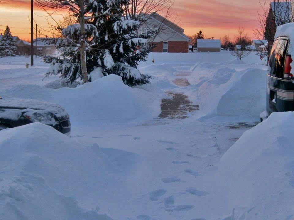
it was crazy for many reasons. In addition to deep snow for months, it didn't make sense that we were seeing so much snow with that extreme cold. On (the few) days when it wasn't snowing there was constant blowing and drifting snow. I've never seen anything like it. If the snowpack wasn't so densely packed powder from all the drifting the depths would have been more insane. The wind was constant all winter. The polar vortex in early Jan was unlike anything I'd ever felt...-50 wind chills (what would that be like -70 with the old formula?), the pic below I took my glove off just to snap the sunset and it felt numb in seconds. Little did I know that it was only the beginning of nonstop snow. Snowbanks and ice in the river lasted to mid or late April, and ice flows on Lake Superior lasted into early June.
-
An absolutely epic winter here. Even a watered down version i would take it and run.
-
Yes. In the lakes forum we are close group but honestly a lot of the time what's good for much of them is not good for me, and whats good for me is often a swing and miss for them. There are exceptions, like "bowling ball" storms, but at the end of the day everyone routes for their own backyard.
-
That stat after January 31, 2006 must be incredible for your area. It was kind of similar here. After white ground from Thanksgiving to New Year's, I had only 4 days with 1"+ snow on the ground in January. To this day I have never seen a more "bare" January before or after. Feb at least had around a 10 day stretch of white ground early to mid month but even then it was a disappointment because it was around 2 or 3" in depth after the failed superbowl storm which was originally supposed to drop 6 to 10". I was only 12 during the Winter of 1995-96 so thank goodness I really wasn't paying as much attention to what was going on around me lol. When I look back it was an absolutely ridiculous screw zone in a stripe from Chicago to Detroit. Seeing the heavy snow in both the upper Midwest and the East Coast makes me feel a little better about that analog. That's why I like to get a sense of how strong analog winters played out in the Midwest to the northeast as a whole because obviously no analog will be exactly repeated. Screw zones will happen any year, but if large areas had good Winters that's a good sign of an active winter this year in my opinion. The aforementioned duds are far outweighed by good times
-
I have almost the exact same thoughts about 2005-06. Thanksgiving to Christmas was pretty much a non stop courier & ives scene, so regardless of anything else I cannot say no to that. But after new years the Winter flat out sucked. 1974-75 was a good example of a mild Winter that was not short on snow here. We had 2 unusually huge snowstorms in Southeast Michigan. December 1st saw 18 to 20" fall in the immediate Detroit area and April 2nd saw similar amounts fall closer to Flint. 1985-86 does not look like anything memorable but considering the above average snowfall I'm guessing it was quite a clipper parade.
-
I would take that analog list mean any day all day here. I don't care to repeat the torchy midwinters of 2005-06 or 2016-17, but even they featured lots of holiday season snow. Definitely not a fan of 1995-96 (cold/dry but I know that's an East favorite) or 1971-72. Every other Winter on the list featured a much harsher Winter than average. Just curious, which ones on that list would a New Englander not care to repeat?
-
I always love popping into this thread early because they seem to be the 1st sub to start a Winter thread. The lakes forum waits until like October.
-
I would say the northern half of the lower peninsula is where you can really count on solid snowcover most or all of the season. The southern half of the lower peninsula is just too prone to occasional thaws, though once in a while you can get snowcover the entire Winter and then some (ie 1977-78, 2013-14). On the flip side the Great Lakes help ensure that even in the suckiest winters there will be plenty of snow chances. The extreme feast-or-famine scenarios that are possible in the northeast are far less likely here. That's why I love the years with good snowcover retention. It makes the Winter seems so much more harsh. Last year is a great example. It started early, it ended late. Snowfall ran around average in the Detroit area to above average in the Flint area. I could guarantee you that if you asked any non weather person if there was a lot of snow last winter, they would probably say no, because the entire season alternated white and bare with no extended stretches. That's why I'm surprised so many people in New England (per this thread) are not big on snowpack. All it would take is one nor'easter and some cold air to keep that snow around for a long time.
-
That's a good point. Maybe there is more moisture available there? I remember when you lived in West Michigan sometimes you said it seemed like Southeast Michigan actually got more synoptic snow. I mean don't get me wrong obviously I have to live by synoptic snow so I never really expect much accumulation from the lake, anything more than an inch is a bonus. I know I don't live in a snow belt so I just consider it nice that the mood flakes are almost always there. A lot of times clippers actually get like a boost/recharge when they cross Lake Michigan so they can dump more snow on the eastern end of the state, I always call those Lake enhanced synoptic snow. Finding a place prone to huge synoptic storms AND heavy Lake effect snow is just about perfect. But you also have to be prepared for those times When 2 miles away may get 2' and you may get an inch.
-
just awesome. id love to visit Watertown during an event. It is true that it settles faster, but it seems to settle faster during those tremendous lake effect storms because once the snowpack gets so deep it seems to need to really have a hefty water content to get deeper (like someone referenced earlier how Buffalo's 82" storm looked like 20" a few days later) If you get a few inches, yes it will settle down to like an inch but it will not disappear lol. For those lighter dusting type of events, winds are actually the enemy because they will help sublimate it fast. I was in the upper peninsula last February, they were forecast to get 3-6" of synoptic snow and the only got 3". Then overnight they forecast another 1 to 3" of lake effect I woke up and had about 7" of fluff on my car. That's daily life in the snow belts. One of my favorite things here is that following most synoptic snow events (except waa stuff), there are almost always lake effect snow showers on the back side. Though we won't see that much accumulation, it tops the snowpack with an incredible sparkle. If synoptic was a wet snow, the trees are plastered frozen in snow and everything glistens. A few pics I've taken. one was a heavy snow squall overlooking Detroit from the 17th floor of MGM, another was looking out my bedroom window one night. Its always funny to see people's reactions when the forecast is "snow showers likely" or "scattered snow showers" then they get stuck in a white out. And then on the flip side during a warned storm you may get 10" of snow but visib never drops below 0.25-0.5 mile.
-
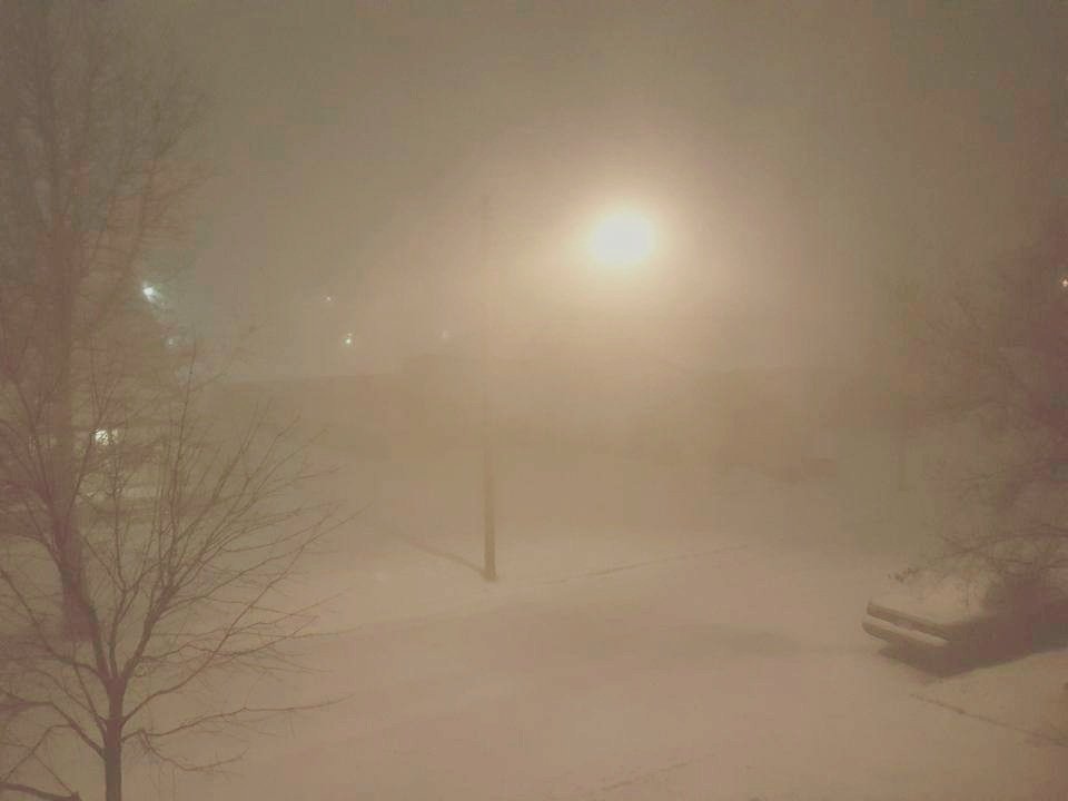
Lake effect is amazing. I want to do a chase this year. I have never been in one of the really big events but I have been in a few decent ones in northern MI. What's so cool about it is almost every lake effect event is full of white outs, even the ones that don't make headlines. Even here outside the belts most of our winters will feature multiple whiteouts. They blow in-and-out so suddenly but the visibility during the brief squalls gets to near zero. For a few fleeting moments you're in conditions more extreme then the biggest synoptic storms. That's why being in one of those ungodly streamers that just doesn't move would just be incredible at how fast it piles up.
-

August 2020 General Discussion
michsnowfreak replied to SchaumburgStormer's topic in Lakes/Ohio Valley
with the frontal passage overnight my total 24 hour rainfall was 3.89". -
If I am not mistaken September is climatologically the sunniest month of the year here in the Great Lakes.
-
What was incredible in May is that it snowed on 5 consecutive days (May 8-12), complete with heavy snow and legit Winter wonderland conditions for a few hours each side of midnight May 10/11. As for October, historically it's a 50/50 shot for seeing the 1st snowflakes, however 7 of the last 8 Octobers have seen snow. Prior to that, 9 of the previous 10 Octobers saw no snow. So it's very hit-and-miss, lately it's been a hit. I generally say, and I mean it honestly, October is the month I enjoy all the fall color then November 1st let it snow. However any time there's temptation of seeing snowflakes in October, I get excited.
-
August 2020 General Discussion
michsnowfreak replied to SchaumburgStormer's topic in Lakes/Ohio Valley
had 3.60" today between 4am and 7pm. -
it's crazy to think that it's only been 3.5 months since I've had snow and the first flakes of the next season may only be 1.5 month away. I know, I know
-
August 2020 General Discussion
michsnowfreak replied to SchaumburgStormer's topic in Lakes/Ohio Valley
2.48" here so far -
Looking like average temps for September for the CFS in its "good" range. Welcome fall!
-
August 2020 General Discussion
michsnowfreak replied to SchaumburgStormer's topic in Lakes/Ohio Valley
I dont follow as closely in summer, and I know beavis was just talking about UHI. just wondering is there any suspicious issues with ORD ASOS or is all good? Only asking because I'm genuinely surprised how much warmer Chicago was than here. Still a hot summer here, but far less days in the 90s. im estimating Detroit will place at 10th or 11th hottest summer. -
August 2020 General Discussion
michsnowfreak replied to SchaumburgStormer's topic in Lakes/Ohio Valley
Thunderstorms with off and on torrential downpours training over the area today. Will be interesting to see how much rain we end up with. -
This was no heat wave here, but if today's forecast high of 92 at DTW pans out, which it should, it will be the hottest temperature since July 9th.
-
I agree about UHI
-
mid September 1939 had some incredible heat for so close to autumn.


