michsnowfreak
-
Posts
18,735 -
Joined
-
Last visited
Content Type
Profiles
Blogs
Forums
American Weather
Media Demo
Store
Gallery
Everything posted by michsnowfreak
-

Winter 2022/23 Medium/Long Range Discussion
michsnowfreak replied to Chicago Storm's topic in Lakes/Ohio Valley
Last year, we lucked into back to back snowfalls Nov 27-29 (4.3" + 2.0") but as I recall they were isolated to just southern Michigan. Dec 2020 was also very flukey to SE MI. We basically had average snowfall while everyone else had a dumpster fire. I want to be buried all winter, but if the snow gods must I'll sacrifice another 200-300% of average snowfall February for some better times in the mid December to mid January timeframe. -
Winter 2022/23 Medium/Long Range Discussion
michsnowfreak replied to Chicago Storm's topic in Lakes/Ohio Valley
While the circus of models continue their indecisiveness....it does appear that mid month amd beyond looks more wintry. Hopefully translates to a white Christmas for most of us. -
November 29 gfs upgrade
-
Winter 2022/23 Short/Medium Range Discussion
michsnowfreak replied to Chicago Storm's topic in Lakes/Ohio Valley
-
Winter 2022/23 Short/Medium Range Discussion
michsnowfreak replied to Chicago Storm's topic in Lakes/Ohio Valley
Did the GFS undergo its late November "upgrade" as planned? -
A definite theme lately.
-
Woah slow down there
-
There's 28 days left in the month.
-
Winter 2022/23 Medium/Long Range Discussion
michsnowfreak replied to Chicago Storm's topic in Lakes/Ohio Valley
I'm as guilty as anyone else in complaining about the models every year, but I can honestly say I have never seen more run to run variability than we've been seeing lately. Not just in the op runs (that's not so unusual), but even the ensemble means. -
There's a few others. Dmc comes to mind.
-
Agree. 2010, 2013, 2016, 2017 were good Decembers. 2012 & 2020 were ok.
-
I've been measuring snow since 1995 and liquid precip since 2000. Regardless of what happens in December (unless we get unforeseen massive amounts of rain and snow), 2022 will be my driest year of record. The last 3 winters have stayed remarkably close to climo for total snow, each of the 3 finishing ever so slightly above average. Our last real snowy Winter would be 2017-18. Our last real low snow winter was 2011-12. We had a real good snowstorm in February 2021 (11") and despite the GHD bust last year we still had 2 6+ storms in Feb). Last 12+ storm Feb 2015.
-
Deform bands actually often give us better snow than the storm itself in many snowstorms. Today's rainstorm is a great sign for a stormier pattern setting up for Winter. We literally could not buy decent rains at any point during the warm season.
-
Honestly, there really weren't any downpours at least here. There was one decent one in like August. But it was brief. And no, February 17th was not the anticipated big dog. You're thinking of February 2nd. That 2 day, 2 wave totaled 0.82" precip, 9.2" snow.
-
Feb 17th was the wettest system of the year (1.29" pcp, 6.6" snow). Rain to hvy sleet to hvy snow. How unusual is that to not have any good summer downpours.
-
Yeah. 1.7 on the 19th and 0.1 just after midnight on the 20th. I'm ready for a bowling ball, those are my favorite.
-
Winter 2022/23 Short/Medium Range Discussion
michsnowfreak replied to Chicago Storm's topic in Lakes/Ohio Valley
Euro weeklies looking pretty cold for December. -
Winter 2022/23 Lake Effect Snow Thread
michsnowfreak replied to Chicago Storm's topic in Lakes/Ohio Valley
Would have been just incredible to see this south Buffalo snow in person. Lucky that 1 of our own lives in the hamburg jackpot zone, we don't have to rely on crappy media stories. Meanwhile here, after days of constant flurries and light snow showers here as the flow annoyingly kept the heaviest squalls to my north, last night's Arctic front brought heavy snow and blowing snow, dropping a quick 1.8". Up to 2.9" on the season. Temperatures dropped to 15° this morning and the powder was crunching as if it was mid-Winter rather than mid-November.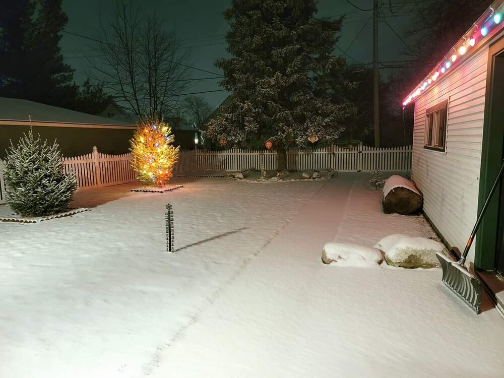
-
Agree. At that point I would cut my losses for the month, enjoy the Christmas season, and prepare for the annual snowmageddon February while enduring the annual crap December
-
If there's anything that puts the nail in the coffin on December, it's gotta be the ever so accurate day 13-16 on the op GFS. Sarcasm aside, the models really are struggling. Hoping the goods do come after a mild 1st week of the month as was alluded to by some recently.
-
Flurries have been falling pretty much constantly the last 2 days, along with a few snow showers. Had a light dusting last night of 0.1" but due to the flow was missing the 1-3 inch accumulations that hit North of Detroit. Like I said in the Buffalo thread, I can't stand missing an inch of snow by a few miles. I'd be on suicide watch for missing a few feet lol
-
Winter 2022/23 Lake Effect Snow Thread
michsnowfreak replied to Chicago Storm's topic in Lakes/Ohio Valley
Since you are south of Buffalo, looks like you are in a jackpot. So lucky. Is that where the heaviest was supposed to set up? Not being from the area it's hard to pinpoint exact placement. -
Winter 2022/23 Lake Effect Snow Thread
michsnowfreak replied to Chicago Storm's topic in Lakes/Ohio Valley
It goes with the territory being in a lake belt but it would literally drive me insane. I can't stand when someone 10 miles away gets an inch and I get nothing. Can't imagine missing out on feet. -
Larry Cosgrove: Maybe a ten day break from the widespread cold. But a look at the formative ridging around and above the Arctic Circle suggests a return to prolonged, full-latitude cAk (bitter cold) by the end of the first week of December. You would be hard pressed to use the word warm today, except perhaps in southern Florida or coastal California. And truthfully, descriptions of cold weather will be in use through the weekend. But the thumb-projection blocking ridge off of the West Coast will start to break down next Monday and Tuesday, and a period of semizonal flow at 500MB should favor a relatively mild condition from the Mississippi Valley to the West Coast over a November 23 -30 time frame. I hesitate to bring the warmth all the way to the Eastern Seaboard, since a vigorous southern branch storm out of Texas and Oklahoma may out the brakes on moderation by the end of the 6-10 day time frame. That disturbance may not fully stop the warm-up, but I can see two factors that will return the USA and Canada to the icebox as we get past the start of December. A ridge complex now In Scandinavia will begin to retrogress into Greenland (-NAO), linking with a weaker positive 500MB height anomaly over the Arctic Ocean (-AO). That will force a deep storm over the northern Pacific Basin to track eastward along the International Border into the Great Lakes. Remember the rule about cAk vortices: the closer a gyre gets to the lower 48 states, or into the nation, the deeper and more widespread the awful chill will get. If things work out as I expect them too, the period between December 7 and 21 will feature high usage of fuels and other energy sources to keep the people warm in the face of winter. And the moisture-laden southern branch storm track will be heard from as well. Hint hint. Sleep well tonight.
-
Jealous Harry. Good luck!