ValpoVike
-
Posts
545 -
Joined
-
Last visited
Content Type
Profiles
Blogs
Forums
American Weather
Media Demo
Store
Gallery
Everything posted by ValpoVike
-
Both the GFS and Euro agree with you.
-
As of this morning I am sitting at 15.59" for the year. The closest climo data to me is Estes Park which shows around 14" annual average precip. Not too bad...but we did have a good monsoon up here this year, followed by a very dry fall. It is remarkable just how different a situation it is just a few miles to the east.
-
Yesterday my home was a frustrating 200' below the snow line. This morning we awoke to a surprise 1.5". We are calling it the meteorological miracle
-
Something really strange is in the air today. There are tiny moist particles falling from the sky...I actually had to turn on my windshield wipers to push it aside.
-
That's really quite interesting. Up here in the Larimer foothills, there seems to be a real lack of climatological data however my experience over the past 8 years is that mid to late January is typically the coldest. This is very similar to what I experienced in my years of living in Ohio and Indiana. I wonder if there is something inherently different (altitude, LOL) in the short distance between Loveland and 7k+ feet up...or if the past 8 years have generally been anomalous up here. Not the first or last time that I wish there was good climate data up here.
-
LOL I spoke too soon and clocked 87MPH at 3:25pm. There is a nice Davis station a bit further up in the neighborhood that hit 93MPH around the same time. Pretty intense.
-
I recorded a 68MPH gust up here at 11:08am. So far (and thankfully) a rather run of the mill winter wind event up in this part of the foothills. I think it is perhaps a bit different story from Boulder and points south, like Bailey and Evergreen areas. It would be interesting to see more reports from down in that area.
-
About an inch up here so far this evening. It's crazy to be excited about that, but here we are.
-
Yep, Hwy 34 on my drive up to Glen Haven. I saw those records on a Facebook post and it is shocking.
-
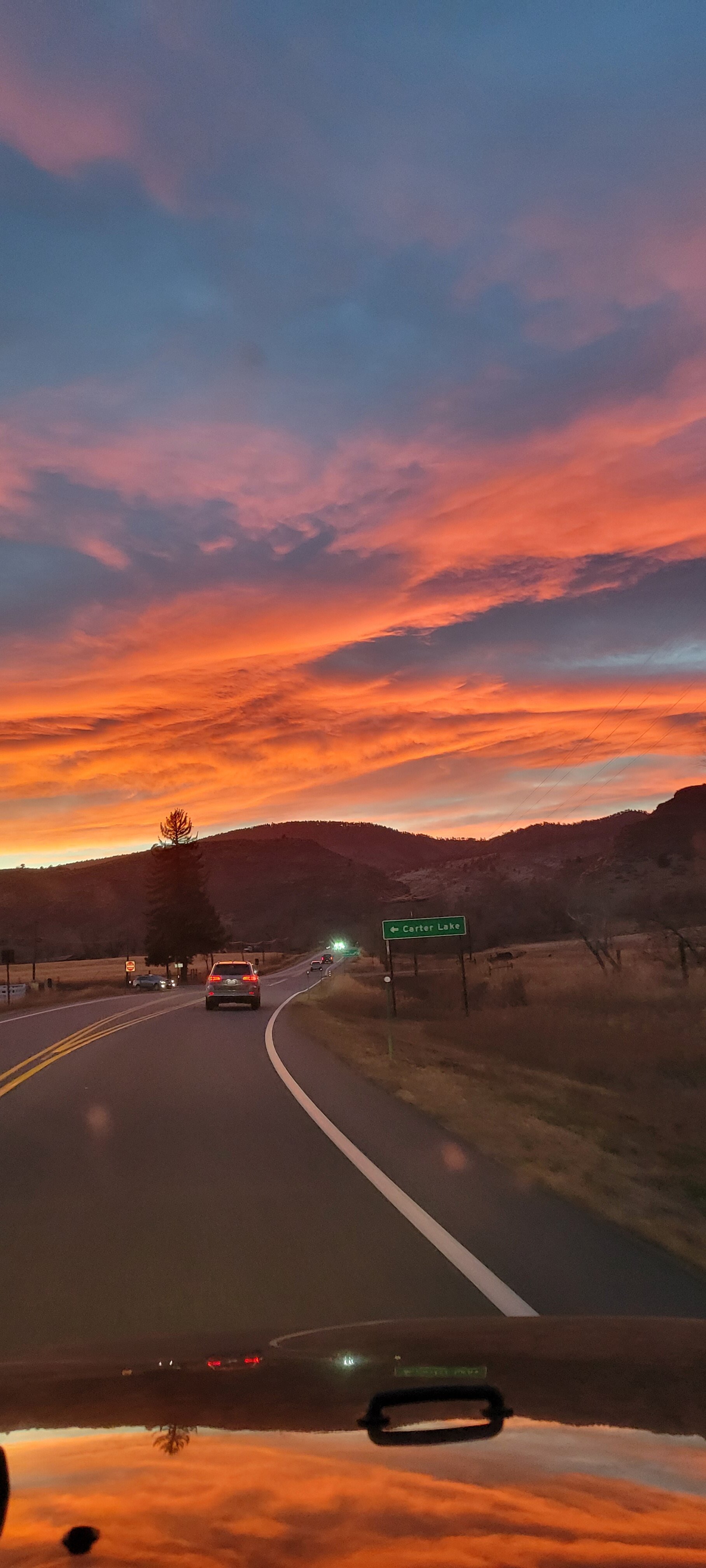
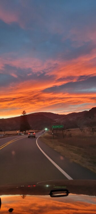
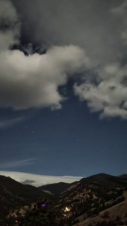
Off topic, but what a sunset this evening along the front range. I captured this photo on my way back home from the airport today. After 7 long days away, the mountains were a welcome sight.
-
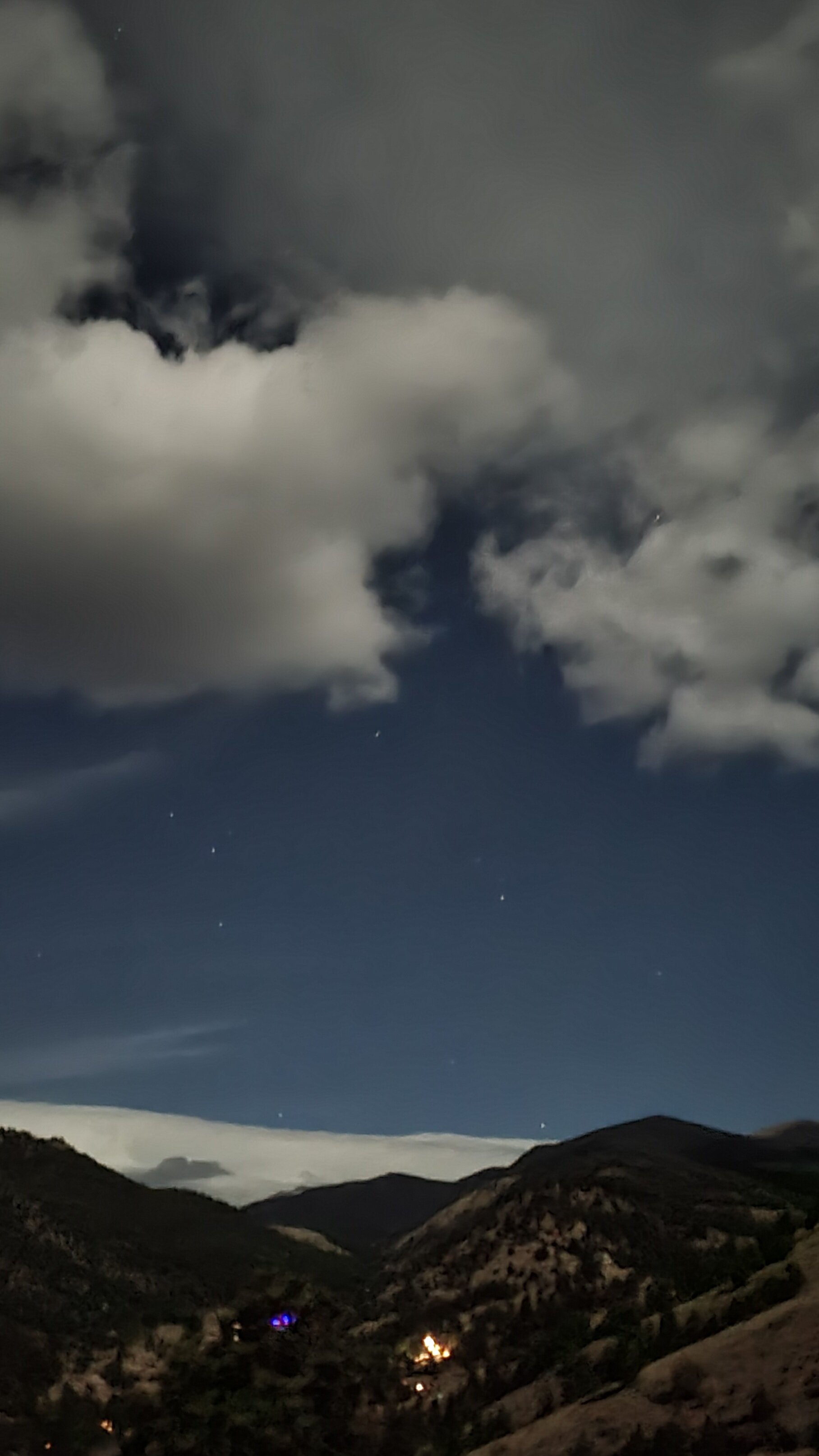
Tonight a weak mountain wave has developed overhead and has been reforming continuously. The full moon makes it an even more amazing sight.
-
Or super overcooked right up to the final days....like what it did last spring in the 90"+ storm for the Front Range that turned out to be 2'-3'.
-
I'll believe there may be a storm if it still shows early next week, but the GFS is overboard usually...especially at this range. I wouldn't take any of it verbatim.
-
It was a mixed blessing. We had 13 flash flood warnings during the Monsoon season, due to the burn scars. Are you up near Horsetooth?
-
Today marks the 1 year anniversary of Cameron Peak making it's final big run (and the start of my 3 week evacuation), as well as the start of the East Troublesome fire. What a difference a year makes. We actually had a decent monsoon up here this year, which was very fortunate as we were trending the same direction as last year before it kicked in.
-
We had 20 minutes of heavy snow and lots of lightning up here this evening. Love these October squall like conditions.
-
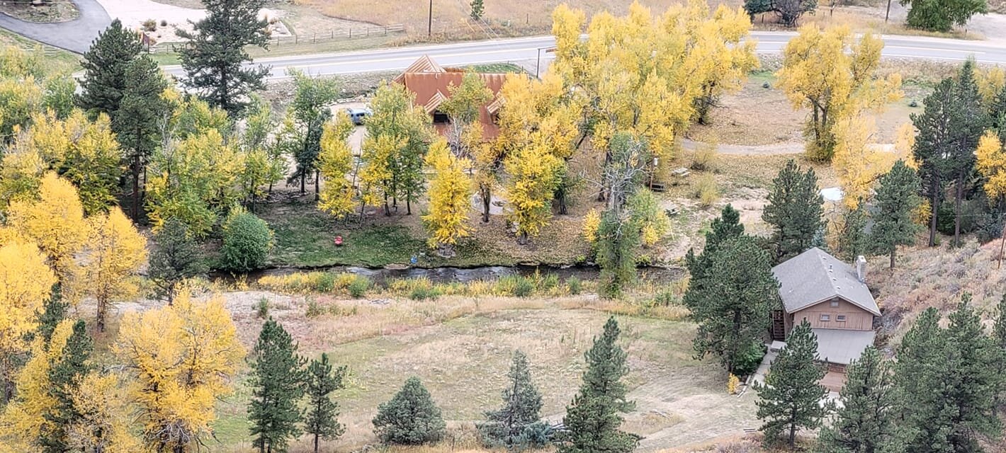
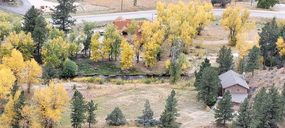
Just a few more days of color to go up here, but I did capture this yesterday looking down from my deck to the North Fork of the Big Thompson.
-
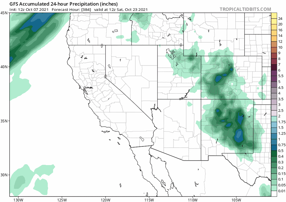
GFS is starting to show something way out at +384, which is a few days later...around the 22nd, with highest impact for NM. It will be interesting to watch this one as we move out of fantasy land.
-
I sure do enjoy reading your posts in the fall/winter/spring. You know it's definitely time to start that winter thread when Raindance is talking about Kamchatka.
-
Yeah, get that winter thread going. I actually had to fire up the heater this afternoon. Up here, sitting at a balmy 42 degrees and socked into the cloud deck with very limited visibility. It feels November'ish...
-
Not sure that one has much chance. Sam will leave a pretty good cold pool in it's wake, and even so it's recurve will allow anything that forms from that wave to rotate up and around the ridge. I think Sam is it for CV threats this year, imho.
-
The mountains have already had snow this year (a couple of weeks ago). For my area, ~Estes Park and Larimer county above 7k', I will predict Oct 7th. This is a very average date for us over the past few years. Last year was a very notable exception on Labor Day.
-
It looks like yesterday was good for a lot of areas. The hail scenes on the news were a bit interesting...fortunately it appeared to be mostly small hail but it did accumulate nicely.
-
Well, quite ironically....Phillips County in the far NE plains received up to 9" of rain last night.
-
I was just thinking last weekend that we have largely escaped large hail events this season. Sounds like that was a bit premature.