ValpoVike
-
Posts
545 -
Joined
-
Last visited
Content Type
Profiles
Blogs
Forums
American Weather
Media Demo
Store
Gallery
Everything posted by ValpoVike
-
The Euro just crapped on the QPFs, and the GFS came down a bit too but not as much.
-
And the GFS this morning must have been offended by our incredulity and added even more QPF to Larimer. Over 8" liquid.
-
Snow ratios could really be impactful this weekend. It will be interesting to see as even some of the lower qpf's of "only" 2.5" could be crippling at 12 or 15:1. Even 10:1 for that matter. For what it's worth, GFS seems to be factoring at 16 or 17 in spots. When I lived in the Midwest, ratio forecasts seemed to be a bit more accurate than in Colorado.
-
Actually, the 12z Euro and the 12z GFSv16 are in decent alignment. They even are fairly remarkably close in terms of the bullseye, with about .6" delta in QPF and much lesser discrepancies further south around Denver. The GFS on the other hand is still way out there on the maxima.
-
GFS isn't blinking at all. In fact, some areas in Larimer county are now showing over 7" QPF.
-
I saw 70" when I lived in Chardon, OH which is geographically the bullseye in the Lake Erie snowbelt. The most I have seen up here is 44" on a few May's ago...but that melted almost entirely a day later with temps in the 70's. The AFD from NWS this afternoon is rightfully trying to walk thru all of the things that can get in the way, but I would be absolutely thrilled to get half of the 65" that the GFS is showing IMBY.
-
You could go to Black Hawk and stay at one of the casinos...maybe a jackpot either way.
-
12z ECMWF is increasing QPF in Larimer and Boulder foothills as well. If I were chasing, I would target the Peak to Peak highway....Nederland to Estes Park area, but as mentioned it would be quite dangerous unless you got a hotel and tracked from a window .
-
I think the GFS may be on crack, but it is a very juicy trend on most of the models with 2"+ QPF's being pretty common up and down the foothills and the front range.
-
After what we went thru last August thru October, I say bring it on. Moisture rules.
-
For a real trip down fantasy lane, check out the GFS Kuchera numbers thru Sunday in the Larimer county foothills.
-
A nice little unforecasted surprise this morning of ~3" and still snowing. Not much, but we'll take it...
-
I thought Denver was upgraded overnight, but I could be wrong. EDIT: Here is text that I found in this morning's forecast discussion: We`ll keep the Winter Storm Warning going for the Denver and Boulder metro areas going early this morning (until 8 am) with the heavier band expected to slowly break down.
-
I noticed that today while browsing Pivotalweather. Both ECMWF and GFS showing a pretty good dumping.
-
It has really been coming down up here for the past couple of hours. The GFS started to trend particularly juicy up here yesterday, and am hopeful that it was right. Some good banding moving slowly south from Northern Larimer, so we shall see...
-
Inversions like this are fascinating to see. A few years ago in February, I drove down 36 from Estes where it was 53 degrees and when I got to Boulder it was snowing and 18.
-
Same story here. I moved here from a lake effect snowbelt and after my first two winters I unloaded my Cub Cadet due to being south facing. I do have a very steep driveway but just park at the top if there is snow on it. Probably an average of 10 days per year that I have to do that. The most extreme example of this is the May 19, 2017 storm that dumped 41" in my area. I kid you not...by the end of the next day it was 100% melted except under trees that had a bit of shade.
-
Oh sure, blame it on the baby! Never mind that we had issues with dryness before she was even born... I literally couldn't resist, but in all seriousness this has been a long term issue.
-
We had intense winds up here in Glen Haven last night. On my home weather station I clocked 99mph at 8:40pm, and lost power shortly after. Some fence damage, and many trees down in the neighborhood especially in the CP burn areas.
-
I did ok up here with a bit over 4". I was expecting 3-6. Definitely not a big snowfall, but I'll take anything.
-
Yesterday was crazy dry. My home station dipped to 4% as well.
-
Only about 1" up here in Glen Haven. We certainly needed a lot more. I woke up around 2am Monday morning and noticed out my window a flame on a ridge above the North Fork trail at the edge of the CP fire. Probably an isolated tree torching, but this fire isn't out yet and the dry pattern setting up over the next two weeks is of concern. Crazy how this thing has survived two large snow events.
-
We can hope. I have never wished for winter as hard as I do now, and I love snow so the bar was already set pretty high
-
Loveland should be ok, RH's there this morning have recovered to 90%+, winds should be much lighter, and the fire front is in grasses. I do think that parts of west Loveland dodged a bullet yesterday. As for our neighborhood, it has burned thru about 30% of the neighborhood and the VFD along with the IC crews are still battling. Fortunately since yesterday morning it appears to be active and not extreme. Reduced wind speed should allow aviation on it today which will help a ton. My home is furthest from the Miller Fork drainage, so I appear to be in good shape. I personally dodged a big giant bullet (so far), but others not so lucky.
-
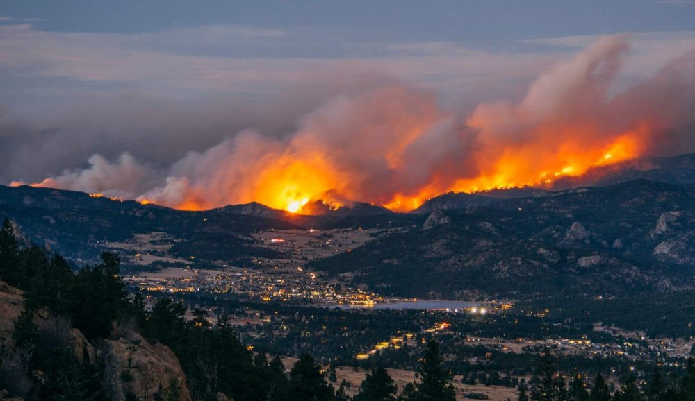
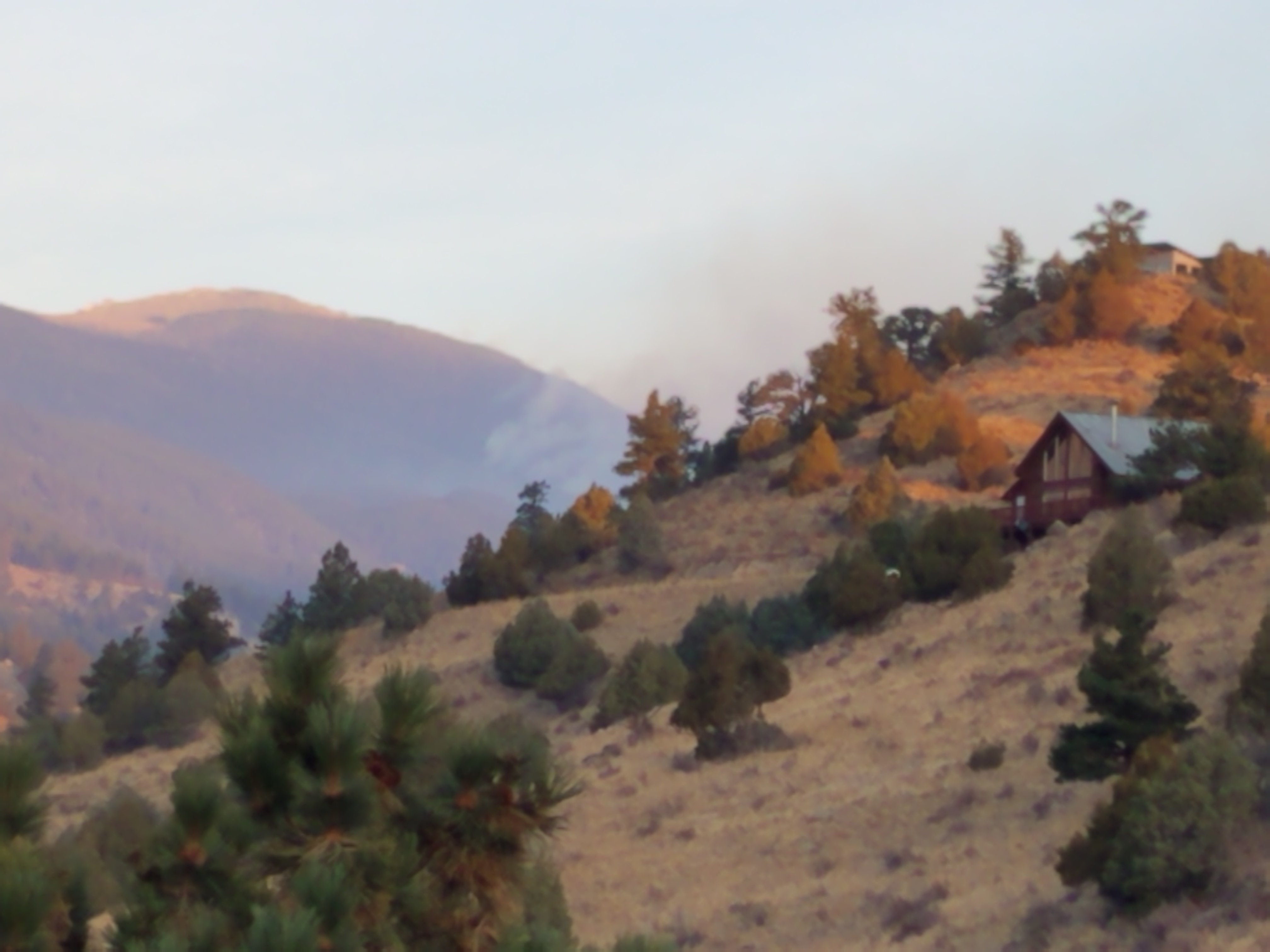
Well, that damn fire finally got us today. My neighborhood, The Retreat, was ground zero for today's fire. This thing is an unbelievable monster. Just this morning the Sheriff office let me thru at sunrise to winterize my home since they had cut power. I took this photo from my deck at 8am before I left. At the time, the fire was still smoldering which you can see. Then at noon it went extreme and tore down the Miller Fork drainage. The other image is from Lily Lake looking over Estes Park back towards the Glen Haven area.