pasnownut
-
Posts
10,312 -
Joined
-
Last visited
Content Type
Profiles
Blogs
Forums
American Weather
Media Demo
Store
Gallery
Everything posted by pasnownut
-

Central PA Winter 2022/2023
pasnownut replied to Blizzard of 93's topic in Upstate New York/Pennsylvania
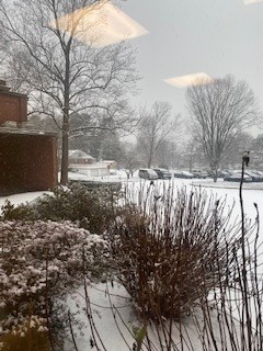
ask and ye shall receive. Its a start anyways... -
Central PA Winter 2022/2023
pasnownut replied to Blizzard of 93's topic in Upstate New York/Pennsylvania
Yep....from a macro perspective...nicest run of the season IMO. CMC and ICON showing similar features/placements w/ large scale features. Good enough for now. -
Central PA Winter 2022/2023
pasnownut replied to Blizzard of 93's topic in Upstate New York/Pennsylvania
thru 288....GFS says bowling balls east as the "ridge" out west is somewhat muted (PNA only slightly + as I suggested yesterday). Even though its not a big storm "diggy" kinda look in the east, its surely a fast flow deal and as we all know....if you throw enough chit into da chute....you're eventually gonna get hit by some. -
Central PA Winter 2022/2023
pasnownut replied to Blizzard of 93's topic in Upstate New York/Pennsylvania
and to your earlier point about the pattern and how it can deliver, the pic you posted here, is a rather decent look w/ SLP/HP placements into a trough in the east......hand me the dice....I'll roll em with that look...even if a day later. -
Central PA Winter 2022/2023
pasnownut replied to Blizzard of 93's topic in Upstate New York/Pennsylvania
for upcoming event we have a general consensus that something is coming. Euro hasnt regained the crown yet. JMO, but i'd take consensus over 1 model. FWIW, the Euro is similar wrt this weekend and is "onboard" for something. -
Central PA Winter 2022/2023
pasnownut replied to Blizzard of 93's topic in Upstate New York/Pennsylvania
Not sure what you think, but through 226, this is arguably one of the nicest runs we've seen in an while. Verbatim we'd have a few chances at some fun. I'm liking the look. Ridge and trough axis is decent, and storms coming from the south would be most welcome. -
Central PA Winter 2022/2023
pasnownut replied to Blizzard of 93's topic in Upstate New York/Pennsylvania
Typical post frontal upslope snow flurries/showers for the normal folks. Down here....BO RING...but will feel more like the season should. All eyes to Sun/Mon...lol's. -
Central PA Winter 2022/2023
pasnownut replied to Blizzard of 93's topic in Upstate New York/Pennsylvania
s/sw winds were to aid in the mixing. When I went to bed it was calm....when I woke up, it was calm. We both know that calm winds in mid winter can lock in the cold at surface....no matter how warm it is above your head. IMO the mechanism to "scour" the cold didnt show up. That was the hunch I had yesterday when looking at satellite imagery wind profiles and temps for our area. Today has been forecasted to be warm for a while so once the fog cooks off, so will the lid on the temps. Warmies can once again rejoice. -
Central PA Winter 2022/2023
pasnownut replied to Blizzard of 93's topic in Upstate New York/Pennsylvania
Yesterday my town had a swing from 46-55 degrees. 9 degree diff is crazy for this time of year. Lotsa mid 40's on way to office. -
Central PA Winter 2022/2023
pasnownut replied to Blizzard of 93's topic in Upstate New York/Pennsylvania
Yeah it looks like better times should be headed our way after this mid week mess. Not screamin snow kinda deal, but time to open the shades as things may pop up and even if marginal temp/snow wise, still better than this pea soup mess. Overnighters did look a touch better for Sun/Mon touch of winter love. Still window shoppin though...cash stays in pocket for a little while. -
Central PA Winter 2022/2023
pasnownut replied to Blizzard of 93's topic in Upstate New York/Pennsylvania
this is from NWS for 17022 in case any think i'm throwing out bunk info. 03 14:56 SE 6 2.50 Fog/Mist OVC007 51 50 96% NA NA 29.83 1010.1 03 13:56 Calm 1.75 Light Rain Fog/Mist OVC006 49 48 97% NA NA 29.88 1011.9 03 12:56 E 3 3.00 Light Rain Fog/Mist OVC006 49 48 49 43 97% NA NA 29.89 1012.3 0.02 0.53 03 11:56 SE 6 1.25 Light Rain Fog/Mist OVC011 47 46 97% 44 NA 29.93 1013.6 0.06 03 10:56 S 3 0.25 Light Rain Fog OVC005 47 46 97% NA NA 29.96 1014.6 0.05 03 09:56 SE 5 0.50 Light Rain Fog/Mist FEW060 FEW075 OVC090 47 46 97% 45 NA 29.98 1015.4 0.21 0.40 03 08:56 Vrbl 5 0.25 Rain Fog FEW006 BKN038 OVC065 45 44 97% 42 NA 30.00 1016.0 0.19 03 07:53 NW 3 0.50 Light Rain Fog BKN055 BKN085 OVC110 44 43 96% NA NA 29.98 1015.5 03 06:56 Calm 0.50 Fog/Mist FEW003 BKN100 44 43 47 43 96% NA NA 30.00 1015.9 0.02 03 05:56 Calm 0.50 Fog SCT003 OVC055 44 43 96% NA NA 30.02 1016.6 03 04:56 Calm 0.25 Fog FEW022 BKN055 OVC110 44 43 96% NA NA 30.02 1016.9 -
Central PA Winter 2022/2023
pasnownut replied to Blizzard of 93's topic in Upstate New York/Pennsylvania
I'm just hoping that we can keep the cloud deck to not get into the 50's or my windows may be open as well... -
Central PA Winter 2022/2023
pasnownut replied to Blizzard of 93's topic in Upstate New York/Pennsylvania
forecast high for today is 60 here in etown. Currently at 49 after starting out at 43. Small diurnal swing so far. Clouds better get crackin or NWS forecast is crackin....for today. -
Central PA Winter 2022/2023
pasnownut replied to Blizzard of 93's topic in Upstate New York/Pennsylvania
and to add to the options for next Monday, the ICON has a wonky Miller B come at us into WVA then pops off the VA coast. rt 30 and N stay in the blue precip and only coatsville to conshohocken get taint/rain. Not sure I'm buying what its selling, but I'm doing some heavy window shopping for sure. Overall consensus is notably better (and flow pattern looks reasonable), so hey I'm taking that as a ++? -
Central PA Winter 2022/2023
pasnownut replied to Blizzard of 93's topic in Upstate New York/Pennsylvania
and to add to Newmans post above....verbatim the 12z GFS shows snow on snow for the LSV inside the next 7 days, as there is a wave coming UNDER us next Monday as well. I'm taking this as a step in the right direction, as were not 240+ searching for paths to victory, and ens guidance continues to look a bit less ugly than what we currently are seeing. -
Central PA Winter 2022/2023
pasnownut replied to Blizzard of 93's topic in Upstate New York/Pennsylvania
yeah i too was wondering where that came from. Pulling an axle out of a trailer in rain....no fun, but its done. -
Central PA Winter 2022/2023
pasnownut replied to Blizzard of 93's topic in Upstate New York/Pennsylvania
thanks as always Mag. I'd also add that if you look at other tellies as we approach mid month, AO and NAO look to add credence to you suggested better look as we get beyond first week of Jan. PNA slightly pos suggests that ridging should be out west, but I'd also think a more flatter look than a big ridge/trough look for the conus. We really did miss out on a nice period before the holidays and hoping the luck of 2023 is a bit better for us. Clock is now tickin.... -
Central PA Winter 2022/2023
pasnownut replied to Blizzard of 93's topic in Upstate New York/Pennsylvania
Merry Christmas to all! Enjoy the time w/ family and friends. -
Central PA Winter 2022/2023
pasnownut replied to Blizzard of 93's topic in Upstate New York/Pennsylvania
yep i got my "normal" 4 minute snow squall, and then a couple of snow showers, but no stickage whatsoever. Meh, but happy for those that kept enough for the white Christmas. -
Central PA Winter 2022/2023
pasnownut replied to Blizzard of 93's topic in Upstate New York/Pennsylvania
You just gave him feedback. Your in trouble now buddy... -
Central PA Winter 2022/2023
pasnownut replied to Blizzard of 93's topic in Upstate New York/Pennsylvania
Yeah, I agree. It's likely precautionary due to fropa and flash freeze potential, more than the snow. 1/2" of snow on icy roads makes for some driving fun tho.. -
Central PA Winter 2022/2023
pasnownut replied to Blizzard of 93's topic in Upstate New York/Pennsylvania
Well I'll be dipped in dogshit. It IS the season of believing....so...here comes my white christmas URGENT - WINTER WEATHER MESSAGE National Weather Service State College PA 412 AM EST Fri Dec 23 2022 PAZ057-059-065-066-232130- /O.NEW.KCTP.WW.Y.0028.221223T1400Z-221223T2000Z/ /O.CON.KCTP.WC.Y.0003.221223T1800Z-221224T1600Z/ Dauphin-Lebanon-York-Lancaster- Including the cities of Harrisburg, Hershey, Lebanon, York, and Lancaster 412 AM EST Fri Dec 23 2022 ...WINTER WEATHER ADVISORY IN EFFECT FROM 9 AM THIS MORNING TO 3 PM EST THIS AFTERNOON... ...WIND CHILL ADVISORY REMAINS IN EFFECT FROM 1 PM THIS AFTERNOON TO 11 AM EST SATURDAY... * WHAT...For the Winter Weather Advisory, snow expected. Total snow accumulations of up to one inch. Winds gusting as high as 45 mph. For the Wind Chill Advisory, very cold wind chills expected. Wind chills as low as 15 below zero. -
Central PA Winter 2022/2023
pasnownut replied to Blizzard of 93's topic in Upstate New York/Pennsylvania
Saw 41 in lititz on way home. Not a mere flake left in Akron.....cept the one typing this. congrats to all the overachievers. Happy to see a bit of a "bust" for many of you. -
Central PA Winter 2022/2023
pasnownut replied to Blizzard of 93's topic in Upstate New York/Pennsylvania
Yeah, looked at some morning Ens runs, and mid next week through first few days (week) of Jan look warmer than a few days ago. As our cold is often delayed I'm hoping that doesnt happen once again (and I should say cool - cause guidance doesnt look cold....just less warm. -
Central PA Winter 2022/2023
pasnownut replied to Blizzard of 93's topic in Upstate New York/Pennsylvania