-
Posts
9,501 -
Joined
-
Last visited
Content Type
Profiles
Blogs
Forums
American Weather
Media Demo
Store
Gallery
Everything posted by pasnownut
-
Fall/Early Winter 2019 Forecasts and Discussion
pasnownut replied to pasnownut's topic in Upstate New York/Pennsylvania
yep, typically low solar and period beyond can be good for lovers of winter. I read that we were at the min, but last week FRD or someone, suggested we are still trending lower. Hoping we can add it to our weather bag of tricks. Just like SSW -
Can i share this in my home subforum? Its as though someone tilted the board and most fell off the ledge already. Man its gonna be a LONG winter. This really is acceptable if verified. Looks like we see saw (if one believes ENS guidance), but then potentially the road to the promise land may be looking better.
-
Actually he and Chill were sniffing out the not so good look. Glad to see Bob already sniffing the way out. I know next week looks less than fun, but looking at the tellies, I just dont feel it will be horrible. Will it snow, maybe not, but the only thing worse than no snow, is warm and no snow. I think that by this weekend, and if one believes tellies/MJO, that the light in the distance may be getting brighter....or maybe it is just the longer daylight that starts this weekend.
-

Fall/Early Winter 2019 Forecasts and Discussion
pasnownut replied to pasnownut's topic in Upstate New York/Pennsylvania
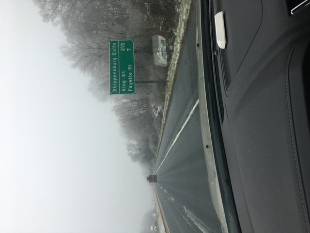
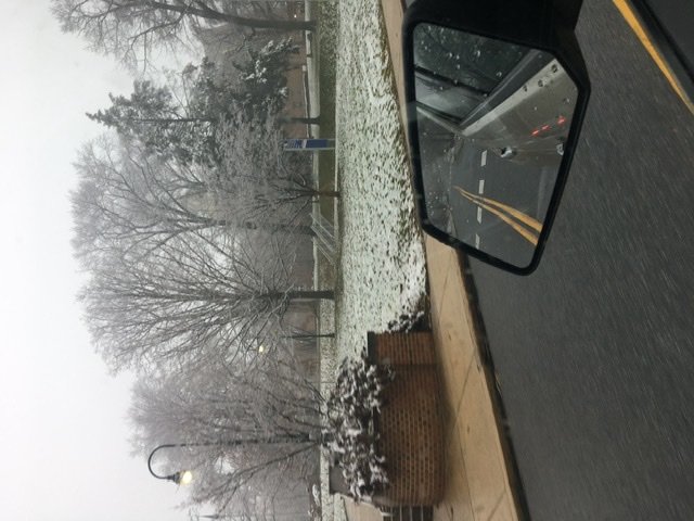
Santa's driving summary for today. (I'm in sales and am old school, and like to see my big accounts to say thank you w/ chocolates and fun stuff.) Santa's route: Etown (icy) Middletown(a little less icy) Mechanicsburg (not much of anything) Shippensburg (see pics from ealier - todays winner for my route) Duncannon - mountaintop icing Selinsgrove - mountaintop icing Lewisburg - ditto Danville - a little icier Bloomsburg - icy then through Centralia to Minersville and down 81 to just above Pine Grove (icy and snowing lightly once on 81) Pine grove to Myerstown (rather icy on trees) Home - natsomuchofanything 294 miles and I'd say I78-81 corridor did the best. -

Fall/Early Winter 2019 Forecasts and Discussion
pasnownut replied to pasnownut's topic in Upstate New York/Pennsylvania
Great points. Just reminding some that this IS a forum to discuss weather, both good and bad. Its rather loose in here, but if you just want to be a Debbie, i'm asking you to start a banter thread for it. If you want to Debbie AND say why for all to discuss, then keep it here. Thats what we are here for. Usually for every argument, there is often a counter argument. Thats what makes the forum click and what the thread is for. Take last night, I thought based on pattern/models, and knowing the tendencies therein, the mesos would be correcting colder (and they did, but not enough), and for that I went on a limb and thought more frozen would verify (part 2). It did in some areas. Others, notsomuch. I come here to discuss, and can be wrong just like the next guy, but at least I offer my reasons for my stance....right or wrong. Anyone coming in here w/ definitive tones, should know better with this sport. Rant over, but winter is not....technically its yet to start. Into next week looks to warm w/ ridging building in the east, and trough dumping into SW. Beyond Christmas (if one believes LR guidance signs of that breaking down start to emerge). For those that think LR guidance is bunk, please feel free to share whatever else you have to offer. MJO is low amplitude NAO/AO still somewhat negative, albeit less than current. PNA headed towards neutral from negative. Points I'm making is that no indicie is the sole driving faction for the good or bad to where we are headed. Furthermore, the base state is notably different than last year, so to say "here we go again" might end up right, but for the wrong reasons. I'm not hear to be snarky w/ ANYone, and consider us a pretty cool group, but I come here to discuss, learn, and have some fun along the way. I hope that most of you know my style and appreciate my stance. Please start a banter thread. EVERY other forum/subforum has them. Thanks Non Management Weather Weenie -

Fall/Early Winter 2019 Forecasts and Discussion
pasnownut replied to pasnownut's topic in Upstate New York/Pennsylvania
Wow.....already. While I prefer December snow to set the mood, Meteoroligically, our region will take the first 2 weeks of March any day over Dec for the atmospheric ease for it to snow. Stats likely prove that as well. We’ve had how many December blizzards/nor’easters? yeah this storm sucked, but please not already guys. Just go outside and punt your blow up Santa. You’ll feel much better. -

Fall/Early Winter 2019 Forecasts and Discussion
pasnownut replied to pasnownut's topic in Upstate New York/Pennsylvania
-

Fall/Early Winter 2019 Forecasts and Discussion
pasnownut replied to pasnownut's topic in Upstate New York/Pennsylvania
Yeah, as Mag alluded to earlier, if we had even a decent HP anchored in NE we'd have been seeing a notably whiter event, and like Trainer said, generous qpf would have made this a good one. Meso's were suggesting more frozen, and while the snow part didnt work (which it usually doesn't in situs like this), we do tend to hold the cold a little better than modeled and that to seems to be the case. We were close to a good one, but it looks like we now have a boring period coming up thru Christmas as the red n blues on the 500's say take some time off and see you after Christmas, as the pattern looks to start trending more favorable around the 26th and beyond. -

Fall/Early Winter 2019 Forecasts and Discussion
pasnownut replied to pasnownut's topic in Upstate New York/Pennsylvania
oh i forgot....33 here in Etown -

Fall/Early Winter 2019 Forecasts and Discussion
pasnownut replied to pasnownut's topic in Upstate New York/Pennsylvania
Little bit of ice accrestion here in ETown. Nada at home, but i really was never in part 2 so its all good. What shame this couldnt be snow, but it's mid december, and looks like 80N is snow/ice and maybe back to some snow. Oh well...onto the next one. -

Fall/Early Winter 2019 Forecasts and Discussion
pasnownut replied to pasnownut's topic in Upstate New York/Pennsylvania
Radar just west of you appears to have snow on your doorstep. Hope you cool enough to see it. -

Fall/Early Winter 2019 Forecasts and Discussion
pasnownut replied to pasnownut's topic in Upstate New York/Pennsylvania
I think us LSV counties are out in this one. Mesos say just north of us were where the action would/could be. I’m at 33 here which is below what I thought it would be by now but still not enough for any fun here. Enjoy northern crew. -

Fall/Early Winter 2019 Forecasts and Discussion
pasnownut replied to pasnownut's topic in Upstate New York/Pennsylvania
32-33 with better returns n some mashed flakes mixed in -

Fall/Early Winter 2019 Forecasts and Discussion
pasnownut replied to pasnownut's topic in Upstate New York/Pennsylvania
Bolded part matches mesos nicely and like I said this am. 80 north is jackpot -

Fall/Early Winter 2019 Forecasts and Discussion
pasnownut replied to pasnownut's topic in Upstate New York/Pennsylvania
Yeah evening runs look quite icy for some. My guess they dont want egg on their face for not calling out early on. Special weather statement is the easiest best way out for ultra short term forecast statement. This was part of my point the other day. While situs like current Dont have to mean big snows, they often can over perform with cold holding vs model outputs. For me winter weather is any sort is a win in December. -

Fall/Early Winter 2019 Forecasts and Discussion
pasnownut replied to pasnownut's topic in Upstate New York/Pennsylvania
Couple raindrops w part 2. 35 deg. -
FWIW Gfs was seeming to “Bring it back” early on as well. More ridging out ahead of it. Not sure it ends up being anything but it came across my mind when seeing it. edit-and just seeing what Bob posted about it being frozen is also a worry as ridging is the likely reason for seeing it pop but the byproduct is scouring our precious cold in advance. Just not a winning setup verbatim
-

Fall/Early Winter 2019 Forecasts and Discussion
pasnownut replied to pasnownut's topic in Upstate New York/Pennsylvania
light snowflakes falling...#mood snow -

Fall/Early Winter 2019 Forecasts and Discussion
pasnownut replied to pasnownut's topic in Upstate New York/Pennsylvania
You're ahead of me by 1.899" -

Fall/Early Winter 2019 Forecasts and Discussion
pasnownut replied to pasnownut's topic in Upstate New York/Pennsylvania
WRF/NAM's look rather similar so it may be a little bit of snow/ice before we change over. 2001kx and Voyager look to be in the fun zone. -

Fall/Early Winter 2019 Forecasts and Discussion
pasnownut replied to pasnownut's topic in Upstate New York/Pennsylvania
I edited my bolded part after you got to it, as i changed snow to frozen, as that is the delineation that i was meaning to highlight -

Fall/Early Winter 2019 Forecasts and Discussion
pasnownut replied to pasnownut's topic in Upstate New York/Pennsylvania
I've tried hard to forget, but thought it was 15 or 16. I do remember the temp though... 76 -

Fall/Early Winter 2019 Forecasts and Discussion
pasnownut replied to pasnownut's topic in Upstate New York/Pennsylvania
member that time a couple years ago.................. skorts for everyone..... thank goodness we will have plenty of liquids for hydration.... -

Fall/Early Winter 2019 Forecasts and Discussion
pasnownut replied to pasnownut's topic in Upstate New York/Pennsylvania
unfortunaely dp's are up so not much help there. Yeah, we need good rates to score frozen down here. Heh...just looked at the nooner NAM's and tippy top of Lanco flirts w/ frozen for round 2 through the whole next round. If you look at snow panels (and understand the flaws within) - one can see the wet/frozen lines - and thats what i use them for in situ's like this. -

Fall/Early Winter 2019 Forecasts and Discussion
pasnownut replied to pasnownut's topic in Upstate New York/Pennsylvania
and to add to above, it was largely a rainer on GFS well into the weekend. If we can mute warmup a bit more, looks like a shot at white christmas for parts of I 80 and N. Here is the hot panel i'm concerned about.


