

WmsptWx
-
Posts
5,521 -
Joined
-
Last visited
Content Type
Profiles
Blogs
Forums
American Weather
Media Demo
Store
Gallery
Everything posted by WmsptWx
-
Okay. The wind has my attention.
-
Makes it easier to moon the parking lot.
-
Which I have kind of felt for a while. I've mentioned it on here but my animals are putting on weight like they've got congestive heart failure and my one cat in particular has grown a much different, thicker, fluffier winter coat than he has in the past. I know that's in no way scientific evidence of a less torchy winter, but it's weird. I didn't watch 14lb bags of kibble disappear in a week the last few winters. Right now I wouldn't be shocked if the entire winter ended up BN.
-
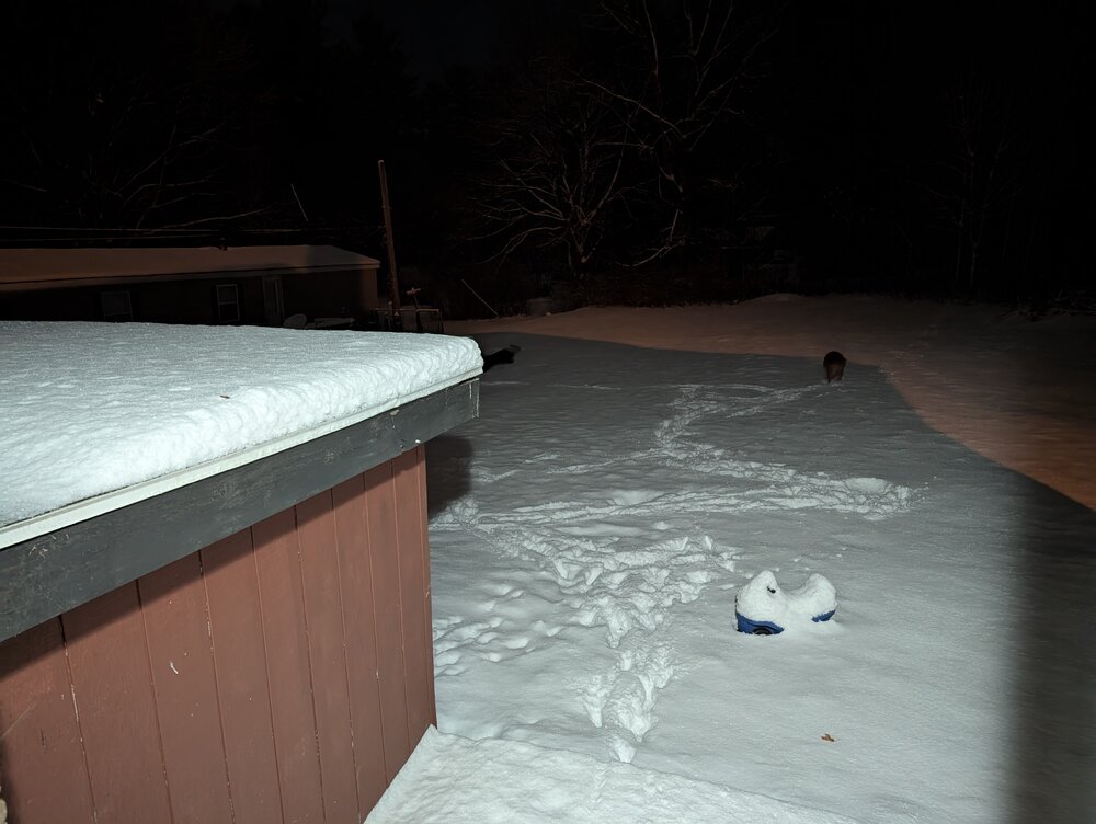
I'm too tired to channel Tolleris Gottfried this morning and I got a new phone last Friday and they didn't have any cases for it and the phone is slicker than a toddler's nose during the Christmas play and I've fumbled this goddamned thing a hundred times already typing, so even trying to address this would probably just result in a Google Pixel 9-sized hole in my work monitor. Coincidentally, the Google Pixel 9-sized hole is about the same as what Nanny's axe wound looks like after the dog laying in the snow finishes up.
-
Nice little uh... first half?
-
Point and click definitely upped the forecast for my zone. Tonight Snow before 1am, then snow showers, mainly between 1am and 5am. The snow could be heavy at times. Patchy blowing snow after 1am. Low around 20. Breezy, with a southwest wind 14 to 20 mph, with gusts as high as 34 mph. Chance of precipitation is 100%. Total nighttime snow accumulation of 2 to 4 inches possible. Thursday Snow showers likely, mainly after noon. Patchy blowing snow. Mostly cloudy, with a high near 26. Breezy, with a west wind 23 to 25 mph, with gusts as high as 50 mph. Chance of precipitation is 70%. New snow accumulation of 1 to 2 inches possible. Thursday Night Snow showers likely, mainly before 1am. Patchy blowing snow before 10pm. Cloudy, with a low around 20. Breezy, with a west wind 15 to 22 mph, with gusts as high as 43 mph. Chance of precipitation is 60%. New snow accumulation of 1 to 2 inches possible. Friday A chance of snow showers. Mostly cloudy, with a high near 25. West wind around 14 mph, with gusts as high as 24 mph. Chance of precipitation is 50%. New snow accumulation of less than a half inch possible.
-
I'm not kidding, 350 over Sandy Ridge was bad but 322 from Philipsburg to Bigler was a damned mess. I could have army crawled home faster.
-
Maybe I should ask you. Pat Narduzzi decided to dunk on West Virginia and then his season went directly into the shitter.
-
Who asked you?
-
Nearing 2 inches of snow. 322 is a colossal shit show.
-
I just drove up 350 from Huntingdon. Mistake.
-
Everything has caved. It's puking snow.
-
PennDOT tractor just went past preparing the road. Very interested to see how this goes up here.
-
If you had the chicken pox, the shingles virus is already inside you.
-
URGENT - WINTER WEATHER MESSAGE National Weather Service State College PA 421 AM EST Wed Dec 4 2024 .A complex storm system will cause light snow later today and during the first part of the night. Stronger snow showers and some heavy squalls are expected in the second half of the night. Then, lake effect snow bands will kick in on Thursday. A break in snowfall accumulations could occur Thursday morning for areas south of Interstate 80, but the snow will pick back up again later in the day. The lake effect will continue through Friday night across for the northern Alleghenies. PAZ017-024-033-042230- /O.UPG.KCTP.WS.A.0009.241204T2100Z-241206T0900Z/ /O.NEW.KCTP.WS.W.0010.241204T2100Z-241206T1800Z/ Clearfield-Cambria-Somerset- Including the cities of Clearfield, Johnstown, Somerset, and DuBois 421 AM EST Wed Dec 4 2024 ...WINTER STORM WARNING IN EFFECT FROM 4 PM THIS AFTERNOON TO 1 PM EST FRIDAY... * WHAT...Heavy snow expected. Total snow accumulations between 3 and 8 inches. Winds gusting as high as 55 mph. * WHERE...Cambria, Clearfield, and Somerset Counties. * WHEN...From 4 PM this afternoon to 1 PM EST Friday. * IMPACTS...Travel could be very difficult. Areas of blowing snow could significantly reduce visibility. Strong winds could cause extensive damage to trees and power lines. * ADDITIONAL DETAILS...A lull in the snowfall is expected Thursday morning, but the snow will pick up in intensity again later in the day. PRECAUTIONARY/PREPAREDNESS ACTIONS... If you must travel, keep an extra flashlight, food, and water in your vehicle in case of an emergency. The latest road conditions for the state you are calling from can be obtained by calling 5 1 1. && $$
-
Notre Dame is locked in at 5. The committee just hasn't put them there yet.
-
Oh Jesus I didn't even see 2001ktx posted that three hours ago.
-
Wednesday A chance of light snow, mainly between 1pm and 4pm, then a chance of snow after 4pm. Cloudy, with a high near 36. South wind 10 to 14 mph, with gusts as high as 25 mph. Chance of precipitation is 50%. New snow accumulation of less than a half inch possible. Wednesday Night Rain and snow, becoming all snow after 10pm. Low around 23. Southwest wind 14 to 18 mph, with gusts as high as 39 mph. Chance of precipitation is 100%. New snow accumulation of 1 to 3 inches possible. Thursday Snow likely before 1pm, then snow showers likely after 1pm. Cloudy, with a high near 28. Breezy, with a west wind around 22 mph, with gusts as high as 48 mph. Chance of precipitation is 70%. New snow accumulation of 1 to 2 inches possible. Thursday Night Snow showers likely. Mostly cloudy, with a low around 21. Breezy. Chance of precipitation is 70%. New snow accumulation of less than one inch possible.
-
URGENT - WINTER WEATHER MESSAGE National Weather Service State College PA 243 PM EST Tue Dec 3 2024 PAZ017-024-033-041000- /O.EXA.KCTP.WS.A.0009.241204T2100Z-241206T0900Z/ Clearfield-Cambria-Somerset- Including the cities of Clearfield, Johnstown, Somerset, and DuBois 243 PM EST Tue Dec 3 2024 ...WINTER STORM WATCH IN EFFECT FROM WEDNESDAY AFTERNOON THROUGH LATE THURSDAY NIGHT... * WHAT...Heavy snow possible. Total snow accumulations 6 inches or more possible. Winds could gust as high as 50 mph. * WHERE...Cambria, Clearfield, and Somerset Counties. * WHEN...From Wednesday afternoon through late Thursday night. * IMPACTS...Plan on slippery road conditions. The hazardous conditions could impact the Wednesday evening and Thursday morning commutes. Gusty winds could bring down tree branches. PRECAUTIONARY/PREPAREDNESS ACTIONS... Monitor the latest forecasts for updates on this situation. && $$
-
Is there something different from the ones I was getting last week?
-
There's going to be some big time parties at these resorts this Christmas. And a ton of rusty skiiers/boarders.
-
So it's going to be cold this winter and not warm? Outstanding.
-
For $65.95/month, Dr. Tolleris will hug you while calling you an asshole.
-
Which means they never should have been down 17 points to a four loss team, which means they should drop a considerable amount even in a win.
-
SECESPN has just established the narrative: Prop up four loss Georgia Tech to save three loss Georgia. And just to be clear, if Alabama wins tomorrow and Georgia wins the SEC next week, the SEC will absolutely throw Texas under the bus as a newcomer to get three loss Alabama and three loss Georgia in the playoffs at the expense of Texas and Indiana.


