

HoarfrostHubb
-
Posts
58,756 -
Joined
-
Last visited
Content Type
Profiles
Blogs
Forums
American Weather
Media Demo
Store
Gallery
Everything posted by HoarfrostHubb
-
HRRR looks like it has a little more incoming for you later today
-
Yeah. Better now. Coating
-
Flurries. Yawn
-
Definitely a warm look upcoming.
-
Not bad!
-
Lots of tulips/daffodils coming up in our flower beds. Even some of the other perenials like our giant bleeding heart is waking up. Grass has some green, but a way to go still.
-
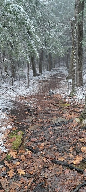
Got in what was probably my last session of the season at Wachusett yesterday, April 4. Conditions were really really rough. Some stuff was barely passable. Some decent snow in others. Left by 10AM after doing 9 runs. They claim they want to open next weekend for their pond skim etc. But not sure how they can pull that off. Not much snow to push around, more melting ahead. It was a great season overall. March really sucked for snow.
-
The ice on my pool is almost melted
-
That might cause a divorce in my household
-
59F and partly sunny. probably made my final turns of the season at WaWa.
-
We didn't have anything stick at my house. Rates weren't good. I didn't see much snow after dark, but I wasn't looking much.
-
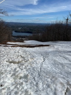
Somewhere on Wachusett today
-
Saturday looks good. Sunday looks ass-ish
-
Snowing in Hubbardston
-
I still want to ski a couple more times... Not sure it will happen on the weekend of April 11/12, but I will try
-
Blue dot is me noggin. 63F attm
-
my condolences
-
This year I think it has 67 days
-
I think his mother is the woman who's face is just to the right of the ball.
-
How is it still March?
-
67 here for the high. Sweating a bit while walking our very energetic dog
-
Damp and swampy. Glad I washed the car today
-
Bents/Sawyers Pond in HUBB is basically ice free.
-
18F here again. Big warmup incoming though.
-
Yep. BOS is +3.3F for Morch. today might bring that down a hair.


