CentralNC
-
Posts
652 -
Joined
-
Last visited
1 Follower

About CentralNC

- Birthday 01/26/1960
Recent Profile Visitors
3,400 profile views


-
My north side of house in the shade. I purposely shovel the driveway and sidewalk to make big piles that stay in the shade all day so the snow lasts the maximum number of days. I ain't right...also I'm 65 years old which makes it even worse
-
Snow ended. Ended up with a solid 2 inches from this system. Snowed continuously from around 6am to 10am, although the heaviest lasted about 1.5 hours. Crazy overperformer. More than yesterday ironically when we only picked up 1/2 inch. I'll take it!
-
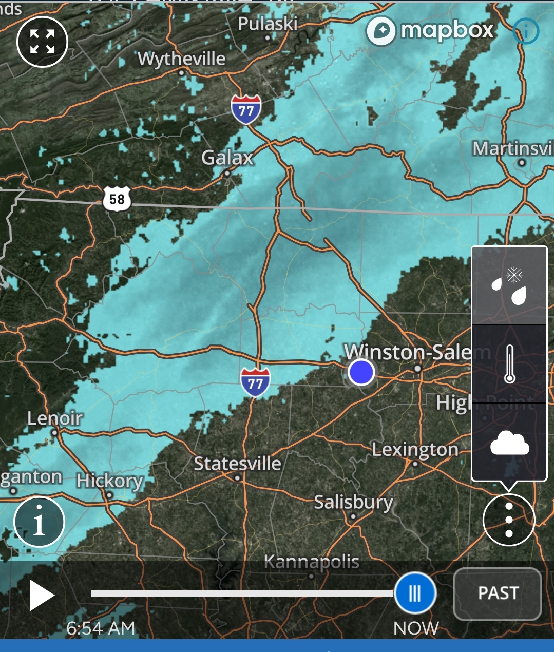
Been snowing in Lewisville since before 6am and has just gotten heavier and heavier since this band has gone through. Overperformer for sure! No complaints!
-
Hope this band holds together

-
Flurries in Lewisville. These upper level systems rarely make it over the mountains. Maybe today will be an exception.
-
Hear, Hear. Congrats. Y'all have waited for a long time. ended up with 1/2 inch here. Nothing on roads.
-
We have about 1/2 inch here in Lewisville. Snowing to beat the band a short time ago (1pm) but now has slacked off quite a bit. 30 degrees
-
Don't think I have ever stated this, but BRING ON SPRING. I've had all the disappointment I can handle for one year.
-
must be a different part of Lewisville from me. -0- flakes for me since 5am.
-

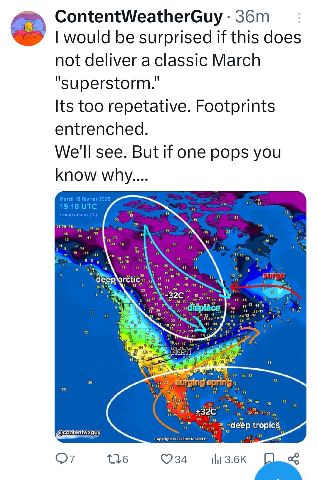
February 19-20 Major Winter Storm Threat
CentralNC replied to NorthHillsWx's topic in Southeastern States
Based on radar trends I still think Raleigh area looks pretty good. In my neck of the woods, not so much. -
February 19-20 Major Winter Storm Threat
CentralNC replied to NorthHillsWx's topic in Southeastern States
Convection firing in the Gulf already. -
February 19-20 Major Winter Storm Threat
CentralNC replied to NorthHillsWx's topic in Southeastern States
Right there with ya -
Cranky off the top rope...the board would crash

-
February 19-20 Major Winter Storm Threat
CentralNC replied to NorthHillsWx's topic in Southeastern States
We got to have something to hold onto, don't we? -
February 19-20 Major Winter Storm Threat
CentralNC replied to NorthHillsWx's topic in Southeastern States
Maybe because they think it will be disruptive to travel since temps will be low for a lot of sticking, etc. I thought it was weird too.