

wxeyeNH
-
Posts
9,835 -
Joined
-
Last visited
Content Type
Profiles
Blogs
Forums
American Weather
Media Demo
Store
Gallery
Everything posted by wxeyeNH
-
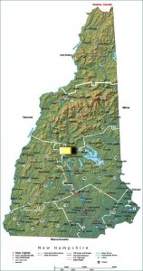
I went up to the top of my hill last night and couldn't see anything. My friend Dave setup at the foot of Newfound Lake and with a time exposure caught them very faintly. Like the ones I briefly saw last week they are usually far on the north horizon. The key lately is you really need to have an unobstructed north view without any city lights in that direction... Here's the pic he posted on his site...
-
Well for the moment I don't see anything so it was fleeing or maybe it will start back up again but bed time for me.
-
Yes, the 03 event was like "wow what is going on" . Spectacular. Going to drive up to the hill one more time right now...just to see if its brighter...
-
It was all below the Big Dipper angle. Only 2 or 3 times living here full time since 2001 have I seen AB near overhead. I know you have Tilton's lights to your north too...
-
Just got back to the house. It's really like 25 degrees or maybe 35 degrees above the horizon. From my house with trees to my north I can't see anything. If I drive up my road 1/2 mile to the hilltop and look to the north horizon over the S Whites its very clear. The hilltop is pitch black with the Milky Way blazing. So unless you can see to the north (assuming no towns) you miss it. Between me and the Whites there are almost no lights. (Downtown Plymouth to the NE). If they get brighter and I can see them from the house I will repost. They seem to change in brightness minute by minute. When I just left they were very dim again....
-
Watching the Aurora Borealis right now looking North from Newfound Lake. Was a pretty good arc across the sky with some pillars a few minutes ago now it's tied down changes minute by minute
-
Skies extremely bright to the north. Damn clouds!! KP index 8!
-
I'm up on a Hilltop right now looking North in the sky looks extremely bright. About 75% covered by clouds but in between the clouds its very bright
-

The August 21, 2017 Great American Eclipse
wxeyeNH replied to ice1972's topic in Weather Forecasting and Discussion
I just saw this picture of the eclipse from space. I found it interesting because as you can see the totality line is not as sharp all the way around. Like taking a flashlight and shinning it over a globe depending on if the flashlight beam points straight down or at an angle, it will make a difference. In the case of the moon the "beam" is the shadow. So if the eclipse was closer to mid day the shadow comes quicker/more defined. If it occurs near sunrise or sunset it is more diffuse. I'm not sure if I am making sense or not. . -
The August 21, 2017 Great American Eclipse
wxeyeNH replied to ice1972's topic in Weather Forecasting and Discussion
I posted this on the New England thread but will repeat it here. This photographers description summed it up perfectly! His picture attached... -
The August 21, 2017 Great American Eclipse
wxeyeNH replied to ice1972's topic in Weather Forecasting and Discussion
Because I saw my 3 1/2 minute total in Aruba in 1998 I have been harping my family and friends to do whatever they had to do to see this one. I started 3 years ago. The last few months I have aggravated so many people because I kept saying you have to do this! Do whatever you can, you just have to see this. A few family members got it and went. A couple of friends too but most just told me, Gene, shut up, enough is enough a partial is fine and I can watch it on TV. Now you guys know! Before this week I was in a club of about 50,000 people that lived in the US and had seen a total. At least you guys now understand. Even today the people I talk to say, yeah it looked neat on the evening news but no big deal! -
I would book a winter (April) vacation in the Mexican resort town of Mazatlan. It's on the Pacific side. Almost guaranteed sunshine. That's what we did. Tropical vacation and a total on the beach. Can't beat it. I was urging my friends last week to look into booking. I was just looking at the rates of resorts there and they are incredibly low. Of course that will change for eclipse week. I bet after this week the resorts in that town are booking fast if they take reservations that far out, who knows? Lots of time to start saving your money!!
-
Jeremy so glad you got to see this. Wow, the weather could not have been better across the US. Sure a few places got clouded out but all and all over 3000 miles the weather was epic. I guess all could be summed up by this picture I saw and the photographers comments. I saw this on facebook and it really summed up my experience in 1998. Now we look forward to April 8 2024. Only 6 years and 9 months away... Blake Farnham is with Sam Ridout-Claude. Yesterday at 5:24am · For three days and two nights I sat on top this mountain thinking of how I would capture something I'd never seen before. I had two minutes of totality, plenty of time to get all the shots I wanted. Yet when the time finally came and the sun went black, tears began to run down my face. I had never seen anything so beautiful, epic, or surreal in my life. The feeling was so overwhelming. I scrambled to change lenses, re-frame the shot, change settings, all while shaking uncontrollably with eyes full of water. Before I knew it the sun was peaking out the other side, it had felt like the whole thing lasted only seconds. This photo is one of only five I was able to capture. We drove over 2,000 miles to see a total eclipse and bring home this picture. I wish everyone could've been sitting there with me. This moment truly changed my life.
-
Just noticed the KP index is 5 right now. Clear skies no moon, any chance of anything up here tonight??
-
The August 21, 2017 Great American Eclipse
wxeyeNH replied to ice1972's topic in Weather Forecasting and Discussion
Everything does become crisper as you get to the thin crescent sun. Usually the shadowed areas are muted in outline since the orb of the sun is not a point. As the last rays come down it is more of a point so shadows on the ground have sharp lines. Many people don't notice but I did. The whole quality of light within 10 minutes is very strange. It's a sunny day but the light is just dim, weird. Something you can't explain to people unless you experience it first hand. Glad it was a success for you! -
The August 21, 2017 Great American Eclipse
wxeyeNH replied to ice1972's topic in Weather Forecasting and Discussion
It's really fun today watching the Utube videos from people in totality. So many people really had no idea what to expect. The hooting and hollering of normal folks is so fun to watch. Kids just jumping around. I knew it would be a total over performer for people that had never seen one. Watching totality with many other people adds to the excitement! -
The August 21, 2017 Great American Eclipse
wxeyeNH replied to ice1972's topic in Weather Forecasting and Discussion
So frickin happy for my fellow AMWXers that are going to see this. You don't know the treat your in for!! Good Luck! -
The August 21, 2017 Great American Eclipse
wxeyeNH replied to ice1972's topic in Weather Forecasting and Discussion
Okay, hot tip! 2024 eclipse goes from Mexico to New England. Hits the Pacific coast of Mexico at the resort town of Mazatlan. Mexico weather is the best and this resort is on the beach. Book a room today!! This is what we did for Aruba in 1998. Winter vacation and long total eclipse on the beach!!!! CAN"T BEAT IT!. We had to book 5 years in advance. So my advice is to get on the phone today and book a vacation. Once the US sees how fantastic a total eclipse is everyone will be thinking about places like Mexico!! Next week might be too late.... -
The August 21, 2017 Great American Eclipse
wxeyeNH replied to ice1972's topic in Weather Forecasting and Discussion
Safe travels Jerry. I am so excited for you! Definitely want to hear a detailed write up. In Aruba 1998 the Cu did not get dampened by the total eclipse. Perhaps it was because it is such a small island surround by ocean. Of course water temps don't change. An hour of slowly decreasing sunlight before totality might make a difference. Now that we have GOES 16 with such high resolution it will be interesting to watch from space to see if in fact the cooling does decrease Cu! -
The August 21, 2017 Great American Eclipse
wxeyeNH replied to ice1972's topic in Weather Forecasting and Discussion
When I went to see the total eclipse in Aruba 1998 I dragged my partner down with me. He is not an nature person and really thought the whole thing was going to be overhyped. Boy did he change his mind once he saw what was happening. Let's see what people say about it being overhyped come Monday night. People will want to see an another one absolutely. Now for most of the country that sees a partial eclipse that's a totally another story. -
The August 21, 2017 Great American Eclipse
wxeyeNH replied to ice1972's topic in Weather Forecasting and Discussion
Totality verses Partial is like almost being dead or being dead! -
The August 21, 2017 Great American Eclipse
wxeyeNH replied to ice1972's topic in Weather Forecasting and Discussion
I was here in Central NH for our 1994 annular eclipse. My house was almost on centerline. 88% coverage. I have videos. At 88% you can barely notice a darkening of the landscape. In Aruba when I saw the 3 minute total eclipse even 5 minutes before totality at 95 to 99%% or more of coverage it was not a big deal. Once the dark curtain of complete shadow descends and the diamond ring comes out everything changes in seconds to the jaw dropping, awe experience. With this eclipse you are going to have people literally at one end of a football field in 99.9% partial saying, that was overblown while 1000 feet away people under totality saying, oh my God, that was crazy awesome. The line is that fine!! Trying to explain this to "average Joe" is so frustrating! -
The August 21, 2017 Great American Eclipse
wxeyeNH replied to ice1972's topic in Weather Forecasting and Discussion
Hum, still quite aways out there. All in all the weather looks about as good as it can get if you factor in the whole track from Oregon to South Carolina. I see that moisture in Missouri and East Nebraska but again its only Wednesday. Too early to make adjustments..... -
The August 21, 2017 Great American Eclipse
wxeyeNH replied to ice1972's topic in Weather Forecasting and Discussion
Time for another post about this total eclipse. I have seen 3 partials, 1 annular and one total. Aruba 1998. From the beach. Almost a 3 minute eclipse. Total blows everything else out of the water. Photographers were set up all around me. I decided not to bother with cameras. So many wondrous things happen so fast. Not just the sun but the rapidly changing twlight all around me. The planets, stars, the eerie light on the hills. There will be a zillion pictures/videos on the web. Grab a couple of pictures just to say you were there but every second that you play with lens and exposures are seconds lost taking in the whole experience. It does go by ultra fast! -
The August 21, 2017 Great American Eclipse
wxeyeNH replied to ice1972's topic in Weather Forecasting and Discussion
Maybe I can make this a bit more clear. It is where the shadow falls off the earth. It's the place where as the sun rises or sets its alreadly in total eclipse. 2024 is going to be a nice eclipse. Moon's orbit will be closer so a wider path. Wider path means darker skies at center line. Next weeks eclipse is 70 miles wide so even if you are at center line the sun will be shinning 35 miles to your north or south. So it will get twlight but not pitch dark unless there is thick cloud cover as the sunlight on the horizons have a lot of cloud angle to penetrate. Another point. The sun angle is now moving southward each day as August moves on. So the southern horizon would have more light. If I were picking a spot I would be a bit north of center line so more of the south sky is darkened. Of course weather is the wildcard. There could be a tropical system heading in from the islands. Let's hope that doesn't happen or at least delayed....
