wxeyeNH
-
Posts
9,813 -
Joined
-
Last visited
Content Type
Profiles
Blogs
Forums
American Weather
Media Demo
Store
Gallery
Everything posted by wxeyeNH
-
 64/56 Very light rain. Late yesterday and last night we had some nice downpours. Got .80". It's been dry today, a bit of sun earlier. Sprinkles resumed an hour ago, enough to wet the ground. 0.01"
 -
2 rounds of showers/thundershowers now through. One earlier and one more recent. Total .86" so far. Looks like the heaviest rainfall for storm totals will be SW of me. I will be happy if we end up 1-2".
-
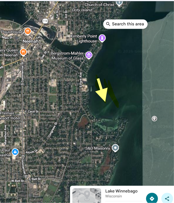
I followed the major tornado that hit the area along Lake Winnebago in Wisconsin. It moved north to south. I just watched a really interesting video that was taken along the lake. It looks like as the winds shifted from the east the lake rose several fee. Watch the lake water level. Was it just the wind? Was it the rapid pressure rise? I have never seen something like this. Attached is the general area and direction. Thoughts?

-
I'm really looking forward to this rain. Sorry vacationers. Less than .75" this month in my area. Bring it on!
-
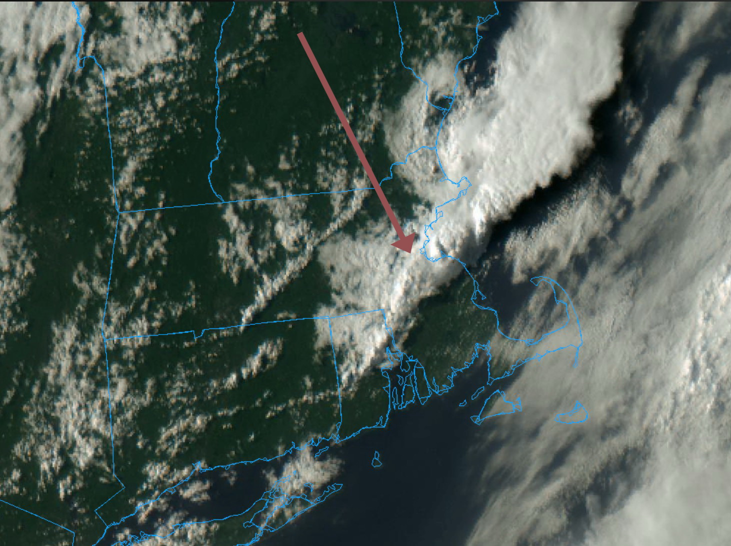
Watching the overshooting tops from about 130 miles away...

-
77/61F Improving vis. Dewpoint crashing. Front is through. Surface drought conditions continue.
-
73/66F Well there goes that. After another shower last night the grand total from this system looks to end at .36". The showers and storms forming are south and east of my location. Unless something happens to the west it looks like this is it. Thoughts Brian? Hope to make 1" for August!
-
We got our largest soak of the month earlier today. .23" That puts me just over .50" for August. I don't see much meaningful stuff on radar as everything quickly weakens as it goes in my direction.
-
It was nice to have the clean air today. It will be interesting to see how much smoke comes back tomorrow and how it interacts with the convection potential over the northeast tomorrow. Maybe it's a good lesson for future modeling. Not to get into politics but I just saw that Trump is threatening Canada with tariffs to get it's s..t together. Perhaps climate changer deniers have more to do with it than vast boral forest management?
-
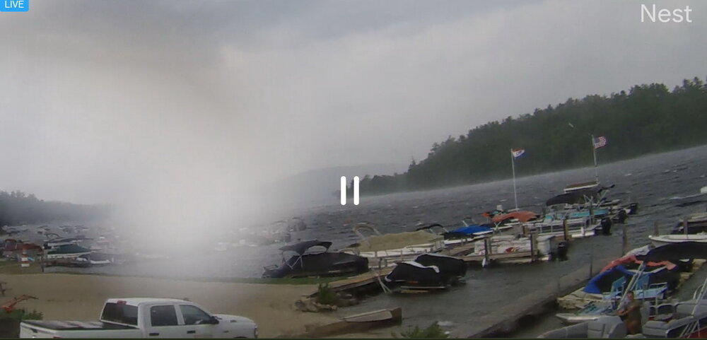
Moderate rain showers with very high winds just moved across Newfound Lake. A very quick drop in temperature to 66Fl Boaters are scrambling. No lightning. I'm sheltered from the W/NW winds but gusted to 30mph. I'm sure winds gusted to near 50mph out on the lake. Watching the live cams. Boaters are scrambling...
-
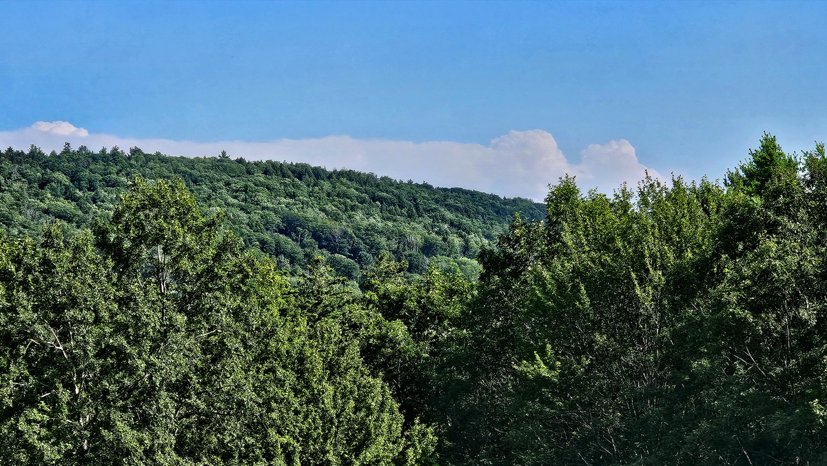
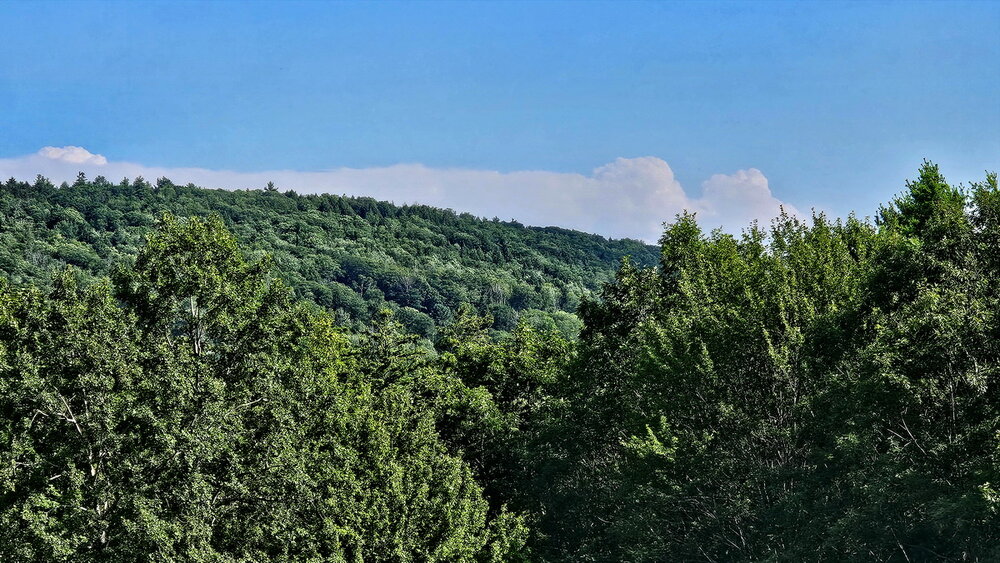
80/60 Building Cu The sun is bright here. Some smoke or haze. From my vantage point I can not make out Mt Sunapee anymore (28 miles) but still can see Kearsarge to my SSW. That is 25 miles.
-
6:30pm 76/56 I just made a time lapse of the past 3 hours. It is interesting to see the smoke move to the south. https://video.nest.com/clip/c02c65ef933a48e098d7046464887f42.mp4
-
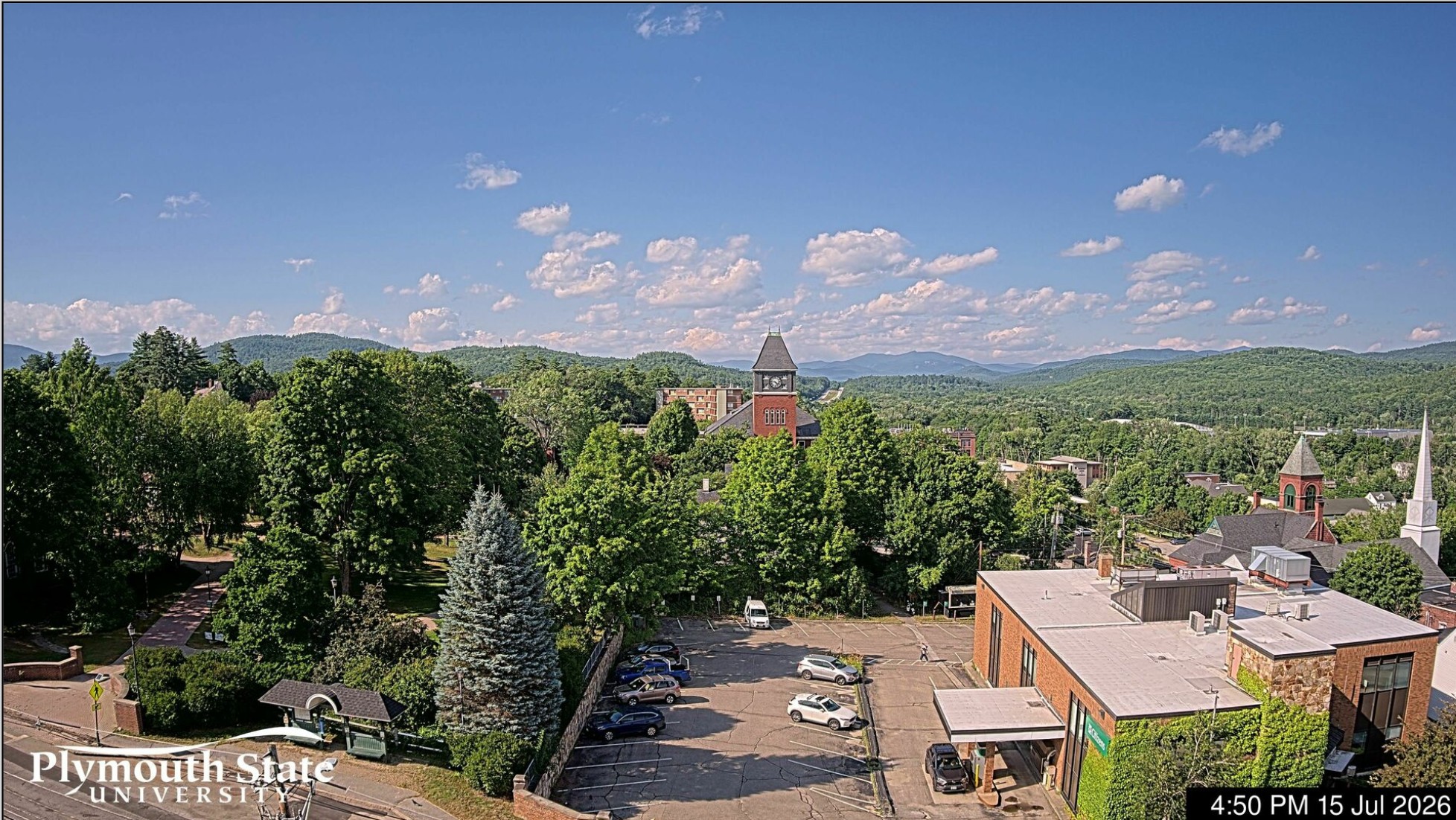
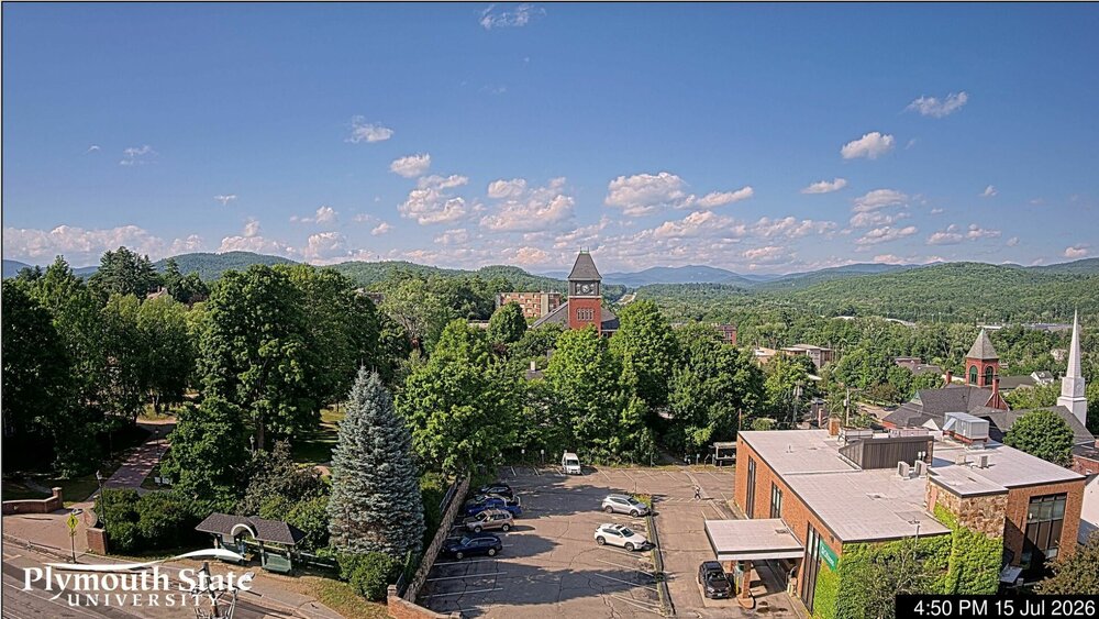
Living life on the edge. A beautiful late afternoon up here in the Plymouth NH area. Brilliant blue skies about overhead and to the north and dark and dirty looking south. It is really an unusual event. 76/56 Current cam view from Plymouth looking north
-
Nice to see bluebird skies again. Smoke just to my south but blue to the north. The sun is back! Other than a few Cu the skies are clear! Unlike the smoke of a couple of years ago this smoke came on quick yesterday.
-
The thick smoke has moved out but wow, the thickest smoke layer I have ever seen. Below is the Nest Cam time lapse. It started around 9am. At that time we had the cirrus overhead with the MCS but skies were basically clear after that. The temperature has jumped 7F in the past hour. 82/69 I'm not sure why the camera was changing the hue of the sky. Maybe to adjust for the darkness? https://video.nest.com/clip/3886a63d346441b9a07cb5463627d987.mp4
-
As of 11:45 here in Central NH we have a very thick smoke layer above us. The whole landscape is yellowish and the sun disc is sharp but so dim you can look at it directly. A very eerie situation. It is only 74.7F. I have no idea how this will impact the severe threat later but it is the densest smoke layer above us that I have ever seen. Meanwhile at near ground level I can see mountain ridges 30 miles distant.
-
As of 11:15am an extremely thick smoke layer has moved overhead. I can look up at the sun and see it very clearly. No cirrus but an erry yellow glow like NYC had several years ago. I have never seen a smoke layer as dense as this while ground visibility is over 25 miles 75/64
-
Looking at the sat pics this morning there are lots of fires burning in Southern Ontario. The thick smoke plume is moving into our area. How much is this going to affect the severe storms later for NNE? Also the MCS is creating a lot of cloud cover especially this morning. So we are not getting much insolation. Maybe this will reduce convection later?
-
Wow, SPC already in enhanced up in NNE
-
Hoisting the Sultan Signal: Heavy Rain Event July 5-7
wxeyeNH replied to WxWatcher007's topic in New England
It was a beautiful day up here. Some smoke A fair amount of smoke looking out at the distant ridges. We are starting to dry out the surface. This past week has been dry other than about .10" on the 1rst. We did have a 5 minute sprinkle earlier today. I notice some drops covering about 1/3 of the deck surface at the height. Does that count as a T for the day? Enjoy your soak down in SNE. -
Brian, my fruit trees are doing good. Apples, peaches, Concord Grapes and 2 of my Chestnut trees have Male catkins. Wheather they are close enough to cross pollinate remains to be seen but I could possibly have some Chestnuts to share come fall! Happy 4th to all!
-
It's 12:45pm. My brother is a doctor in DC. He and his family are at the 250th July 4th event. The police are shutting the whole thing down right now until 5pm. Although there are a huge amounts of people the medical tents can not keep up with the heat victims.
-
Thanks for this page. Is this hourly obs or if it is refreshed is it also ASOS stations that upload near real time?
-
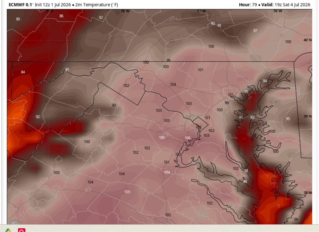
I see a diaster in the makings. Not political this would happen no matter what administration but.... 3pm Euro temp's on July 4th in DC. Severe thunderstorm potential too. For security no umbrellas allowed on the National Mall. No shade. No shelter. No place to run for severe weather. What could go wrong?

-
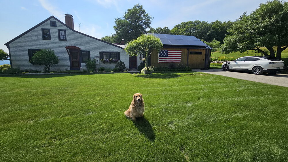
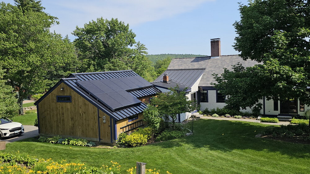
We have a standing seam newer metal roof. The panels are clamped on the standing seams. 2 years, no problems. Just panels east/west on the barn. Today I'm running 3 window ACs and charging my 4 year old Mustang Mache and the system is generating more power than I can use. I'm sending the extra back to the grid and getting paid for that about $3 so far today. Other people might have problems but going with my electric car and roof has been a huge W for us. (Picture taken around 3:30pm). Golden Retriever approved! 4pm 92/74F