
Thundersnow12
-
Posts
11,414 -
Joined
-
Last visited
Content Type
Profiles
Blogs
Forums
American Weather
Media Demo
Store
Gallery
Everything posted by Thundersnow12
-

January 30-February 1 Winter Storm Part 2
Thundersnow12 replied to Hoosier's topic in Lakes/Ohio Valley
Under -
January 30-February 1 Winter Storm Part 2
Thundersnow12 replied to Hoosier's topic in Lakes/Ohio Valley
Good burst of snow already in southern Joliet area via twitter video -
January 30-February 1 Winter Storm Part 2
Thundersnow12 replied to Hoosier's topic in Lakes/Ohio Valley
Only 1/2SM in TAF for both ORD/MDW. I’ll take the under and say they dip to 1/4SM at some point, especially at MDW. -
January 30-February 1 Winter Storm Part 2
Thundersnow12 replied to Hoosier's topic in Lakes/Ohio Valley
18z HRRR significantly increased QPF/snowfall amounts across Chi metro compared to the several previous runs that came in drier. -
January 30-February 1 Winter Storm Part 2
Thundersnow12 replied to Hoosier's topic in Lakes/Ohio Valley
HRRR has been slowly trending colder the last few runs along/north of I-80 in Illinois -
Feb 3rd - 5th Potential strong stm threat
Thundersnow12 replied to Brian D's topic in Lakes/Ohio Valley
Lol I was just kidding but it def looked like Trubisky -
January 30-February 1 Winter Storm Part 2
Thundersnow12 replied to Hoosier's topic in Lakes/Ohio Valley
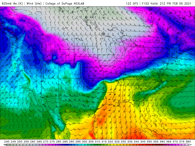
Been awhile since I can remember seeing pink on that color scale for that area -
Feb 3rd - 5th Potential strong stm threat
Thundersnow12 replied to Brian D's topic in Lakes/Ohio Valley
You really gotta change your profile picture lol each time I see it I think it's Mitch Trubisky and it's really throwing me off. -
January 30-February 1 Winter Storm Part 2
Thundersnow12 replied to Hoosier's topic in Lakes/Ohio Valley
I was half serious with that RAP gif, half trolling my guys Joe and Alek but yeah it's something to watch heading into this afternoon. -
Feb 3rd - 5th Potential strong stm threat
Thundersnow12 replied to Brian D's topic in Lakes/Ohio Valley
If the lead ejecting wave didn't shear out, it's a poor mans GHD I, still an impressive run. -
Feb 3rd - 5th Potential strong stm threat
Thundersnow12 replied to Brian D's topic in Lakes/Ohio Valley
This one has a lot of things going for it (taking 12z GFS at face value) and those compact srn stream waves ejecting atop a tightening baroclinic zone with open GOM can go crazy if things come together right. Impressive coupled upper level jet structure, plenty of cold air coming down and great trajectories off the gulf.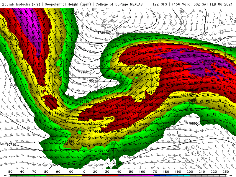
-
January 30-February 1 Winter Storm Part 2
Thundersnow12 replied to Hoosier's topic in Lakes/Ohio Valley
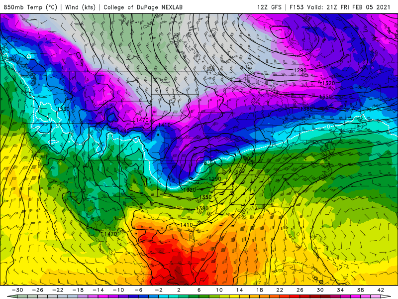
RAP much lower on snow totals due to 850 warm nose being more aggressive. Compare previous runs valid 21z -
January 30-February 1 Winter Storm Part 2
Thundersnow12 replied to Hoosier's topic in Lakes/Ohio Valley
-
January 30-February 1 Winter Storm Part 2
Thundersnow12 replied to Hoosier's topic in Lakes/Ohio Valley
I'll set the line at ORD since we will actually have people who know how to correctly measure again at 8.4" -
January 30-February 1 Winter Storm Part 2
Thundersnow12 replied to Hoosier's topic in Lakes/Ohio Valley
Sucks ratios gonna be 7-9:1 probably. A 13-15:1 event would’ve been money with amount of QPF -
Feb 3rd - 5th Potential strong stm threat
Thundersnow12 replied to Brian D's topic in Lakes/Ohio Valley
0z Euro and 6z GFS were impressive -
Don’t think so. He works later tonight
-
Ride 7-10” for the metro and call it a day
-
Can hear the sass in this post all the way from Colorado
-
That profile picture though
-
Suggests rates of 2-3”/hr on leading edge thump
-
End of the 0z HRRR is pretty impressive.
-
Legit
-
Pretty livid I can’t come home for this one. Looks awesome
-
Ride it


