

mahk_webstah
-
Posts
11,057 -
Joined
-
Last visited
Content Type
Profiles
Blogs
Forums
American Weather
Media Demo
Store
Gallery
Everything posted by mahk_webstah
-
07-08
-
I’m certainly not a promoter of regional war. I want you guys to do well almost as much as I want myself to do well. I’d like to get through Sunday with a net gain of significance on the crust. I think that’s likely. It’s just you were talking about Stowe, which I thought was hyperbolic.
-
But doesn’t the correction vector still point colder?
-
But I don’t buy ending winter. We might have a couple of days where the systems get warmer and messier and even some rain but it looks like we go straight back into a winter pattern. We don’t get out till mid to late March.
-
GYX 05Z Long Term Forecast Update...Canadian high pressure will then briefly builds on Wednesday before being pushed off to the northeast by an area of low pressure that will cross over the Gulf of Maine on Thursday. This will result in widespread precipitation with the vast majority likely falling as snow, although some rain may mix in across southern NH and coastal ME. Several inches of snow accumulation are possible on Thursday. High pressure then returns for Friday and Saturday before another potential winter storm arrives late next weekend or early next week. And then the risk for the weekend Another deeper trough follows late next weekend, and like that,, we have a much more amplified pattern. This could bring a more significant system, with more warm air to tap into, and a better chance for mixed precip, although, it is a week off, so confidence is low.
-
-
We hump and hopefully we trend
-
Good trends overnight for up here. At least for next 7-10. their map for the weekend has primary in western PA their qpf map had 1”+ New England and the risk for decent snow is high for cne nne and medium for sne
-
 But who expected such a domination?
 -
Good time to put the closing thoughts on this thread. the Iggles flew high. A good number of weenies got to high five though not as many as I hoped. Thanks for letting me start a thread. Let’s see if indeed this storm is the first of a decent run over the next few weeks
-
Yes I don’t know what models they blend. GYX very confident in less than .5qpf Thursday
-
After sliding lower, my Wunderground numbers have gone back up to six for Wednesday, Thursday and 12 for the weekend
-
Glad to understand how you think the correction vector will be pointing
-
Still time to revert to its original form. But we’d have to see that by tomorrow I’d think. Wpc was still fairly honky overnight. .3-.5 is still a decent pack adding storm. maybe we need a thread for next weekend. It’s a week out now.
-
You and the other meteorologist can fight it out
-
That’s 06-07
-
I literally got 7.5 inches in every spot I put the ruler in. So that’s a pretty confident measurement. Still very light snow falling but probably not accumulating much.
-
Decaying big block should produce KU in next couple weeks. I’m just repeating what others have said but it certainly makes sense. This is a good pattern for getting snow in different ways. Right now we’re in the 07-08 phase which is painful at times for people south of the New Hampshire border, but very productive up here. I would think the pattern would shift in your favor in a week or so
-
I think there are some confusion about this thread. It is for the Wednesday night Thursday not the Tuesday thing. I’m hoping we will get some clarity later this afternoon on what this looks like. For about five or six days it’s looked like maybe a 4 to 8 inch storm up this way at least. Not sure if it’s still there in that form.
-
He tried to give it to you yesterday. But then late in the night he took it back
-
You will have several chances over the next two weeks.
-
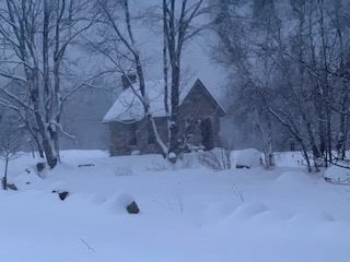
That’s a great spot you have. still an inch an. Hour but mostly done soon. pretty sure my stake in the woods will be 20 and in the fields 15 or so. And we’re still near the beginning.
-
It’s looked that way for a couple weeks. But maybe capped with a big dog
-
-
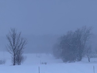
I didn’t realize how hard it was snowing until a little bit of light came up and I went outside. 7 inches and snowing hard with the snow growth of our dreams.

