

mahk_webstah
-
Posts
11,057 -
Joined
-
Last visited
Content Type
Profiles
Blogs
Forums
American Weather
Media Demo
Store
Gallery
Everything posted by mahk_webstah
-
Despite fears of suppression, at least on my part, on all of these ensemble means it seems that southern New England and central New England and parts of northern New England are constantly in the bull’s-eye.
-
Pretty unreal and that’s only 20 February. I was starting to get a little disappointed about Sunday but when I look at my ten-day forecast, there’s just a lot of snow in it. It’s just going to keep coming. Snow on snow is a blast. Even just having somewhere between three and 4 inches today. It feels like a big storm because there’s already a lot of snow on the ground
-

Tracking February 6. Light to moderate event potential
mahk_webstah replied to Typhoon Tip's topic in New England
From our earlier burst -
Tracking February 6. Light to moderate event potential
mahk_webstah replied to Typhoon Tip's topic in New England
Almost 12 in the woods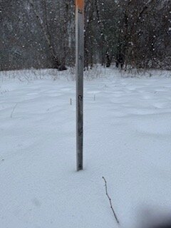
-
Tracking February 6. Light to moderate event potential
mahk_webstah replied to Typhoon Tip's topic in New England
2” At 11:15 still heavy snow temp up to 7.5 meazured .8” in 30 minutes exactly -
Tracking February 6. Light to moderate event potential
mahk_webstah replied to Typhoon Tip's topic in New England
Heavy snow 6.4 degrees on my deck. -
Tracking February 6. Light to moderate event potential
mahk_webstah replied to Typhoon Tip's topic in New England
You think so? Snowing very hard here and it looks like there’s a band in Southwest New Hampshire just north of Keene that will probably push up. Keep us in heavy snow. I do see the opening back towards Springfield on the radar. -
Tracking February 6. Light to moderate event potential
mahk_webstah replied to Typhoon Tip's topic in New England
Snowing moderate increasing. Growth improving. Radar makes it look like a 3 hour storm. Hopefully redevelopment as tho moves ne. Wunderground dropped from 4.9 to 3.6. 6.2 degrees -
Tracking February 6. Light to moderate event potential
mahk_webstah replied to Typhoon Tip's topic in New England
Very light snow started a few minutes ago. Small flakes. I do like the look of the radar for Southern New Hampshire. -
The pope thinks it’s going to be south
-
Yeah I don’t want hopes hinging on a lucky far north band
-
Not too much I hope. I like where it is. But it will oscillate and maybe nudge north in the end.
-
Tracking February 6. Light to moderate event potential
mahk_webstah replied to Typhoon Tip's topic in New England
Even if it doesn’t max out, we are in and near the beginning of a good stretch, most likely. It’s gonna be very deep winter here by Monday morning, and we’ll probably keep adding to it even if we get fringed. At some point, they’ll probably be another couple moderate or large storms by March. Been a while since we’ve had this kind of winter, at least the second half. I’m home all the time now with the babies and mostly just focused on the babies and eating and the gym so I’m really able to enjoy the winter unfolding. -
Tracking February 6. Light to moderate event potential
mahk_webstah replied to Typhoon Tip's topic in New England
In my experience, occasional but not necessarily every year. They are awesome at one level, but you don’t really wanna stay out in it for very long. I think it was the winner of 2013 and 14 maybe where we had a heavy storm with temperatures in the very low single digits. you’re too young to talk about the good old days. -
Tracking February 6. Light to moderate event potential
mahk_webstah replied to Typhoon Tip's topic in New England
At least around here, I don’t think so. The heaviest stuff will probably be brief, but they have precipitation in the form of freezing drizzle going into the evening. -
Tracking February 6. Light to moderate event potential
mahk_webstah replied to Typhoon Tip's topic in New England
Sunday is headed in a good direction and that map is only through 7am -
We prefer fluff to sand
-
Structure of system good for many. Northern band and good ratios but south enough for many. 6-10er in general it seems
-
Tracking February 6. Light to moderate event potential
mahk_webstah replied to Typhoon Tip's topic in New England
I’m sure. It is a remarkably fast moving system. But pretty rare to see it so cold just before snow breaks out. -
Tracking February 6. Light to moderate event potential
mahk_webstah replied to Typhoon Tip's topic in New England
Ranging from -1 to -6 with snow starting in 3 hours or so. -
GYX brings good news for many up here and further south .LONG TERM /FRIDAY NIGHT THROUGH WEDNESDAY/... Long Term Update...Main focus for the update was to update this weekend`s snow event. Overall, guidance has slowly trended south with QPF max as the forecast low`s center passes south of Long Island and out into the open Atlantic. It is progressive, but pulls with it a decent plume of moisture. There continues to be a good signal for higher snow ratios with a deep snow growth layer and lift within it. Finer details will come into view, but will need to watch for banding that lingers on the north side of the storm that could enhance snowfall amounts across the southern to central part of the CWA. Timing did shift later with recent guidance potentially not beginning until later Saturday evening through the overnight hours into Sunday morning.
-
Wpc honking hard for heavy snow Sunday of more than 8” from about the mass ct border up to the southern whites. Looks like a fast moving hard hitting storm
-
Enjoying what might happen from the day 7 Wpc map for Feb 13:
-
Wrong thread
-
This is Coochie Kuo so reduce accordingly. I also realize now that it is not the mean but the operational total. But still respectable after two storms.


