
Interstate
-
Posts
5,749 -
Joined
-
Last visited
About Interstate

- Birthday 03/03/1976
Recent Profile Visitors
10,573 profile views

.thumb.jpeg.555ceb86ff9c30f7616786e9a51781a1.jpeg)


-
But management did sign Baz, Bradish, and Alonso to long term deals... We have not had that in the past.
-
He went up against arguably the best pither in the NL. The Orioles had their changes twice and just could cash in. That 15 pitch at bat in the 7th did him in.
-
Ham sandwich
-
Nah. We are setting up for a trade
-
I say good riddance. He’s Minnesota’s problem now.
-
Waxing
-
That trade is kind of weird. Why would Minnesota win Dean Kremer?
-
Stop trying to steal the Orioles' thunder
-
You could not ask for a better day on July 30th.
-
Waning
-
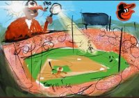
This has to be the wildest Orioles game I have ever seen.
-
I just got a glancing blow from the storm in Harford that just went TW.
-
Yeah I think that shower midday really hurt our temps
-
Maybe not
-
Maybe we will all be stuck between systems... STW to our SW and one to our NE


