.jpeg.334887ee505ee3a32ba3405431f39d37.jpeg)

Seminole
-
Posts
294 -
Joined
-
Last visited
Content Type
Profiles
Blogs
Forums
American Weather
Media Demo
Store
Gallery
Everything posted by Seminole
-
2024 Atlantic Hurricane Season
Seminole replied to Stormchaserchuck1's topic in Tropical Headquarters
None that I can recall. Everyone was on board the hyper active year bandwagon. -
2024 Atlantic Hurricane Season
Seminole replied to Stormchaserchuck1's topic in Tropical Headquarters
No one seems to know what is wrong. I do find it interesting that the Sahara is experiencing years worth of rain during this quiet period of no named storms. -
2024 Atlantic Hurricane Season
Seminole replied to Stormchaserchuck1's topic in Tropical Headquarters
Nothing to write home about behind that wave though.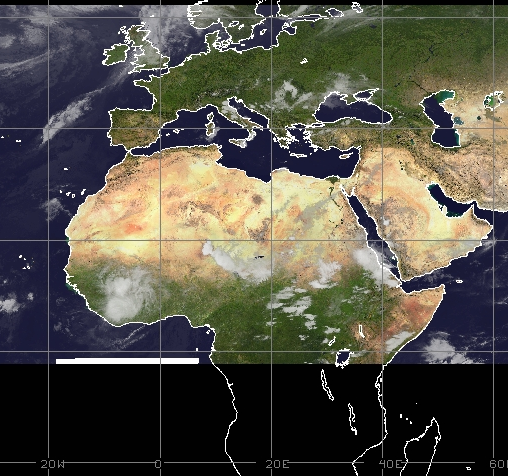
-
2024 Atlantic Hurricane Season
Seminole replied to Stormchaserchuck1's topic in Tropical Headquarters
Very interesting read. The conclusion is that moderate TC activity occurs during this type of environmental setup. The data in the study is for 71 years. I don't think its a leap to postulate that rapid unprecedented ATL Nina cooling could swing the overall trend into the low/no TC genesis category. -
2024 Atlantic Hurricane Season
Seminole replied to Stormchaserchuck1's topic in Tropical Headquarters
Does this potentially factor in with the lack of development in the MDR? https://www.msn.com/en-us/weather/topstories/no-one-can-figure-out-why-the-atlantic-ocean-is-cooling-at-record-speed/ar-AA1pcupU -
2024 Atlantic Hurricane Season
Seminole replied to Stormchaserchuck1's topic in Tropical Headquarters
Since 1950 there have been 19 landfalling hurricanes that hit the United States in October. Ten in Florida and six in Louisiana. That is roughly one every 4 years long term average. Some recent notables since 2016, include Matthew, Nate, Michael, Delta and Zeta. The past decade the frequency has increased with one every 2 years. -
2024 Atlantic Hurricane Season
Seminole replied to Stormchaserchuck1's topic in Tropical Headquarters
Lots of dry air preventing development in the MDR. -
2024 Atlantic Hurricane Season
Seminole replied to Stormchaserchuck1's topic in Tropical Headquarters
SAL has not abated to the degree it normally does by this time of year. Dry dusty air is entrenched in the MDR and across the Caribbean basin. -
2024 Atlantic Hurricane Season
Seminole replied to Stormchaserchuck1's topic in Tropical Headquarters
Some of the other models are picking up on this. Yucatan and Western GOM would be likely targets with that setup. -
2024 Atlantic Hurricane Season
Seminole replied to Stormchaserchuck1's topic in Tropical Headquarters
Lot's of SAL in that region hindering development. -
2024 Atlantic Hurricane Season
Seminole replied to Stormchaserchuck1's topic in Tropical Headquarters
One thing Debby has done is cool off North Florida. Much less humidity today and cooler. Feels almost like Mid September. The cooler weather and upwelling of Debby will knock the SST's in the eastern GOM down some. -
2024 Atlantic Hurricane Season
Seminole replied to Stormchaserchuck1's topic in Tropical Headquarters
Normally it abates by mid August. This year the SAL has been ridiculously high and there is another good size plume of it entering the MDR. -
2024 Atlantic Hurricane Season
Seminole replied to Stormchaserchuck1's topic in Tropical Headquarters
SAL is still a real problem: https://www.myfoxhurricane.com/saharan_dust_car.html -
Debby is running out of time. What is happening looks very similar to the Euro solution.
-
That is not how RI is supposed to happen. Dry air and running into shallower waters is my guess as to why.
-
The Nature Coast cannot catch a break. Those folks are storm hardened since last year. These folks are prepared. They know what to expect.
-
SE right quadrant fighting some dry air. That and now entering shallow waters the rest of the way will keep Debby from exploding before landfall. The NHC 85 mph max looks reasonable given this setup.
-
Debby is starting to enter the West Florida GOM shelf. Sea depth will get shallower the rest of the way.
-
100% on the coordinates. The 8:00 PM Advisory will likely confirm this.
-
NNE and maybe a tad ahead of schedule.
-
The 5:00 PM Advisory had Debby at 84.4 W and now it appears she is at 84.1 W. Definitely a turn to NNE.
-
High density population right there.
-
My son was 14 in 2012 and we were vacationing at Pink Shell Resort in Ft. Myers Beach. He made is Weather Channel debut when they showed a live shot of him bouncing around on a water trampoline in the middle of that Debby.
-
NHC left Debby at 65 mph for 5:00 PM advisory. No pressure change noted by the HH. Another recon in a couple of hours.
-
Live view from St. George Island Florida. We are riding it out along with a lot of other full time residents. https://www.blueparrotsgi.com/multimedia/livecam.htm


