nrgjeff
-
Posts
3,903 -
Joined
-
Last visited
Content Type
Profiles
Blogs
Forums
American Weather
Media Demo
Store
Gallery
Everything posted by nrgjeff
-

January 10-11 Severe Weather Threat
nrgjeff replied to DanLarsen34's topic in Central/Western States
I expect supercells in Texas Friday evening. If things go early enough, maybe late afternoon. Trying to find positives for storm chasers that way, haha. LLJ indeed will increase with time, and do so quickly and substantially. SPC rightly talks about the line possibly breaking up into supercells. We normally discuss the more common opposite, sups congeal to line. However with a rapidly strengthening and backing LLJ lines can and do occasionally break up into supercells. It's most common right after the line develops (as opposed to sup line sup). In this case a line may develop; then within 1-2 hours, actually break up into supercells for a couple hours. In all cases sups eventually go linear (or go back to linear) this weather pattern. You won't see me travelling to chase this. However I know people closer who are watching it. -
Questions remain in Alabama due to morning rain on Saturday. Euro has consistently hammered Mississippi and the GFS has now slowed down to do the same. NAM going nearly unidirectional upstairs is a real party pooper for fans of intense severe weather though. Saturday is still the back half of the NAM (as of Thursday writing) where NAM accuracy falls off. However the accuracy issue is usually on mesoscale details. Upper wind fields is a larger scale issue. I'm afraid the GFS/Euro will trend toward the semi-unidirectional NAM. Sure it has helicity off the charts, but that is mostly speed shear. Turning is meh on the NAM. It would be a strong but sloppy line. Now the GFS and Euro (globals) both still have a classic winter Dixie outbreak. Globals start turning 700 mb wind, with 500 mb southwest or better. NAM has 700 mb barely west of south and 500 mb still SSW. They all have a mess at 200 mb, but the globals have enough turning up to 500 mb for a lot of severe wx and some tornadoes. Plus they all have robust LLJs. Instability is marginal, but that is normal in winter severe weather. Tonight or Friday morning, one could check fcst soundings for where that instability lies Saturday; low level or mid-level. If low level (just a few thousand ft AGL) it only takes a few hundred CAPE for severe. If mid-level only it's tough to light the candle. Such mesoscale detail isn't clear until about a day to 36 hours ahead. If everything comes together, one would expect that secondary warm front, originating from the Gulf Coast front, to lift north of I-20 or even US-82. Worst action would be from there south. Otherwise it's a sloppy rain-out except down on the Gulf Coast. Most of this was copied from my Tennessee Valley post. However it looks like the worst of it will be this Southeast Region, because of central/southern Mississippi and Alabama. Even there it could underachieve if the NAM is right.
-
Yes at one point Alabama looked capped on the Euro following stabilizing Friday night rain. Euro has consistently hammered Mississippi Saturday. I'm less concerned about caps now. NAM going nearly unidirectional upstairs is a real party pooper for fans of intense severe weather though. Saturday is still the back half of the NAM (as of Thursday writing) where NAM accuracy falls off. However the accuracy issue is usually on mesoscale details. Upper wind fields is a larger scale issue. I'm afraid the GFS/Euro will trend toward the semi-unidirectional NAM. Sure it has helicity off the charts, but that is mostly speed shear. Turning is meh on the NAM. It would be a strong but sloppy line. Now the GFS and Euro both still have a classic winter Dixie outbreak. Still sloppy, but it's relative down here. GFS/Euro start turning 700 mb wind, with 500 mb southwest or better. NAM has 700 mb barely west of south and 500 mb still SSW. They all have a mess at 200 mb, but the GFS/Euro have enough turning up to 500 mb for a lot of severe wx and some tornadoes. Plus they all have robust LLJs. Instability is marginal, but that is normal in winter severe weather. Tonight or Friday morning, one could check fcst soundings for where that instability lies Saturday; low level or mid-level. If low level (just a few thousand ft AGL) it only takes a few hundred CAPE for severe. If mid-level only it's tough to light the candle. Such mesoscale detail isn't clear until about a day to 36 hours ahead. If everything comes together, one would expect that secondary warm front originating from the Gulf Coast front. Worst action would be from there south. Otherwise it's a sloppy rain-out and I'm watching college basketball all day Saturday.
-
December/January 2019/20 Winter Speculation Thread
nrgjeff replied to AMZ8990's topic in Tennessee Valley
ECMWF Op is slower than the GFS on the cold next week. However the EPS is colder than the GEFS in the 11-15 day range. Hopefully my Panic Room I post ages well. Darth Vader: I find your lack of faith disturbing. Thursday GFS runs have been cold in the extended, some stormy. Now those 11-15 day systems could go anywhere from Ohio to Florida; but, no worries if an 11-15 day storm cuts or is too buried. Main thing is the GFS has a cold 500 mb pattern. Is it just the dumb operational? GEFS isn't running as cold. Well, the EPS is running that cold. Perhaps the colder 500 mb weather pattern should be favored. EPS has also destroyed the GEFS recently; so, I kind of like a cold EPS. Also some evidence the EPS is handling the MJO and other tropical signals better. I'm not sure about the SPV jostling, but Holston I love those 3D graphics either way. Finally the CFS is frozen so maybe the GEFS will go that way. See what the ECMWF weeklies have tonight. They are based on the 00Z (previous am) EPS so probably cold. Closing with some non-model data. Jax has good posts in our ENSO thread. With the IOD relaxing but El Nino trying harder, perhaps the MJO will spend more time in true Pacific cold phases, vs just a secondary echo off the IOD. Still got convection in warmer phases, but there's plenty building in the colder phases too. -
And 30% is posted for our parts of our Forum Region! Where's the siren emoji? My thoughts are similar to those from Monday. GFS is a bit fast, ECMWF is slower, truth may be in between. Regardless the 12Z Euro is total eye candy. Still early for soundings*; but, the constant level plots are lit. So is the surface. * Friend reminded me it's also too early for meso-scale forecasts (outflow, cap, etc) and that's right. However it is my decision point, more than a forecast. Mesoscale will determine my chase status. If not, plenty of college basketball on Saturday. KU hoops is on on CBS! As for my snow post from Monday, I'm sorry if I raised false hope north of I-40. What a disaster! Guess I was jacked up on severe wx thoughts.
-
The 12Z ECMWF is pretty lit (verbatim) Saturday. Oh I'm glad I saved the best for last. Winter is choking, so I'm ready to talk severe! Most notably, the Euro has a southern stream system to spark convection in the Deep South. Surface low going into the Midwest may have unidirectional winds aloft. The South, on the other hand, should have veering with height. Next feature is a long-shot in January, but the Euro shows a secondary boundary in North Mississippi to North Alabama, south of the synoptic WF. Should the coastal warm front merge with this boundary, it'll be more believable. At any rate Friday night rain sets up the possible outflow boundary OFB I'm talking about. Winter set-up means an even higher than usual possibility of a morning rain induced stable bust Tenn Valley. I'd need the coastal front to merge with the OFB to give it more spark. Now Alabama may be capped. This whole OFB and moderate cap would be wonderful in the Plains in May. Dixie in January? It could work, but I'm not holding my breath. Few more days to watch this. Mississippi looks less capped as the southern short-wave induces cooling aloft. Still great wind profiles ahead of the trough. Mississippi is also favored in winter climo. Alabama is more February and later. We'll see though. 30% generates a lot of social media hype, but this is typical Dixie in winter - very conditional. Wind fields are there but instability is always TBD. While I'm eagerly watching (though not holding my breath) chances are I end up watching college basketball most of Saturday in my nice dry living room.
-
December/January 2019/20 Winter Speculation Thread
nrgjeff replied to AMZ8990's topic in Tennessee Valley
Weeklies try to bleed cold south week 3-4 but dang it's ugly. BN heights over the Great Lakes attempt to drive it. However the PNA looks neutral at best; never really goes negative. Some AK and Western Canada AN heights but US West heights are dreadfully BN. Could spit out energy I guess; but, also WAA ahead of each wave. Figure the SER torch fest will tone down, but not going full tilt cold though. On the optimistic look, it only takes one system to phase right in that choppy pattern noted above. -
December/January 2019/20 Winter Speculation Thread
nrgjeff replied to AMZ8990's topic in Tennessee Valley
Extended is depressing. However the Upper Plateau and over by the Tri Cities may have a nice Tuesday. Does not look big, but looks like something. Upper Plateau and TRI, appears the column will cool enough up there thanks to dynamic cooling. Thickness and 850 both get down with QPF after the fall. Snow output is noted on most models, but I still like the thickness QPF method best. It looks good. Maybe only an inch or two (the 2 higher elevations). Daytime is a challenge, but not as much so in January compared to say late Feb. Meanwhile south of I-40 looks hosed, especially KCHA and southeast Tenn. Oh but we may have some severe fun this weekend. More in that thread after the 12Z Euro. -
Great football weekend for Tennessee! First the Gator Bowl and then the Titans win at NE. Both were white knuckle affairs. We'll switch to Kansas for basketball, lol. Both KU and Wichita State had good wins. Now, what about the damn winter weather? Need a win there. Yoda, may the force be with us.
-
Recycle time If all else fails, my panic room is the open Great Plains in May.

-
Belated Merry Christmas and Happy New Year! I'm actually around but lulled by the mild weather. Don't get me wrong, I enjoy it! Yes Israel has great microclimates. It's not quite California, since the Med is warmer than the Pac. However the humid coast and desert inland is sharply divided by the mountains on which Jerusalem sits. Range is north/south most of the way. Far south the Negev Desert is pretty extreme, but with stunning diving in the Red Seas. Then you got that occasional snow skiing northeast Israel toward the Golan. Yeah snow!
-
Google Translate SPC: Tennessee Valley = North Alabama. Bama did get their obligatory tornado warnings, lol! In all seriousness SPC typically refers to the Lower Tenn Valley. Appalachians = maybe East Tenn. If you like severe wx you'll have to just hope, because something usually goes wrong. Except the Plateau might surprise. Also check the probabilities. IIRC they were never really there for East Tenn. Marginal used to be general, so it does not really count in my mind. I still have trouble giving Enhanced respect because it used to be Slight. However the science can discern the two now; so, I think breaking up the categories is correct. What else to include in Banter? Pacific convection is everywhere. Thunderstorms for everyone. Good luck forecasting the mid-latitudes though. Finally in sports, Kansas is #1 and Gonzaga is #2. Somehow this run feels like the GFS, and I'm not necessarily talking about the Zags. KU is at Villanova next. KU suffers the #1 jinx frequently.
-
I have heard, snow breeds more snow. Basically it says a cold weather pattern is in place so another snow falls. We've seen two in a row here. I've seen it back in Kansas. I wonder if we'll ever see it again, lol. As for the thunder, it is about an amplified pattern. It can go both directions, especially in the Plains. I think here it's more the warm to cold, due to slower recovery. This time looks like a Deep South system is wasted Sun/Mon. Then next week is forecast warm, but the 6-10 day has been less reliable than usual lately. Oh yeah this is the Obs thread. Decent wind rain thunder and lightning in Chattanooga Monday evening. While sub-severe IMBY it was still a notable December thunderstorm with intermittent vivid lightning and loud thunder. Calmed down overnight. Then just before dawn the winds cranked up as the cold front crashed over the Plateau into town.
-
Oh the weather outside is frightful, literally! Midday was robust in Louisiana including that tornado emergency for Alexandria. This afternoon looks a little more linear for North Mississippi. Strongest shear is ejecting away from Louisiana and southern Mississippi; however as of 3pm Central those south cells remain robust. Greater and forecast instability allowed this event to escalate day 1. Also it appears the LLJ was a little less veered through midday, compared to progged over the weekend. Little details make a big difference in Dixie. Y'all be safe!
-
December/January 2019/20 Winter Speculation Thread
nrgjeff replied to AMZ8990's topic in Tennessee Valley
Yes what Jax says at the end bleeds into the weekly versions. I almost mentioned it above, but didn't since it's week 3+. Well, why not? CFS locks up cold in Canada (BN heights) downstream of its AK ridge. Euro weeklies, on the other hand, go with AN heights in southwestern Canada and the US Pac NW. That's not a classic +PNA but it has some of the characteristics (including Hawaii). Euro surface is not too cold here in the SE US but it's better than the CFS furnace. While weeklies are not too useful past week 3, one can certainly see colder scenarios than the CFS shows. -
December/January 2019/20 Winter Speculation Thread
nrgjeff replied to AMZ8990's topic in Tennessee Valley
EPS has been zig zagging wildly all week, more like the GEFS or even the lowly GFS. Speaking of it, the GFS can't decide between snow or severe Christmas week. Oh what fun! Carvers check-list above looks good to me. While the models still have -NAO overnight they got real warm with the Pacific indicators. Equal balance shifted warmer, but it can (and probably will) change again both ways. Convection in MJO phases 2-3 adds volatility since both the models struggle in those phases. Bottom line: I think the end of December will average mild. It will be variable however, note another sharp midweek cold front on deck. Christmas week could three-peat. Perhaps surprisingly, I'm less bearish than the weekly models. Maybe a turn colder in early January. If not, that time of year normal temps can still get it done. -
SPC still has Monday highlighted. Lots of kinematics including close to the surface, so a little straight line wind would not surprise me. However now the 850 mb level is veered off and precip may be sloppy. 925 mb is trying not to veer off and surface to just aloft is south. Still I think given the frontal orientation along the upper winds, it's a mess. Models continue to trend more positive tilt on the trough. At one point a few days ago it was almost neutral, but that's long gone. Can't imagine anything more than 15% even on game day. Not all D4-8 go big. This one was just evident on the synoptic scale, but slight all the way.
-
December/January 2019/20 Winter Speculation Thread
nrgjeff replied to AMZ8990's topic in Tennessee Valley
EPS is not as cold as the GEFS at the ground. However the EPS trends toward that Greenland ridge. Hopefully this info helps the blocking discussion if no EPS access. @jaxjagman has a solid post deciphering Anthony speak on the previous page. @Carvers Gap is probably right about the ECMWF, this page. I've seen a few mild 11-15 day forecasts turn cold in the 6-10 day period. Tough pattern for models and humans. Christmas week (at least early) currently looks thunderstormy. Who knows? Maybe the GFS will go snow again. Any solution, including sunny and 55, could happen. My main point is that I'm skeptical of an extended blowtorch. I won't call big cold either. Just looking at the trend, it's back and fourth. And it actually snowed in Chattanooga! -
Always fun to saber rattle severe in December, a holiday tradition for me, though I enjoyed the snow yesterday. Moisture looks a little JIT and the wave has a slight positive tilt on the ECMWF. I can see why SPC waits. However the upper level wind fields are robust. Currently no VBV issues and 500 mb is nearly straight west. Things like this can work out in December when it's more about dynamics than thermodynamics. We'll see... If Monday does not work out there's always Christmas severe saber rattling. Big warm-up is forecast that holiday week before a front. Little more of a West trough is forecast for a few days before advancing into the Plains and Mid South. Funny a few days ago one GFS run had snow for Christmas. Anything is possible 2 weeks out!
-
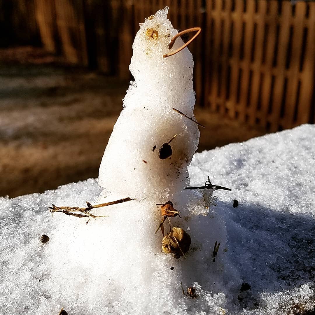
12/10-11/19 Potential Valley Wide Snow Event.
nrgjeff replied to John1122's topic in Tennessee Valley
Thank you to everyone for reports and pictures. I still can't react, but it lets me post. Reactions serve a valuable purpose, to cut down on clutter posts. Anyway I do have something to share. Got a thick dusting last night, maybe 1/3 inch but not a half. Here is our result. Daughter and I built this thanks to a 2-hr school delay. Micro-snowman sits on a deck railing. Zoom in for the win!
- 486 replies
-
- 9
-

-

-
- snow
- rain to snow
- (and 2 more)
-
December/January 2019/20 Winter Speculation Thread
nrgjeff replied to AMZ8990's topic in Tennessee Valley
True a strong tight PV does not necessarily mean blow torch. Just as a weak PV is not guaranteed cold. If the strong PV translates to 500 mb and a +AO then odds of big cold drop, but models are conflicted on the AO. I have a feeling it gets colder the beginning of January. Warm spells have not lasted as long as progged so far this winter. The easing of the IOD, previously more lit, may reshuffle. However for now the trend is variable instead of constant warmth. I'll put at least some chips on colder than normal at least a couple weeks in January. -
12/10-11/19 Potential Valley Wide Snow Event.
nrgjeff replied to John1122's topic in Tennessee Valley
Still can't believe it's snowing in Chattanooga, even though it's not sticking well. Grill and metal surfaces mainly, but the flakes add holiday cheer. I'm out of reactions today. Want to thank all who report. Love the pictures coming in now. AmWx needs to allow more reactions instead of stifling expression (or forcing more posts when a reaction will do). Anyway the dry air that robbed Nashville is stubborn. I think it's impacting precip advancing out of Alabama toward southeast Tenn. Feels like that slug of moisture will break up in southeast Tenn. Appears northeast Tennessee is doing OK though. On the plus side the Upper Plateau seems to be doing well today. Earlier I thought there, it might be a good day. On the Upper Plateau it is now time to play Ice Cube's song Good Day. Radio version if kids in the room.- 486 replies
-
- 3
-
-

-
- snow
- rain to snow
- (and 2 more)
-
12/10-11/19 Potential Valley Wide Snow Event.
nrgjeff replied to John1122's topic in Tennessee Valley
Sleet in East Brainerd (Chattanooga) which matches official KCHA ob. I'm falling out of my chair, winter precip actually made it into the valley floor / Chattanooga proper, lol! Nothing sticking. I wasn't even checking until I heard it on a north facing window. I'm still recovering from almost falling out of my chair.- 486 replies
-
- 10
-
-
-
- snow
- rain to snow
- (and 2 more)
-
12/10-11/19 Potential Valley Wide Snow Event.
nrgjeff replied to John1122's topic in Tennessee Valley
Good to see new members posting. Thank you for the observations! Welcome to the board. If long time lurkers, welcome to posting on the board. Memphis will have a tough time. Looks like that dry air aloft is quite evident on the radar, hole around the site. Nashville might have the same problem; however, being farther east keeps BNA in the game longer. GFS bless its heart. Had the dry air near MEM but still tried to spit out lots of snow accumulation. GFS forecast all that virga but forgot it's not hitting the ground. NAM radar simulation looks wrong compared to live composite radar; however, NAM is right it's not hitting the ground. I still think it could be a good day on the Upper Plateau into East Kentucky. Have the Ice Cube song ready, lol! MRX to TRI is such a crap shoot trying to get the Valley to cool off. However maybe the NWS has a point about cold air delayed but not denied meeting moisture at the right time. (Post is back on page 3). Speaking of looking back, page 4 dual pole radar discussion is a good read. Thanks y'all. One easy part of the forecast: Chattanooga all rain.- 486 replies
-
- 8
-
-
- snow
- rain to snow
- (and 2 more)
-
12/10-11/19 Potential Valley Wide Snow Event.
nrgjeff replied to John1122's topic in Tennessee Valley
Looks good Middle Tennessee. Looks boring southeast Tenn. I've been surprised at ECMWF snowfall output. Euro seems to be accumulating too soon with the warm ground and questionable 2m temps. Plus the old fashioned thickness/QPF chart ends precip so quickly right after thicknesses drop. Yes, the 06Z is more realistic with the Valley of Death black hole. NAM might be more realistic with lighter totals. Interestingly, the NAM shows temps cold enough for a few hours during light QPF. Its thickness/QPF chart meshes well with its snow output, which adds confidence over the Euro. While my lighter model choice may sound bearish, at least it accumulates a little - an improvement over my thoughts yesterday. Plateau and parts of Middle Tennessee lower elevations appear to have a good shot at sticking snow. Might only be an inch or so but it should be really pretty sticking to the trees and stuff. Mountains of course will get theirs later, but that's pretty much a given. Forecast fun is at lower elevations. A more vigorous last piece of energy could drop a couple inches west of the Plateau with 3+ on the Plateau. More likely scenario is less than an inch lower elevations (Mid-Tenn) to a couple inches Plateau. Mid-South edit: Gut says it gets going east of Memphis and North Mississippi. However that area is infamous for surprises with rushing cold fronts. We'll see, but I doubt it. I'm not expecting anything around Chattanooga. Maybe Signal Mountain dusting, iff the more vigorous case above. I've doubts about Huntsville and Knoxville, but we'll see. Feel better about Tri Cities, maybe even Morristown. Those two can do OK with lingering moisture. Still think the best correctly timed true lift will be Middle Tenn.- 486 replies
-
- 8
-
-
-
- snow
- rain to snow
- (and 2 more)