nrgjeff
-
Posts
3,906 -
Joined
-
Last visited
Content Type
Profiles
Blogs
Forums
American Weather
Media Demo
Store
Gallery
Everything posted by nrgjeff
-
John that was a great year, really both 2015 and 2014 for KCHA. My daughter almost forgot what it's like to have snow in town. Yeah I drove her (and myself hehe) to Calhoun, Georgia in December 2017. She really did not remember the 2014-15 snows in KCHA. And we snow ski every year. However just like us on the Board, for kids snow IMBY is something different and truly special. So, this Feb. 8 was really great in Chatty. Daddy daughter dance was the night prior. Then boom! Four inches of snow IMBY!!
-

February/March 2020 Winter's Last Chance Thread
nrgjeff replied to John1122's topic in Tennessee Valley
PowellVolz is right about the ECMWF trouble two Saturdays ago. Actually the systems do have some similarities. Both follow a first wave that pulls in cold. Both are greater than post-frontal junk, yet not WAA monsters. Really they are the pattern recognition I seek. NAM is probably too amped but I think the Euro is missing the wave and some isentropic lift. See my previous post. I'm guessing the 18Z GFS stays similar to its previous runs, somewhere in the middle. Look for trends on the 18Z or overnight ICON and Euro, hopefully less bearish even if staying on the light side. Finally, I had to put Darth Vader in Banter again. Cheers! -
Dear AFD Authors, RE East Tennessee snow on Thursday.

-
February/March 2020 Winter's Last Chance Thread
nrgjeff replied to John1122's topic in Tennessee Valley
Great post Math/Met. Inverted trough is the only way Chattanooga can get snow when surface temps are above freezing; otherwise, it's straight downslope hell. Indeed the NAM/GFS hint at a slight inverted trough in wind fields. It does not stand out as well with isobars. Hvward also makes a good point about the Spectral vs Gridded models this set-up (Mountains, SE sub) which was valid with the Chattanooga surprise as well. No major concerns/changes with the 12Z data. American gridded NWP sticks with sticking snow. Euro does not have much. Appears the Euro is missing subtle wave strength. This is not post-frontal junk. We have a true short-wave with isentropic lift coming through Thursday. Euro might not resolve the best early to midday isentropic lift. I get at that indirectly at 700 mb. Euro is CAA. Others are neutral with a frame or two slight WAA. That's going to also be isentropic lift. Rose/snow colored glasses? Maybe, but I'm going with American guidance. Possible the Euro is picking up on more strength in the dry northern stream. However pattern recognition favors the wave producing the upglide/isentropic lift. Pattern recognition favors the American guidance Thursday. -
February/March 2020 Winter's Last Chance Thread
nrgjeff replied to John1122's topic in Tennessee Valley
Just got back from skiing Snowshoe, WV. Talk about lucky/blessed in an otherwise awful winter. Snowed up there Friday and conditions gradually improved with each night of snow-making. Alas, this is my home thread back at 500 FT. Gut likes Thursday along-north of I-40, plus the Plateau and Mountains. Wait, the GFS/NAM don’t have precip? A risk with such cold dry air. However that solid HP anchors any cold in place; so, it’s of course and overall big plus. ECMWF usually has QPF to/north of I-40; so, I think it looks good (NWP verbatim). System originates in Texas and slides to our south, my favorite track. Yes basic WAA precip. Should not cut with northern stream pushing (billiard ball meteorology) if the surface high ain’t enough. 700 mb temps look close to ideal. Trouble is boundary layer. Anybody shocked there? I think I said that before Chattanooga got 4 inches of boundary layer problems. -
Hopefully we can avoid Death Nina SER. Japan model isn’t too bad. Most of the cool is south of the Equator. Is the PDO trying to take a breather? Better be after spring cause warm off West Coast makes severe season bo-ring! Now, that look could be nice next winter if the central north-PAC keeps cooling.
-
2019/2020 Mountains and Foothills Fall/Winter Thread.
nrgjeff replied to Tyler Penland's topic in Southeastern States
ECMWF looks good overnight, though typical Day 4 caveats are in effect. Other models agree somewhat, even if the GFS loses the system some runs. NAM appears to have it. High press remains firm for the cold air. System tracking to the south, originating from Texas, my favorite for sliders / non-cutters. Northern stream appears to prevent any cut, if the HP wasn’t already enough. 700 mb temps look great for the Mountains. Lower elevations (Sanitarium) have boundary layer temp issues. Mountains should be fine, in fact at/below freezing above 3,000 FT. Starting late last week, better late than never! -
Need ENH along north of I-20 from JAN to BMX, including MSU and UAH (latter or universities not airports). Temps/Dews are way ahead of progged. Meh soundings on models are worthless. Winds ARE turning with height. CAPE with lifting WF going into evening in Dixie. What could go wrong? A lot!
-
February/March 2020 Winter's Last Chance Thread
nrgjeff replied to John1122's topic in Tennessee Valley
Oh yeah that pesky inversion will add to the mountain wave event, increasing the efficiency of the LLJ crashing down the north slopes. Weekend of the 22nd is starting to look interesting on the Globals for the Plateau and Mountains. Could be for anyone along-north of I-40. Not much to add at this point. Now that Chatty had it's good snow, I'm really rooting for y'all up there! Oh hello 12Z Euro! It won't be that cold, but the attempt is good for winter lovers. Maybe a storm system instead. -
Well that would suck the life out of severe. I place my order for cooler weather central tropical Pac. Keep warm east. TNI boom!
-
Looks like Iron Basketbowl II for me tonight. ESPN crooks have my Kansas game on + this evening. Does that mean wish for severe too?
-
Oh that looks like help from downslope too. Quite obvious on visible satellite now. Chatty still in the soup. Good to know!
-
TN valley heavy rain/flooding week of whenever
nrgjeff replied to janetjanet998's topic in Tennessee Valley
I'm ready to see that MDT Red on the SPC charts instead of the WPC charts. Can it just be April yet? 12Z QPF progs are not quite as bad East, but still there Mid-Tenn. Trouble there is double whammy of daytime rain and then the squall line. -
TN valley heavy rain/flooding week of whenever
nrgjeff replied to janetjanet998's topic in Tennessee Valley
We got almost an inch more overnight. Apparently it all ran off. @dwagner88 was I seeing things or the creek was almost up to the bridge by Food City Jenkins and EB Rd? -
MRX rightly is/has been more concerned about flooding. SPC has caved, lol. OK seriously, they did not cave. Shorter Term data not available or reliable at Day 4 shows the problems with the set-up now as we move in to Day 2. It's too damn warm at the mid-levels. Oh this wind field would be amazing with April or even March surface temps. Winds with height turn almost 45 deg. Usually Dixie has about 30 deg. Rooted supercells would spin up in a hurry, but... CAPE is hard to come by. They talk about low-CAPE high shear events. This is almost NO CAPE. Looks like skinny cape above 700 mb and questionable if any below. Lack of low-level CAPE juxtaposed (vertically) with low-level turning is a deal breaker. So, I have zero interest in chasing. I'm not really even worried about severe at home. I will be peacefully relaxing and watching Kansas at West Virginia. Uh, actually I'll probably be barking at my TV, lol! Actually the ESPN crooks put it on + which I boycott. OK, hope for severe!
-
I didn't even remember who wrote what. That's funny though, lol! Yes I hope they keep the AFDs public. Surely they will always do them for shift-change and coordination with offices. I mean if SPC is public, surely AFDs can be public. I could just make a phone call; but, he thought of no AFDs has me... Back in the Panic Room!
-
TN valley heavy rain/flooding week of whenever
nrgjeff replied to janetjanet998's topic in Tennessee Valley
Rare High Risk and large Moderate Risk of flooding is quite significant for the South. Due to the high impact of this event, please share with your fiends on social media. Make sure the graphic comes up on the post. Date it and make it public too. (just change back to friends your next post.) I went through Thursday, though the High is through Tuesday. This is going to be bad from rivers down to streams and low areas. -
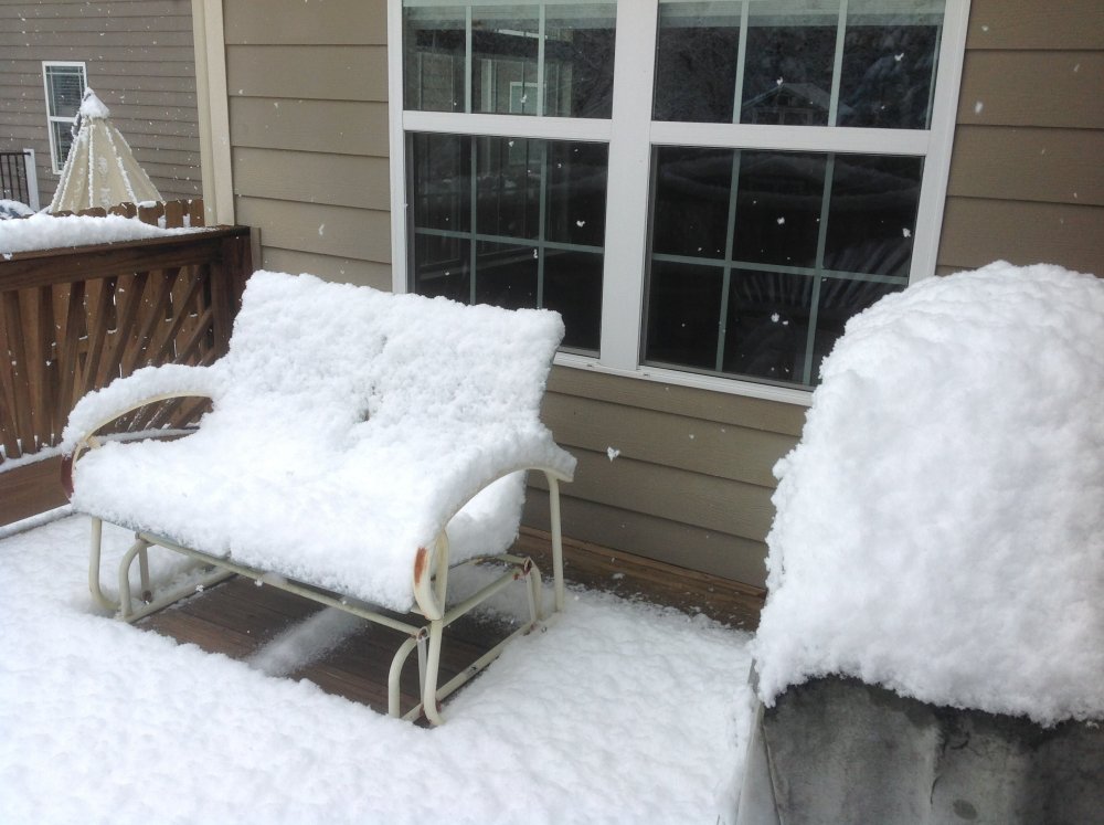
Sun angle IS brutal. Chattanooga winter wonderland was gone by 2pm Saturday. I want to say that I found the criticism of MRX inappropriate and uncharacteristic for this Region sub-forum. I did not want to say that in the Obs thread because it was such a beautiful day for some of us. Why ruin the mood? Figured I'd wait a couple days. Funny though, where to put it. It's not Banter but it's out of place in the event thread. Panic Room was a thought. Since it came up... I ask those without the degree to avoid unnecessary and near-personal bashing of the NWS or TV Mets. Might sound like a Met-snob, but this rare call-out is necessary. Once again I really loved the snow. I thought 1/2 inch (ECMWF qpf not sun issue). Hoped for 1-2 inches (US models). Bama magic came through for Chatty! Four lovely inches of snow and a whole lot of fun for kids of all ages!! It only takes 3 hours to make a season. The Super Bowl. Saturday snow in Chattanooga!
-
Southeast Valley Special Obs and Last Min Forecasts.
nrgjeff replied to John1122's topic in Tennessee Valley
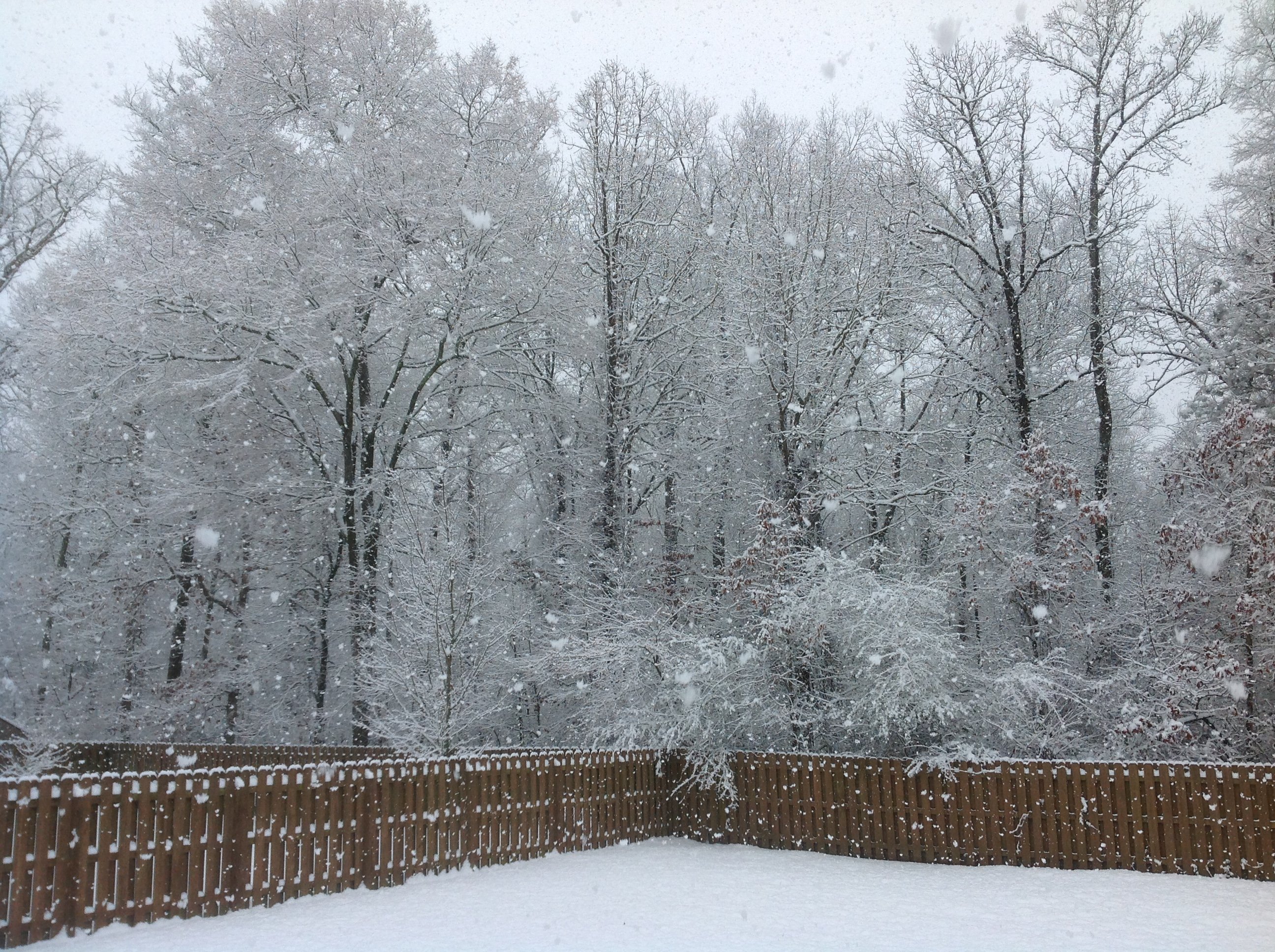
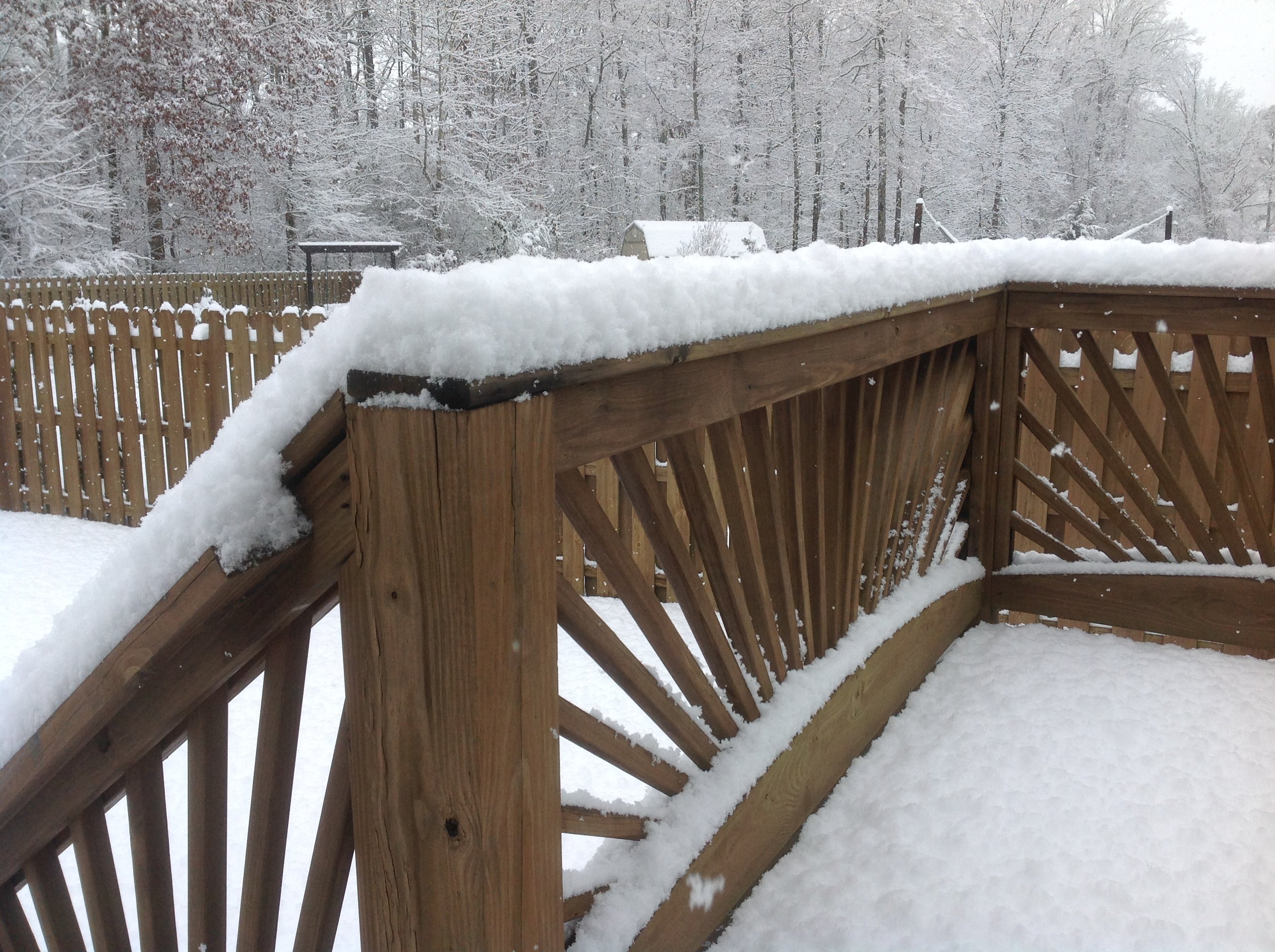
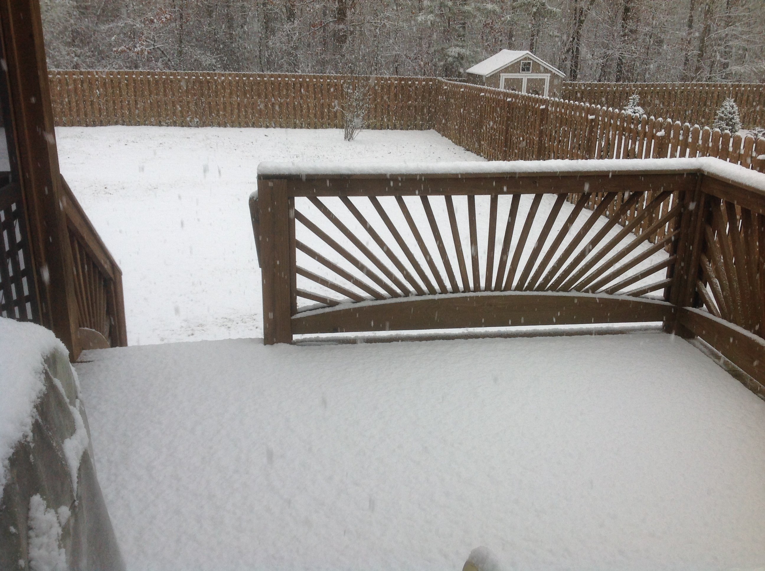
Wrapping up with almost 4 inches. East Brainerd, Chattanooga, Tenn. Phat flakes for a while. Kids all playing. Glorious!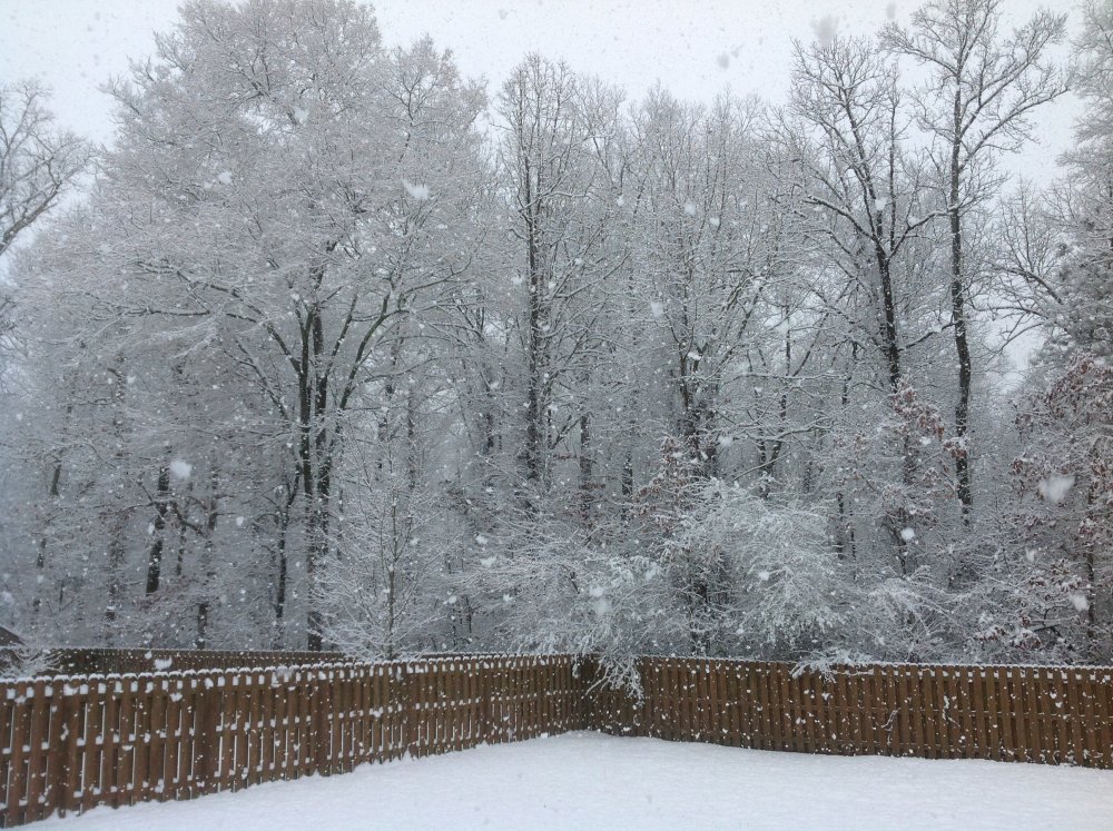

- 85 replies
-
- 10
-

-
Southeast Valley Special Obs and Last Min Forecasts.
nrgjeff replied to John1122's topic in Tennessee Valley
Thank you all for the congrats. I'll run out of likes and thank-yous today. 8:30 Eastern. Chattanooga baby!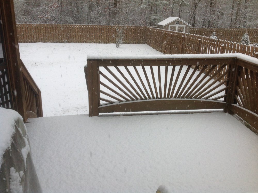
-
Southeast Valley Special Obs and Last Min Forecasts.
nrgjeff replied to John1122's topic in Tennessee Valley
It's Happening! Two 50 year events in six days. Chiefs win the Superbowl. Snows IMBY. OK 5 years on the snow sticking greater than half inch (forecast). Started about 7, sticking at 7:30 Eastern. Hope we have 2-3 hours of this. East Brainerd, Chattanooga, Tenn.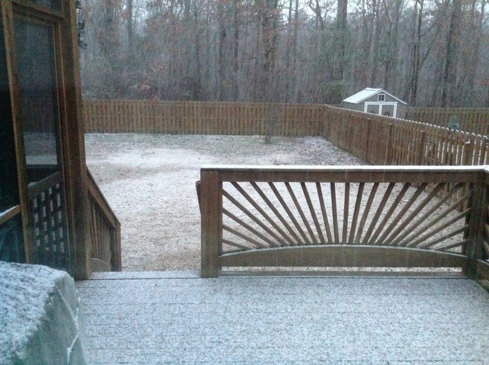
-
February/March 2020 Winter's Last Chance Thread
nrgjeff replied to John1122's topic in Tennessee Valley
Interesting point about low level moisture Saturday. One huge challenge is not super moist above 700 mb. Dendrite growth temperature zone looks weak, but some moisture. Now if we were forecasting severe weather, I'm all about the extra ground moisture. Those concerns noted, It's a feisty little wave. Figure places with terrain help will be nice. More notes added later: The Euro for Saturday appears a little low relative to consensus. Others have more qpf and snow, from more WAA aloft. Just a little more moisture up to 600 mb would be enough. GFS looks too amped, but I said that about the Euro for Friday. We'll see. Moving to next week, the ECMWF and GFS remain in sharp disagreement. So do the weekly products. The issue is MJO forecasts. Unfortunately the (currently mild) Euro usually wins those battles. GFS has advantage in only 1-2 MJO phases, and these are not it. That said, I'm in ski weenie mode after what just happened today and will happen tomorrow. Fingers crossed the GFS scores a rare win on the Euro next week. . -
Mood when it snows more than forecast. Today that's Plateau and parts of Middle Tenn.
-
Chattanooga has snow flurries/showers in town that do not stick. However Signal Mountain above town is frosted. Lookout Mountain is less so, even though it's higher. Meteorology is what you expect. Weather is what you get, lol! I know 1-3 inches fell in other parts of the state. Pictures??? Pleeeaaazzzeee So happy for everyone who got a nice snow today. Looks above expectations in many places (LSRs NWSChat). Flurries is in Chatty is AE, lol! Few weeks back I busted an optimistic snow forecast up your way. Hope this makes up for it. Kind of like 2 interceptions; but, then 3 touchdowns. Yeah I'm happier than normal for others who got good snow. Super Bowl feeling continues baby!
-
Snow is that Mahomes 44 yard pass to Hill that started the optimism. I'm happier than normal for others getting sticking snow. Must be a Super Bowl feeling!