nrgjeff
-
Posts
4,261 -
Joined
-
Last visited
Content Type
Profiles
Blogs
Forums
American Weather
Media Demo
Store
Gallery
Everything posted by nrgjeff
-
My guess is that level of damage is why Mississippi is slow to get restored. NES is close to fully restored. @Carvers Gap my charts above are just as likely to be fulfilled by the polar jet as the STJ since it's still early season. I'm agnostic as to which. I just want action, ha! All, if we transferred some of the CAPE from the February thread we'd have a decent shot at severe. Sorry it's Free for All Friday!
-
Welcome to the land of Nada this weekend. You're a week late, ha! Yea the clipper has some gumption on clouds physics. Separately, we need to re-open Politics over in Off-Topic to let off some steam. Better there than here!

-
Ice storm started as a heavy rain outlook from CPC. Let's not do that again! Instead, how about severe weather?
-
Chase early. Chase often!
-

Jan 30th-February 1st 2026 Arctic Blast/ULL Snow OBS Thread.
nrgjeff replied to John1122's topic in Tennessee Valley
Few flurries in Chattanooga Sunday evening. I did a double take. Hoarfrost is as beautiful as ice, with zero impacts. Winner! The moonlight pix? Those have 99% solar eclipse vibes. Only 19 more years! -
Jan 30th-February 1st 2026 Arctic Blast/ULL Snow OBS Thread.
nrgjeff replied to John1122's topic in Tennessee Valley
Above was a layup forecast with this low-level profile and upper level cold. -
Jan 30th-February 1st 2026 Arctic Blast/ULL Snow OBS Thread.
nrgjeff replied to John1122's topic in Tennessee Valley
Regarding Chattanooga proper, we're just not a northwest flow town. I'm quite happy with the event though. Signal Mountain may restart if it hasn't already. Might as well be another Universe. As for Florida, ever since the Gulf of America, lol! -
Jan 30th-February 1st 2026 Arctic Blast/ULL Snow OBS Thread.
nrgjeff replied to John1122's topic in Tennessee Valley
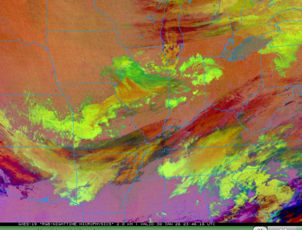
Hytop looks like an elevation map west of Chatty. Y'all enjoy! Then northeast Alabama drew a winter wx advisory. Where are or North Bama crew? Separately @Holston_River_Rambler lee of the Lakes had to be producing at the time of your image. RGB at the time had the orange tint to clouds.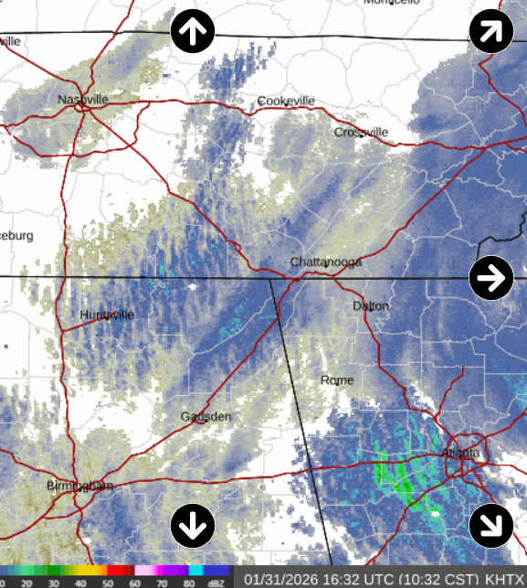
-
Jan 30th-February 1st 2026 Arctic Blast/ULL Snow OBS Thread.
nrgjeff replied to John1122's topic in Tennessee Valley
We are officially past doubling down in blackjack. We have achieved a Hard Way in craps. Pays more. Two inches East Brainerd. Light snow continues. -
Jan 30th-February 1st 2026 Arctic Blast/ULL Snow OBS Thread.
nrgjeff replied to John1122's topic in Tennessee Valley
Definitely a Midwest type of snow. Minnesota, KC, whatever. It is unusual in Chattanooga. We're enjoying it! I may be closing in on two inches. Definitely 1.5 blowing around. -
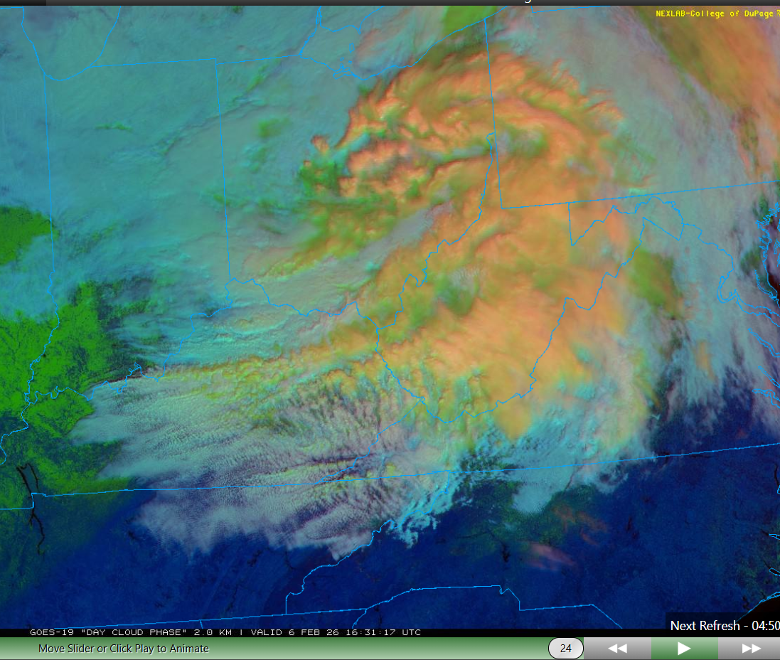
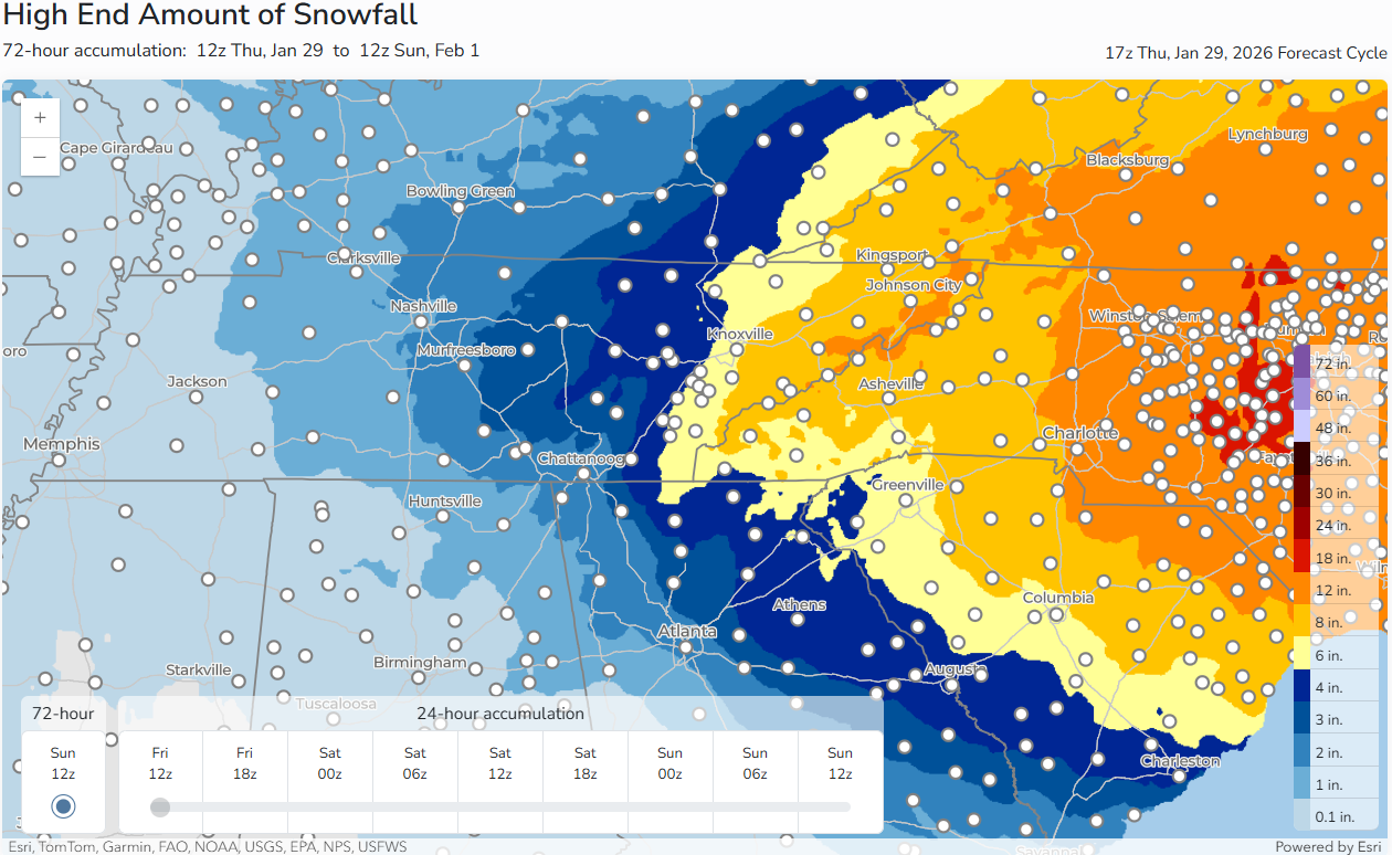
Seems like almost everyone overachieved last night. MRX just posted additional snowfall forecast and it's over in the OBS thread. I would think a little more than that for northeast Tenn? Forecast wise.. Northeast Tennessee might only be around the 3rd quarter - far from winding down. See baroclinic leaf like feature. I was expecting just a lumbering cold core by morning. Instead, the system is still going. Then NW flow and upslope areas might only be at halftime. This is gonna go most of tonight there. Then the true Mountains (Smokies and Southern Apps) should still have snow showers Sunday morning. Southeast Tennessee will probably wind down to snow showers and flurries by midday. Signal Mountain should keep going with quality snow showers most of the day. Points north (Flattop Mtn. Cumberland plateau) should do even better. Daytime cloud physics. I prefer it over Vis to detect snow producing clouds.

- 782 replies
-
- 6
-

-
- extreme cold
- snow
- (and 1 more)
-
Jan 30th-February 1st 2026 Arctic Blast/ULL Snow OBS Thread.
nrgjeff replied to John1122's topic in Tennessee Valley
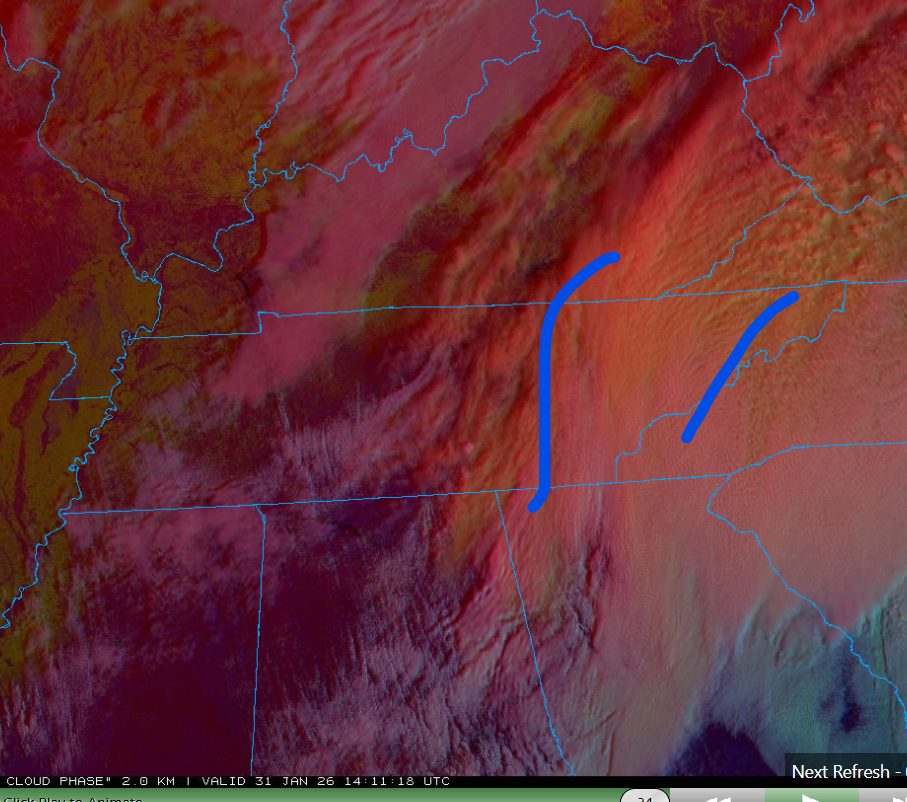
Playing with house money now. Chattanooga is well above the 50% NWS forecast. See if we can double down and push the 90%. Maybe play the Hard Ways for highest scenario? I like blackjack and craps metaphors. Y'all to my northeast, I didn't expect this. Do we have a hint of a baroclinic leaf? Didn't look at model satellite depictions but that seems more bullish than forecast.. little more than just a lumbering upper-low. Bit early for Daytime RGB (transition from night RGB) but I think the leaf feature shows better than on Vis.
-
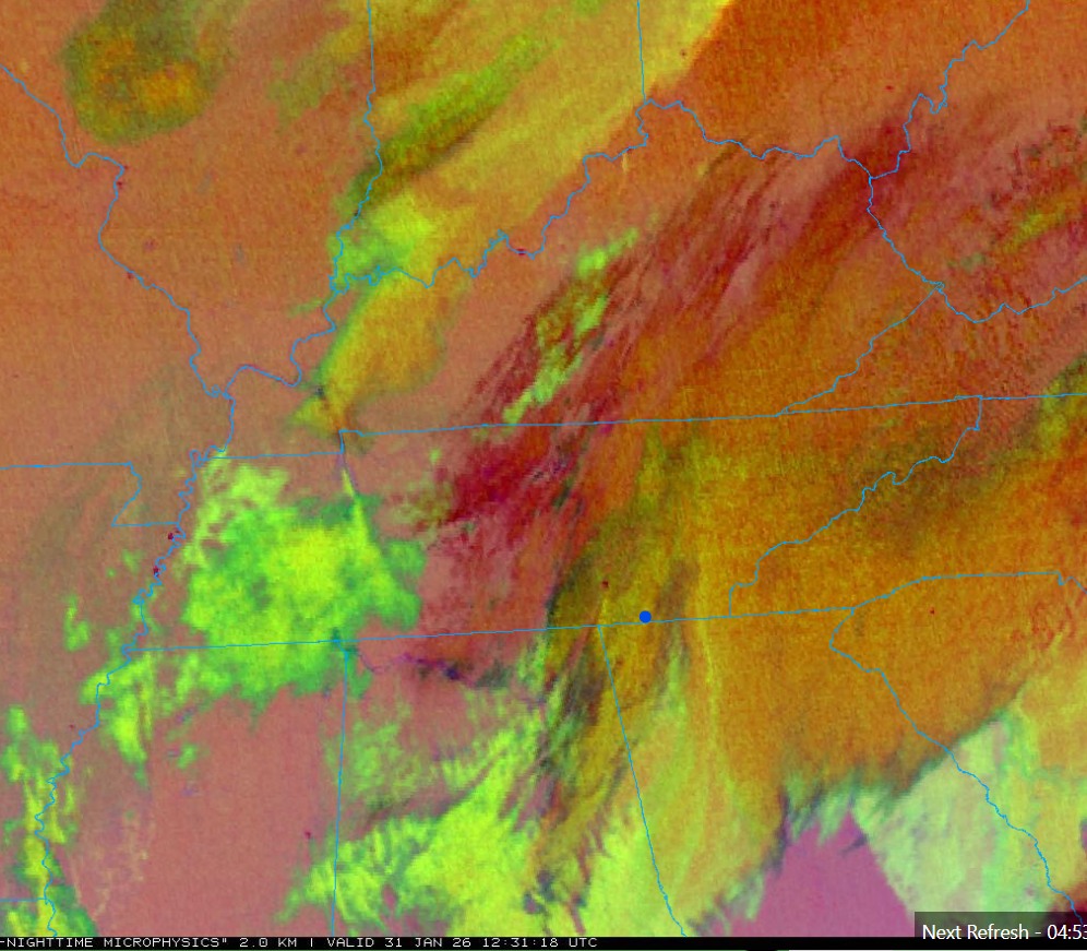
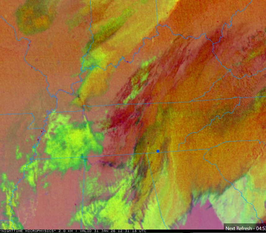
Per OBS thread, KCHA lower elevations has another couple hours as the last lobe on radar comes through. Shows as multi-layer clouds on Satellite (below) just coming in, and following the overnight round now east. Signal Mountain and points north especially the Upper Plateau should have good snow showers all day, some moderate north, in the moist low-level flow beneath cold core aloft. Several hours of steady snow will continue farther east in the Winter Storm Warning areas. Then any upslope areas will have snow showers well into tonight with the upslope half of the event. Mountains will still go hard overnight and probably still have snow showers going Sunday morning. Cold upper-level low is just swinging into northwest Tennessee at this 12:30 UTC shot below. That'll keep things going
- 782 replies
-
- 3
-
-
- extreme cold
- snow
- (and 1 more)
-
Jan 30th-February 1st 2026 Arctic Blast/ULL Snow OBS Thread.
nrgjeff replied to John1122's topic in Tennessee Valley
I have an inch in East Brainerd. Found a couple less windy spots to measure. As usual a bit less than Ooltewah and Apison, but I'm happy with the result. I'd be happier if some of y'all would use the Apison Rd improvement by Southern instead of EB Rd. Multi-level clouds will soon depart the Chattanooga metro in a couple hours, and snow will wind down to flurries. Signal Mountain is a different story. As usual it'll benefit from the moist low level sounding. Snow showers all day! More outside my local Chatty area in the Forecast thread later. Coffee time! -
Jan 30th-February 1st 2026 Arctic Blast/ULL Snow OBS Thread.
nrgjeff replied to John1122's topic in Tennessee Valley
It's getting windy because somebody posted Cousin Eddie, who is from Kansas. Some of it is typical fropa wind. We also have a bit of a press gradient tomorrow as the low press deepens off the Carolinas. -
Jan 30th-February 1st 2026 Arctic Blast/ULL Snow OBS Thread.
nrgjeff replied to John1122's topic in Tennessee Valley
Yes light snow has been falling in East Brainerd, Chattanooga probably for 30 min or more per other in-town and 'burbs reports. I was watching the Michigan and MSU game. Half-time is check floodlight out window time! Thank you Signal Mountain crew for the earlier reports. Now we just settle in. This system radar and ground truth might have lower than usual correlations. Flakes growing in EB but yeah I think this is just an initial snow band. -
In contrast to my Obs thread rant.. On the positive side for tonight and tomorrow, the cold core. KCMO area is squeezing out snow showers despite a dearth of multi-level clouds. KCMO is not exactly known for upslope, ha! If they can do it, favored areas in Tennessee will do well on Saturday / Sat. night.
- 782 replies
-
- 8
-
-
- extreme cold
- snow
- (and 1 more)
-
Jan 30th-February 1st 2026 Arctic Blast/ULL Snow OBS Thread.
nrgjeff replied to John1122's topic in Tennessee Valley
Regarding Downslope. Also if Chatty gets dome blocked somehow. Not good, otherwise... Also I may need to stop everything until I find out what the hell is going on Signal Mountain. If they can't even get it to saturate, rage will grow exponentially in town. -
Shifting from forecast to nowcast. Have to decide whether this is stay up late or get up early. I'm gonna need a rave for the all-of-the-above all-nighter option. Wetbulbs are probably in the mid-30s everywhere. With below 0C temps aloft it's all snow. Any initial sprinkles should goto snow. Plateau clearly has multiple rounds. This is the appetizer. Main course is tonight into early Saturday. Saturated profile snow goes on into Saturday night. Mountains is even better. Chatty looks mostly overnight. Everywhere around us will go through Saturday morning, but it'll cut off fast in Chat-town. Enjoy it while it's here! Everywhere else looks good on MRX charts. Upper Plateau will almost certainly over-achieve though.
- 782 replies
-
- 7
-
-
- extreme cold
- snow
- (and 1 more)
-
Here we go! Roads will get slick in Chattanooga late tonight and Saturday morning. probably not as bad as 2014 since we are not as cold. I like the rest of the MRX snow chart too.
- 782 replies
-
- 4
-
-
- extreme cold
- snow
- (and 1 more)
-
Roads will go insta-slick in Chatty. They'll eventually go winter wx advisory. Can't justify a warning with no tree damage, but that awful travel morning in 2014 is on the table. Good thing it's a Saturday!
- 782 replies
-
- 2
-
-
- extreme cold
- snow
- (and 1 more)
-
Straight from WPC! My hype train has left the station.

- 782 replies
-
- 8
-
-
- extreme cold
- snow
- (and 1 more)
-
Chattanooga will eventually get a winter weather advisory, but I think we are still a period away. Perhaps afternoon ZFP. Thankfully it's on a Saturday, but light snow will turn roads immediately icy like the 2014 debacle. Knoxville could get more than a few inches of powder. Classic travel related WSW. Powder should be no problem for the power infrastructure. Plus it's well away from the main Restoration Area. Absurd cold at 500, 700 mb and periods of subtle WAA at 850 will do it. Leads off with slight WAA ahead. Then some WAA into the cold core later hours. Plus that DGZ beneath where models usually "look." Finally yea, the Carolina mountains are going to have Utah level powder. Ski conditions don't get any better in the World. And it's gonna be right here! If one is already ski in ski out. Roads? oof!
- 782 replies
-
- 4
-
-
- extreme cold
- snow
- (and 1 more)
-
Euro indeed improved so much at 06Z that is snows in.. Chattanooga!! I'm cautiously optimistic with the very cold ULL and low-level soundings beneath it. NBM high-res Ensemble still lacks snow; but, I hypothesize the Ens algo isn't translating very light QPF to fluffy snow. We'll see. NAM and others are trying to come around. Yeah FV3 hints. I get a choppy presentation on my sub, but it's snow in Tenn. We need more of that Euro trend. Cue up Back That Thang Up by whoever sungs it. Maybe Stove could build a club /snow meme. Hip Hop snow dance!
- 782 replies
-
- 5
-
-
- extreme cold
- snow
- (and 1 more)
-
Fall/Winter Banter - Football, Basketball, Snowball?
nrgjeff replied to John1122's topic in Tennessee Valley
Vols game last night was the same as tracking Southern snow. Got it! Ope, OT Comfy lead. Ope, one-pointer! Vols reeled in the road win. Let's do the same in East Tenn!