

nrgjeff
-
Posts
3,903 -
Joined
-
Last visited
Content Type
Profiles
Blogs
Forums
American Weather
Media Demo
Store
Gallery
Everything posted by nrgjeff
-
Arctic air situation qualifies everywhere but Chattanooga, lol! Long as the vort max is north we have warm nose risk. Downslope is not as much the issue with northerly rather than easterly winds. Meanwhile the ECMWF is steady. Keeps almost all of Tennessee involved. For Chattanooga see above. Signal and Lookout are good. Oh wow! Kingsport heartburn never ends. Do we cue up Metallica? My Friend of Misery.
-
Forum needs a glow sticks rave emoji for a forecast like that above. Reality is that along and north of I-40 and I-81 all systems are go!
- 841 replies
-
- 11
-

-

-
Regarding last post page 7. Chattanooga proper might score two busts in a row. Looks fine for the rest of East Tenn. Barring a hand-off debacle I think all of the TRI should be fine. ICON follows GFS with Chatty winter precip. Prepare for disappointment in the valley. I'll double down. How about snow in Soddy and Ooltewah but not Downtown or East Brainerd? Signal and Lookout look solid though.
-
Southern Valley warm-nose risk is mainly because the vort max is still north. With less of a defined low level low, downslope will not be the deal killer. Plus the dry air will cool with precip. But that vort max. HRRR is too amped though. We know it's always on steroids for severe. Well the physics of the model remains the same; therefore, one can deduce it's too amped. So the HRRR warm risk is too much. NAM is probably the worst case. Globals of course are all systems go! I feel pretty good about along and north of I-40 and I-81. South is TBD. Note the MRX lowest case still gets Knoxville snow. Shows the classic Athens north. MRX highest case gets Chatt. Official fcst looks reasonable. Nashville, Memphis, Paducah and Jackson, KY also have a public snow forecasts up.
-
1. Tri Cities should do better, or at least be more consistent @Carvers Gap. 2. I'm never excited about Chattanooga @dwagner88. Last post of the day. Cheers!
-
So much to discuss. It does looks like a decent situation state-wide. 1. Sounding is from near the rain/snow line so yes it has a warm nose. What I'm seeing above that is a saturated DGZ. Looks like an isentropic lift event along all the right surfaces. 2. Chattanooga could benefit from dynamic cooling aloft; however, surface temps should remain mid-30s during snowfall if it snows. Signal and Lookout will be snow. 3. @8283 El Nino Baby welcome to Tennessee! Rose Bowl effect in Chattanooga today - I know that's Southern Calif. Chattanooga got blanked but snow sits on local mountains. I used to forecast for several California newspapers including the LA Times and San Jose Mercury News. California micro-climates rock! We will try to satisfy you here in Tennessee. 4. Yeah the banding on the Euro is probably forecast banding of snow. Of course those locations are subject to change. 5. There's still time for East Coast weenies. Our last system surprised them. Can we get two in a row in DC for Ian? As others have noted a less amped slider would really help Chattanooga proper. However it might put us in conflict with Memphis - where snow is quite possible this time.
-
That's not bad right above. 1-2 West. My conceptual model has 1-3 most of Mid-Tenn, except far southern. Then 3-5 looks reasonable Upper Cumberland into Kentucky. Upper Great Valley should do better than last time. Chart looks similar at higher elevations with 6-8. KCHA remains a big warm nose risk. Signal and Lookout get snow again though. GFS below must be forecasting some banding. Not unreasonable, somewhere in the Region.
-
I like the GFS/Euro blend. NAM is still probably too north the 12Z run. UK Met is with the other globals south of the NAM. Still blanks Chattanooga. However it looks really similar to Sunday night. Add more for Western Tenn. If we can get a more diffuse northern boundary then Kentucky remains well in play. Track may be broader north and west. South side (KCHA) still has warm nose issues. Also does not line up as well for North Alabama (still light snow but not nearly as much).
-

Fall/Winter Banter - Football, Basketball, Snowball?
nrgjeff replied to John1122's topic in Tennessee Valley
Add the Florida Gulf Coast to places that get more snow than Chattanooga. NYC got hammered right after comparing itself to HSV. See what I'm trying to do here? -
UK and ECMWF join the chorus for I-40 and I-81 north on Thursday. Looks like all good straight east of Knoxville too. GFS has an odd southern solution; so yes, I'd go with the GEFS. OK in Chatty we are praying for the GFS Op. Cold air will be in place. Might not start below freezing, but it's not starting at 70. Starting around 40 is doable with an east wind, except for... you know. ECMWF weeklies in cold for three weeks. Could be a fun January. It has MJO support attm. AN rain Deep South and BN precip here is a good look. Snow holds less moisture.
-
Chart below is important enough to post twice. I just eyeball the convection on the Pacific satellite. The 200 mb divergence or 850 mb convergence or outgoing radiation all show the same thing. Why make it complicated though? Satellite is simple. Now one can look at forecasts of the other variables on the models, but satellite is by far my favorite diagnostic tool. One can also loop it to get an idea for the next couple days. With up to a 7 day lag for effects in North America, that goes pretty far. Oh yes convection is in a favorable area for cold in the Southeast. China chart is also favorable with Siberia ridge and South China storm track. See @jaxjagman above. Sometimes China and US weather go together - depending on what's going on in Alaska. I like 2-3 weeks of cold. Mild interlude sometime next week would not shock me. Northwest Canada ridging never really settles down, so I could go with the CFS 16-20 Day with another cold shot. Unfortunately that could be it. I'm joking spring starts after Martin Luther King Day. However if the mild interlude fades (to normal or cold) late next week that could be signs of a more durable cold pattern.
-
Yeah @Uncle Nasty we know the physics, but it's still a tough pill. I mean the picture right above is not that far away. Chattanooga is of course the lowest elevation; so, downslope does more here. Also the Mountains are directly east-northeast, so that just magnifies the relief over which the downslope travels when a surface low is pivoting. KCHA misses the critical time of snow. Cold air simply must be in place first. We've done it from mid-30s before, but I've never seen it starting above 40 with rain. Tri-Cities is always a pressure cooker. I mean at least in KCHA we can just set our expectations low - or go up Signal/Lookout where it snowed. Kingsport has to get going early on the east wind; otherwise, the north wind on the very back side is downslope. Johnson City often has to endure downslope crap before the wind turns around more. Parimutal racing metaphor. Kingsport is a breaker and JC is a closer. If Kingsport does not break it's over. JC just has to wait. Bristol seems to behave a little closer to the Norwegian cyclone model, unless warm nose hell which often delays.
-
Some crap never changes. Expected but still... Congratulations to everyone else who got snow. LOL Tuscaloosa but not Chattanooga. I understand the physics but I'm still shaking my head in disgust. Again, I'm happy for everyone else in the entire free World who got snow!
-
Enhanced Severe risk and storms Dec 31,Jan1
nrgjeff replied to jaxjagman's topic in Tennessee Valley
LOL Tuscaloosa gets snow and Chattanooga is blanked. Sh!t no wonder I like severe weather. Birmingham eventually change over? Otherwise Chattanooga needs a friend of misery. -
Yeah it's nowcast time and the models add less incremental value. Knowing climo is why I'm so cynical in KCHA. We have a nice baroclinic leaf on both satellite and radar. It's not moving terribly fast either, since we are still pre-pivot. Except for Chattanooga proper, I think all systems are go. Signal and Lookout will definitely have snow. Last post of the night. Best to all!
-
Fall/Winter Banter - Football, Basketball, Snowball?
nrgjeff replied to John1122's topic in Tennessee Valley
SPC is licking the column in Chattanooga after the triple dare. Best thing about a Christmas Story is they did a good job with all that snow outside. -
SPC Mesoscale discussion does not account for the Great Valley. I don't expect a micro-scale map, but that broad brush is pretty bad to be honest. Chattanooga in the heart of the heavy sticking snow? Um, no. That aside, SPC seems to be with the local WFOs. They see the trough pivoting negative. That will indeed cool the column in a hurry. Lower Great Valley won't benefit much due to typical downslope and oh my it's still warm! Still SPC makes good points about the rest of the system. More than Feb. 2020 it reminds me of an event back in Kansas during October. Don't ask how long ago, haha. Tight low came in while temps were above freezing. Low pivoted negative and dumped 1-2 inches per hour snow.
-
Yeah grassy areas are not melting if it's in the 20s, even if the soil is still 40s. Roads will probably quickly improve after it ends though. Obligatory back deck and grill pictures will be preserved most of the morning. Looking forward!
-
Arctic fronts are good at coming in quicker west of the Plateau. I think you're right. Unfortunately the Great Valley can not escape downslope, esp below Maryville, Tenn. Chatt temps are still nutty warm. Plateau blocks low level cold. Smokies double down with sinking motion out of the East. I'm not sure why MRX is so optimistic. I always love mention of the T-word though. Good for points north and east and west and even south. TROWAL!
-
Enhanced Severe risk and storms Dec 31,Jan1
nrgjeff replied to jaxjagman's topic in Tennessee Valley
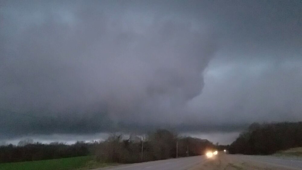
Here are screenshots of video from near Muscle Shoals on New Year's Day. Two separate supercells produced rotating wall clouds, but I could not discern any touchdown. A middle second sup is not pictured because it was garbage. Thanks to @Fred Gossage excellent TV and radio commentary. First supercell near town about 3:30 pm Third supercell just south of town 5:00 pm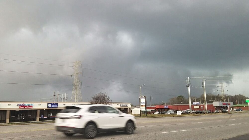
-
In Chattanooga we remember all the big strike-outs. Bottom of the Ninth Game 7 WS with RISP. All we need is a blooper. WhifX3! There was the Chattanooga Saturday miracle February 2020. Nice things before the Pandemic, lol!
-
Lock in that RAP. See Chattanooga forecast. Rest of y'all are good to go!
-
It's just the HRRR. In all seriousness probably some sleet. Eventually it's changing over and snowing for a few hours. DGZ ain't bad either. Can't always be perfect saturation. Hopefully inside 12 hours a Red Tag does not jinx it. Still thinking warm nose hell dusting or less KCHA. I like almost every other forecast point in our region.
-
So Tornado Warnings and Watches improve the effect over general thunderstorms. Just kidding! Regarding the Great Valley, it's definitely downslope. Cold air likes to get trapped. Warm air would rise through cooler air (instability) or just be static stable (all else equal). Of course with terrain it's not equal, and we get downslope instead.
-
Fall/Winter Banter - Football, Basketball, Snowball?
nrgjeff replied to John1122's topic in Tennessee Valley
Yes it was an excellent bowl game. Very entertaining for neutral fans and the national audience. Now I'm ready for basketball and other winter things. Red tag can't say the word for risk of a jinx.


