Terpeast
-
Posts
5,326 -
Joined
-
Last visited
Content Type
Profiles
Blogs
Forums
American Weather
Media Demo
Store
Gallery
Everything posted by Terpeast
-
Jan/Early Feb Medium/Long Range Discussion Part 3
Terpeast replied to WinterWxLuvr's topic in Mid Atlantic
H5 looks great. Near perfect. But what matters is what we have at the surface. How cold does it get, not just when it's dry, but when it's precipitating. Do we get a good high to the north when we get an incoming wave? Where does the r/s line lie? Those details obviously can't be resolved this far out, and I'd be highly skeptical of snow maps at 3 weeks out. Take last week for example - 3 weeks or even 1 week prior, snow maps barely showed an inch and we ended up getting ~10 in one week! I don't remember seeing a snow map like that on the weeklies that far out. If anything, they were further north across PA into SNE, even up until 2 days before the second wave, and then it dunked south at the last possible minute. -
Jan/Early Feb Medium/Long Range Discussion Part 3
Terpeast replied to WinterWxLuvr's topic in Mid Atlantic
Nice... and this is entirely before the "good" pattern starting Feb 8-12ish?? -
Jan/Early Feb Medium/Long Range Discussion Part 3
Terpeast replied to WinterWxLuvr's topic in Mid Atlantic
True, but we had the cold air. This time we don't. -
Jan/Early Feb Medium/Long Range Discussion Part 3
Terpeast replied to WinterWxLuvr's topic in Mid Atlantic
Agreed. I think E PA / N NJ wins this one. Not sure about NYC metro. High elevs in our sub may get a little bit, too -
Still good. Especially shaded areas facing NW
-
Jan/Early Feb Medium/Long Range Discussion Part 3
Terpeast replied to WinterWxLuvr's topic in Mid Atlantic
We got "lucky" twice last week but that was when there was plenty of cold air. I don't think we luck into this one this time, except for higher elevations (I'm looking at you, PSU). For the rest of us, we wait until 2nd week of Feb, maybe a bit sooner. -
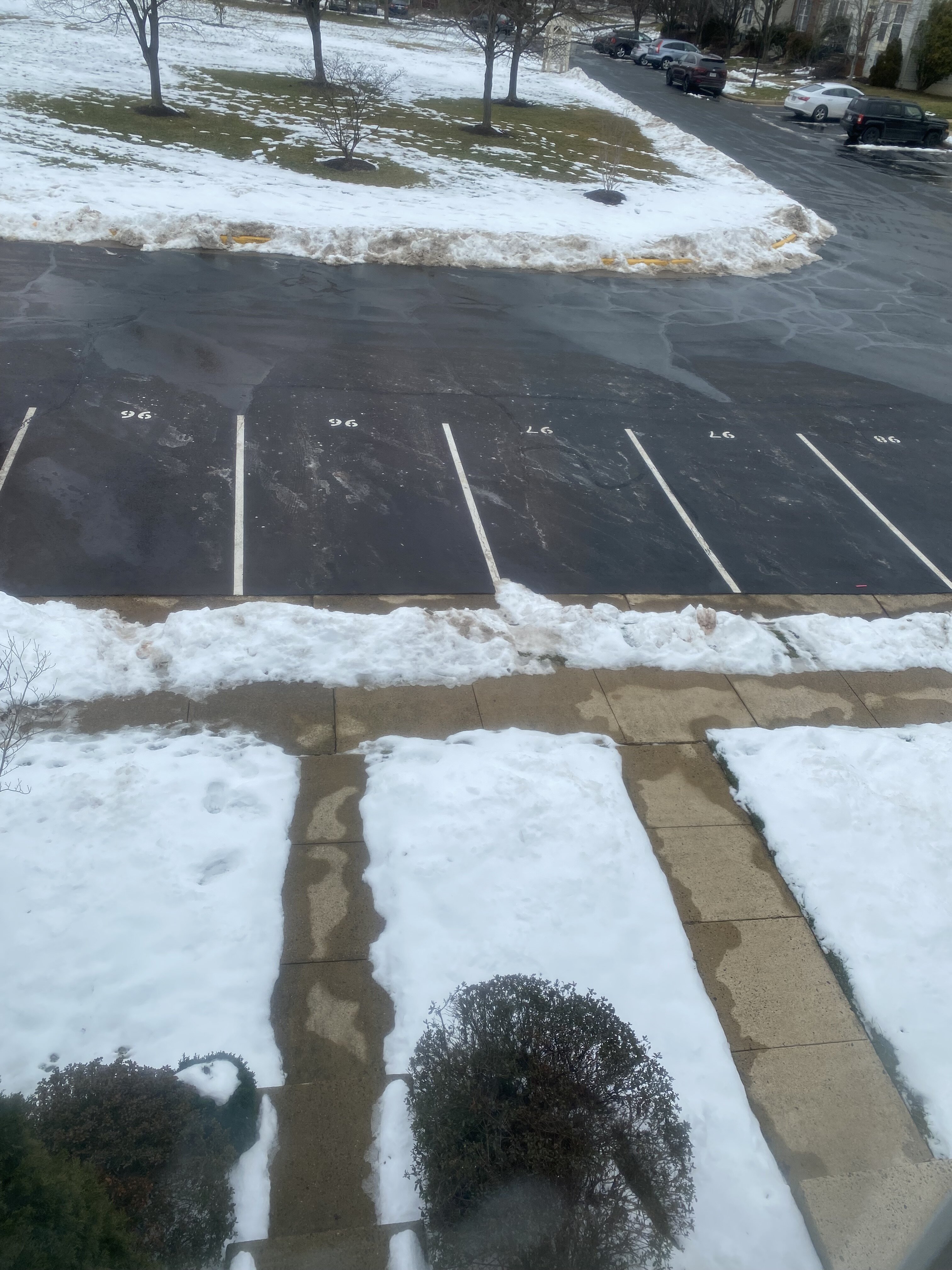
36. 10 days of snowpack. Hanging tough at 3-4 inches in most areas, with some bare ground showing now. It was interesting to see which spots imby hang on the longest and which melt off first…
-
Jan/Early Feb Medium/Long Range Discussion Part 3
Terpeast replied to WinterWxLuvr's topic in Mid Atlantic
Yep looks that way. Positive sign. In February, every day counts! -
Jan/Early Feb Medium/Long Range Discussion Part 3
Terpeast replied to WinterWxLuvr's topic in Mid Atlantic
I like it. As long as there is no can kicking. get that thing to undercut is how we win -
Jan/Early Feb Medium/Long Range Discussion Part 3
Terpeast replied to WinterWxLuvr's topic in Mid Atlantic
I think many of us, including myself, have selective memories of our winters where we live. We tend to remember the snowiest highlights of each winter, while memories of warm/rain with brown ground fade away. This effectively magnifies how much snow we think we ought to see here. Before y’all come at me, I say again that I’m guilty of this too Plus kids here got 10 full days of sledding. I’m sure they’ll have good memories of this period. -
Low of 21
-
Jan/Early Feb Medium/Long Range Discussion Part 3
Terpeast replied to WinterWxLuvr's topic in Mid Atlantic
Beautiful split flow right there, stronger branch south -
Jan/Early Feb Medium/Long Range Discussion Part 3
Terpeast replied to WinterWxLuvr's topic in Mid Atlantic
Good. That’s the sign I was looking for. This is the opposite of a can kick -
Low of 9
-
Jan/Early Feb Medium/Long Range Discussion Part 3
Terpeast replied to WinterWxLuvr's topic in Mid Atlantic
Yeah I need a break, too. I can’t imagine a year like 2013-14 while working remotely and taking care of my daughter who is almost 3. After a crazy week, I took a nap today and slept for almost 4 hours! -
Jan/Early Feb Medium/Long Range Discussion Part 3
Terpeast replied to WinterWxLuvr's topic in Mid Atlantic
Let’s hope this doesn’t get can kicked, we cannot afford that -
Jan/Early Feb Medium/Long Range Discussion Part 3
Terpeast replied to WinterWxLuvr's topic in Mid Atlantic
That’s a big step back from previous runs. Now looking like an interior north hit with rain down here -
Jan/Early Feb Medium/Long Range Discussion Part 3
Terpeast replied to WinterWxLuvr's topic in Mid Atlantic
Looks like a transitional week feb 5-12 (similar to first 10 days of Jan) and then feb 12 and onwards we get our chances i do wish it gets moved up even a few days though, we don’t want this thaw running the clock out on us -
Fell short of freezing. 31.5 for the high, now 30.9
-
Jan/Early Feb Medium/Long Range Discussion Part 3
Terpeast replied to WinterWxLuvr's topic in Mid Atlantic
So this might go in banter or panic room because this is purely unscientific conjecture… But if the pac jet is getting stronger with a hadley cell squeeze no matter in a nina or nino, what should we root for? More ninas where the jet doesn’t get as super extended as in ninos, but still extended enough to stick a pna ridge in the west? Last time we tried that though, we got a +PNA but the downstream trough dug right underneath into baja, and the pna ridge just flopped over right on top of us. Maybe that was just a one off? I know in ninas we get an Aleutian ridge which is usually kiss of death for us, but it shouldnt take much of an extension to push that ridge over the top into AK and drive more cold air down here? It can’t be that hard -
Jan/Early Feb Medium/Long Range Discussion Part 3
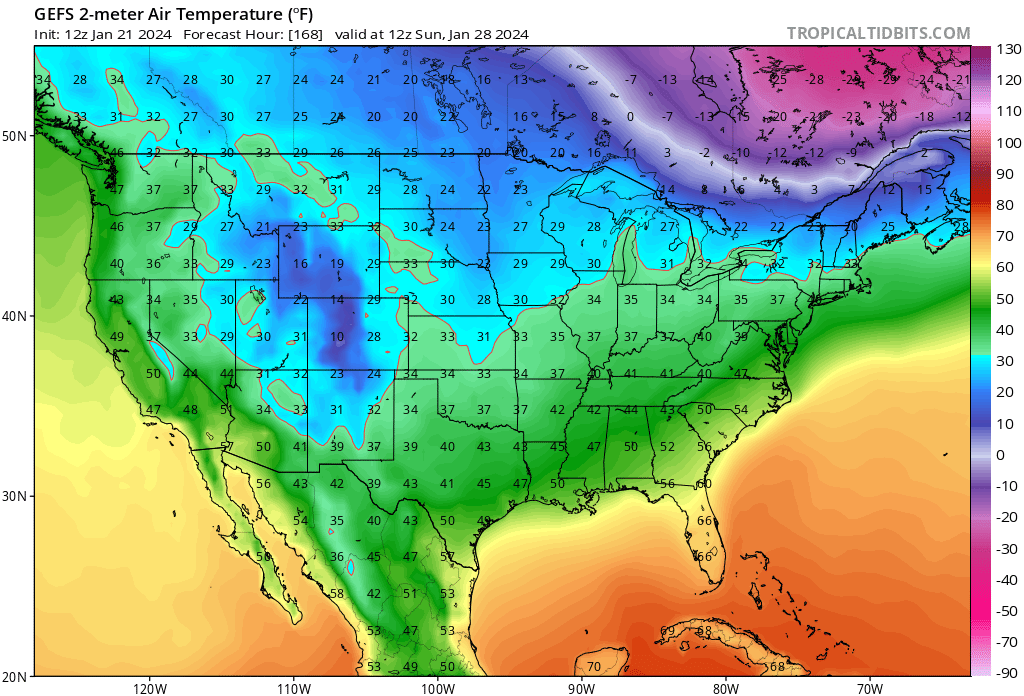
Terpeast replied to WinterWxLuvr's topic in Mid Atlantic
For now it’s way too warm, but there’s a cold high lurking to the north. It won’t take much of a favorable trend to flip this into our favor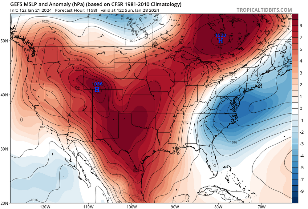

-
Low of 18
-
Jan/Early Feb Medium/Long Range Discussion Part 3
Terpeast replied to WinterWxLuvr's topic in Mid Atlantic
That’s your plan B -
Jan/Early Feb Medium/Long Range Discussion Part 3
Terpeast replied to WinterWxLuvr's topic in Mid Atlantic
Feb 12 2024 book it -
High of 25, now 19