Terpeast
-
Posts
5,326 -
Joined
-
Last visited
Content Type
Profiles
Blogs
Forums
American Weather
Media Demo
Store
Gallery
Everything posted by Terpeast
-
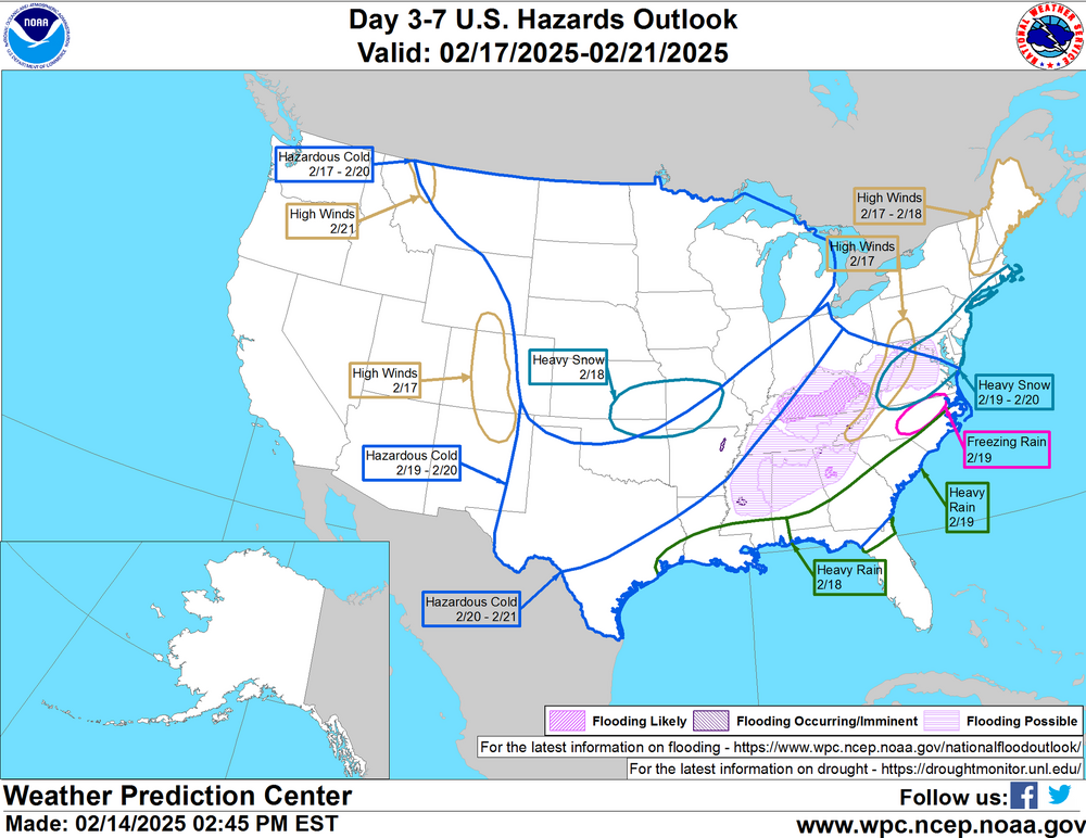
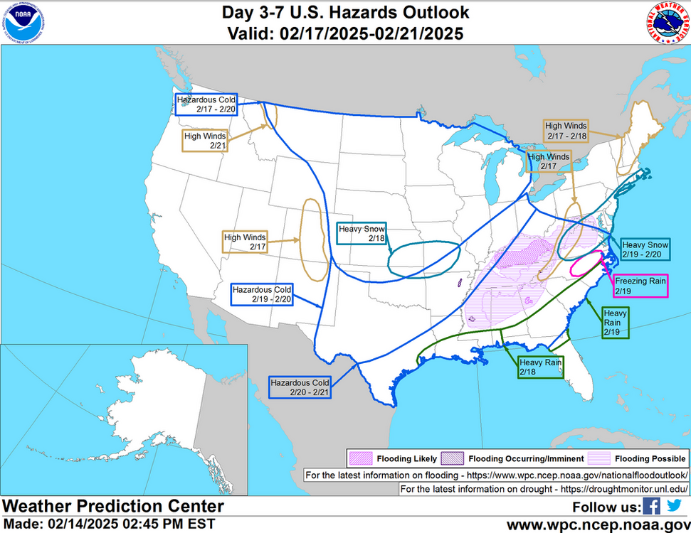
Well if you're going by that verification, its jack was off by about 50 miles too far south. Look at the map, and draw your own conclusion.
-
I think the GFS just needs a little more time. Let's give it till tomorrow 12z
-
I think I read somewhere, can't recall exactly, but the location that would have been DCA measured around 20-21 inches in the knickerbocker storm. On the other side of DC, Rock Creek Park measured 33"
-
-
That's a lot of members right along the coastline.
-
Best part? We're inside a week on the best performing OP model
-
I knew this would be an interesting day of tracking. Wasn’t sure if it would be in a good or bad way. So far so good!
-
About the same as the GFS, with the Euro beating both
-
It reminds me of Feb 2006, except colder
-
CMC is a beatdown, let's hope it's onto something.
-
CMC 135, I think its finally starting to turn the corner. Precip building in the Tenn valley
-
CMC at 126 precip is pretty far south, but lets see if it turns the corner. Still better than the last run
-
CMC 111 setting us up
-
6z is an improvement NW of 95
-
Heavier snows DC & S/E at hr 132, mod snow to blue ridge, still going at 135
-
Better than 6z
-
mod snow 129
-
Lgt snow starts hr 123 for DC metro
-
PV is more NW instead of previous run pressing further SE
-
N/S and S/S timing more aligned, making a phase more likely. Still early.
-
Was going to say the same thing.
-
hr 87, looks like the s/w out west has more room to dig. We'll see. Early
-
Tbf I look at 4-6 past runs to glean any meaningful trends. But if it’s jumpy, it doesn’t mean much it anything.
-
I've been loving these 4-6" storms the past two winters, but I keep fantasizing about getting a big dump of 17", 30", or whatever big number.
-
And there's a difference between getting a foot in your backyard while Boston gets 3 ft, and getting a foot and watching Raleigh getting 3 ft.