Terpeast
-
Posts
5,326 -
Joined
-
Last visited
Content Type
Profiles
Blogs
Forums
American Weather
Media Demo
Store
Gallery
Everything posted by Terpeast
-
Low of 33.6
-
Right where we want it?
-
I’m seeing the l/w pattern as more of a clippers/LES pattern. We’ve had plenty of that in the past before the 2010s onward, and while it got cold it wasn’t that easy to get snow. But we’ll see whether there’s a well timed s/w that digs enough to give us a snowstorm. Far too early to tell, but so far we have dec 1-2 and dec 5-8 windows to track. It may be similar to this past Jan where we did not see those 2 minor storms coming until they were starting to dig east of the rockies, and the models kept trending south until they were right on our doorstep.
-
IIRC the GEFS has always had a flatter pna ridge than the other models. GEPS the tallest/strongest, which gives us more cold but also more suppression risk
-
11/21: T (brief graupel) 11/22: T (non accum snow showers that lasted a few hours)
-
Low of 31.5
-
Except for the mountains, the qpf maps are almost the inverse of each other! Good test for the models and seeing which ones to trust more when we track the real stuff.
-
That’s crazy cold!
-
Yeah I picked up on that one too, I referred to it as the dec 2 clipper, but timing and wave characteristics will probably change
-
I don’t either, but to me that’s now the worst case scenario.
-
GEPS/EPS still has a signal for Dec 3-7, with maybe a clipper on Dec 2. GEFS looks totally dry. Still far out, so its probably noise. Ens haven’t budged on the cold.
-
I’m with bluewave on this one. After watching the entire NA continent experience its warmest fall in ages, on top of the warmest winter on record last year, we’re not gonna have much snow cover to start with. Soil temps are going to be warm. The positive takeaway from this is that a cold pattern is taking place early on, allowing time for more snow cover to get laid down over Canada and central US, which will help produce more local sources of cold air, which will only help the East through the rest of the winter. I’m just hoping we don’t get another 89-90 scenario where December gets cold, and then it completely flips warm and stays that way through Jan-Feb. I think there will be more variability than that.
-
Nice work. I’m on the same page. It’s tempting to say something like the winter pattern remembers the late Nov pattern, but I don’t think we see another 2013-14. I also think the chance of a total ratter has gone down a bit.
-
Honestly I don’t think you have much to worry about. I’m more interested in what happens after.
-
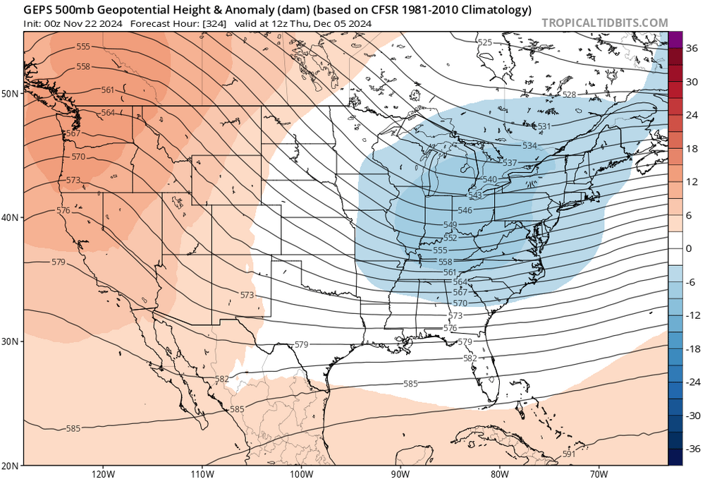
For Dec 3-7, GEPS still shows a signal for a coastal with plenty of cold, and EPS to a lesser extent. GEFS not picking anything up yet. Haven’t bought in for the Thanksgiving storm. I’m almost certain it will be rain for just about everyone except interior NE. Not cold enough yet.
-
Yeah either I was in a precip hole or the pws rain gauge undermeasured
-
45 now. Got 0.12” yesterday which was surprisingly little.
-
That’s the wave I have an eye on. GEPS had it on 0/12z
-
Southern slider just misses us on Nov 30. It’s close. At d8 its very close…
-
I don't think I've seen an MJO RMM forecast that shows it dying into COD from the warm phases in the last few years. Usually it gets even stronger as it goes through the MC. I hope this is right.
-
The counterclockwise rotation of this low is nuts
-
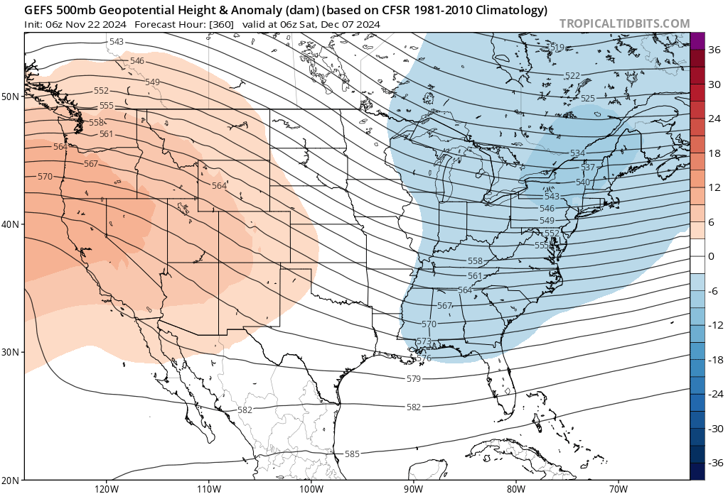
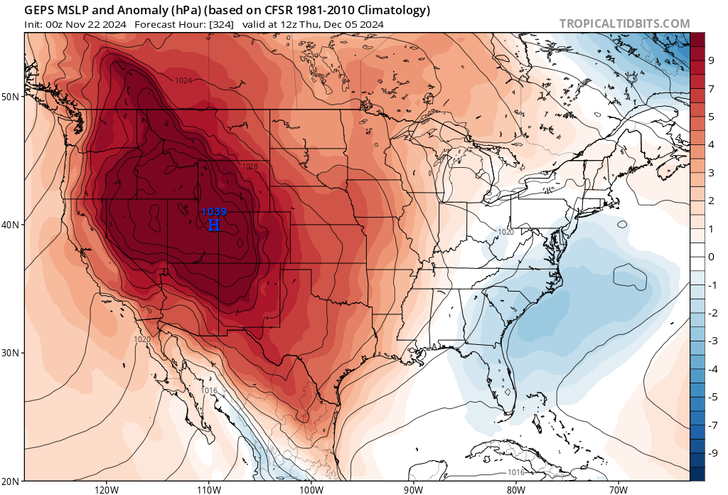
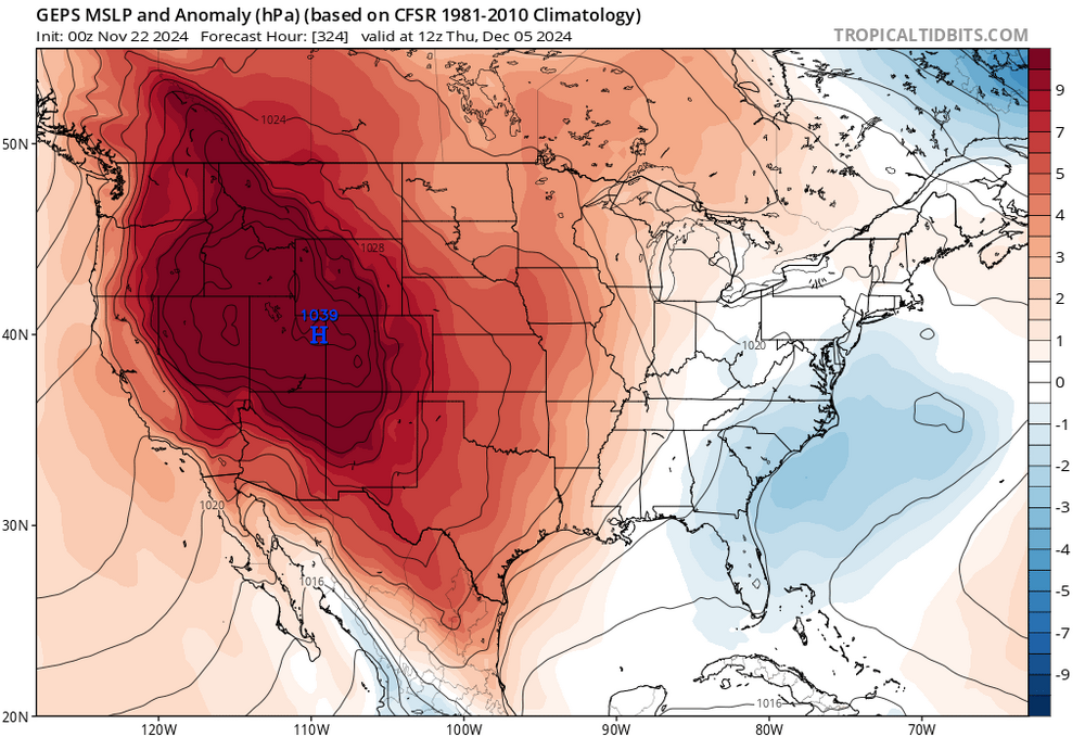
Time for a December thread. GEFS/GEPS starting to show a potential coastal Dec 5-7 time frame with cold still hanging around. I should add that the canadian is more aggressive with the signal that time frame, the gefs or eps not so much.

-
Switched over to rain. 36/34
-
Thats pretty amazing, you're really not that far from me as the crow flies.
-
Still light snow, temp dropped to 35.8. Expectations met. Now we just need to make sure PSU gets his inch.