Terpeast
-
Posts
5,326 -
Joined
-
Last visited
Content Type
Profiles
Blogs
Forums
American Weather
Media Demo
Store
Gallery
Everything posted by Terpeast
-
The key is getting that sw energy to eject early enough. Dec 8 or 9 will work, but dec 10 might be too late as the pattern relaxes
-
However! The canadian ens shows 2 waves, one on 12/9 and 12/11… which tells me that geps is split between gfs and euro camps.
-
0z CMC more similar to GFS than the Euro. Just a day later. Same with ens. The canadian has been doing just as well as these two so I wouldn’t sleep on the canadian.
-
26
-
Band is south of watertown, and it’s still above freezing (33-36) 31 and clear imby.
-
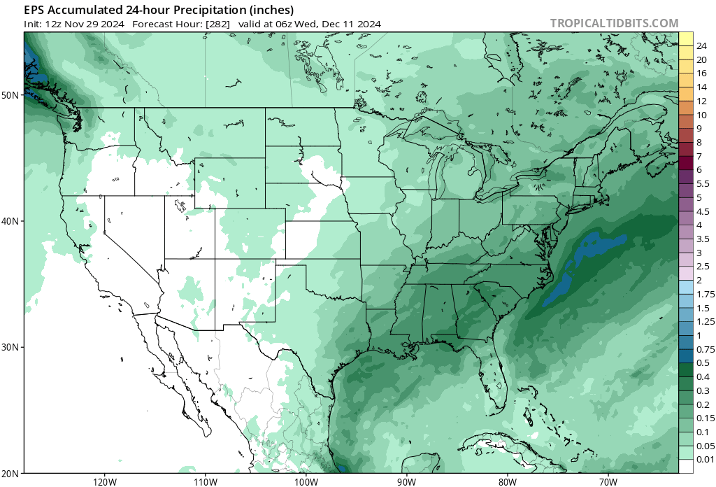
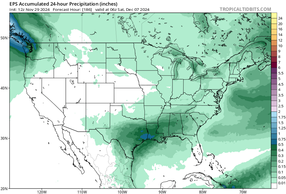
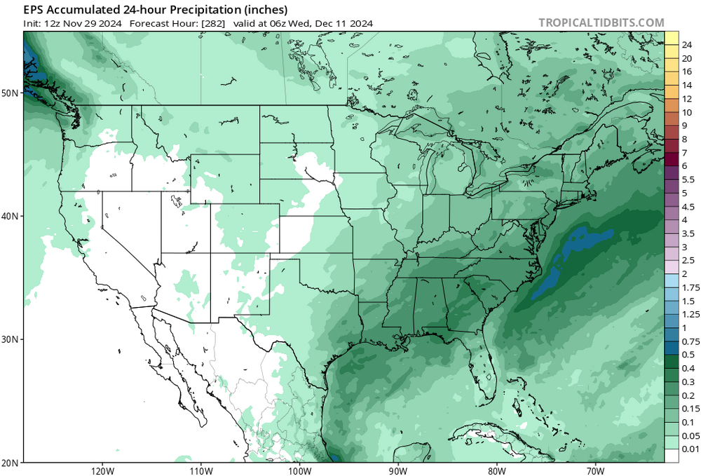
To clarify your point, the dec 7 event gets quashed south but brings a lot of moisture up for the dec 11 event.
-
Interesting run, yes. Mean is washed out, but there is a signal within. The op shows one of these possibilities


-
My condolences.
-
Are you talking about the Op or ensembles?
-
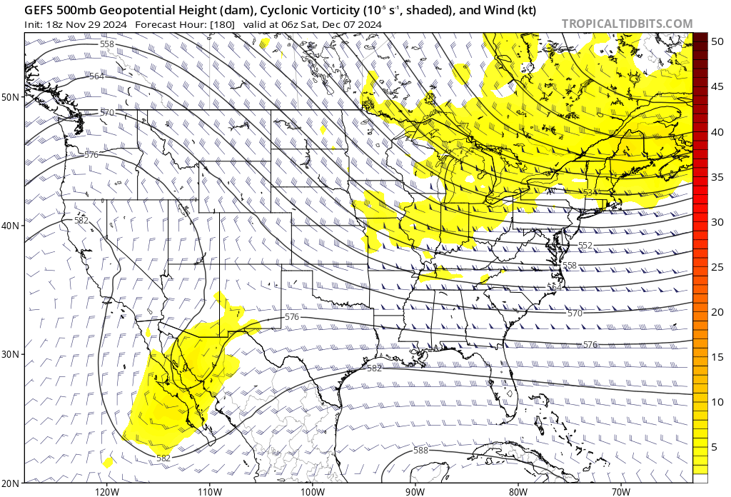
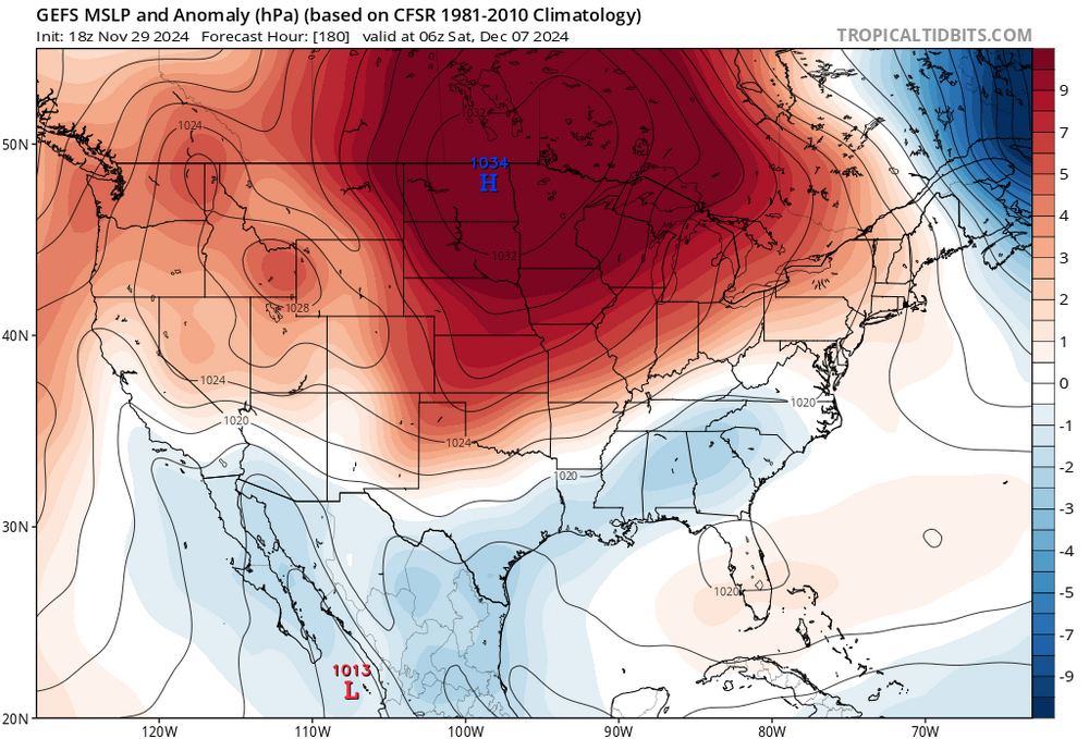
All ens show a trough digging into the OH valley, which is a decent signal for a storm that might bring us snow in the dec 10-12 timeframe (12z gfs op shows this playing out) 0z EPS shows that too, look at the height lines even if the 500mb anomaly colors show neutral.
-
Sprinkles. 41. Think if my elev was a few hundred feet higher, I’d have seen some wet flakes
-
Yep. Our dec climo is like 2” total for the entire month.
-
At least we’re seeing clippers making a comeback. Something we haven’t seen in years. And with the PV lurking nearby up top, it’s possible that these may trend south at the last minute, like those two storms last January did.
-
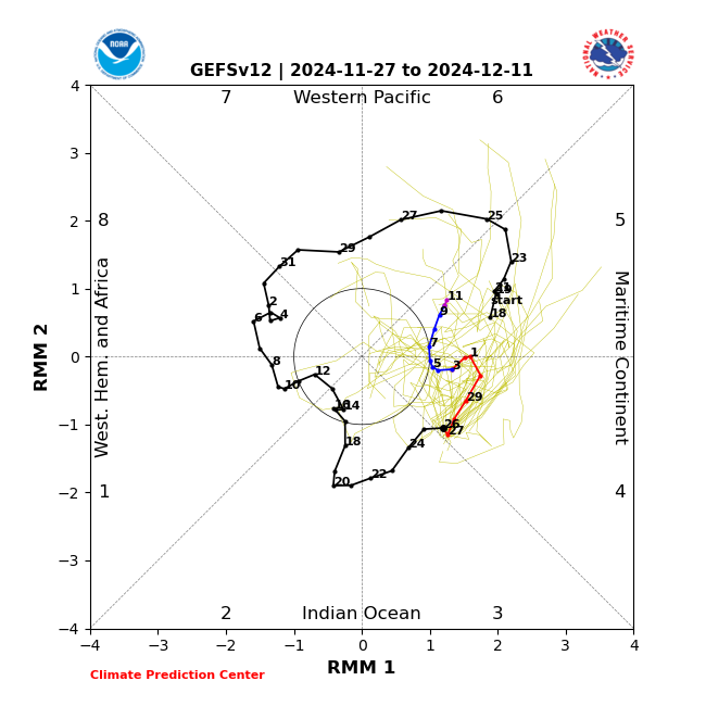
While we can’t take the rmm forecast amplitude literally, I still think rmm forecasts have some utility where we look at multiple models/ens and look at what phases they think the mjo will be in and how quickly or slowly they cycle through. The spread gives a good idea of the uncertainty of the amplitude, which can be really noisy. Even in noisy amplitude predictions, we can get a good idea of where the mjo is going to be, phase wise, in a week or two ahead of time.
-
29.8 for the low. Now 36
-
We’d want that trough to either be centered over bering sea or undercut the aleutians. Either would work in getting a west coast ridge
-
GEFS is similar, almost identical
-
Trades may kick up a bit so we may get more of a nina signal, but still don’t think we’ll reach -0.5 ONI for an official nina. Maybe barely. So there will be other competing factors, with lots of variability and back-and-forths. Still think we moderate mid-dec, then turn back cold late dec early jan.
-
With those ssts being so warm, I don’t buy it… yet. But if this 4-6 pass trends weaker, the models may soon react to that and trend colder for the east. ETA both gfs and euro weeklies put the mjo at the end of phase 7 around last week of december, with varying levels of strength
-
45 and wet. The only thing that’s getting torched is the turkey in the oven. Happy thanksgiving!
-
If models are correct on a moderating trend end of second week of Dec, this coincides with MJO going into 5 at decent amplitude. My thinking is second half of Dec will be mild, NN to somewhat AN for the east until MJO goes into 7 and 8 sometime late dec or early jan, and that’s the next period I’m interested in. We should have more cold air to work with since Canada is almost entirely snow-covered.

-
That would be the second time in this calendar year
-
This coincides with the MJO going into 5 at decent amplitude. We may moderate back to NN or somewhat AN for a period of time around the 12th or so, but things may get interesting again once we get to 7/8 (maybe late dec or early jan) with a colder airmass the second time around. Still watching the clippers and the 12/8-10 window.
-
12z EPS shows the same thing. Less intense than GEPS, but we can work with that.
-
I see it too, its been on the models for a while. And more than one clipper too. TBD whether the precip makes it over the mountains and gives us some light snow.