Terpeast
-
Posts
5,326 -
Joined
-
Last visited
Content Type
Profiles
Blogs
Forums
American Weather
Media Demo
Store
Gallery
Everything posted by Terpeast
-
Either way, low confidence. It’s not going to be as clear cut as we thought it would be even a month ago when it looked like another record warm winter through and through. It’s looking more like there will be a couple of surprise curveballs along the way. Not saying it’ll be a BN winter/AN snowfall in the east, I’m sticking with my AN temps and BN snow outlook, but probably not as bad as we thought.
-
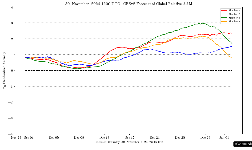
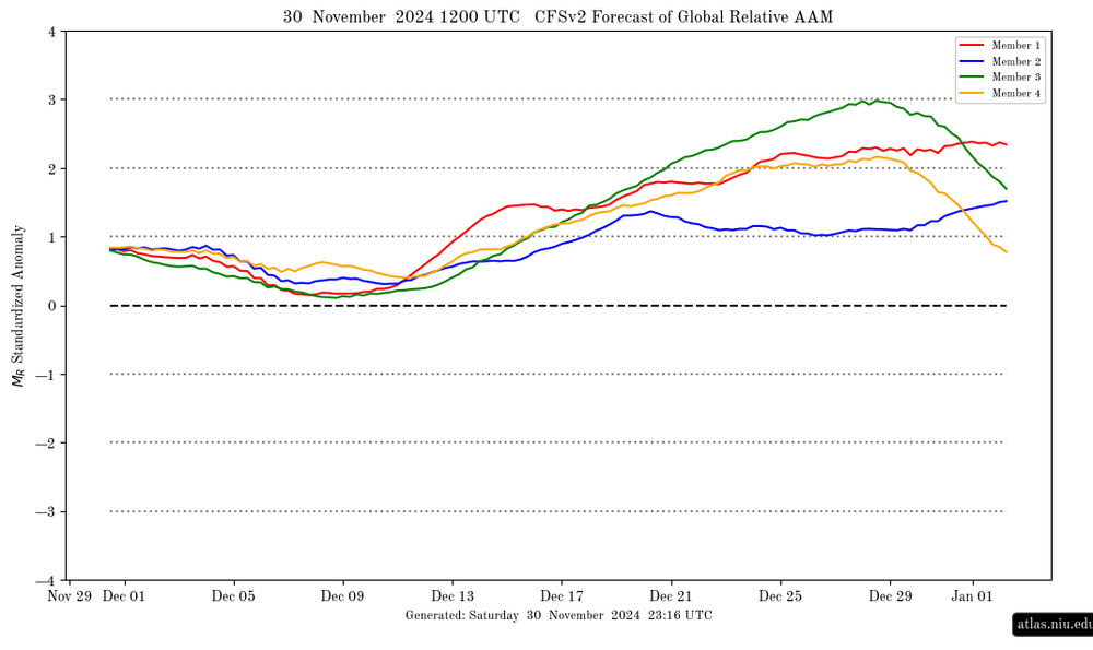
I think that is a low confidence outlook given that the AAM’s weakening is forecast to only be temporary. Although the Dec 10 “moderation” coincides with the AAM going neutral, the CFS is projecting the +AAM to restrengthen after mid-Dec.
-
it may be speeding up just a little… IIRC previous runs showed it still in 5 until the 11th or so
-
I can see that playing out if the MJO goes into 7-8-1 and the AAM stays positive. Even a +1 C won’t be prohibitive for snowfall in the MA.
-
They could be trying to revert to a standard La Nina pattern, except they keep maintaining -EPO. But two weeks ago, they were depicting a torch around this time and that was a huge miss. Maybe it’s just a one-off, but with the continued +AAM and the MJO going into 7 and 8 later this month into January makes me think otherwise. The new Cansips seems to have shifted in that direction, too.
-
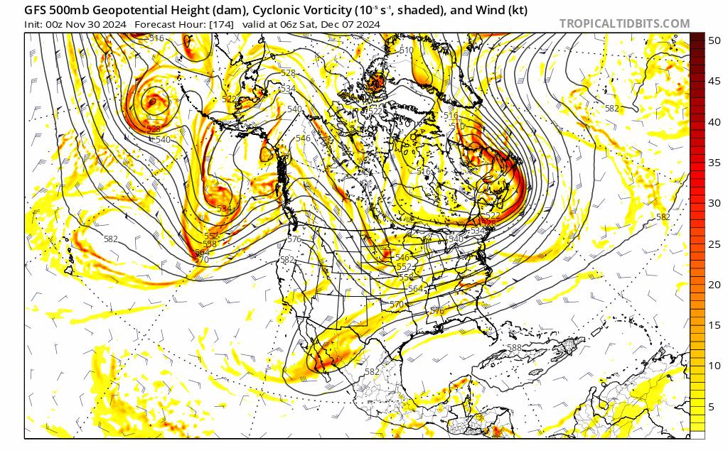
All ensemble models show cold air reloading in W Canada while maintaining -EPO at the end of their runs, so any mid-month moderation may be short lived (a week, maybe 2).
-
All ensembles show cold air reloading in W Canada while maintaining -EPO at the end of their runs, so any moderation may be short lived (a week, maybe 2) Still having trouble resolving the dec 8-11 threat(s). Need another couple of days to converge on the most likely solution
-
20.3 for the low
-
21.6
-
Yeah that’s a chilly look. Flow is fast, though. +nao keeps things moving along, but that in combination with the -epo also “fixes” the PV on our side of the globe (as opposed to the other side)
-
26 and dropping fast
-
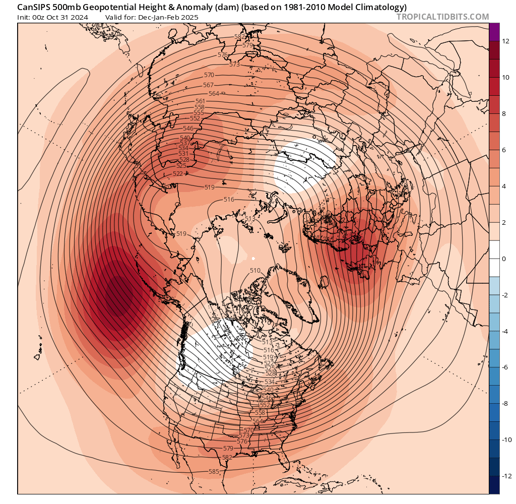
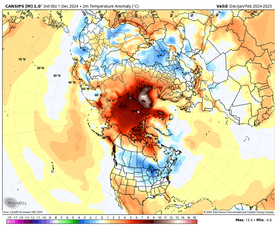
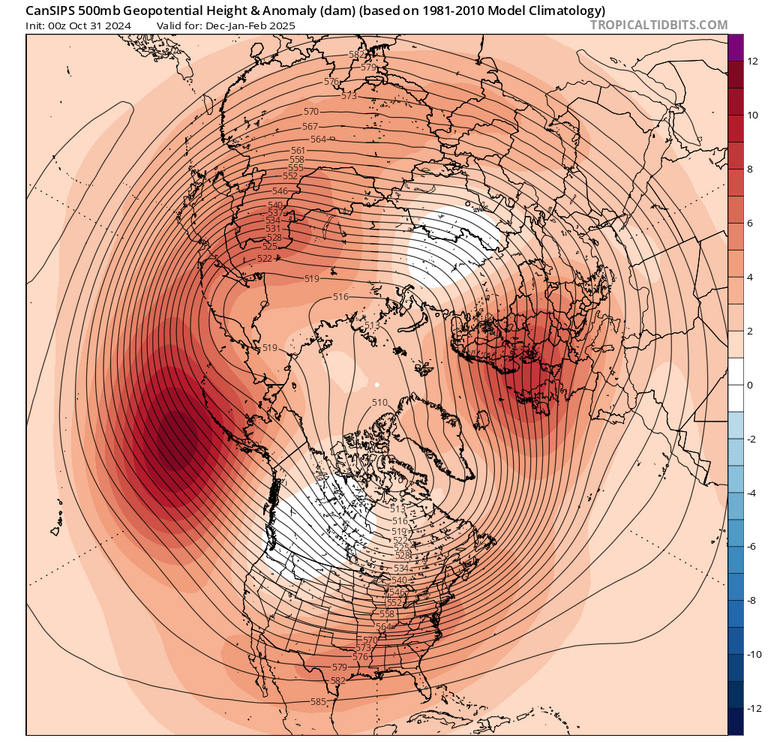
Don’t look now, but new Cansips now predict a NN DJF for our sub. Previous run was a torch. Source: Eric webb’s tweet Old runs from TT:


-
Yeah, even the ensembles are shifting. Too chaotic to get a good read on it.
-
Your contest numbers are slightly more bullish than my own…
-
Agree. More like U40s/L50s for the highs and lows around freezing or just below. Sometimes we can snow with that if well timed. End of GEFS run shows cold source developing even when we go mild. Wouldn’t take that long to get back into a colder pattern especially if it coincides with the MJO going into 7 and 8.

-
Only 36 for the high
-
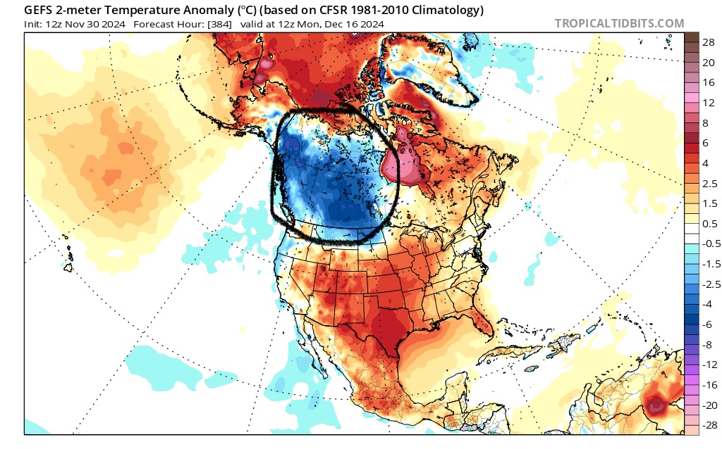
To add to this, even if we go milder after 12/10, we still have a ridge over AK which should maintain our source of cold air. It's not as if the pac jet will ape and wipe out all cold air from the entire NA continent, like it did early last December and we had to wait 4-5 weeks until it finally reloaded.
-
I'm sticking with my guesses. No changes...
-
Euro and gfs (at least the ops) might be switching places. But this has always been a low confidence outlook, and I’m not holding my breath until we’re 4-5 days out, which takes us to next Tuesday-Wednesday. At least its cold and will be that way for a while. Reminds me of the 1980s when getting cold air was easy, but snow was hard to come by.
-
Yeah, they’re seeing the same thing we are. Just a very low confidence outlook at this point. Let’s hope the gfs/cmc trends this morning converge and the euro caves.
-
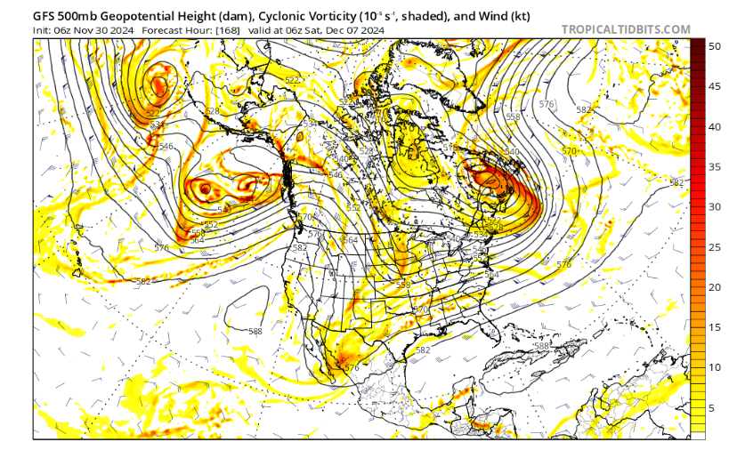
06z gfs phases the two pieces even more than 0z old run new run
-
I figured, yeah. Lets hope it’s not just a blip, but a start of a trend. I think canadian has a compromise between the two camps
-
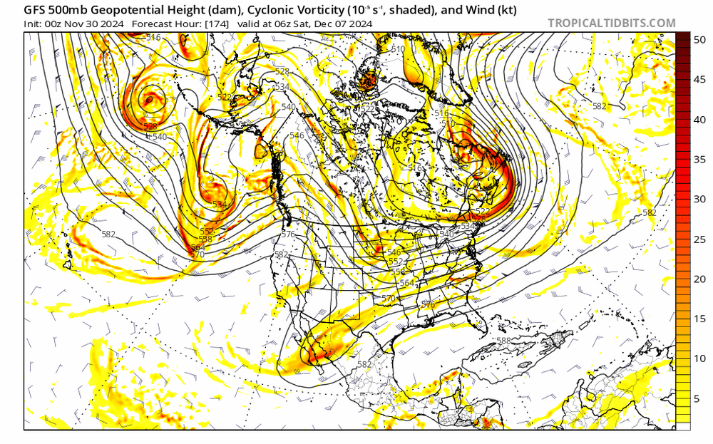
Are you looking at that energy over Alberta/Montana? Its so chaotic its hard to pick out the individual pieces
-
I see what you’re saying. It doesn’t have to completely phase, the NS just needs to dig enough to pick up energy from the SW. the CMC does it too. Euro completely misses by hundreds of miles, and then completely phases with a second NS wave. Drastically different solutions, very low confidence forecast.
-
Looks like a huge bust for watertown. Weren’t they supposed to have 3’ otg by now?