Terpeast
-
Posts
5,326 -
Joined
-
Last visited
Content Type
Profiles
Blogs
Forums
American Weather
Media Demo
Store
Gallery
Everything posted by Terpeast
-
Bottomed out at 18.9
-
Yes, we’ll go milder for most of the month or even the rest of the winter, but I don’t think it’s as clear cut as some are making it out to be. I think there will be more variability this winter as we’re already seeing chinks in the -PDO/Nina armor. This 10 day cold period is probably the first out of 3-5 cold periods that’ll likely happen this winter. Ofc the minute it hits 60 degrees sometime in the next week, many will say “TORCH! Winter cancel!” For me, nothing has changed. It’s funny when it got cold over Thanksgiving, people were upping their snowfall guesses in that contest thread… while I stuck with my original guess (5-12” for the forum outside of the mountains).
-
My analog years: 1999-00 2008-09 2010-11 2017-18 2021-22 2022-23 So yeah, no I don’t think so. Maybe a 2021-22 though
-
His most recent tweet pointed to -EAMT with a barfing emoji. It sounds like he was capitulating out of frustration. Honestly I’m confused about his assessments in EAMT because he says the high pressure NW of himalayas with low pressure in the lee is -EAMT. Yet he also referred to the same pressure configuration as +EAMT in both Dec 2018 and in 2020-21. So which is it?
-
Both 18z gfs and 12z AIFS have a follow up wave after the cutter. It’s rain for now, but close. Any colder, it’ll be wintry.
-
Rather than a full blown SSW, we may have a reflection from a wave breaking event this month. Just not sure what the implications are. I’d have to dig more into it and see if it’s worthwhile posting more details.
-
The fact that the CFS caught it early lends more credibility to that model.
-
Notice all models are now “trying” to keep the western ridge going in the medium range…
-
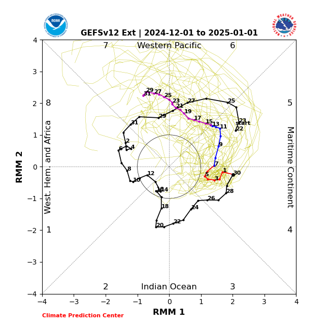
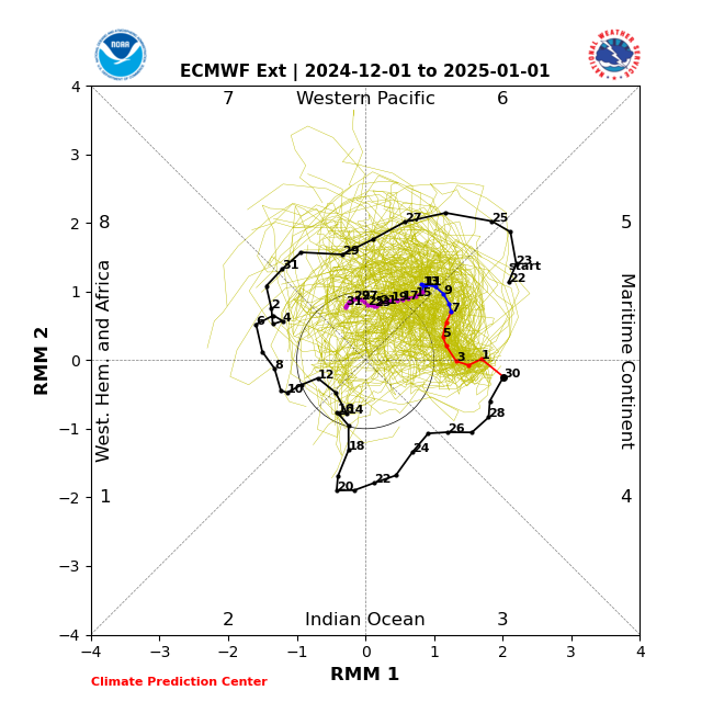
Extended GEFS & EPS are very different after around dec 15 in handling the MJO, which will likely have implications for late Dec even early Jan.
-
GEFS and EPS while in lockstep with the mid-month moderation, they diverge because EPS wants to maintain -EPO the rest of the month and keep cold air nearby, while the GFS flattens the Alaska ridge a bit giving NW US/SW Canada less cold.
-
Kill off the bugs early. Never a bad thing.
-
I think extra variability will be the story of this winter. For now, the warm pool via MJO 5-6 is starting to exert its influence, but as I’ve been saying for almost a month now, the period I’m watching is when the MJO completes its pass through 6 entering 7/8/1 and the +AAM comes back at the same time. Still estimate that to be late Dec - early Jan, but sometimes models rush a pattern change, so it could be after the New Year. I could be wrong about the specifics, but again I think we’re going to see more variability.
-
Low of 25
-
Yeah, the models have been pretty shaky and I think thats going to be the story of the entire winter.
-
Thought the strat PV is staying strong for the foreseeable future. Got any new data on that? And a strat warm is no guarantee of a cold outbreak here. It could spill to the other side or to Europe. We better hope that EPO stays negative if we get a strat warm.
-
Carver’s Gap just posted euro weeklies in the TN forum. Not a lot to complain about…
-
11/21: T (brief graupel) 11/22: T (non accum snow showers that lasted a few hours) 12/1: T (snow shower that briefly dusted)
-
Light snow. Finally! Car top starting to get dusted.
-
Commanders are so back
-
Still nothing. Don’t think it’ll happen. Rt 15 looks like a wall
-
Nothing yet in Ashburn, hoping this band pushes east of 15
-
12z Euro starting to latch onto a 500mb s/w on 12/7-8. Decent vort pass over us. Nothing on the surface yet, but it's a change from the last run. After that, the 12/11 system cuts to the lakes.
-
Hard to say. Some members still show a dec 8 wave, at which time we have the cold air to support snow. But how strong it is, and whether it’s even going to play out or get swallowed up by stronger energy out west, is still TBD. Unfortunately it’s been trending the wrong way for several days now. The stronger system could potentially be a Midwest low, with coastal redevelopment. Best to hope for with that system is we have enough cold air damming to keep up the potential for a front end thump before changeover. Not loving the ice storm scenario, though.
-
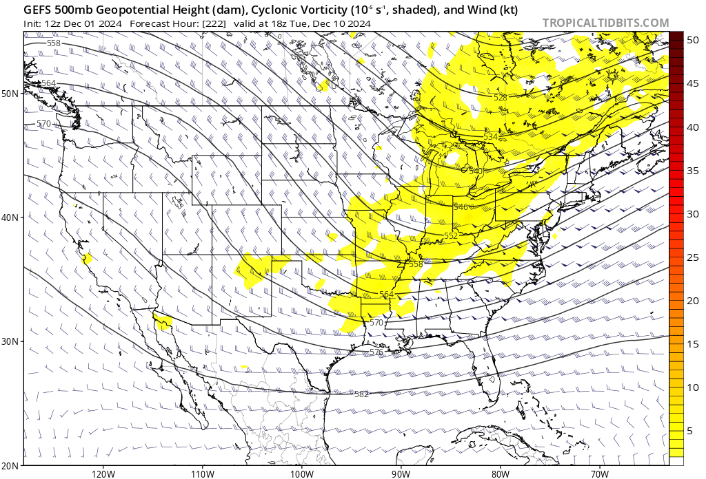
I noticed the GFS ensembles trended weaker with the SW energy and this is becoming a wave almost purely driven by the NS. New run: Old run from 3 days ago:

-
Yep. It seems the models, esp the GFS, are completely lost as to handling the dec 8-11 system (we can’t even nail it down to a calendar day). Until we see multiple models converging onto a similar solution, nothing is off the table.