

Terpeast
-
Posts
5,326 -
Joined
-
Last visited
Content Type
Profiles
Blogs
Forums
American Weather
Media Demo
Store
Gallery
Everything posted by Terpeast
-
Haven’t been paying attention to that yet. Need to resolve the two waves before that first, then we’ll have a better sense of what the day 10 threat might look like
-
For now Euro is on its own with the north shift, and it’s just one run. Need to see what 0z models say, and need to see if they start following the euro on the north shift. It may be onto something, or it may be a blip. Many are taking this seriously because Euro is the best performing model.
-
Between i-66/rt 50 and i-70 were progged to see not more than an inch or so averaged across all models, and we ended up with 3-6” both storms
-
The two Jan storms last year shifted south within 2 days, but that situation is a little different.
-
Just now getting a chance to sit down and dig in, but @wxmvpete already did his excellent writeup. I don’t have much to add. Keep it coming!
-
Looks like a classic N+W event we used to get a lot in the past. I’d take it as long it doesn’t keep trending north (which is still a possibility)
-
After my daughter goes to bed, I’m going to dig into why the models are diverging. But by then I may not have much to add, you all provide great insights so quickly.
-
Now the GFS and Euro diverge! Oh boy this is gonna get interesting.
-
January: Medium/ Long Range: May the Force be with Us....
Terpeast replied to Weather Will's topic in Mid Atlantic
Looks like the typical GFS swings/noise to me. Yes it’s faster, but the NE trough/confluence also moves east accordingly. Almost like they’re dancing in sync. Qpf amounts won’t be figured out until the meso models have their day with it. -
January: Medium/ Long Range: May the Force be with Us....
Terpeast replied to Weather Will's topic in Mid Atlantic
Yep fewer north outliers this run vs previous. Southern edge no change -
January: Medium/ Long Range: May the Force be with Us....
Terpeast replied to Weather Will's topic in Mid Atlantic
Surprised to see ukie colder than cmc, maybe a good sign. Both are around the same caliber for model verification, close behind euro -
January: Medium/ Long Range: May the Force be with Us....
Terpeast replied to Weather Will's topic in Mid Atlantic
I like the 10-11th where it is now. -
January: Medium/ Long Range: May the Force be with Us....
Terpeast replied to Weather Will's topic in Mid Atlantic
Thinking those snowfall maps are generous on the south side of that band, but the CMC always been close to mixing along I-66 the past several runs. It hasn't really changed except moving the storm along faster. -
January: Medium/ Long Range: May the Force be with Us....
Terpeast replied to Weather Will's topic in Mid Atlantic
One positive out of a faster storm is we'll get snow starting at night or early morning hours. Easier stickage. CMC gets dangerously close to mixing here, but is the warmest of the 3 models so far this cycle. -
January: Medium/ Long Range: May the Force be with Us....
Terpeast replied to Weather Will's topic in Mid Atlantic
CMC splits the difference between the GFS and euro -
January: Medium/ Long Range: May the Force be with Us....
Terpeast replied to Weather Will's topic in Mid Atlantic
CMC s/w is more robust than GFS. But wave spacing is going to be a delicate issue for us. -
January: Medium/ Long Range: May the Force be with Us....
Terpeast replied to Weather Will's topic in Mid Atlantic
CMC is also a bit faster at hr 78 -
January: Medium/ Long Range: May the Force be with Us....
Terpeast replied to Weather Will's topic in Mid Atlantic
Confluence is actually a bit stronger, but more east -
January: Medium/ Long Range: May the Force be with Us....
Terpeast replied to Weather Will's topic in Mid Atlantic
And earlier neg tilt, which could mean more moisture feed. Too early to tell -
January: Medium/ Long Range: May the Force be with Us....
Terpeast replied to Weather Will's topic in Mid Atlantic
Just spitballing based on gut feel, no real scientific reasoning. I think the best waa banding will occur just to the north of me. Hopefully I can stay within that band too -
Happy new year all!
-
January: Medium/ Long Range: May the Force be with Us....
Terpeast replied to Weather Will's topic in Mid Atlantic
Looking ahead, some ridging is trying to push into Alaska again, which would keep the EPO from going too positive.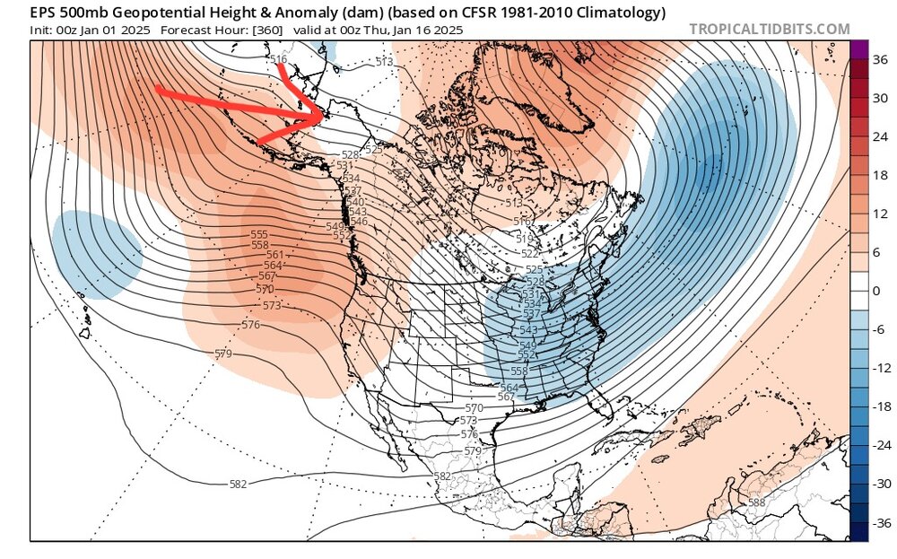
-
January: Medium/ Long Range: May the Force be with Us....
Terpeast replied to Weather Will's topic in Mid Atlantic
Nice set of 0z and 6z runs. The south trend needed to stop and it did. This is now within 5 days. Confidence is ticking higher. -
January: Medium/ Long Range: May the Force be with Us....
Terpeast replied to Weather Will's topic in Mid Atlantic
And btw, happy new year everyone! -
January: Medium/ Long Range: May the Force be with Us....
Terpeast replied to Weather Will's topic in Mid Atlantic
Ukie further south and bit slower


