Terpeast
-
Posts
5,326 -
Joined
-
Last visited
Content Type
Profiles
Blogs
Forums
American Weather
Media Demo
Store
Gallery
Everything posted by Terpeast
-
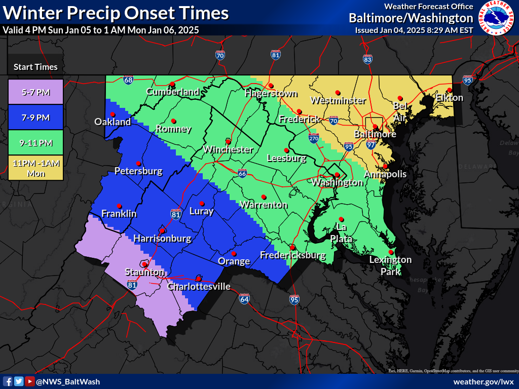
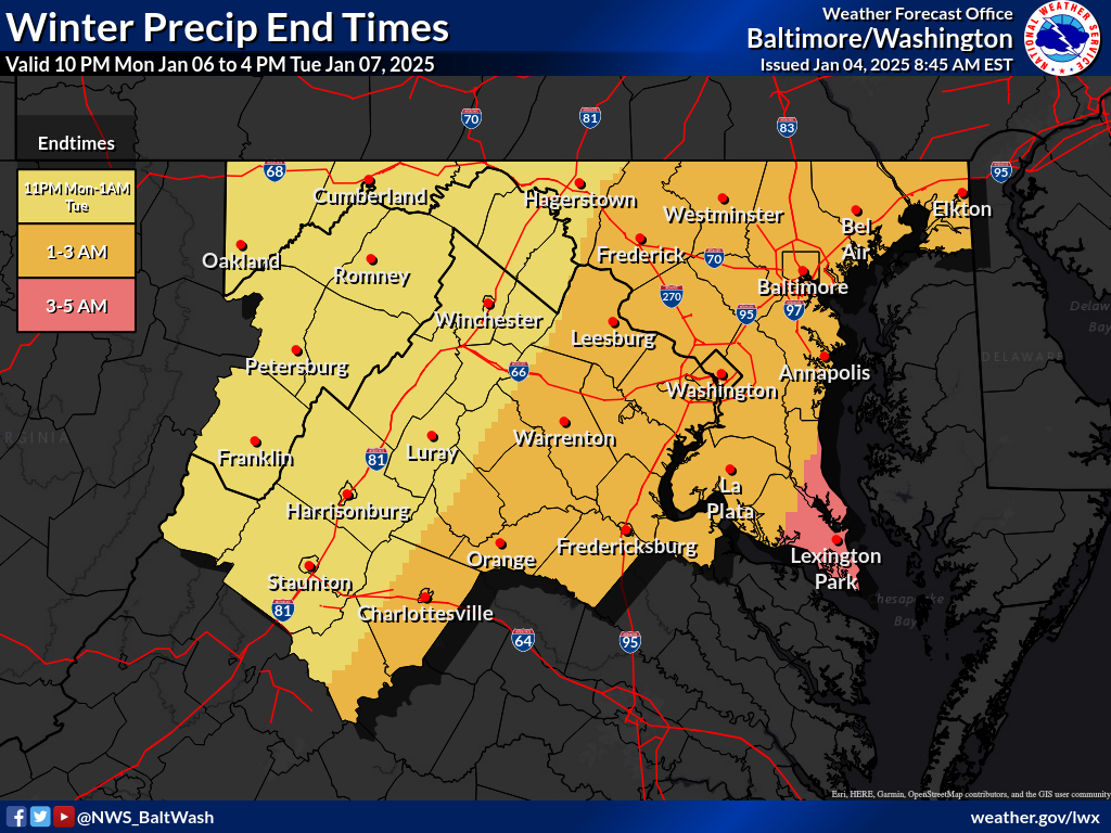
You could very well be right! I almost did not add the 36 hrs to 24-36 hrs. Really best inside of 24 hours
-
24-36 hours or less
-
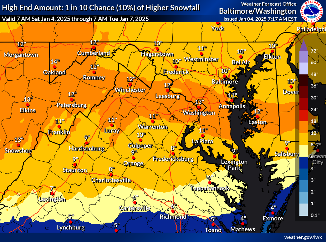
I know it’s out of range, but this is beautiful

-
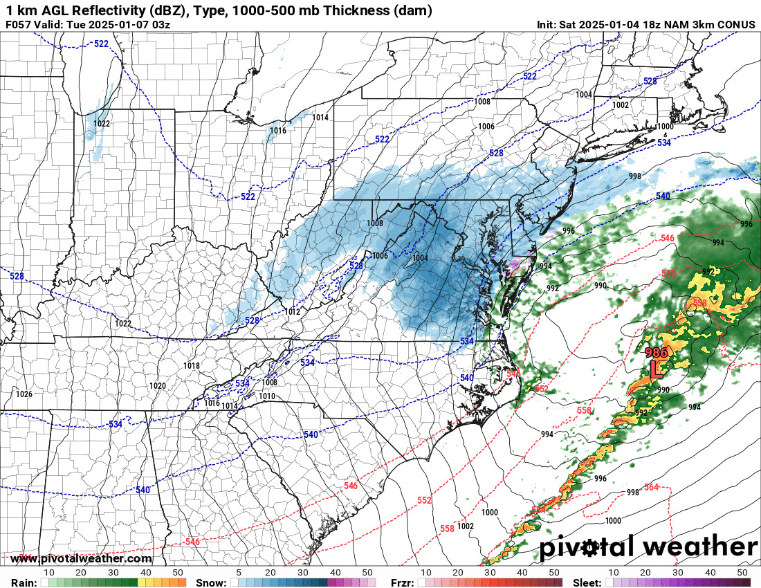
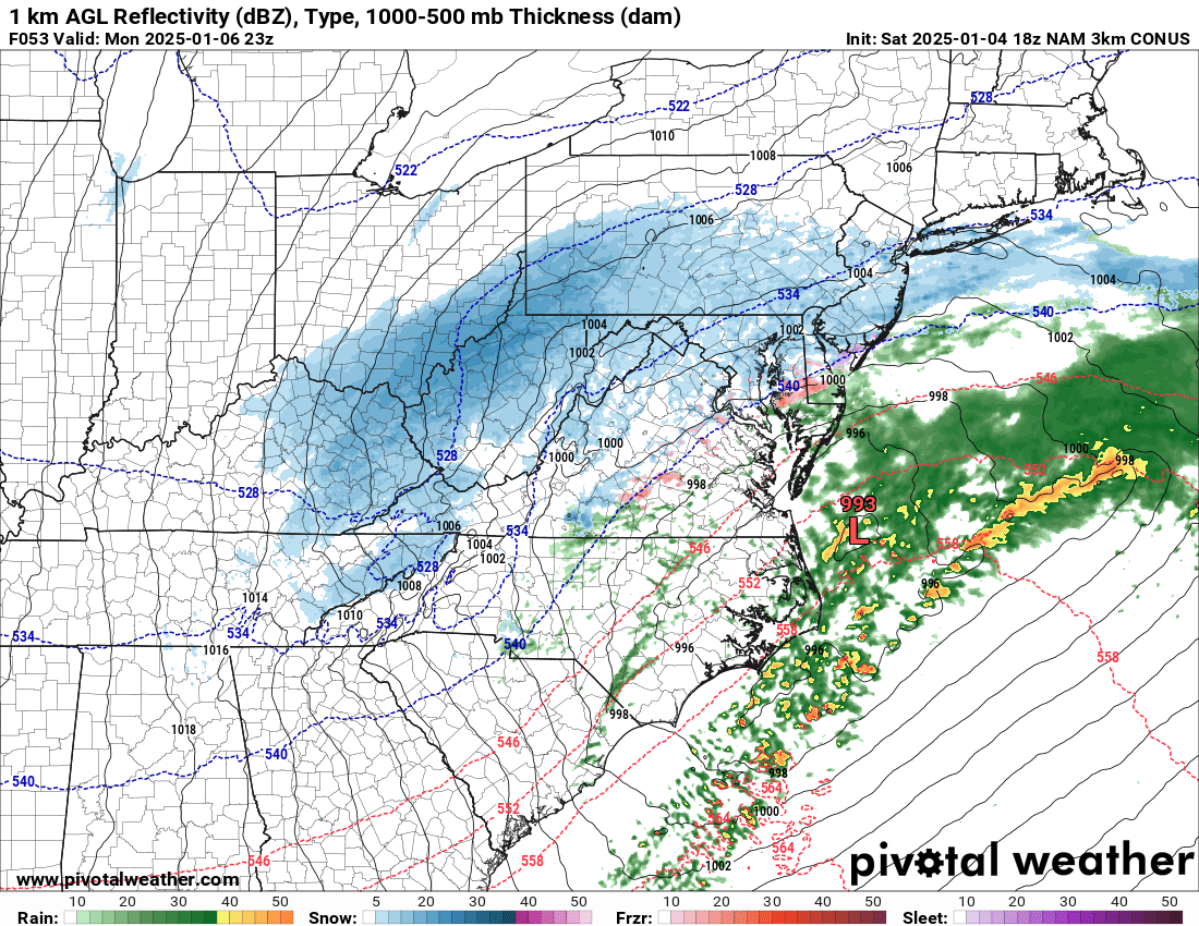
NAM 3k also bringing wrap around snow

-
Yeah I also think with strong frontogenesis and high DGZ rates, it’ll overcome any thin warm nose and keep it heavy snow with some riming. But as soon as those rates let up, it’s going to be sleet or freezing drizzle as with a dry slot. I don’t think we lose any real accums with it, maybe an inch if that. And the snowpack will be tougher.
-
3k says we don’t flip at all
-
Strong 850 frontogenesis across NoVA but warm nose over the potomac river, so it’s sleet verbatim (12k version, haven’t looked at 3k) Edit: changes back to snow next panel
-
This one gets rid of the weird dry slot at 12z
-
Confluence about the same. Closed low is stronger, but heights in front are a bit lower.
-
NAM is about 30-40 miles south baaed on H5 vort. Doesn’t sound like much, but could make a big difference in qpf and thermals
-
Nice CAD if the thermals are accurate
-
For the VA part, I hope its me haha But probably winchester and lottesville
-
FYI


-
I think the euro and ukie are underestimating the dual banding, with one on the north side with good ratios, fully believe that band drops over 6”. If the gfs and euro were to split the difference, that north band will be across north-central MD
-
That was yesterday’s run. But good to compare
-
Sfc low farther south, but not sure what it showed last run
-
Low of 27
-
Ignoring the numbers and only looking at the max stripe - I would tick that a bit north maybe by about 20 miles but all should do well.

-
Yep. I think EZF definitely flips, DC SE pings a bit, but north of 50 should stay all snow, with the usual max lining up along and just south of i-70, and maybe even a secondary max little north of that due to higher ratios.
-
Just woke up. Let me see if my summary is correct? - Euro didn’t budge - GFS ticked south - NAM NAMed DC north, flirt with mix line - SREF a whole new level of NAMing - Ukie even more south - LWX disregarded euro and ukie
-
It actually moved a tick south, but not so much to really change the big picture. Small details like mixing, dry slot, banding, etc are still TBD
-
They don’t quite phase, only pushes the storm down a bit. But if they phased, lowland areas east of blue ridge through delmarva could get pummeled even more. Something to watch.
-
Starting to see interaction between the tpv lobe and the closed low, could get interesting
-
Confirmed, h5 vort same thing
-
No they’re not. Relax.