

Terpeast
-
Posts
5,326 -
Joined
-
Last visited
Content Type
Profiles
Blogs
Forums
American Weather
Media Demo
Store
Gallery
Everything posted by Terpeast
-
Really does feel like snow out there. 18 degrees. Woulda been beautiful cold smoke. Better luck next time
-
This falls in line with the next cold window I'm seeing around March 4-10. I think it'll be a shorter window than the models are predicting. Here's hoping we get a well timed wave in that window as a last winter gasp.
-
@mitchnick I think you'll find this interesting: Known AIFS Forecasting Issues - Forecast User - ECMWF Confluence Wiki
-
The deamplification trend is real
-
Yep. Ignorance was bliss. Now it’s like we know too much
-
Sorry if it sounds selfish, but I have an overseas family trip planned next February and I’d be more worried about missing the big one if it were an el nino.
-
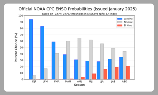
El Nino next winter is not a lock. We’ll know better by summer, but looks neutral maybe nina-ish going into Fall right now
-
Just saw a snow plow drive by. Not sure they got the latest memo
-
I was saying in the other thread about models deserving a poor grade, and if the storms comes back north (unlikely) then that would be an even more damning on the models.
-
I know we’re upset about the modeling fail, and I am too… but objectively, this has been a decent winter south of i-70 especially after going in with -enso/-pdo/+qbo and a high chance of a wall-to-wall torch. I wouldn’t change my grade on this winter even if it ended today. C+/B- imby, B+/A- for the southeast zones who jacked twice in the biggest storms. My grade is based on how much cold we had, how much snow fell, how many “snow days” we had, and how long snow cover lasted. Model performance gets a totally separate grade, and I’m not as generous on that end.
-
Narrator: “Plot twist, there is no storm.”
-
a 50 mile shift is not much at this range and while that is certainly possible even in this case, it’s doubtful given the strong trends the opposite way.
-
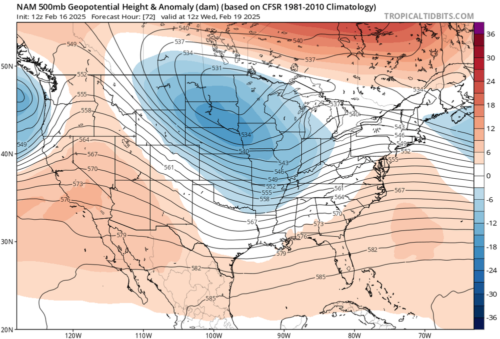
NAM caved. It may still show 3-6” here but with the trend that amount will dwindle in the next several runs.

-
Well. That was… exhausting. Need to rest and turn off all screens and devices. I’m out.
-
Thanks, now we know what to watch for in the next runs
-
Tbh I never really bought into the favorable pattern going all the way to mid march. I had it going to march 1 maybe 2, before it warmed up. Now the warm up is coming a week earlier, but it may be a brief warmup. It may get cold again after that, but I don’t know how favorable that pattern would be for snow.
-
Probably
-
Do you really believe that this may happen? Two differences between now and march 2001- modeling is better, and the block is so strong. I mean, a 30-50 mile shift NW, sure. But 200-300 miles in this situation? I think that is less likely
-
We want it to trend more stream interaction. We may not see results at the sfc immediately
-
Since NAM is a mesoscale model, maybe it’s seeing something that globals aren’t seeing wrt gulf moisture and latent heating putting the slp track north. LWX alluded to this in the afternoon AFD.
-
If anything 18z nam is a bit faster
-
63, heights tick lower across the board but vort/energy is stronger and norther. Angle of attack still more NE
-
18z nam 54, h5 vort angle of attack a bit more NE
-
Otoh, NAM doesn’t dig that much either but is way more north. So there’s that…
-
On both, go back 24 hr. You’ll see that the SS sw doesn’t dig as much as before


