Terpeast
-
Posts
5,326 -
Joined
-
Last visited
Content Type
Profiles
Blogs
Forums
American Weather
Media Demo
Store
Gallery
Everything posted by Terpeast
-
Despite a trough in the west, that’s actually a colder look I’ve seen in a while. Worth noting that trough entering the aleutians with a poleward alaskan ridge beginning to pop. Previous runs were mostly zonal flow right from the pacific.
-
Barely off the high today. Sitting at 63.
-
66 for the high in Ashburn. If we can avoid hitting 70 tomorrow, that’s a win.
-
CMC copied the Euro for Jan 9. Holding back precip until the (marginal) cold air leaves. Ergo, CMC/Euro must be correct I see posts about the day 11 threat, but... it's day 11. Give it another week and see if it still shows a trackable threat.
-
It’s really close. At DCA or in the city center, probably white rain as light precip, or wet non-sticking snow under heaviest rates. N&W of the cities probably snow.
-
If the model with the least snow has at least an inch for us, then I’ll start to get more invested in this upcoming window.
-
I’ve been wondering this but did not want to say anything until now. Maybe unscientific conjecture… but if mid-latitude SSTs warm faster than tropical SSTs, are we going to be in a permanent “La Nina” background state, even as tropical SSTs are just as warm as historical neutral or even El Ninos from way in the past? Scary thought.
-
I think that’s for every individual to decide for themselves…
-
A suppressed OTS look is what we want to see at range. I think it trends closer to the coast over time. My bigger concern is the airmass.
-
Yeah, I'm no expert on SSWs so I trust your analysis... and that leaves the MJO. And it's tough to get into phase 8 during a slowly fading but stubborn Nina like this one. The latest model runs seem to be recognizing this.
-
We seem to be stuck in a purgatory of a pattern that isn’t quite a complete torch, but not quite an arctic one, and the west is getting all the snow. We need a major forcing event to interrupt the pattern, like a SSW that falls into our favor or a high amplitude MJO event in a favorable phase. And when we start hoping for those kinds of pattern disruptors, we know this winter is in trouble.
-
Nice! Definitely can swing that. I think psu mentioned this recently, too but I forgot the name. How far ahead of time? A couple days? Weeks?
-
Looks like some potential for some upslope in the next week or two. Thinking of taking my wife and kid out to WV for some sledding, maybe near Davis WV. May try to make it a day trip without staying at a hotel. Any specific locations where we can park and take our sleds to? We don’t need a huge hill, just a nice little one we can do for a couple hours, and then drive back home.
-
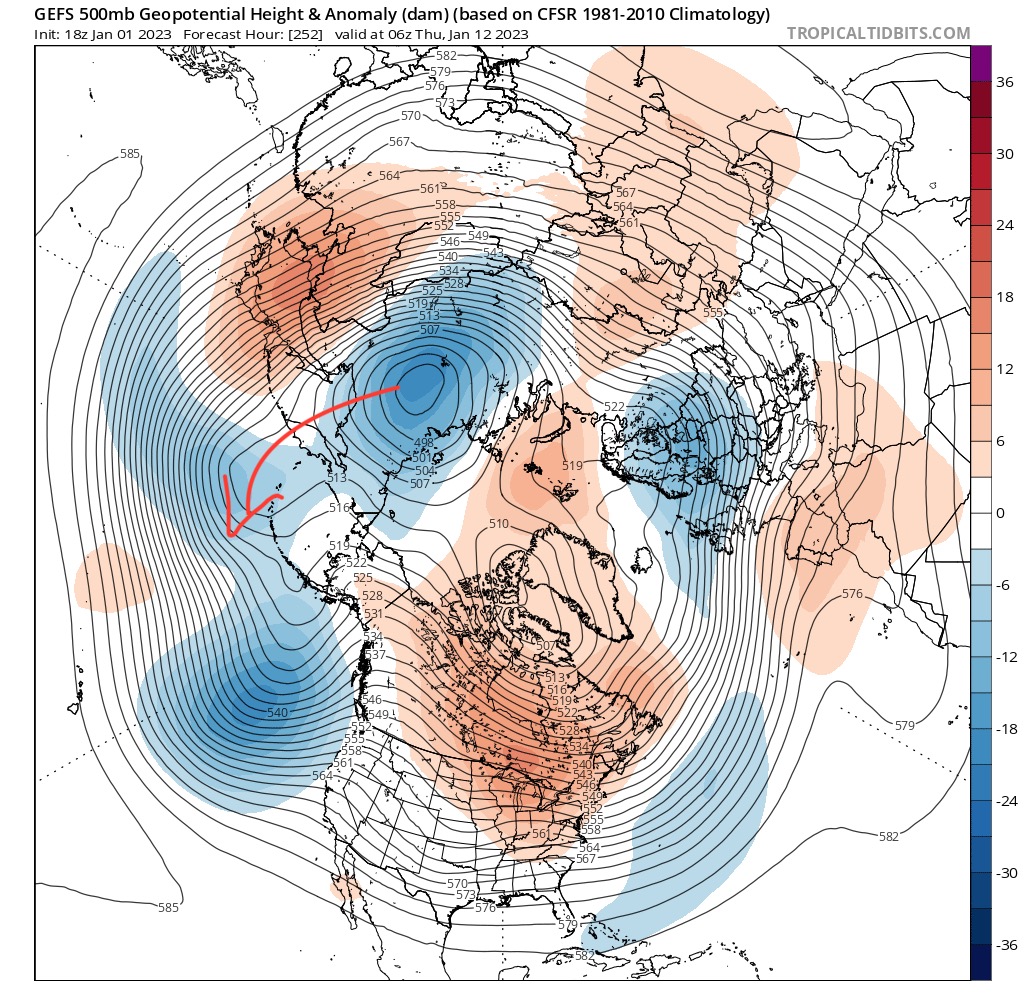
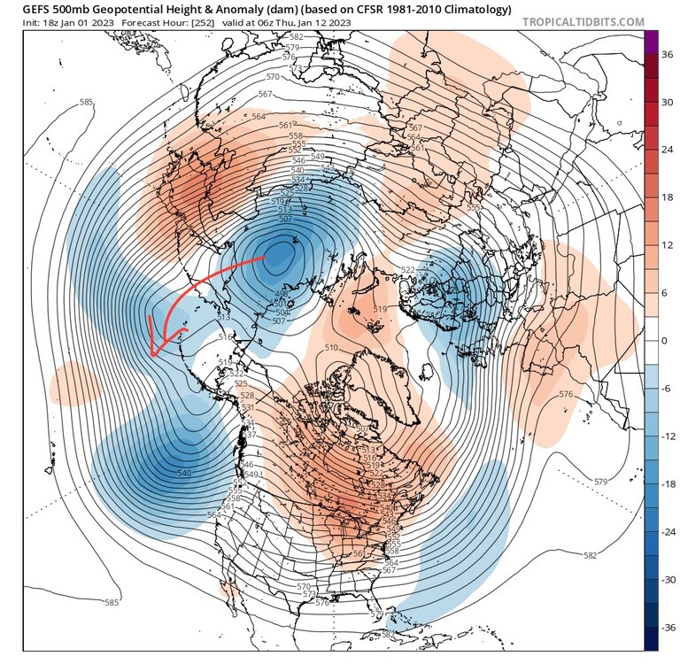
Key feature to watch is how the siberian PV progresses from D9 and onward. We want it to move into the aleutians domain for any workable setup.
-
Yeah, but what matters is how it plays out in real life. The cutter is a great example. The models, especially the GFS had the wave digging deeper south under us as close as 7 days out.
-
Seems the models want to show a nino-ish look at range but then tilt towards nina-ish when it gets closer. Been the trend this winter, and it makes sense. They want to rush the nina out and it’s stubbornly holding on.
-
That’s what I was wondering, too. I mean, if you’re going to move, might as well move to Vermont or Buffalo. Unless he still has to commute to work, which I think may be the case.
-
Exactly what I’m saying and what I’ve been foreseeing when I posted my outlook. Our window of opportunity for snow is narrowing fast.
-
If I’m right about this winter, the second half of January is our best shot at a decent snowfall. We whiff this time and Feb goes +3 with the -pna/SE ridge coming back, best we can hope for is a late Feb early March gift.
-
Gorgeous day out. 62
-
Happy new year all!
-
Nowhere near a super nino, more like an east based one. Check the pac SST map, you’ll see relatively warmer temps in nino 1.2 vs 3.4. Don’t think we’re saying extended torch, we don’t know. But I’m less confident compared to a couple days ago after seeing the models get warmer each run.
-
Yeah, that was what I was saying in my recent comment this morning. I was hoping to see this week’s torch come to a quick end with a nice pna ridge and plenty of cold air in Canada to set things up for the next wave that decides to come by. What I’m seeing in the latest ensemble runs is +5 to +10 air across the eastern 2/3 of Canada, and my first thought was “how is this going to lead to snow here?” As much as I want to see it, I just don’t. Not yet.
-
My only concern with the current look is warm temp anomalies over Canada even with a good h5 look right over us and the SE. Not sure we’ll get our air cold enough to snow even through the end of Jan.
-
Drizzly foggy 49. Low 43