Terpeast
-
Posts
5,326 -
Joined
-
Last visited
Content Type
Profiles
Blogs
Forums
American Weather
Media Demo
Store
Gallery
Everything posted by Terpeast
-
Jan Medium/Long Range Disco: Winter is coming
Terpeast replied to stormtracker's topic in Mid Atlantic
Even though they did a decent job for December, we shouldn't be trusting even the weeklies beyond 2-3 week lead times -
Jan Medium/Long Range Disco: Winter is coming
Terpeast replied to stormtracker's topic in Mid Atlantic
700+ hour maps, really? At least it's not showing a aleutian ridge, so there's that. -
At least the SPV stays weak for a while
-
Jan Medium/Long Range Disco: Winter is coming
Terpeast replied to stormtracker's topic in Mid Atlantic
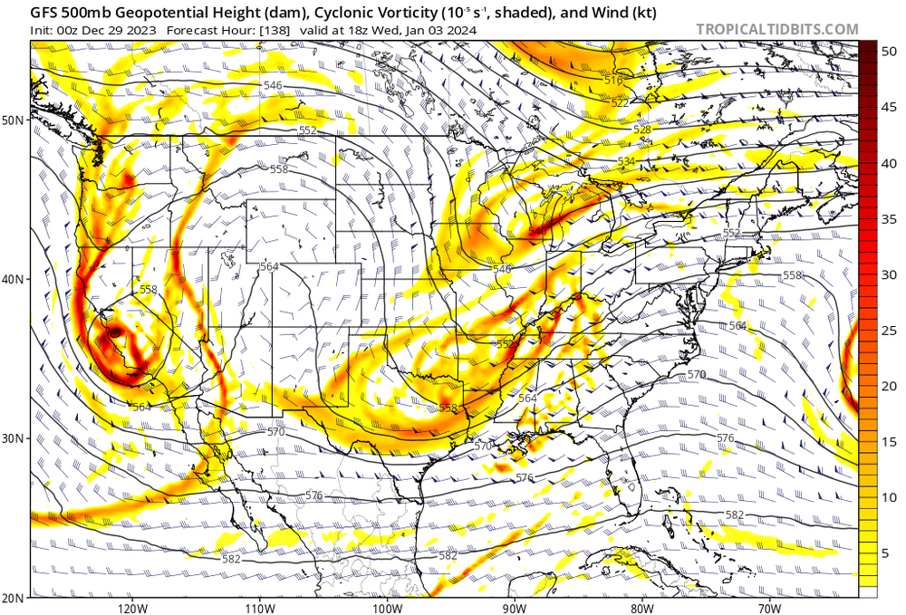
NS vort quashes the SS wave a bit and that's why it's a miss on this run. The canadian holds the NS vort back a bit and then tries to phase with a neutral tilt, that's how we get colder air in and the low further N without torching the mids. That's the path to a (minor) win. Won't be a significant event. Maximum upside is probably a 2-4 incher if we can reel that in. Otherwise it's a miss OTS. Ensembles say we get another shot on the 7-8th but the Op runs seem to have other ideas. Will lean on ensembles at that range, though.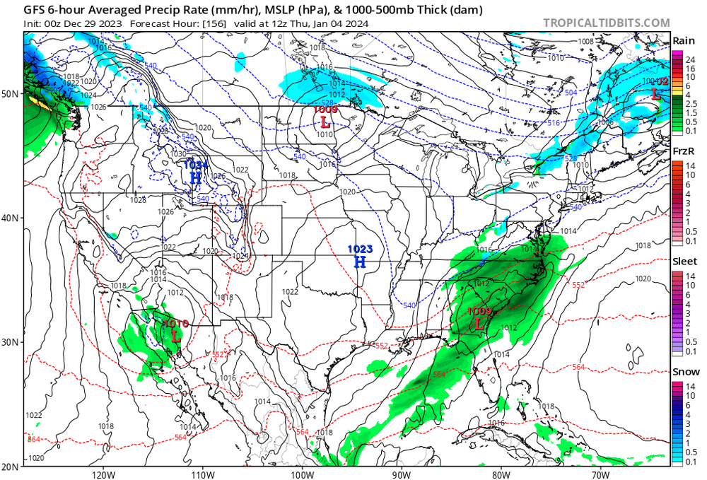
-
Jan Medium/Long Range Disco: Winter is coming
Terpeast replied to stormtracker's topic in Mid Atlantic
Gettin' close... and has support from the canadian
-
Jan Medium/Long Range Disco: Winter is coming
Terpeast replied to stormtracker's topic in Mid Atlantic
I was comparing 12z eps with 18z gefs but didn’t scroll an extra day to the end of the gefs run. That extra progression is for the worse, yeah. I hope it’s on an island and that the eps/geps are more correct -
Jan Medium/Long Range Disco: Winter is coming
Terpeast replied to stormtracker's topic in Mid Atlantic
End of both EPS and GEFS runs don’t look that different to me. Both have a -nao and a bit of a broad -pna trough that isn’t terribly warm anywhere in NA except well NE closer to the nao block. Yes, the trough is more tilted SW (as expected with a -pdo) but it’s not a shut the blinds look. Both show a mild warmup over a few days after the Jan 7-8 system, but overall much colder in canada and conus than this week -
Jan Medium/Long Range Disco: Winter is coming
Terpeast replied to stormtracker's topic in Mid Atlantic
Yeah, I’ve been following those pointed questions and the radio silence that followed. Why don’t they just come right out and say it’s virtually impossible? Maybe they’re afraid that mother nature will throw yet another curveball that catches them with their pants down. I mean, come on. I’d have a lot more respect for them if they put forth their own winter outlooks at the risk of getting it wrong. And own it. -
Jan Medium/Long Range Disco: Winter is coming
Terpeast replied to stormtracker's topic in Mid Atlantic
Just checked EPS and GEFS, they still show a storm signal for Jan 5, as does the op euro. GEPS is more suppressed. The op GFS and op CMC don't show it. Jan 7-8 storm still there, too, on the ensembles. -
Jan Medium/Long Range Disco: Winter is coming
Terpeast replied to stormtracker's topic in Mid Atlantic
He said that because of the MJO being favored in the warm phases due to 30+ ssts in the MC, the models would correct warmer as lead times shorten. [Bluewave, if you're reading this: Nice job, you take this round.] At least he said that El Nino winters are best judged for the period after Jan 15 through the end of Feb, and anything that happens before that isn't relevant due to nino climatology. So there's that. -
Jan Medium/Long Range Disco: Winter is coming
Terpeast replied to stormtracker's topic in Mid Atlantic
At least Anna has a healthy dose of skepticism... -
First sunny 60 degree day in what seems like several weeks. Very mild day, no coat needed. This should be the last day before I get back into the 40s for highs and 30s for lows for the foreseeable future. (whether its cold enough to snow is another question!)
-
Best spot for snow vacation home within 4 hours of NOVA
Terpeast replied to SnowenOutThere's topic in Mid Atlantic
That being said, lots of bare ground at Davis/Canaan. https://www.resortcams.com/webcams/canaan-valley-resort/ (it's not just us, you should see some of those cams up at Vermont. So sad) -
Best spot for snow vacation home within 4 hours of NOVA
Terpeast replied to SnowenOutThere's topic in Mid Atlantic
Great post. I visited Deep Creek last year for my snow fix and it was really fun and nice. We loved it. So we looked at real estate prices, and I'm sorry, but those houses are waaaaaay overpriced. Even more stupidly priced than closer into the DMV area (which is high priced for valid reasons). -
Jan Medium/Long Range Disco: Winter is coming
Terpeast replied to stormtracker's topic in Mid Atlantic
IAD got 10” with that Jan 1964 storm Mood in this thread seems a little better now. I was afraid to open it this morning! -
0.81” on the day 6.54” total MTD
-
Jan Medium/Long Range Disco: Winter is coming
Terpeast replied to stormtracker's topic in Mid Atlantic
I’ll say this. I’m not canceling winter and as long as we’re in a nino, I’ll never cancel it. Even if it means ‘winter’ will only be a one and done 18”+ storm. However, I think if we get to Jan 1 and guidance shows nothing of note through the 15th, it will at that point be safe to say that a 2009-10 or 2002-03 blockbuster is definitely off the table. We may get a 2014-15 or 65-66 style ending, though. So at that point, I’ll probably downgrade my outlook to 15-30” instead of 20-40” areawide (not including my DCA siting penalty). We can easily get 15-30” in one storm. ofc I’ll grade my outlook based on my original forecast, so it’s probably not going to earn an A. -
Jan Medium/Long Range Disco: Winter is coming
Terpeast replied to stormtracker's topic in Mid Atlantic
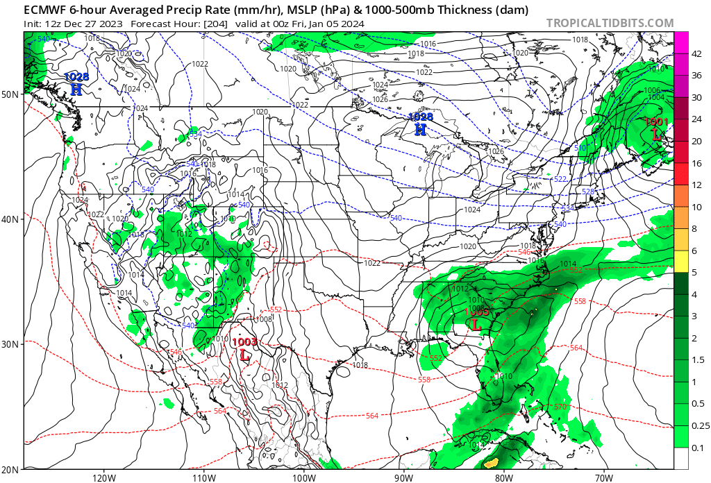
Did anyone notice the 12z euro? I know it’s the op run, but look Cold high up top, gulf low brewing. It’s a miss, but it’s close.
-
Yeah, that’s when the colder air was supposed to come. That was always the first step. The real problem is whether it’s cold enough. It may need to come in waves to get it there
-
0.38” yesterday and 0.15” so far today. 46
-
Best spot for snow vacation home within 4 hours of NOVA
Terpeast replied to SnowenOutThere's topic in Mid Atlantic
Good research, and useful for when I retire and buy a place in the mountains. -
It’s not that bad. Not a terrible look at all once Canada gets a chance to cool down until then
-
Canadian ensembles see it, too... if not a day earlier. They mostly skipped the Jan 3 perfect track rainstorm though (suppressed SE)
-
That’s been on my radar as well. Cold air availability is much better then (as long as it doesn’t trend warmer)
-
Gfs ensembles building W canadian ridge into Alaska becoming more -epo ish. It will be fine, so everyone take a breath. Let Jan 3 go. we can’t win them all.