

Terpeast
-
Posts
5,326 -
Joined
-
Last visited
Content Type
Profiles
Blogs
Forums
American Weather
Media Demo
Store
Gallery
Everything posted by Terpeast
-
WINTER WEATHER ADVISORY IN EFFECT FROM 7 AM TO 7 PM EST SATURDAY...* WHAT...Mixed precipitation expected. Total snow and sleet accumulations of a coating to an inch, and ice accumulations of a light glaze.* WHERE...Stafford, Eastern Loudoun and Northwest Prince William Counties.* WHEN...From 7 AM to 7 PM EST Saturday.* IMPACTS...Plan on slippery road conditions.* ADDITIONAL DETAILS...Precipitation is expected to begin as snow and sleet between 7 and 10 AM. Precipitation will change to freezing rain between 10 AM and 1 PM, then rain after 1 PM. Precipitation is expected to end during the early evening.
-
Jan Medium/Long Range Disco: Winter is coming
Terpeast replied to stormtracker's topic in Mid Atlantic
Lets hope it plays out exactly like this. The weaker SPV should help, and the 4-6 convection should fade by the end of the month or sooner. what really shocked and puzzled me is that -VP anomalies were stuck over 7/8 for 6 months, and then suddenly it shifted and now there’s suppression over 7/8/1 despite record warm ssts in nino 4 -
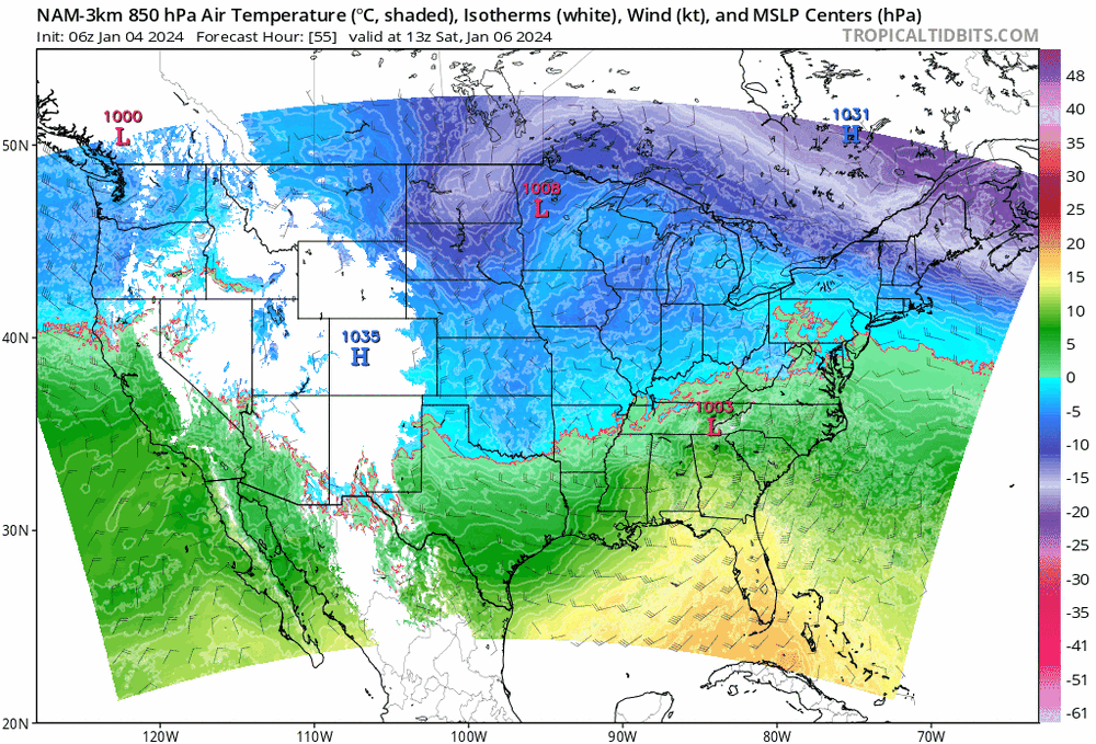
0 line 850 keeps jumping around on the 3k
-
It counts. I have ice in the creek behind my house
-
Jan Medium/Long Range Disco: Winter is coming
Terpeast replied to stormtracker's topic in Mid Atlantic
It’s not typical, it should be colder or neutral there. The loudest person in the room is being drowned out by other noises But if/when convection quiets over the MC, that is our chance -
Jan Medium/Long Range Disco: Winter is coming
Terpeast replied to stormtracker's topic in Mid Atlantic
By the time the MJO runs its course through 4-6, it’ll be late Jan. If it doesn’t reload back at 4, we still have a chance. But with that rug pull on tomorrow’s storm, I’m not so sure about above normal snowfall this year. Could still happen with 1 well timed wave with just enough cold air. We do have that STJ going for us. -
Jan Medium/Long Range Disco: Winter is coming
Terpeast replied to stormtracker's topic in Mid Atlantic
That’s what I was saying the other day about the MJO. We don’t want tropical convection too strong in the MC. -
Jan Medium/Long Range Disco: Winter is coming
Terpeast replied to stormtracker's topic in Mid Atlantic
Tbh, I’m not too encouraged by what I’m seeing in the LR. At least not as encouraged as 2-3 days ago -
Reading between the lines, could be 0.5-2” just east of 15 but west of IAD
-
From LWX Winter Storm Watches remain in effect along and west of US-15. Snow totals also increased a bit for the higher elevations of northern MD, particularly along Parr`s Ridge where the Winter Storm Watch was expanded into Northern Baltimore County. A decision on whether to upgrade to a Winter Storm Warning or Advisories will be made later this morning. Advisories are expected to be issued today for the tier of counties east of the current watches. Ice accretion amounts up to two tenths of an inch are possible in parts of the Central Shenandoah Valley into Central VA, including the Blue Ridge, with a trace up to a few hundredths of an inch of ice possible elsewhere in the Watch area. Snow/sleet amounts will vary, though looking at 4-6" along and northwest of a line from Spruce Knob to Winchester to Westminster. Between that line and US- 15 snow/sleet amounts could vary between 1-3". Between US-15 and I- 95 in Virginia, and east of Parr`s Ridge in Maryland snow/sleet amounts between a trace to a couple tenths of an inch.
-
Dipped to 19.4. First sub-20 this year
-
20.1 low
-
LWX did up my high end potential to 4” as the 90th percentile. Before it was around 3-3.5”. Can’t complain about the 18z/0z trends Still thinking 1.5-2” before flip
-
I hope the gfs isn’t right, but it did get colder at the surface.
-
And if this is the snow depth, I’ll take that 2”. Its enough to cover the ground and build a snowman with my daughter. Then when it flips, we go back inside and have a hot chocolate
-
Jan Medium/Long Range Disco: Winter is coming
Terpeast replied to stormtracker's topic in Mid Atlantic
Thats what I’m hoping for - that the neg AO blocking overrides the MJO and gets cold over us, and when the cold relaxes, we get into the favorable mjo phases and keep blocking up top -
37/21. Feels like a normal winter day
-
Is it like that for 3k too?
-
A degree or so in F is noise. Nothing has changed today. Still time to bleed colder and the mesos can catch that better than the globals. Also, higher thumpy qpf will help, not hurt. 18z is a bit lighter than 12z
-
Jan Medium/Long Range Disco: Winter is coming
Terpeast replied to stormtracker's topic in Mid Atlantic
Best if we scoot through 4-6 as a weak wave or inside COD and reemerge at 7, then we can hunt for big dogs. Most biggies start as a wave in the N Pac while the mjo is at 7. Could be early Feb -
I think they’re hedging on either 5” snow or 0.25” ice. The latter more likely further south. But this doesn’t scream ice storm to me
-
Check LWX. Hoisted watch for west of 15 I’m just a few miles east. Likely going to get an advisory closer in
-
Just checked, its a smidge better. Probably noise
-
Jan Medium/Long Range Disco: Winter is coming
Terpeast replied to stormtracker's topic in Mid Atlantic
Mild just 3 days then cold, if going by that op run This is the kind of warminista cherry picking that really grinds my gears. A lot of that goes on in the NYC forum (not naming names) -
Other than the euro, the bleeding has stopped. For now…


