.jpg.2573028626d558966424be2bdf9b8490.jpg)

Buckethead
-
Posts
2,735 -
Joined
-
Last visited
Content Type
Profiles
Blogs
Forums
American Weather
Media Demo
Store
Gallery
Everything posted by Buckethead
-
There's a power saw for every application. J/s lol.
-
I was up on the bald stargazing until around midnight. I'm not accustomed to getting that cold in September lol. The wind was brutal! Starting out at 36.4° this morning.
-
Got down to 38.8° up here last night, sitting at 43° now. Sent from my SM-G970U using Tapatalk
-
I've been stuck in the fog and clouds all day and only made it to 54 and hour ago...back down to 53 now with a good breeze.
-
Starting out the day with rain/fog and 52°. It's gonna be a great weather weekend! Sent from my SM-G970U using Tapatalk
-
Nice, cool, damp day. There's a fall vibe in the air for sure. I see 30's in my forecast this weekend. We're inching closer to winter. Sent from my SM-G970U using Tapatalk
-
That cool down should help get the leaves changing. The maples and a few other species are already changing here in Wolf. Sent from my SM-G970U using Tapatalk
-
Down to 54° here. Currently 46° on Mt. Mitchell. Sent from my SM-G970U using Tapatalk
-
Started out at 51°. Feels just about perfect today! Sent from my SM-G970U using Tapatalk
-
Nevermind, lol. Those fell apart pretty fast. I have a passing light shower and 75°at 4400'. That's about as hot as we ever get here in July. I bet it feels awful down in the valley today. Sent from my SM-G970U using Tapatalk
-
Got some strong storms heading in soon. Sent from my SM-G970U using Tapatalk
-
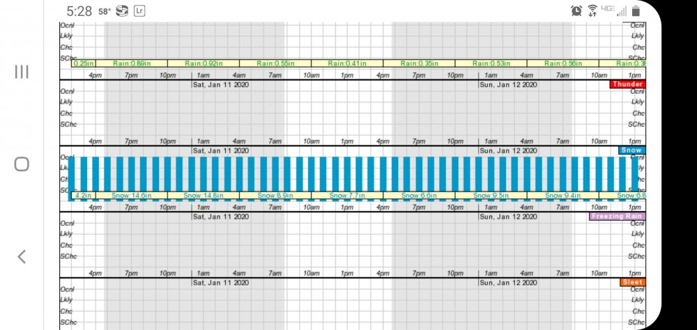
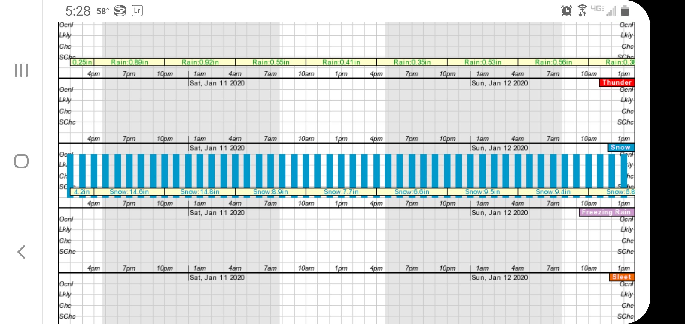
Here's hoping I can get more than 3" of snow at one time this season. Last season was weird. Sent from my SM-G970U using Tapatalk
-
Had a high of 77 on Saturday here in Wolf. The warmest summer temperature I've had since moving here three years ago is 78.7, so you could say Satuday was summer like. And now I have snow in the NWS forecast tomorrow night into Wednesday. Gotta love spring!
-
That's 1.5" better than I've had in any one storm this season way up here at 4400'. Nice! Sent from my SM-G970U using Tapatalk
-
I have about 3.5". Still snowing but I doubt I reach 4".
-
I'm glad to see you got something man! I've seen many winters in Gaston and St. Matthew's with less.
-
Picked up an inch in the last hour, 25/25. Sent from my SM-G970U using Tapatalk
-
Currently 26/26 with an inch on the ground and moderate snow in Wolf Laurel at 4400'. Sent from my SM-G970U using Tapatalk
-
28.2/24 with nickel sized flakes falling and a dusting on the ground in Wolf.
-
Wolf Laurel, NC elev. 4400' 31.1°/27
-
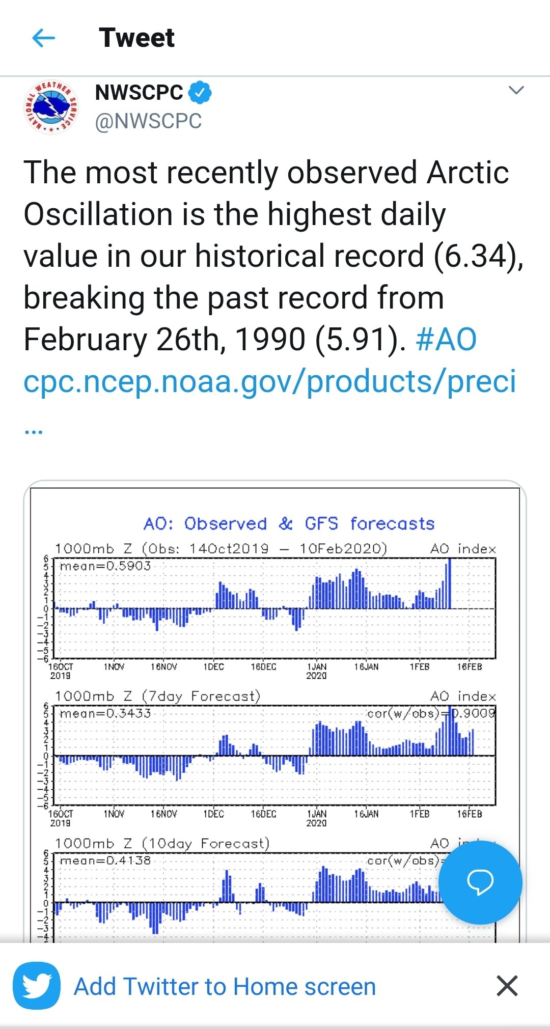
https://mobile.twitter.com/NWSCPC/status/1226866908479160323?ref_src=twsrc^tfw|twcamp^tweetembed&ref_url=https%3A%2F%2Fd-3944355110867719083.ampproject.net%2F2001281851410%2Fframe.html

-
Someone from GSP has been in here...
-
The long term disco is an absolute dumpster fire. What happened to waiting until storms get closer to the mid range before we start posting clown maps four times a day? Come on y'all, we're better than this.
-
Possible tornado in Horry County about an hour ago. Sent from my SM-G970U using Tapatalk
-

Southeast Sanitarium - A Place to Vent
Buckethead replied to Jonathan's topic in Southeastern States
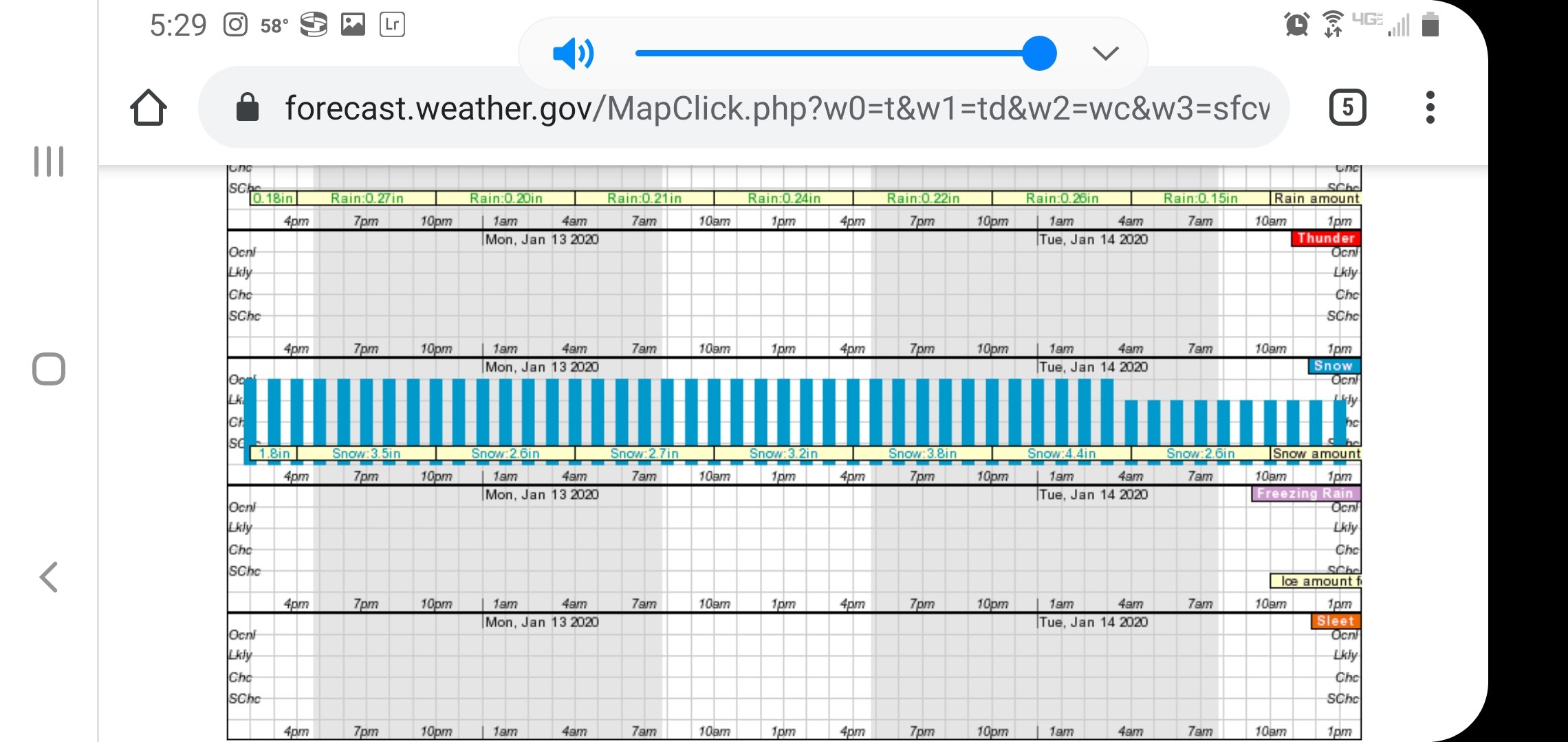
Now in graph form!