.jpg.2573028626d558966424be2bdf9b8490.jpg)

Buckethead
-
Posts
2,433 -
Joined
-
Last visited
Content Type
Profiles
Blogs
Forums
American Weather
Media Demo
Store
Gallery
Everything posted by Buckethead
-

2019/2020 Mountains and Foothills Fall/Winter Thread.
Buckethead replied to Tyler Penland's topic in Southeastern States
A little over 2" here today so far. Still coming down good. -
2019/2020 Mountains and Foothills Fall/Winter Thread.
Buckethead replied to Tyler Penland's topic in Southeastern States
My mud is frozen again. Currently 18.2°/17 with big flakes coming down. About an inch so far. -
2019/2020 Mountains and Foothills Fall/Winter Thread.
Buckethead replied to Tyler Penland's topic in Southeastern States
Looks like WSW amounts above 3500'. It would be nice if it's sniffing out another one like it did last week. -
2019/2020 Mountains and Foothills Fall/Winter Thread.
Buckethead replied to Tyler Penland's topic in Southeastern States
I had picked up 5.60" since since midnight last night at 2pm. Won't be able to measure any more though since a tree on the hill next to my house just fell and took out my rain gauge. My mountain is dissolving. -
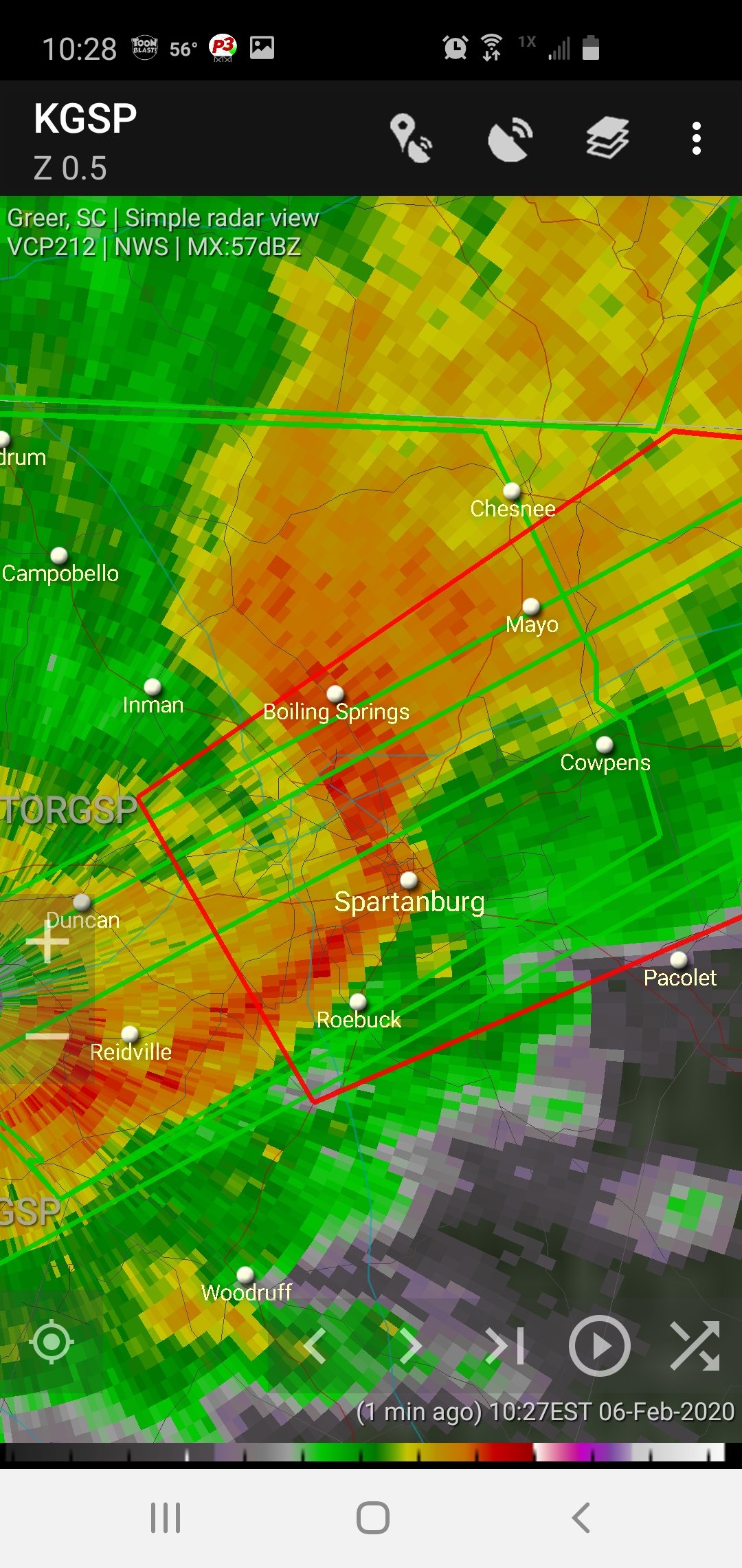
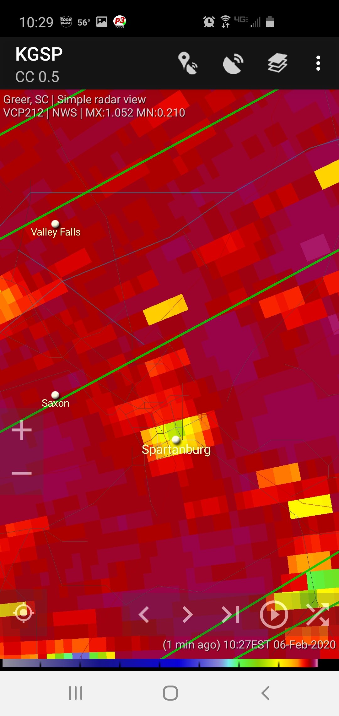
Nasty looking tornado warned storm in spartanburg.


-
Tornado Warning NCC045-071-109-061515- /O.NEW.KGSP.TO.W.0005.200206T1448Z-200206T1515Z/ BULLETIN - EAS ACTIVATION REQUESTED Tornado Warning National Weather Service Greenville-Spartanburg SC 948 AM EST Thu Feb 6 2020 The National Weather Service in Greenville-Spartanburg has issued a * Tornado Warning for... Western Lincoln County in the Piedmont of North Carolina... Central Cleveland County in the Piedmont of North Carolina... Northwestern Gaston County in the Piedmont of North Carolina... * Until 1015 AM EST. * At 948 AM EST, a severe thunderstorm capable of producing a tornado was located 9 miles north of Shelby, or over Lawndale, moving east at 35 mph. HAZARD...Tornado. SOURCE...Radar indicated rotation. IMPACT...Flying debris will be dangerous to those caught without shelter. Mobile homes will be damaged or destroyed. Damage to roofs, windows, and vehicles will occur. Tree damage is likely. * This dangerous storm will be near... Belwood and Fallston around 950 AM EST. Waco around 1000 AM EST. Cherryville around 1010 AM EST. Other locations impacted by this dangerous thunderstorm include Crouse and Vale.
-
2019/2020 Mountains and Foothills Fall/Winter Thread.
Buckethead replied to Tyler Penland's topic in Southeastern States
Just search for WxSouth on Facebook. Sent from my SM-G970U using Tapatalk -
2019/2020 Mountains and Foothills Fall/Winter Thread.
Buckethead replied to Tyler Penland's topic in Southeastern States
Hard to look at the GFS/ECMWF/Canadian models for this weekend and not get a little excited. All of them are close to warning criteria along the border. A lot could change still, but it's only four days away. -
2019/2020 Mountains and Foothills Fall/Winter Thread.
Buckethead replied to Tyler Penland's topic in Southeastern States
Yeah, it has an elevation dependent look to it for sure. It would work out okay for me and Joe, but I'd rather everyone got in on it. We shall see. -
2019/2020 Mountains and Foothills Fall/Winter Thread.
Buckethead replied to Tyler Penland's topic in Southeastern States
I'm over 1.5" now. Earlier it was paste falling but now it's powder. Sent from my SM-G970U using Tapatalk -
2019/2020 Mountains and Foothills Fall/Winter Thread.
Buckethead replied to Tyler Penland's topic in Southeastern States
I'm down to 28 with an inch of paste on the ground so far. Currently in between showers. Sent from my SM-G970U using Tapatalk -
Currently 30.1°/29 and light snow.
-
2019/2020 Mountains and Foothills Fall/Winter Thread.
Buckethead replied to Tyler Penland's topic in Southeastern States
If this keeps up it might turn out decent. Sent from my SM-G970U using Tapatalk -
2019/2020 Mountains and Foothills Fall/Winter Thread.
Buckethead replied to Tyler Penland's topic in Southeastern States
It might not add up to much for the week as a whole, but it's nice to see snow falling yet again today. I think that makes either 4 or 5 days this week snow fell. -
2019/2020 Mountains and Foothills Fall/Winter Thread.
Buckethead replied to Tyler Penland's topic in Southeastern States
Picked up another .75" of snow today. You can tell how bad of a season it's been when I'm counting the ones under an inch lol. -
2019/2020 Mountains and Foothills Fall/Winter Thread.
Buckethead replied to Tyler Penland's topic in Southeastern States
Had some pretty cool fog in the Toe River Valley this morning up to 4000'. Took these from the Wolf Laurel CC. Sent from my SM-G970U using Tapatalk -
2019/2020 Mountains and Foothills Fall/Winter Thread.
Buckethead replied to Tyler Penland's topic in Southeastern States
Moderate snow in wolf now, 33°/31. Edit. Heavy snow now. Huge flakes. -
2019/2020 Mountains and Foothills Fall/Winter Thread.
Buckethead replied to Tyler Penland's topic in Southeastern States
It's about time y'all got some snow. Hope you get a nice surprise! -
2019/2020 Mountains and Foothills Fall/Winter Thread.
Buckethead replied to Tyler Penland's topic in Southeastern States
Had a really dense layer of fog move in from the NE this morning between 2-4kft. Temp dropped from a few degrees as it moved in down to 29. -
2019/2020 Mountains and Foothills Fall/Winter Thread.
Buckethead replied to Tyler Penland's topic in Southeastern States
I have a nice little snow shower passing through currently. Been off and on all day. -
2019/2020 Mountains and Foothills Fall/Winter Thread.
Buckethead replied to Tyler Penland's topic in Southeastern States
Ah, March '09. Had an 8-12" forecast and got dry slotted. (I was in Columbia) That was the first time I saw a meteorologist cry live on screen over a blown forecast. -
2019/2020 Mountains and Foothills Fall/Winter Thread.
Buckethead replied to Tyler Penland's topic in Southeastern States
Is there a 925mb level in the high country? I thought that was around 2500'. -
2019/2020 Mountains and Foothills Fall/Winter Thread.
Buckethead replied to Tyler Penland's topic in Southeastern States
I hope you guys a little lower can score on this one. That would be something if the Nam was right. -
2019/2020 Mountains and Foothills Fall/Winter Thread.
Buckethead replied to Tyler Penland's topic in Southeastern States
I picked up about ¾" last night. I dont think that much would've stuck if it weren't for the snow still on the ground. -
2019/2020 Mountains and Foothills Fall/Winter Thread.
Buckethead replied to Tyler Penland's topic in Southeastern States
I finally dipped below 30° about 5 minutes ago. Doubt it'll matter much though.