Eduardo
-
Posts
1,030 -
Joined
-
Last visited
Content Type
Profiles
Blogs
Forums
American Weather
Media Demo
Store
Gallery
Everything posted by Eduardo
-
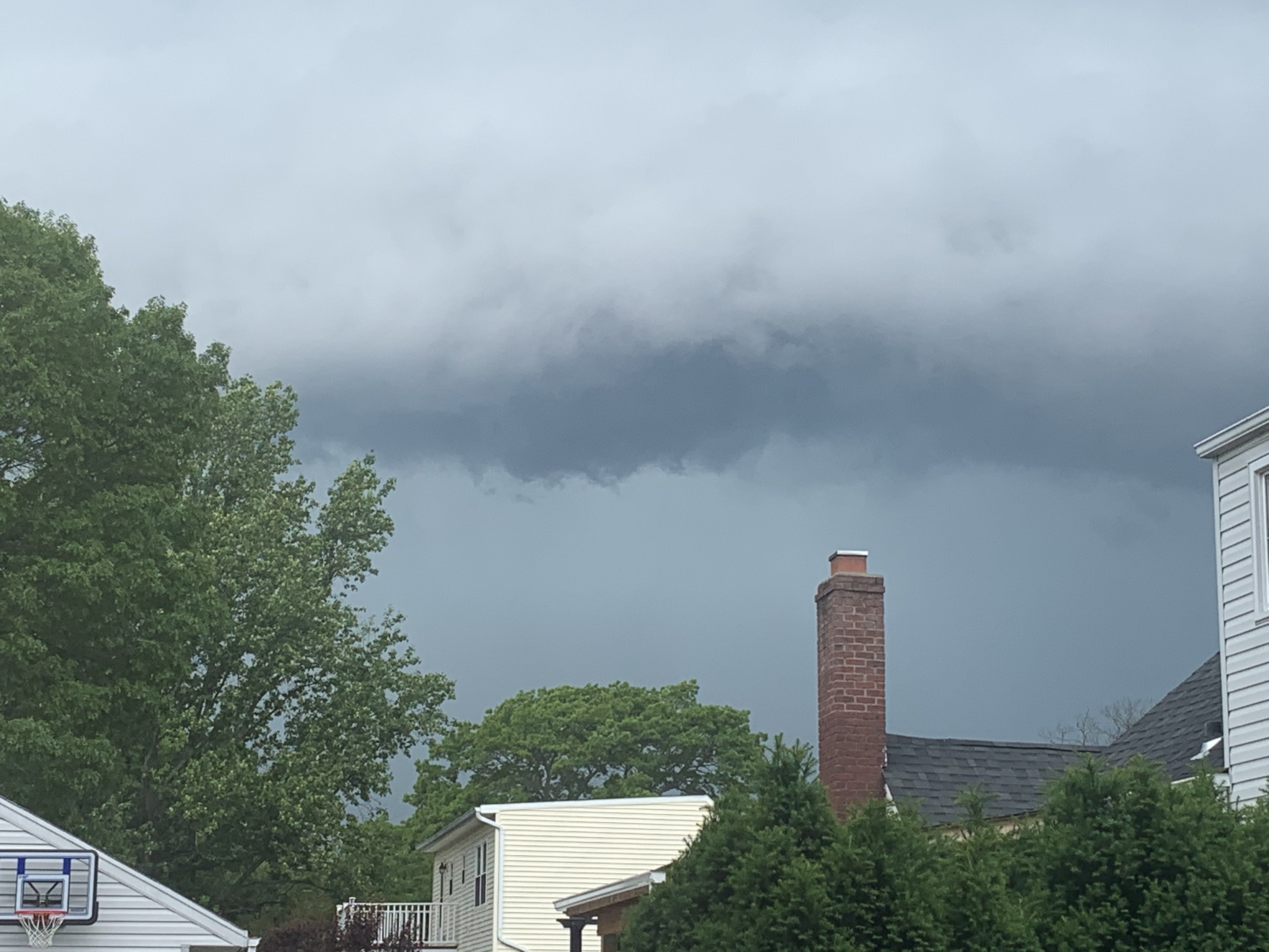
Yeah they certainly petered out as they stumbled their way southward though. Here in Lindenhurst, the sky darkened, but we got nothing aside from a 2-min bout of drizzle. Sun's back out now.
-
June 2020 General Discussions & Observations Thread
Eduardo replied to Rtd208's topic in New York City Metro
Yeah wow. Sun came out for about half an hour here in Lindenhurst and now, out of nowhere, have heavier rain than before! -
June 2020 General Discussions & Observations Thread
Eduardo replied to Rtd208's topic in New York City Metro
Sky looked ominous, but just a breezy downpour here in Lindenhurst.
-
May 2020 General Discussions & Observations Thread
Eduardo replied to Rtd208's topic in New York City Metro
For the past few years, it seems like our preferred weather patterns are “fast-forwarded” by a few months, delaying springs and summers on the front end, but extending them on the back end. What explains it? -
February 2020 General Discussions & Observations Thread
Eduardo replied to Rtd208's topic in New York City Metro
Failed here in Lindenhurst. Saw it breaking up overhead. Boooooo! -
January 2020 General Discussions & Observations Thread
Eduardo replied to Rtd208's topic in New York City Metro
One thing I have learned over the past few years: Broadly speaking, Pacific patterns have staying power in this climate regime and LR models often break them down too quickly. In 2013-14 and 2014-15, I distinctly recall models breaking down those glorious -EPO patterns only to see it pushed back over and over again--which of course redounded to our benefit. 2018-19 and 2019-20 was the flip side of the same phenomenon and we saw raging +EPO patterns remain robust in spite of LR models constantly forecasting their reversal. In future winters, we should keep this in mind as we try to sift out the head fakes. -
Yeah I am in Lindenhurst and this does happen from time to time. 6.4” on the year so far.
-
Wintry mix potential weekend of Jan 18-19, 2020
Eduardo replied to wdrag's topic in New York City Metro
I second this. Just drove home to LI from a ski trip up at Mountain Creek in Vernon, NJ where so many of the drivers seem to suffer from delusions of invincibility. Had a car pass me in excess of the speed limit on a snow-covered secondary road. About a mile ahead, we saw that he had gone off the road into a tree. Several spin outs on I-80 too. Not the night to be in a rush folks. Not worth the risk! -
January 2020 General Discussions & Observations Thread
Eduardo replied to Rtd208's topic in New York City Metro
Last year, I finished with a single-digit snow total. Today is the first time I fear that may repeat itself. Looking pretty ugly moving forward. -
January 2020 General Discussions & Observations Thread
Eduardo replied to Rtd208's topic in New York City Metro
Really a matter of perspective. Most of us don’t care about an almost-certain positive monthly departure so long as we are looking ahead to a pattern that can produce. Looks like a very niño-ish progression here. We should start rocking soon (finally)! -
January 2020 General Discussions & Observations Thread
Eduardo replied to Rtd208's topic in New York City Metro
Hobbyist question here: When you say that this pool of high-octane fuel will "enhance" the MJO in its unfavorable phases, do you mean to say that it will: (1) become more amplified as it passes through those phases; (2) spend a greater-than-usual time in those phases; or (3) both? -
January 2020 General Discussions & Observations Thread
Eduardo replied to Rtd208's topic in New York City Metro
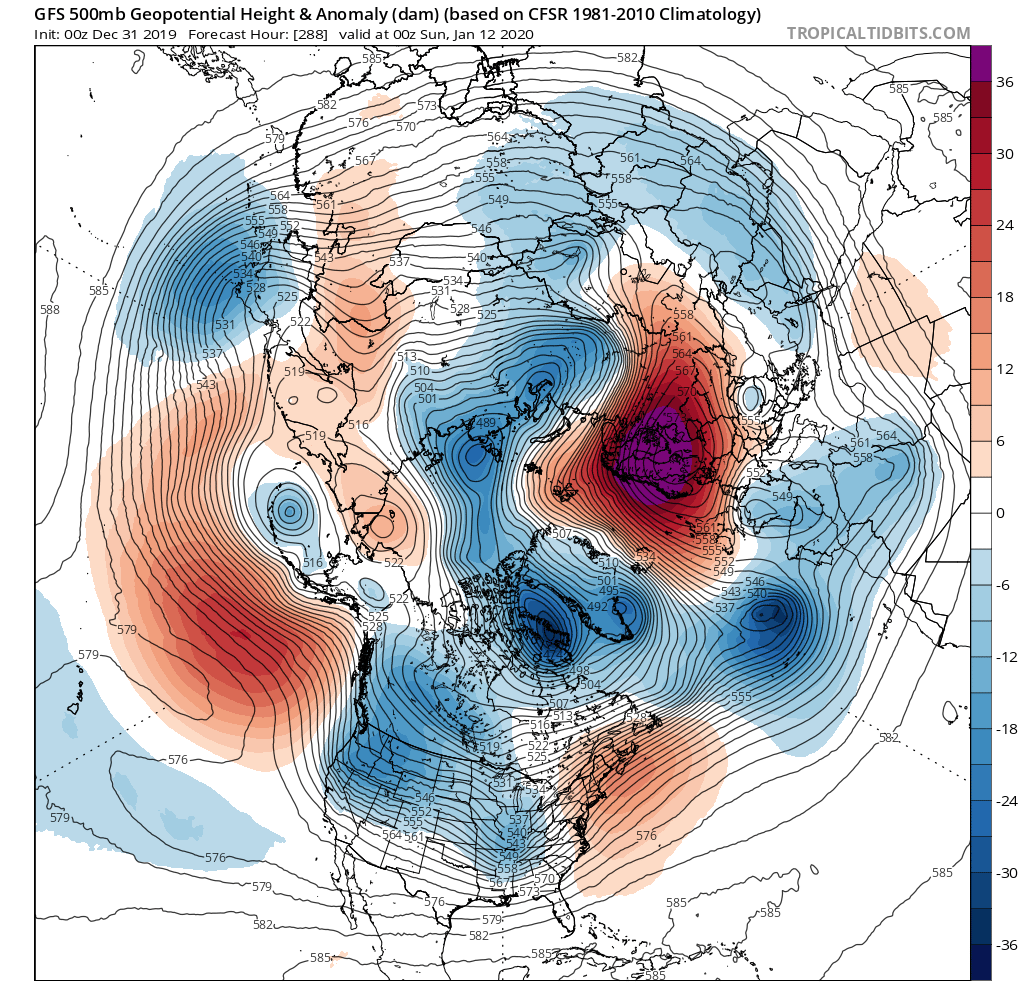
Squinting hard through my rose-colored glasses here, but the one thing we have on our side is that we actually have cold air on our side of the globe. Were we staring at this map with the PV trapped over in Siberia, I might be ready to waive the white flag, esp with the Pacific SSTs favoring the MJO looping in its unfavorable phases.... But the (relatively) nearby cold at least keeps alive the possibility that some elusive ATL help can rescue us at some point. -
Forgive me if I am mis-remembering, but didn't the January 2016 storm benefit from a "bootleg block" that originated up in the Scandi/Kara region? Like most, I am squinting hard to see some light at the end of the tunnel. The optimist in me feels good that we at least have the cold on our side of the pole. Were the PV locked up over Siberia right now, I think I'd have the towel in-hand...even up here. Great analysis in here, as always!
-
Hugging that Scandinavia ridge showing up on the 288hr op GFS. Pretty much all I’ve got given the doom and gloom on here today.
-
This!! So much this! I’m as anxious as anybody to get some meaningful winter weather in here, but LR modeling isn’t worth chewing on until we are inside ten days (at least)!!
-
How does this evolution compare with that of 2013-14? IIRC, we flipped cold right around New Years, (at least up here) cashed in with a storm right in the beginning of January, and remained in the freezer for at least a month and a half.
-
Pre-Xmas storm has my interest more than anything right now, but my worry is that we tearfully watch it bomb out over the Flemish Cap. If we somehow can toss some sand in the gears of that PAC jet, things could get interesting. We deserve it after enduring last year’s garbage pattern. Got my fingers crossed!
-
Decent trends today, but might a cutter next week tug that TPV toward the 50/50 position which, combined with the modeled west-based -NAO, might set the table for a more interesting Xmas week? Not looking to be invidious, but what do we think of the "sacrificial lamb" perspective?
-
Winding down in SW Suffolk. Roads are wet with slushy patches, but I measured 2.2" on the grass. Brings me to 4.4" on the season so far. Not too bad after last year's shutout. Here's to keeping it going and hoping the leadup to Xmas has some fun in store for us!
-
Felicitous choice of analogy! Posts like these are why I love these boards. Excellent convo all-around today. Thanks!!
-
From a hobbyist perspective, it seems like the theme of the past few years has been a general humbling of our ability to forecast general long-range weather patterns. Certainly, LR models seem to miss the mark more often in the past two years or so. (1) Is there something to this anecdote? (2) If yes, is there some scientific basis for this? (I was thinking maybe the MJO/PAC firehose is mucking things up.)
-
Maybe my memory is failing me, but I remember it being bitter cold with long-lasting snowpack after December. Wasn't that the winter where we had an all-snow event with single-digit temps?
-
How does December 2013 compare? IIRC, we had a relatively cold month and managed one -EPO/+NAO-driven SWFE mid-month or so. After that, we really got underway with several "thread-the-needle" events a few days after New Years. 2013-14 was one of my favorite winters, but I am wondering whether we would be playing with fire taking our chances with that pattern again.
-
Great points here! Have the GEFS/GEPS also performed better on the MJO front, in fact? If so, then that's probably the best explanation for their better verification up-top.
-
November 2019 General Discussions & Observations Thread
Eduardo replied to Rtd208's topic in New York City Metro
Sounds like last year. Closed the shades after the first weekend of December and never opened them back up. Hoping we don’t endure the same MJO madness this year. Broadly-speaking, seems like we are planting a fork in the road—one way leads toward a 2013-14-type our once and the other takes us toward 2018-19’s lair of doom. Is that somewhat accurate?