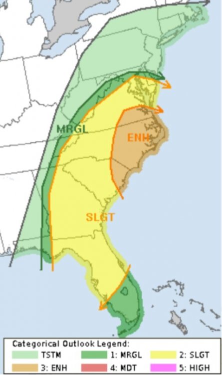
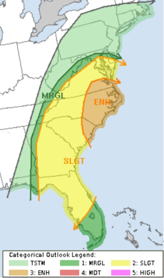
1:30pm SPC update:
...Carolinas to the Middle Atlantic region...
Southern-stream shortwave trough will deamplify as it becomes
absorbed within the base of an amplifying northern-stream trough and
move off the Atlantic Seaboard early Friday. The northern-stream
trough will continue through the Carolinas and Middle Atlantic
region during the day accompanied by a cold front. Modest low-level
moisture with dewpoints in the upper 50s to lower 60s F will advect
through the warm sector along a 50 kt low-level jet. This in
conjunction with some cloud breaks will destabilize the boundary
layer with MLCAPE from 500-1000 J/kg possible. Some thunderstorms
may be ongoing along the NC coast early Friday in association with
the leading shortwave trough. Farther upstream, storms are expected
to intensify along and ahead of the cold front as the boundary layer
destabilizes from VA into NC and possibly as far south as SC.
Strengthening mid-upper wind profiles accompanying the
northern-stream shortwave trough will support 40-45 kt effective
bulk shear supportive of embedded organized structures with storms
developing within the evolving squall line and some supercells with
any storms developing ahead of the line. Damaging wind appears to be
the main threat, but isolated tornadoes are also possible. Severe
threat should end by early evening as the cold front moves offshore.