tamarack
-
Posts
15,476 -
Joined
-
Last visited
Content Type
Profiles
Blogs
Forums
American Weather
Media Demo
Store
Gallery
Everything posted by tamarack
-
December 2024 - Best look to an early December pattern in many a year!
tamarack replied to FXWX's topic in New England
12/29/17 was the coldest mean I've had since moving here in May 1998. Its -1/-31 was 36° BN. The week 12/27-1/2 averaged 29° BN, with temp 2/-22. The 15 days 12/25 thru 1/8 ran 21° BN, with temp 9/-14 plus 22" snow. Had 0.15" ZR overnight with 0.1" accretion. Driving to PWM midday for wife's (long scheduled) procedure, should be interesting travel. -
GYX has been emphatic that, given current info, this event won't be a repeat of last December 17-18. From GYX AFD PWATs of 1.25-1.4" across the region indicate ample moisture moves into the region, with dewpoints making it into the 50s by the end of the day. These PWATs and dewpoints rival the December 18th flood last year. Despite this comparison, this flood will NOT have the severity of December 2023. This is due to a less favorable upslope enhancement pattern, in addition to the more progressive nature of the upcoming storm meaning the storm will likely move much quicker through New England than what was seen on December 18th last year. For more details, please read the `Hydrology` section. from ‘Hydrology’ Questions have been raised about this event in comparison to last December. This flood will NOT have the severity of December 2023. There is more storage for runoff with low stream levels across most of the region, the storm will be more progressive, and the snowmelt from the mountains will be less.
-
December 2024 - Best look to an early December pattern in many a year!
tamarack replied to FXWX's topic in New England
Do that and it's almost exactly average (29/12 for 12/24) here. I was looking for a repeat of the week following Christmas 2017, a cold snap worthy of the St. John Valley. -
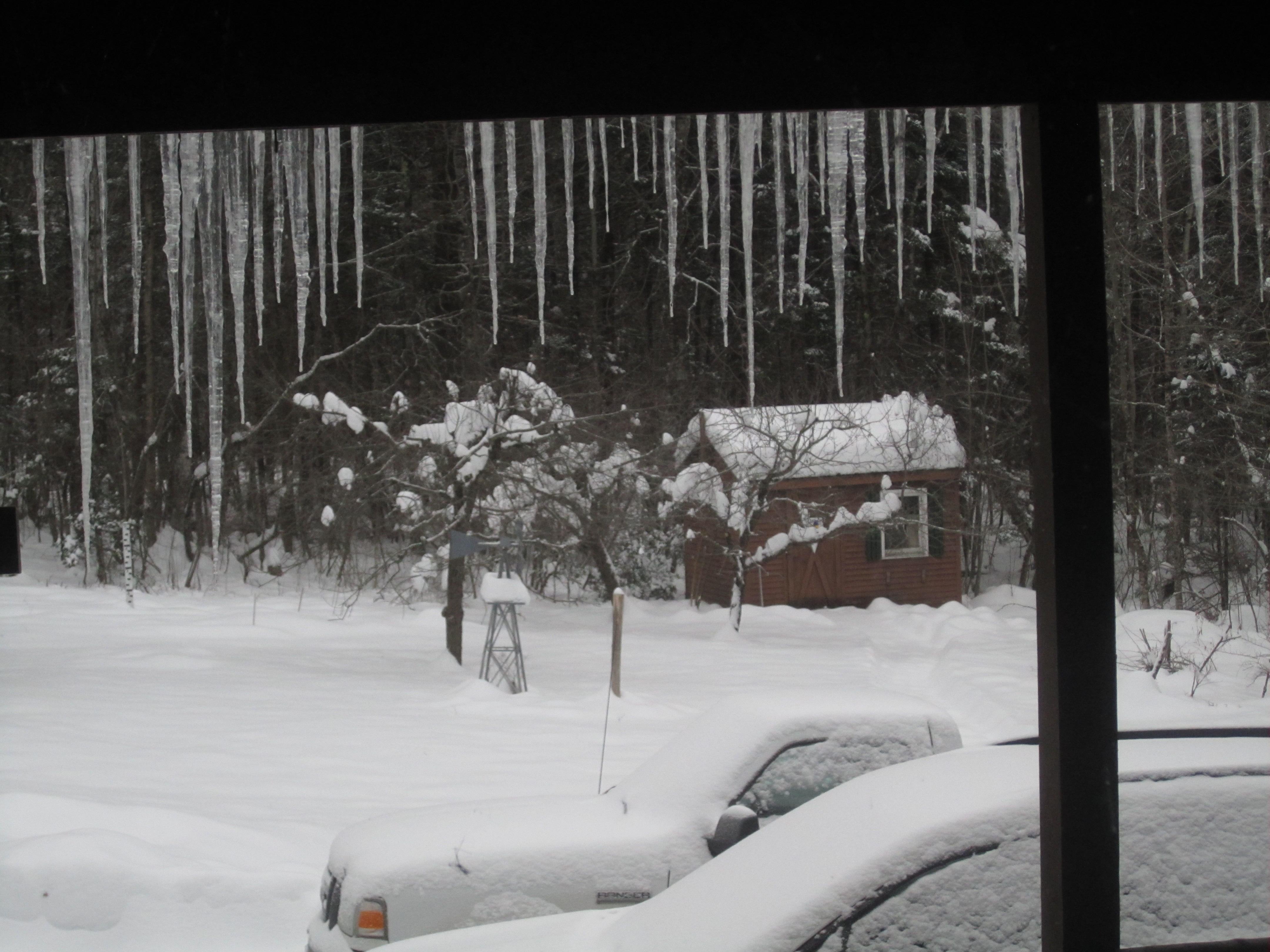
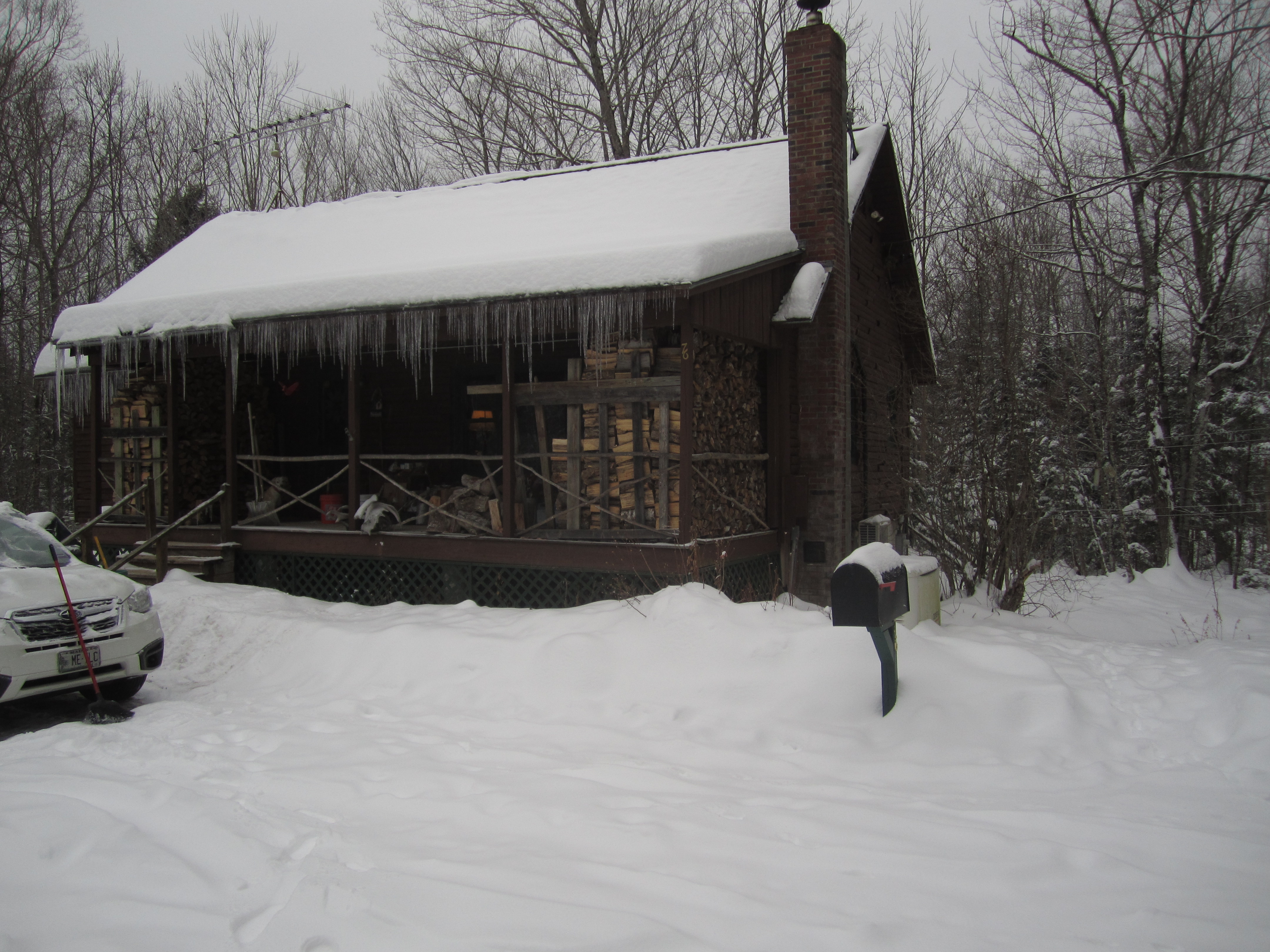
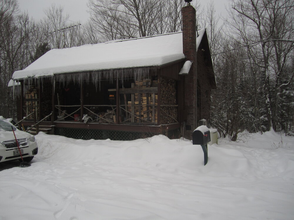
Yup, nearest thing to a Maine camp we'll ever own, on 80 acres. Nearest neighbor is 500' away. It looks like a log cabin, but the L.C. Andrews homes are stick framed with 3-sided Northern white cedar logs for the exterior. Built in 1975 (by a first-time home builder and it shows) it has 3x4 studs at 2-foot spacing. By the turn of the century they changed to 3x6; our walls are 7-8" thick so the newer models are really robust. We're at the end of the maintained road (2,000 feet from pavement) though high-clearance vehicles can travel the 3/4-mile of unmaintained if/until the snow gets too deep. 16" at the stick but 2 pickups came thru today.
-
Agreed. He has some of the same long-term downsides as Raffy. Soto is a significantly better hitter, especially OBP, but both are BN on defense now and likely headed for DH in a few years. However, 15 years is riskier than 11 and RF at the Stadium plays a lot easier than 3rd base. Also, Judge at center helps Soto whether the latter is in RF or LF, while Sox SS aren't covering much for Devers. GYX discussion has the foothills as the most vulnerable to flooding, with RA plus melt progged at 3-5". It helps that fall was dry; last year's flooding was primed by a 2-3" RA one week before the big dog. That's because even after all these years nobody can still seem to grasp the lines themselves don't produce big wind...it is always along the leading edge of the torrential rain. You get a massive gust of wind then a brief lull of quietness then it pours cats and buckets which quickly stabilizes the atmosphere. Apparently, 12/18/23 didn't follow the script here. Our massive gusts lasted 4 hours and began several hours after the heavy rain arrived.
-
December 2024 - Best look to an early December pattern in many a year!
tamarack replied to FXWX's topic in New England
Me too. Nemo was the poster child - a nice 11" here while PWM had 31.9", GYX 26.8"; I think Jeff had 25.5" and AUG 25. A few miles south from AUG, Gardiner had 30.0". (In our 13 winters there, 85-86 thru 97-98, their biggest was 16", though I measured 17.5 for Dec. 20-21, 1995.) Five hours of lgt snow brought 1.6" last night, total to 24.0". By the time the downpour commences, we'll have about 3" SWE in a 15" pack. My guess is that we lose about half; if it all goes, it would bring at least moderate flooding, maybe worse, though GYX has been consistent in contrasting this event with last Dec 18, not comparing. -
A wintry look this morning.

- 697 replies
-
- 10
-

-
November numbers: Avg max: 46.4 +4.0 Mildest, 69 on the 1st and 6th Avg min: 29.1 +4.5 Coldest, 14 on the 15th Mean: 37.8 +4.2 2nd mildest November, only 0.1° lower than 2006. Precip: 3.78" +0.44" Wettest (whitest): 1.09" on the 28th Snow: 9.0" +4.0" The 8" storm on 28-29 was a branch breaker (several large pine limbs) as it had 1.44" LE for a ratio of 5.5-to-1. The 6" recorded on the 18th is the greatest on Thanksgiving here.
-
Happened thrice for me: 12/24/66 in NNJ (didn't believe it possible until the 2nd boom). 11/21/89 in Gardiner and 2/10/05 here in New Sharon. Spacing would say that #4 was coming soon. (Of course, like TCs, spacing means nothing.)
-
December 2024 - Best look to an early December pattern in many a year!
tamarack replied to FXWX's topic in New England
Measured 3.5" at 7 AM, 0.22" LE, and some light snow continues - maybe another 2-3 tenths. Pack at 16" but the top half is high ratio and vulnerable to warmth and RA. -
New England Winter 2024-25 Bantering, Whining, and Sobbing Thread
tamarack replied to klw's topic in New England
My little Ranger would be all but helpless with all-seasons, especially for getting up our driveway (all uphill) and nearby Mile Hill, a 300' elevation climb in that mile (with about 200 yards of 8-10% grade near the top) and with a sharp curve at the bottom. Good snows and a couple hundred pounds of firewood over the rear axle is good medicine. -
December 2024 - Best look to an early December pattern in many a year!
tamarack replied to FXWX's topic in New England
He resembles the evening news, but instead of "If it bleeds, it leads" we see "If it's toast, he'll post." The 18.3" total snowfall YTD trails only 2018 and 2014, and the pack since the Wednesday night surprise (3-to-6 became 3-plus-6) is tops for 27 Novembers here. 15-14-13 past 3 days. Morning low here was 2 and if the clouds hadn't arrived, we'd have dropped below zero as it was 5° at 10 last night with bright stars. Season's first measurable (1") began about 8 hours after we set out Tuesday for SNJ and T-Day with family. Neighbor had 8" Thursday night, supported by local cocorahs reports (10+ in Farmington) and the catch bucket for the 2 events held 1.85". I hope folks talking total wipeout from the midweek bath. It would probably take 3"+ of near 50 RA to take out the 2"+ SWE (plus tonight and maybe some Monday night) in the current pack. Were that to occur, we'd have moderate flooding and only the dry autumn would prevent worse. -
Turkey Day Birch Bender Snow Storm/Observation Thread 11/28/-11/29
tamarack replied to dryslot's topic in New England
No snow in Gloucester County, NJ. We had a super time and for the first 380 miles on the return it was a slick as ever. One mile from the Piscataqua bridge we hit the jam - crash on the bridge, southbound lane, and we s-l-o-w-l-y detoured to Rt 1. Finally, after 95 minutes, we reached Maine on the drawbridge and as we crossed, we noted that I-95 had opened and all the cars that had been behind us were now flying ahead at 60 mph. The jam southbound was still back to Mile 5 on the Pike as we headed north. Next door neighbor reported 8" on T-Day; what time did the snow start at your place? When we reached home, in 12.5 hours instead of 10.5, we found 5-6" of crunchy stuff almost able to hold us without sinking. Wednesday's 3-6" forecast then turned into 3+6 (9.3" of 14:1 moist fluff) with 8" coming 9 PM thru 5 AM Thursday. Still 13-14" at the stake -
Blowvember - and not named for wind potential
tamarack replied to Go Kart Mozart's topic in New England
So "right thru the goalposts" but under the crossbar? Looks like our first snow here will be while we're in SNJ where it will be RA. Maybe we can get caught in a storm when we return on Dec 3 or 4. On our first visit a few weeks after they moved there from DEC in Jan 2015, we delayed the northerly drive from Jan 27th to the 28th, thus avoiding the 30"+ blizzard in SNE. Got home about 6 PM to find 20" of single digit sand that wouldn't pack underfoot but made our feet slide sideways - missed the most powerful January snowstorm that has hit where I was living at the time. -
Blowvember - and not named for wind potential
tamarack replied to Go Kart Mozart's topic in New England
We lose out from downsloping too, but we also save a lot of snow, both in the air and on the ground, through CAD. Maybe the clown maps don't account for that? -
Blowvember - and not named for wind potential
tamarack replied to Go Kart Mozart's topic in New England
Two more clown maps with a snow hole east from the Whites (including my area, of course). I've seen that phenomenon far too often to think it's merely random. Fortunately, things rarely turn out so poorly here. (Especially last March-April) Event total 1.77" thru 7 this morning, month total 1.92". Saw a few catpaws at 750' on Weeks Mills Road this morning, all RA at 390' at home. -
Blowvember - and not named for wind potential
tamarack replied to Go Kart Mozart's topic in New England
And the Grinch is waiting. -
Blowvember - and not named for wind potential
tamarack replied to Go Kart Mozart's topic in New England
'Fraid so - previous flake tardiness record was 11/21/04. That winter had no snowfalls greater than 3.4" thru Feb 9, after which we had 60" in 31 days, finishing with 94", 5" AN. -
Blowvember - and not named for wind potential
tamarack replied to Go Kart Mozart's topic in New England
Where I grew up in NNJ is at 700, probably a couple inches there. Had 0.39" thru 7 AM, about ~0.2" since. Still haven't seen a flake this season. -
November 21-22 Rain to Snow Disc/Obs SWNE Wake up to 6” ?
tamarack replied to Sey-Mour Snow's topic in New England
At 1,800' asl. My NNJ HS (Butler) had a 2-hour delay this morning, probably about 2" there. I've yet to see a flake. Weird wx is fun. -
Blowvember - and not named for wind potential
tamarack replied to Go Kart Mozart's topic in New England
And before here in the Maine foothills? Latest I've had to wait for the season's first flakes is today's date, so a new late start whenever one is seen. We head for SNJ this coming Tuesday and there's a chance that no flakes arrive before then. even BWI may be able to pull some minor accumulation Another 2009-10 on the way? That was the season when they got 7" more than CAR. -
Blowvember - and not named for wind potential
tamarack replied to Go Kart Mozart's topic in New England
GYX overnight shift QPF was 1.5-2 here yesterday, 1-1.5 this morning. Daytime shifts Tues-Wed 0.5-1 both days. Models flipping? Cloudy with a raw wind and low 40s. Hoped the deer would be moving ahead of the storm. If they were, it was elsewhere. -
Blowvember - and not named for wind potential
tamarack replied to Go Kart Mozart's topic in New England
The 2 storms in the first half of Dec 2003 totaled 37", more than half of the season's snowfall. Only one event with more than 5" in Jan-April. Jan '04 had 7 maxima between 1 and -8 but only 7.7" snow/0.57" precip. The -7 max on the 14th was recorded at 9 PM on the 13th; the afternoon max was -11. -
Blowvember - and not named for wind potential
tamarack replied to Go Kart Mozart's topic in New England
Or November 22-23, 1943 in NNE. -
Blowvember - and not named for wind potential
tamarack replied to Go Kart Mozart's topic in New England
Yikes! In the 1950s my mom could buy 4 cartons for that. (Unfortunately. At age 55 after 40 years of 2-3 packs/day, she was diagnosed with emphysema. She quit cold turkey but gradually lost lung function until passing at age 70. Her 2 non-smoking sisters lived into their 90s.)