

Baroclinic Zone
-
Posts
47,702 -
Joined
-
Last visited
Content Type
Profiles
Blogs
Forums
American Weather
Media Demo
Store
Gallery
Everything posted by Baroclinic Zone
-

March 12/13/14 Blizzard/Winter Storm/WWA etc
Baroclinic Zone replied to Bostonseminole's topic in New England
NAM! And what you do after it. -
March 12/13/14 Blizzard/Winter Storm/WWA etc
Baroclinic Zone replied to Bostonseminole's topic in New England
Let's do this! -
-
Attention All Philly Subforum Members
Baroclinic Zone replied to Rjay's topic in Philadelphia Region
Personally I'd like to merge with the Caribbean Subforum. -
-
-

From the album: First snow
-
-
-
 LMAO!!!
 -
166986 10150527997374893 200632219892 8587857 1767364303 N
Baroclinic Zone commented on Isopycnic's gallery image in Members Albums Category
 holy hell
 -
From the album: First snow
-
After that accident he'll be Robo Miser
-
Love it.
-
December 13th, 2007 rakeage. 12" snowstorm.
-
Remembering Snowpocalypse -- 12/18-12/19, 2009
Baroclinic Zone replied to Ian's topic in Mid Atlantic
This storm did not suck imby. I think I ended up with 19". -
Well historically, he did. 14" and done. This was the storm that broke that camels back.
-
11
-
Weenie radar image from January 12, 2011 @ 3am.
-
Devastating tornado strikes Joplin, Missouri
Baroclinic Zone replied to Hoosier's topic in Weather Forecasting and Discussion
JoMo, I wish you, your family, and your community all my thoughts and prayers. You've been through hell and back. -
Devastating tornado strikes Joplin, Missouri
Baroclinic Zone replied to Hoosier's topic in Weather Forecasting and Discussion
I'm just getting up to speed on this. Just devastating news. -
Your posts are all jacked up. This stuff pops up in almost every quoted reply you do. <br /><br /><br /><br /><br /><br /><br /><br /><br /><br /><br /><br /><br /><br /><br /><br /><br /><br /> Makes your posts difficult to read.
-
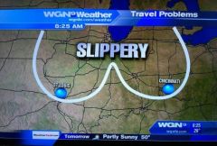
Kevin must have drawn up that map.
-
Weenie Ridge FTW
-
That's why I said impressive overall. Seems like the majority of the area saw 12-36"
-
Not that I recall. TAN recorded 2.07" at the ASOS for L/E. It was a 2 footer storm for me living in downtown Middleborough. Very impressive widespread system.
