MANDA
-
Posts
1,887 -
Joined
-
Last visited
Content Type
Profiles
Blogs
Forums
American Weather
Media Demo
Store
Gallery
Everything posted by MANDA
-
There is general meso model consensus that if you live in NW NJ, roughly north of 80 and west of 287 you are going to be left wanting. Hopefully we can get a bit of a NW shift. I'm hoping for at least a .50" but that could end up being wishful thinking if trends persist.
-
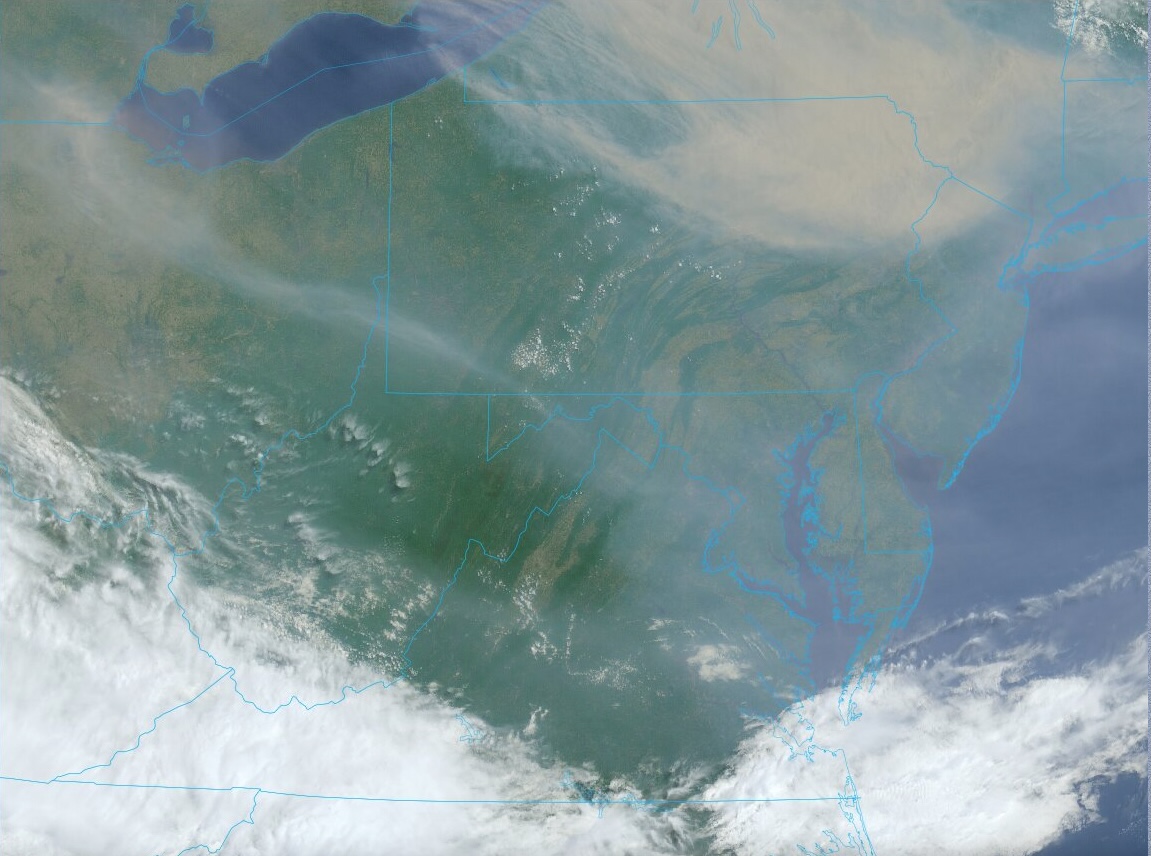
Latest Drought Monitor shows no changes of note for our forum week over week. Expansion of Moderate Drought over PA, WNY and WVA. With the expected rains over the next week our area should at least hold steady if not lose some of the Abnormally Dry classification. Smoke coming in the back door today. Minimal effects, just some mid and high level haze.
-
.31" on the day here. Most of that fell this morning/early afternoon. Only about .05" from afternoon showers. I'll call the .31" a win. 1.08" on the week!
-
As expected totals were heaviest west and faded east. Eastern PA did well! I'm happy with how we did in my neck of the woods.
-
Received .77" here. Grass looks a little less crispy this morning.
-
Yes, there are going to be winners and losers today for sure. Convection is hard to predict so I'm hoping I come out on the wetter side of things being more west. Just remember how this event looked 7-10 days ago. So much wetter. Totals were always going to depend on track and placement of upper low and with the track of the upper low much more north and west than what was depicted 7-10 days ago we're going to struggle hard to get an area wide decent rain event today. Hoping mid and late week trends hold for a wetter solution but there is need for caution as it is many days out. I'd rather have a chance though rather than have nothing on the horizon.
-
Yep. Also means there will be winners and losers as far as totals go! Seems the further east you go the lesser the chances at meaningful totals, IMO. Anything less than .50" at my location will be a fail.
-
I've been holding onto a .5" to 1" rain event and it still seems to be on track.
-
Yes and these dry patterns are hard to fully break without a tropical system or the hopeful return of Fall rainy pattern. Will be interesting to see how this evolves. I'm leaning toward the dry pattern more or less persisting. Drought begets drought and drought can beget heat although pattern has been very persistent in keeping heat away so far. Just a NW flow of dry air with trof axis just to our east. Seems ridge is getting ready to build over the southern plains. Hopefully it stays there and does not move bodily east. Not expecting that but we'll see.
-
Yes, guidance has been gradually scaling back over the last several cycles. Euro at this point is the only op model offering anything decent. If the Euro fails and the other guidance is closer to reality it will do nothing to ease the dryness. I'm still thinking .50" - 1" is a reasonable possibility. Especially over NNJ. CNJ and SNJ not looking hopeful with developing pattern for next week. THANKFULLY temperatures have been normal or just below. Can't imagine if we had upper 80's+ with bright sunny skies, would be much worse for soil moisture.
-
Meanwhile back at the ranch. Latest Drought Monitor shows large expansion of Abnormally Dry into upstate NY and western NJ. Seems to me more of NJ should be in the abnormally dry category!? Large expansion of Moderate Drought across PA. Hope we can get some meaningful rains Monday/Tuesday around here. Badly needed.
-
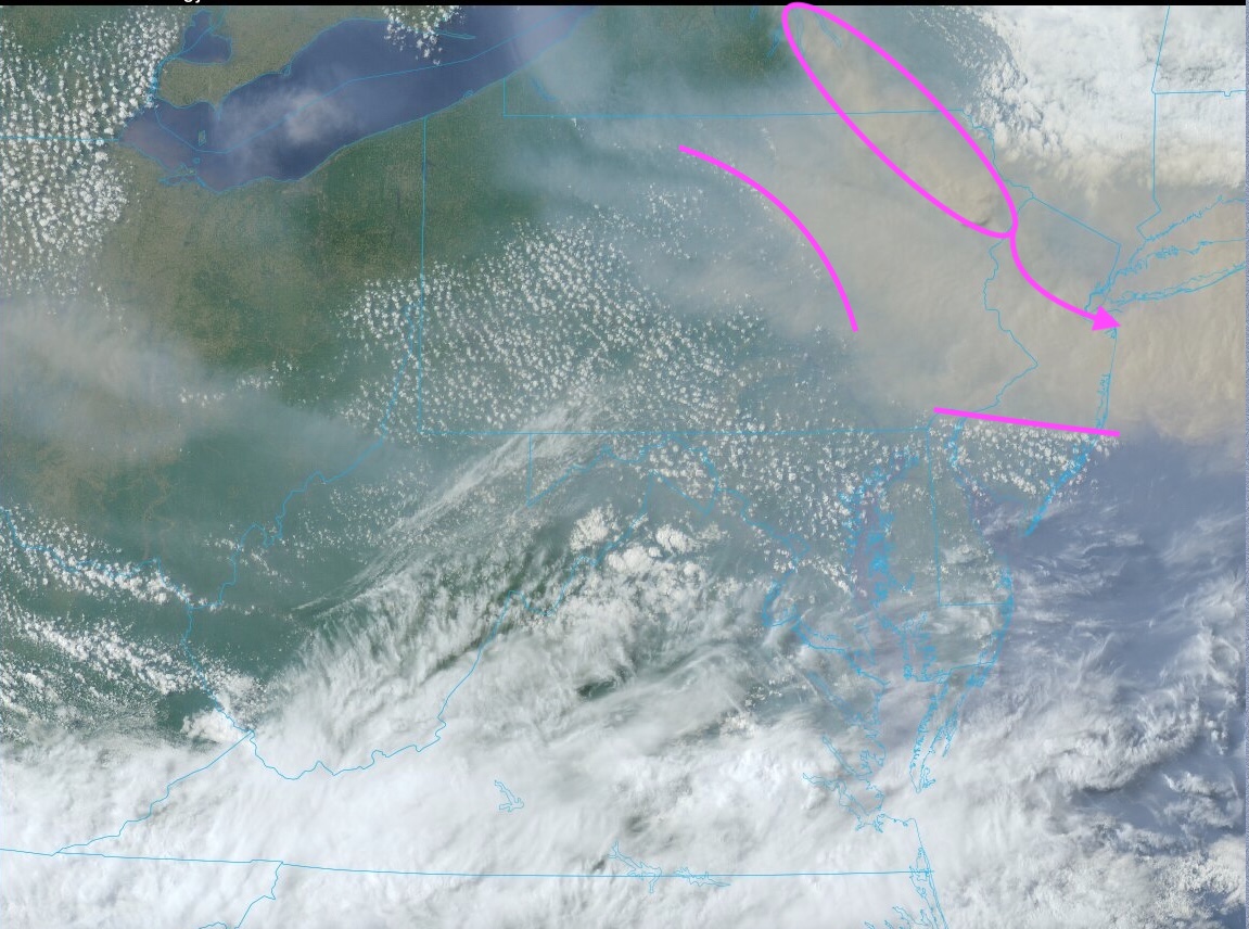
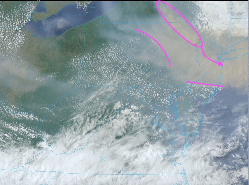
Thick "blob" of smoke has crossed into Sussex County NJ. Looks like I'll be on the southern fringe of it as it moves e.s.e. across far NNJ and toward NYC, especially northern part of Manhattan and the Bronx (rough trajectory) over the next 2 hours or so and then across western L.I.
-
Question to Don, Forky and FPizz- Great and amazing pictures. What kind of camera did each of you use?
-
Yeah, one last really think batch heading southeast. Also cool that on the edge of the smoke shield the fair weather CU are popping.
-
Worst of it has passed my area. Disk of sun again visible and no visible smoke in the air at the surface. Still dirty looking sky and stink of smoke but not near as bad as 2-3 hours ago.
-
Ground level smoke here in Watchung. Very unpleasant to be outside. Way worse than at any point yesterday.
-
Worse than yesterday. Visibility lower and smell is stronger. You can even see faint visible smoke a few meters above the ground. If I didn't know any better, I'd think something was burning a block away. Orange/yellow tint to the atmosphere and disk of the sun completely blocked out.
-
Edge of the dense plume has crossed into my area. Air quality went down very quickly and the air looks very hazy and dirty all of a sudden.

-
Let's hope the upper low cutting off under the ridge next week does it in the right place so that the meaningful rain affects this forum. If it doesn't and/or tracks north of the area we're screwed. Details to be determined.
-
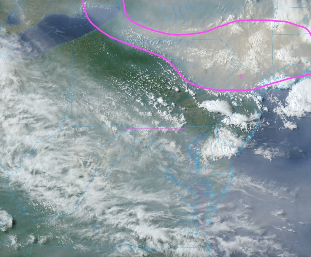
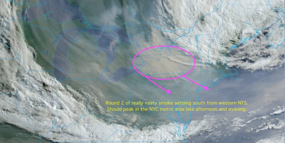
Here we go again - Round 2. First visible pics of the day show another area of unusually dense smoke settling south from western and central NYS. Will peak in the metro area late afternoon and evening with results similar to yesterday evening. Nasty. Still haze and smoke smell this morning but less than last evening. Enjoy the respite before the next batch arrives.
-
Same here. Closed all the windows and your campfire analogy is perfect description. Just what it smells like out there. Really intense.
-
Really don't think I've ever experienced anything like this before. Smoke smell is really intense and just being outside for 5 min hurts your throat and eyes. Not going to water the garden tonight.
-
Just nasty outside. Visibility down to about 1.5 miles here on my ridge top. Sun looks like a red ball and you can smell the smoke. Dense area of smoke has been pressing south all day and continues to do so.

-
Skunked here. Just a few drops.
-
12Z guidance continues to indicate needed rainfall around here for early next week. Still a ways off but trends have been consistent so that is encouraging. Will be a rather complex evolution so exact placement of best totals uncertain but HPC seems on board for needed rainfall over a large area - at least from this vantage point.