MANDA
-
Posts
2,980 -
Joined
-
Last visited
About MANDA

- Currently Viewing Forums Index
Recent Profile Visitors
16,323 profile views


-
We'll see what August has to offer but you have to think the hottest of the hot is behind us for this summer. With the wet period underway that would tend to make it harder to reach into the upper 90's +.
-
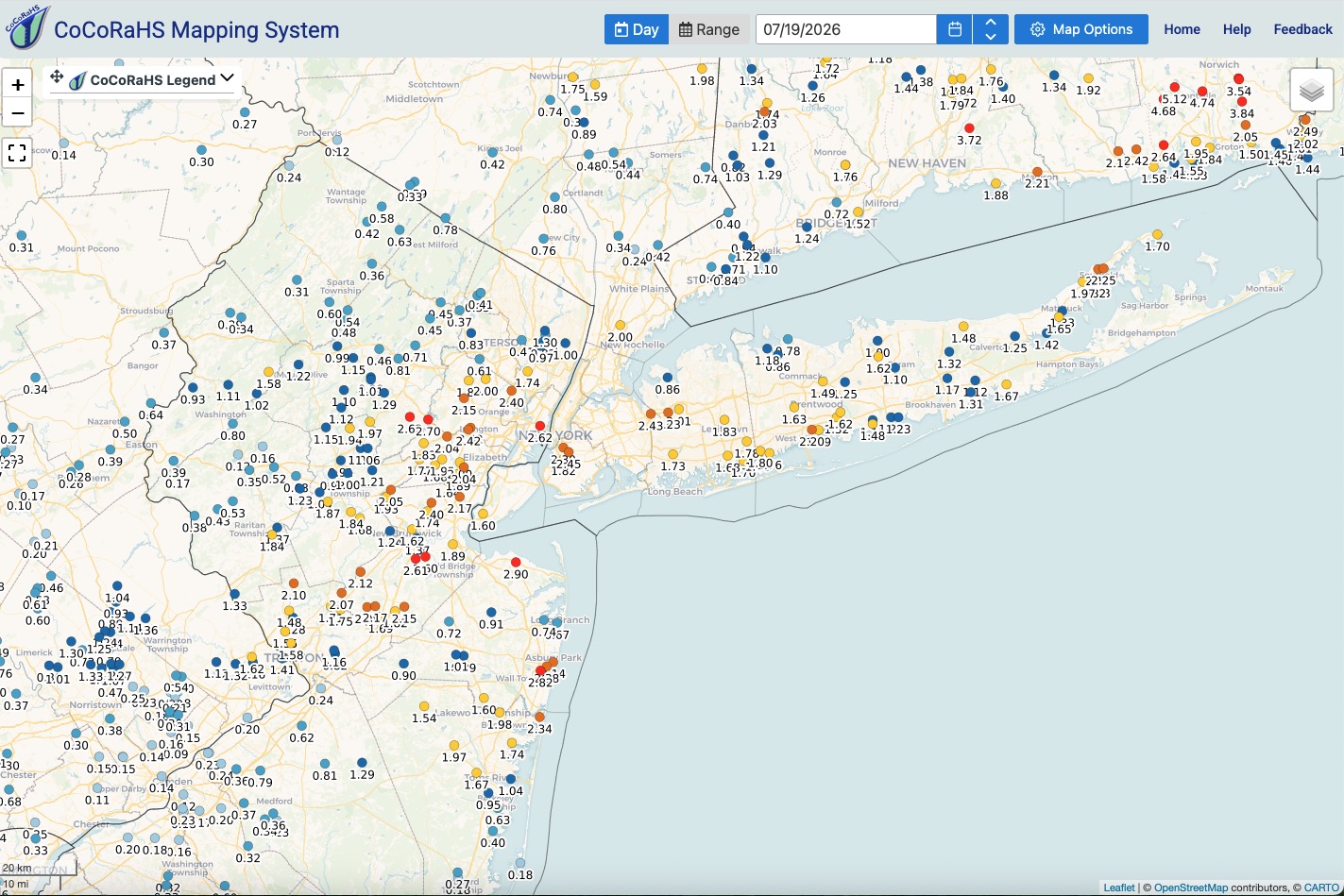
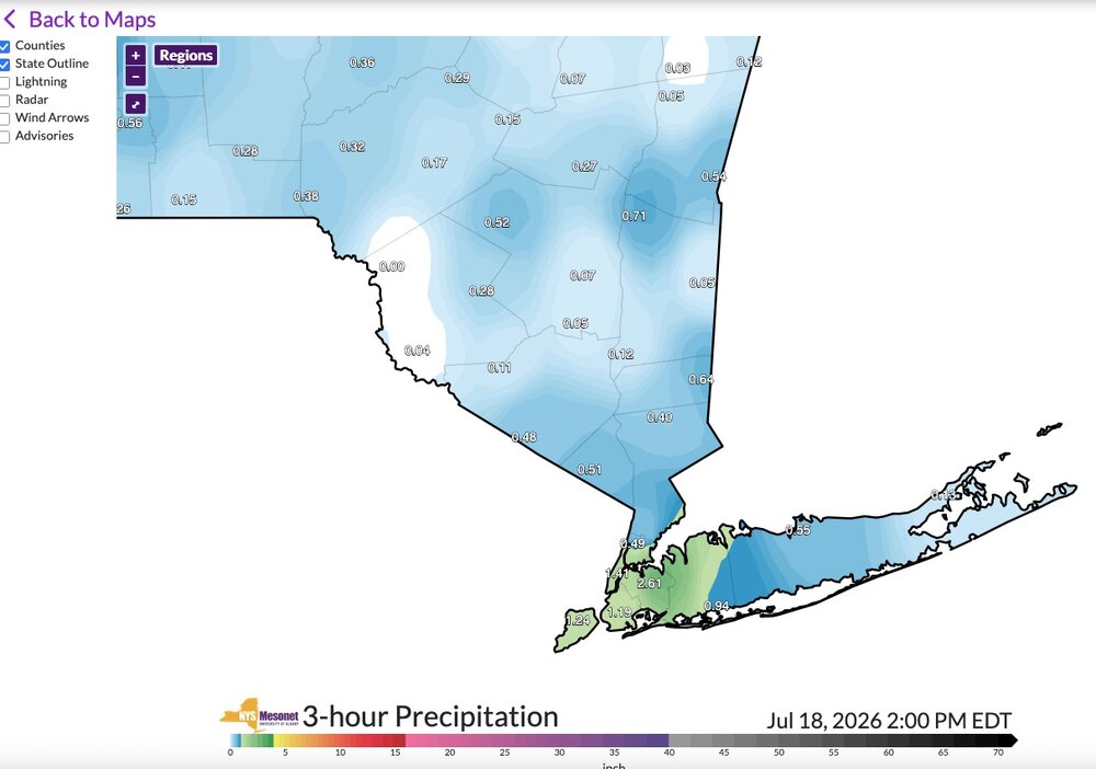
Total rainfall here yesterday was .99". Received .92" from morning round and just .07" from the second round during the evening. Nice out this morning with a light breeze, generally blue skies although some slight haze is lingering. Smoke still continues to spill into the western lakes region and then filters east from there. Much more diluted than recent days. Rainfall map attached. Western areas of the sub forum kind of got shafted. Surprised some locations didn't see bigger totals based on training echoes on radar yesterday south of 78 and north of I195 and across the city and LI. My lawn is looking great for mid July! I have not had to water much if at all over the last month around here. Enjoy the day!

-
Picked up .92" so far today. BGM radar cover NWNJ pretty well. https://weather.cod.edu/satrad/nexrad/index.php?parms=BGM-N0Q-1-48-100-usa-rad OKX radar cover the rest of the area https://weather.cod.edu/satrad/nexrad/index.php?parms=OKX-N0Q-1-48-100-usa-rad
-
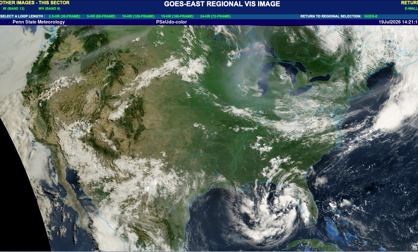
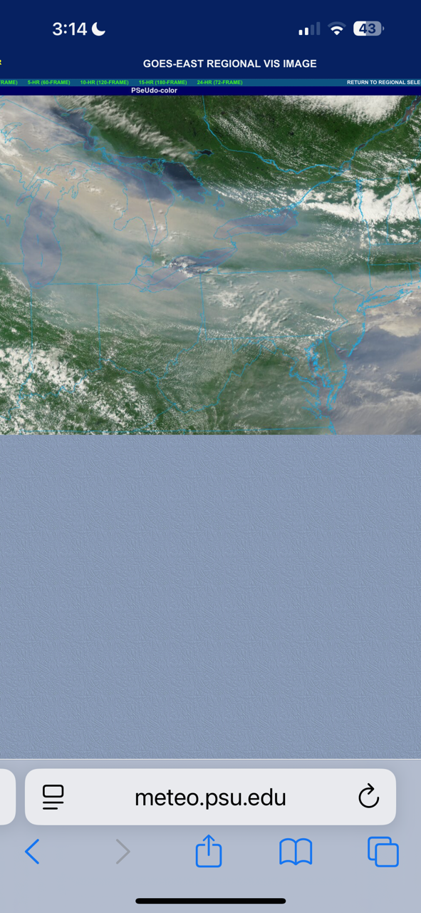
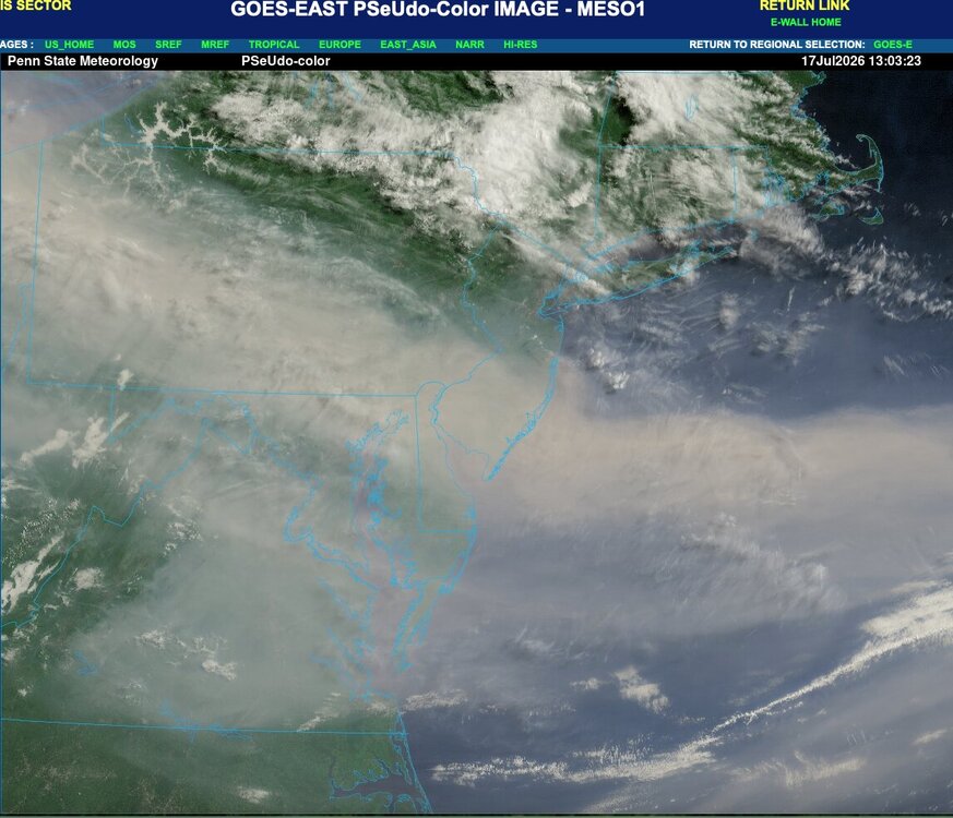
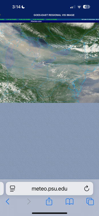
https://www.meteo.psu.edu/ewall/PSUGOES_MESO1/loop30.html
-
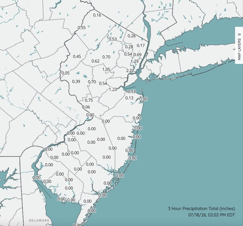
Yeah, was just going to post that. I have to believe there are some going to be 3-5" totals in the area south of 78 and along and north of I195 from this "first round".
-
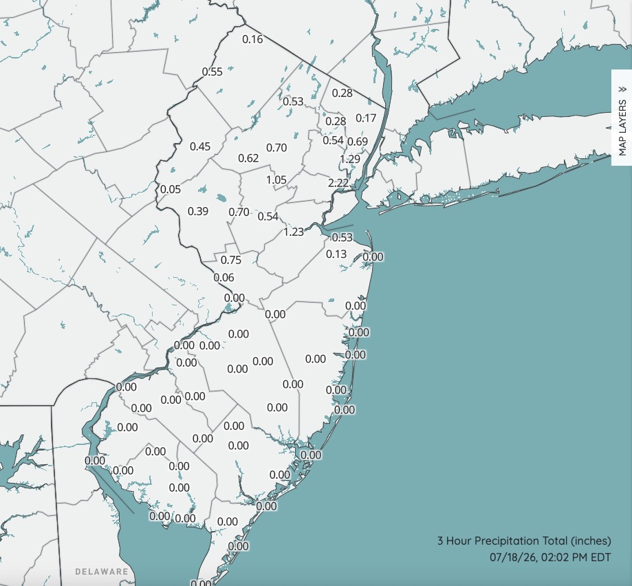
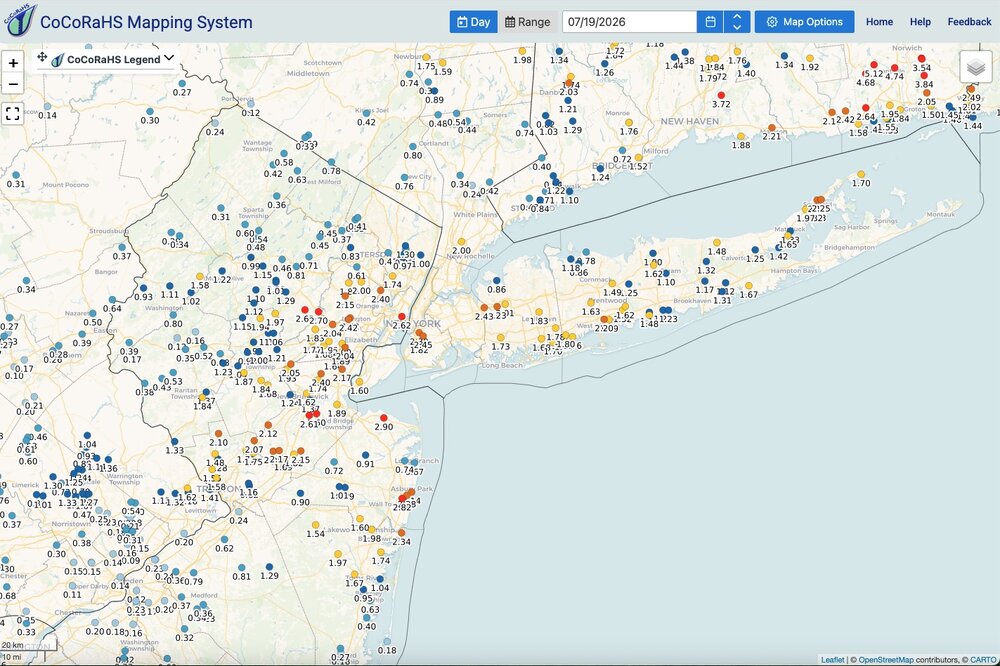
Snapshot of rainfall totals so far. Quite certain there are much higher totals in between these reporting sites. These drenching downpours are highly localized. I am also of the belief that anything truly severe is going to be south of a TTN to Sandy Hook line. I'm actually fairly confident on that and it could be a nasty go for some late this afternoon into the evening along and south of I195.
-
Lights flickering.....PLEASE NO. Not ready for another round of power outages. Not now and not later today. Just no.
-
Lots of thunder here and sky is dark. Per radar a drenching is about to take place.
-
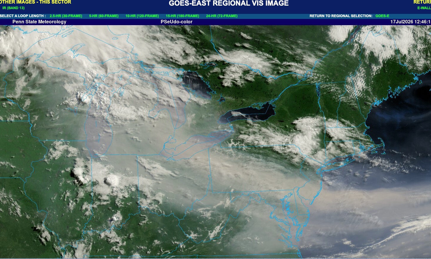
Yeah. Main smoke plume is shifting southward today. Actually fairly clear up here in NWNJ right now with only some haze to the south and clear blue skies to the NW.

-
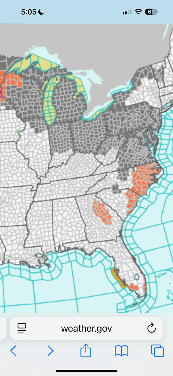
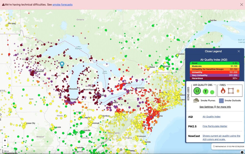
Dense smoke advisory for the Great Lakes. Don’t think I’ve ever seen that before.

-
Do I remember correctly they were over 500 in 2023???? I honestly forget but it was bad back then. Couldn’t stay outside for any more than a few minutes.
-
GOES East updating. Will take a few hours for animations to populate.
-
Video from western Ontario. https://x.com/WeatherMonitors/status/2077271025713397760/video/1
-
Good map. Link below. You can click on the link then click circles to get the actual reading. There are readings in the 600- 800 range over MN/WI. https://fire.airnow.gov/#4.77/44.35/-79.59
-
Been using it. Better than nothing but not great. Sky is hazy here. Faint smoke smell to the air but nothing horrendous. Air quality is poor but still no smoke visible at the surface in my area. Out my way this still trails 2023 by a big margin. Still nasty though.