

HKY_WX
-
Posts
3,113 -
Joined
-
Last visited
Content Type
Profiles
Blogs
Forums
American Weather
Media Demo
Store
Gallery
Everything posted by HKY_WX
-
My first obs from the deep south snowstorm is we got no hot water. Frozen pipes here. The joy of bitter cold.
-
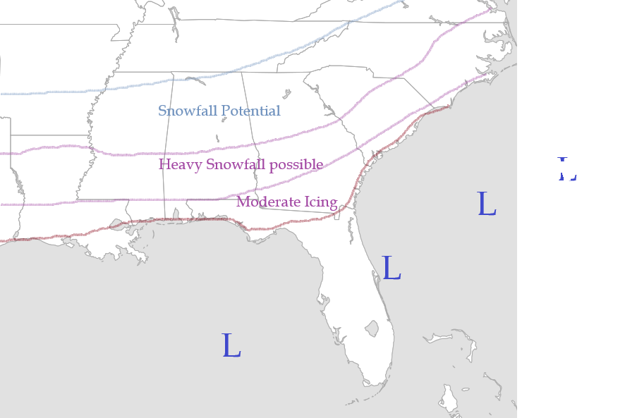
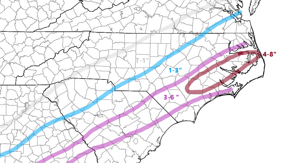
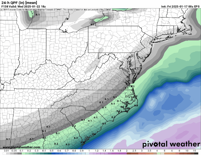
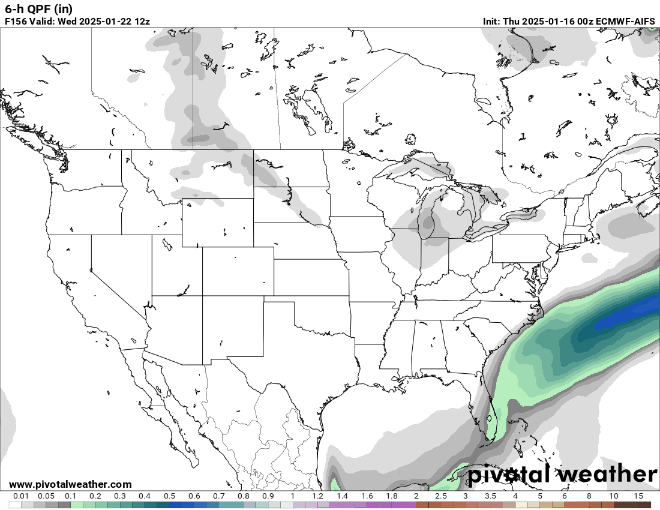
Following up with a totals map. I think we'll continue to see a slow trend NW with the precip shield up until gametime on the models for the reasons I suggested above. Timing will be important tomorrow in NC as temperatures will be below freezing and anything that falls will start to impact the evening commute immediately.
-
I'll post one later tonight
-
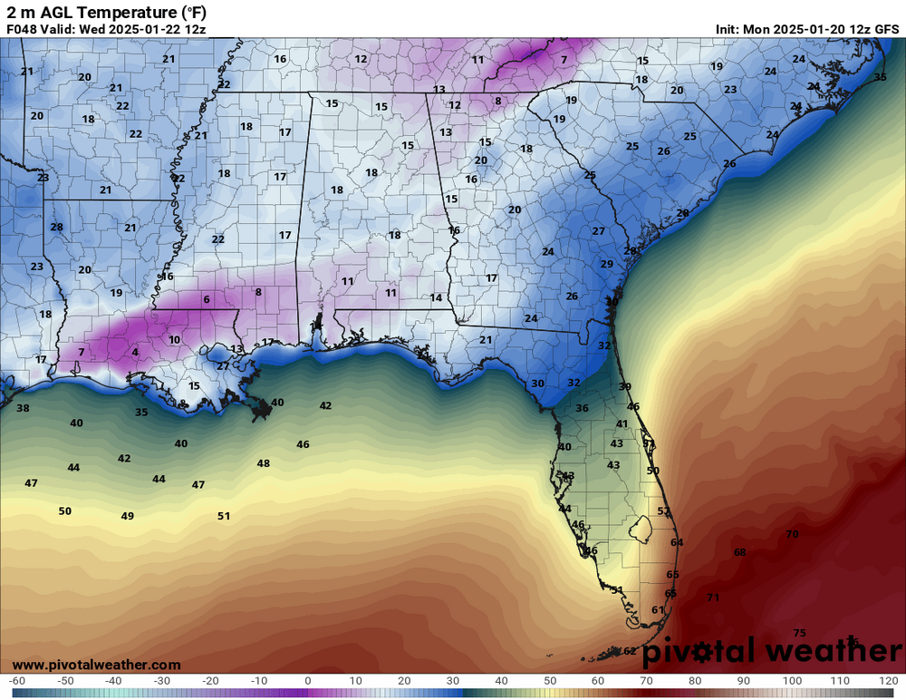
GFS Wed lows in the deep south. Snowcover. Prob overdone but crazy
-
If I fart, it snows in boone
-
Lol u guys sound like spurned lovers.
-
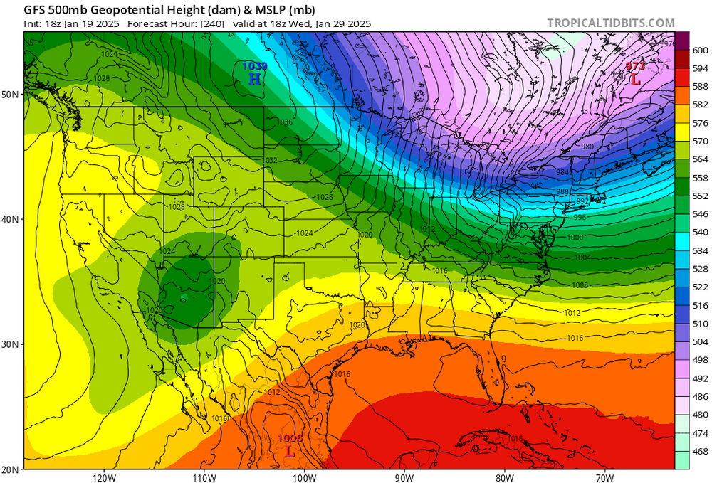
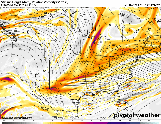
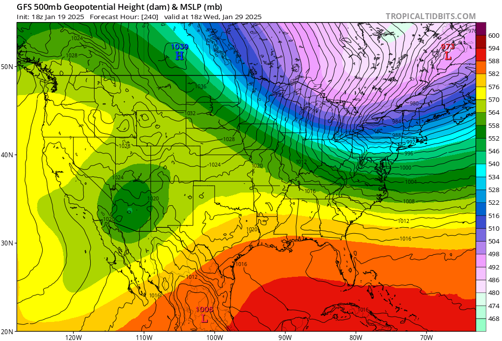
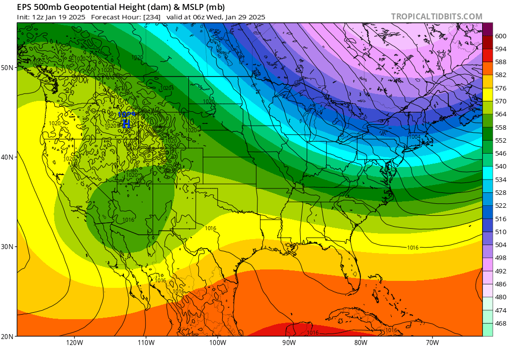
The euro/gfs both are showing some signals of a large split flow stj low 10 days from now. This is a big dog ice/snow look . First one I've seen in the extended that gets me interested (1st real big dog look this year). Worth mentioning since both the gfs and ec show it.

-
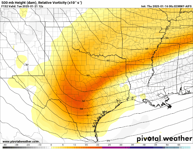
This what i'm thinking currently. Will update with some totals tomorrow night. I don't expect any dramatic jumps with this system at this point as the pattern doesn't dictate such, but a trend NW as we get near gametime wouldn't be unexpected (if not expected given the last 2 systems of note). I've noticed the GFS has had a bias of overshearing STJ waves recently until it self correct within 72 hours. This is one reason for the last minute corrections we've seen with some of the models. From an NC IMBY perspective, my location of Choice would be somewhere around Greenville NC to Kinston NC. Not sure I would expect historic snowfall but moderate to major for that area in NC. The totals in LA/Southern MS/AL could be historic however.
-
The primary trend that led this in a positive direction is the Polar Vortex over Canada. Notice how the heights are trending west a bit. That allows the polar jet wave over Minnestoa/Dakotas to drop in behind the STJ wave. This promotes a more negative trough access(aka the warm moist firehouse is now pointed NNE instead of ENE). It doesn't take much to change the QPF shield in this scenario given it is mostly dependent on overrunning and an isentropic lift scenario. This also lends credit to the idea when Arctic Airmasses drop-down out of Canada they tend to move like a bowling ball and error a bit west on the models.
-
00z Euro Ens has been the best performing initialization run/model in Jan verification data. So this is definitely a positive step.
-
Gfs trend for the current new england system. Each run is valid for 7pm Sun.
-
Thanks man. I would like to see what happens with the models around 84 hours out. Thats when the prior system started trending NW as well as the one about to impact New England. From a Raleigh perspective, we don't need a large shift. About 100 miles or so. For western NC it will take a bigger shift obviously. Most systems either favor one or the other. This one obviously favors i95 over i85.
-
Look at the stamp. It's 120 hours. This will likely change. I actually am glad Wilmington is in the jackpot right now lol. I've see this movie too many times. I always hope for Forest Gump to dump Jenny but he never does.
-
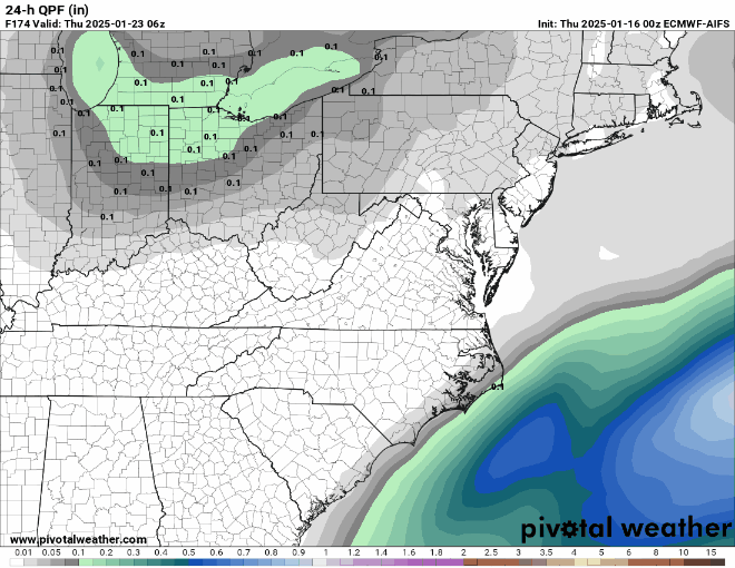
Basically 1 inch of QPF(rain) = 10 inches of snow for a general 10:1 ratio (which is standard in most places except the south because we suck at snow). If it's 15:1 then every tenth of an inch equals 1.5 inches of snow. Which is probably more likely in this scenario on the NW fringes.
-
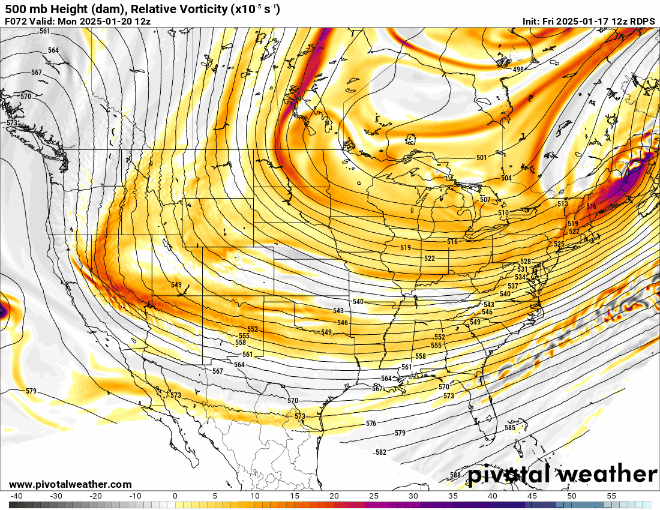
At 5h, the RGEM looks poised for a big dog at 84 hours.
-
If this materializes, I would expect ratios on the NW fringes to be in the 15 to 20:1 range.
-
I would like to see the Euro climb on board, but seeing the trends with it and the AI version give me some comfort. The AI version is a bit later in getting the system into the east, which actually helps interior sections as it allows the PV over Canada to swing out a bit and relax.
-
I actually searched for some verification #'s that included the ICON but couldn't locate any. Prob because it sucks.
-
Gfs has trend almost to the ggem evolution at 6z tonight. Need euro to hope on board for me to believe it completely
-

-
ILM jackpot lol.
-
After getting a look at the 12z Euro AI, there's a bit of encouragement. Just need to get this wave out west to continue digging southwest. That will sharpen up the trough and get that overrunning moisture/firehose pointed more NNE instead of ENE. The margin on this one is very small and it wouldn't take much to be back in the game. The models giveth and the models taketh away.... But the models do sometimes giveth back...
-
More recent verification score for Day 5 SLP. 00z Euro Ens mean is king apparently. 00z Euro Ens mean: 8.47 8.5 00z Euro Control 8.3 12z GFS Ens Mean 8.2 12z GFS Control 8.0 00z GFS Ens Mean 7.9 00z Ukmet 7.9 00z GFS Control 7.5 00z Canadian 7.3 Show Replies
-
Some recent model performance. ACC (Model vs Reality/Reanalysis) at day 5 for 500mb. ECMWF = 1 CMC = 2 UKMET = 3 GFS = Distant 4th
-
Trend gif for the Sunday system in the Northeast. Something to keep in mind. It's just now within 4 or so days for that one. Specifically focus on the s/w over Colorado.
.thumb.gif.14e3f6d826cfb2d1263b6878e81a7cee.gif)


.gif.1f97fa636f59e97a8dd84c5511b7cc8c.gif)