HKY_WX
-
Posts
3,113 -
Joined
-
Last visited
Content Type
Profiles
Blogs
Forums
American Weather
Media Demo
Store
Gallery
Everything posted by HKY_WX
-
There's a nice cutoff 850 low over eastern nc friday night. Should provide a nice band of snow over central nc. Exciting trends on the nam tonight for the triangle.
-
Outside of the mtns and va border, the triad is prob the best spot.
-
Warm inversion in the Lee sucks lol. Remember that many times in hky. Ral looks like a classic front end dusting to sleer/rain with a backend inch or two. These 10:1 maps are worthless if you live below 3000ft. I'd stick to the ferrier method for a system like this. This will be purely rate driven outside of the mountains and VA/NC border.
-
10:1ratio maps are prob pretty useless considering this will be marginal below 850mb. Still, the dynamics will support some banding and clusters of higher amounts. Def will be a hit or miss type of event
-
Definitely like the foothills and western Piedmont for a mixed bag as of now. Will need a continued cold trend to get the triangle in the game. Still time for trends in either direction
-
Given the amplitude of the incoming sub tropical wave and the increasingly (trending) stronger confluent setup over the northeast, someone is likely to see a very high impact ip/zr storm in the mid Atlantic. Whether its central VA or central/western NC, still too early to say.
-
Trend is most important here. Definitely liking this one from an ice perspective in the usual spots.
-
The 500mb low over New England is a good sign for day 4. This will back up the flow and promote a cutoff/more negative tilting trough. Models have a tendency to play catch up in these scenarios.
-
Looks like the eye has most cleared out on WV Sat. Also some explosive CDO in the NE Eyewall. Possibly some land frictional impacts as it makes landfall.
-
I wouldn't surprise me either. I'm not sure they have been tested quite like they're about to be tested after the COE redesigned them post-Katrina. Unreal we have a rapidly strengthening (Likely Major) Hurricane heading directly for them. How 2020
-
When the Levee breaks, Moma you got to move.... LZ
-
Not comparing the systems in that context. It's been a while since a formidable hurricane took a path this close (or directly over) New Orleans.
-
Makes me wonder what kind of impact this will have on the New Orleans Levees. Coming in at a simliar angle to Katrina, just a bit further west.
-
Definitely strengthening at the moment
-
Day 10 is very close to a Hazel scenario with caribbean tropic trouble and a potential negative tilt through/ cutoff over the Ohio Valley. Something to watch at least.
-
Definitely don't see any indications of shear and the SST's are more than warm enough. Agree with the above sentiments that this regains Cat 4 status tomorrow sometime.
-
Agreed, I think we'll see some significant intensification tonight/tomorrow.
-
Delta has that "look" this morning. IMO it looks more organized exiting the Yucatan.
-
TCHP in the Caribbean is off the charts.
-
Quite the hellacious lead band just came through here in Raleigh. Heavy rain and gusty winds.
-
do u guys have a link to the chase stream
-
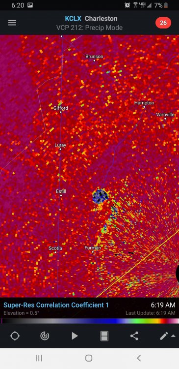
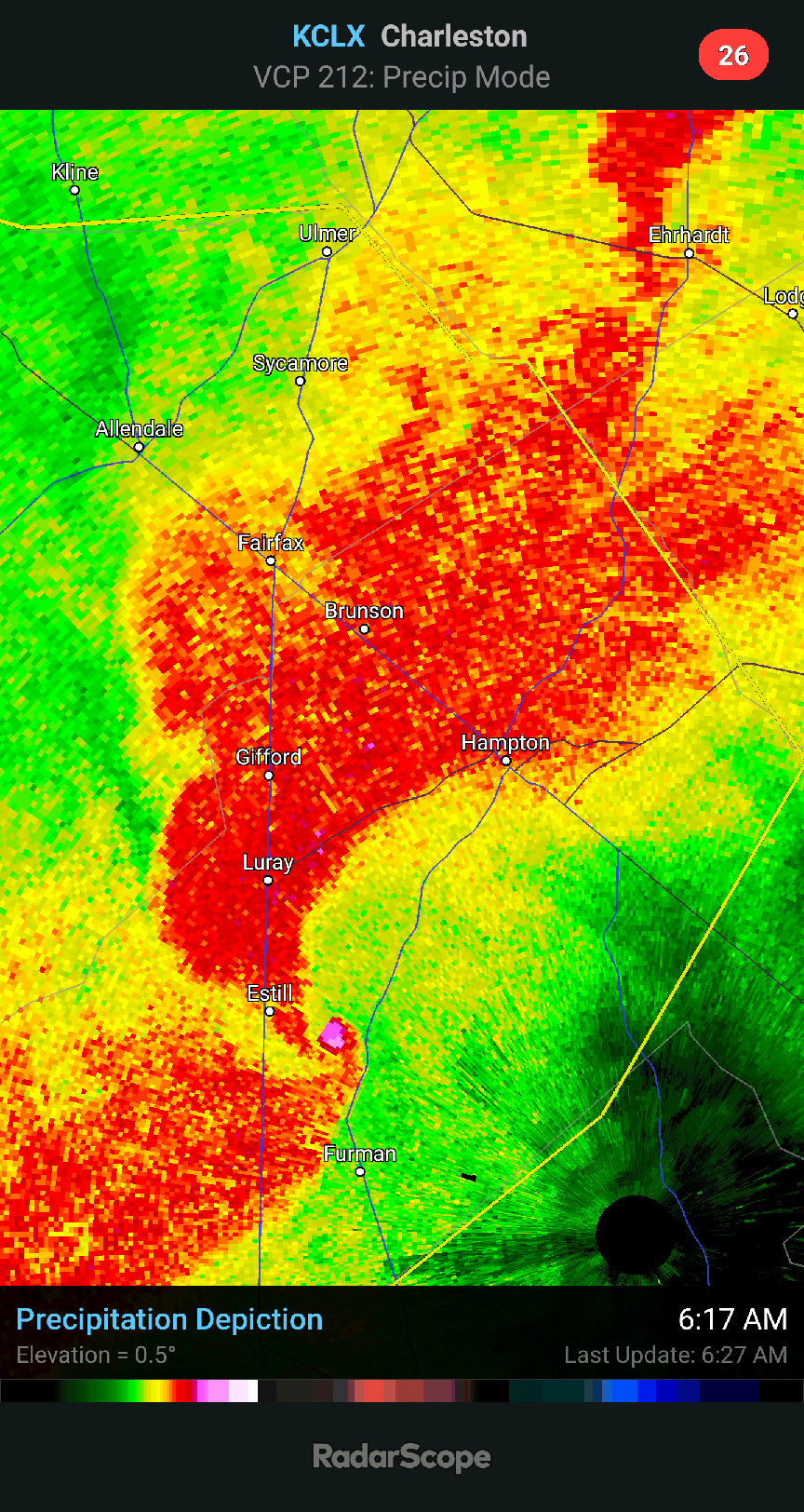
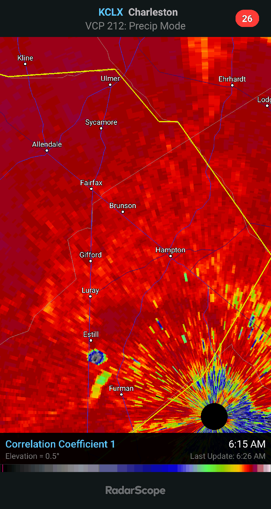
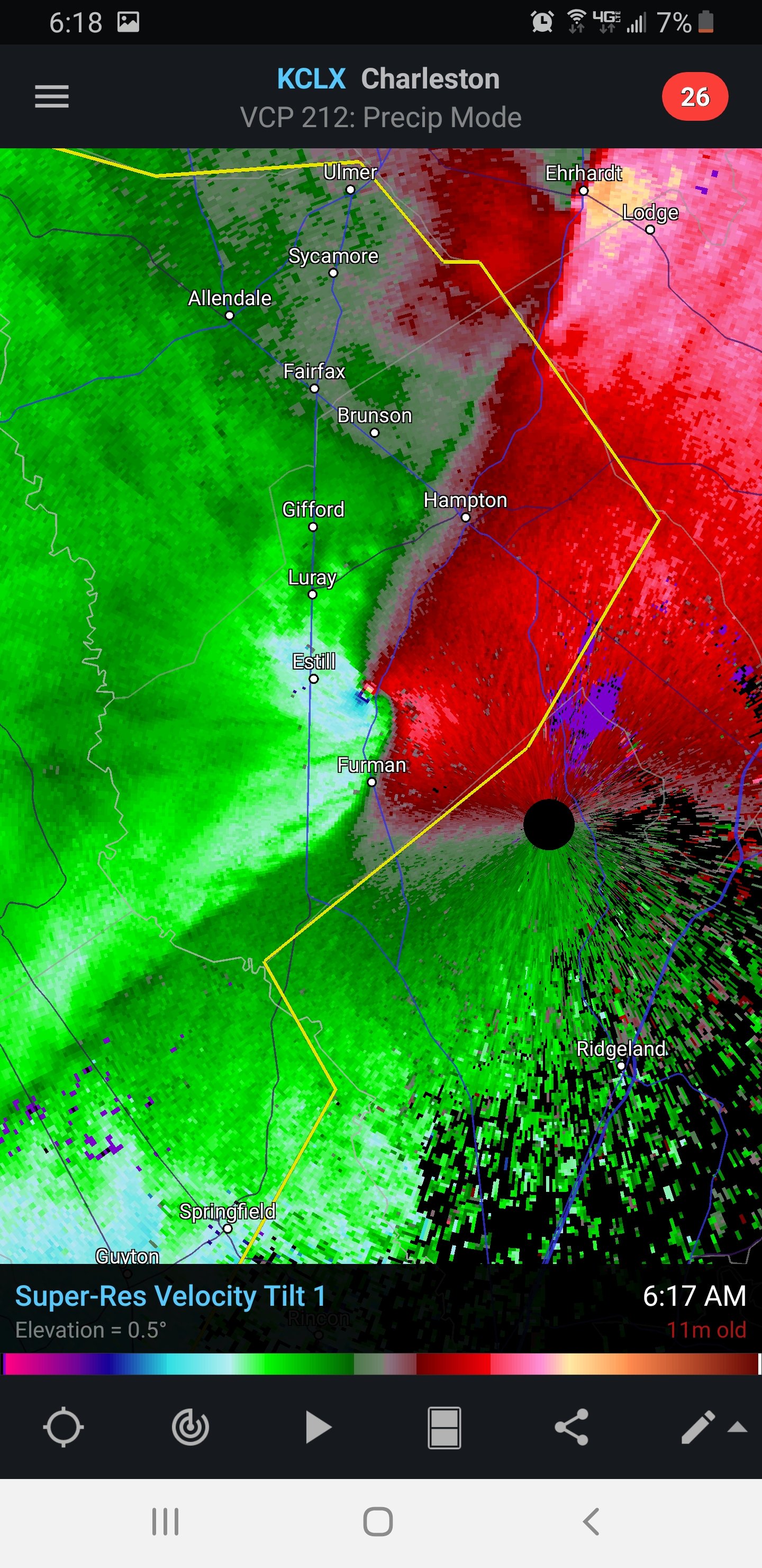
Waterboro got pasted
-
Headed towards chs. Hope it fades bf
-
Geeze